Best time to visit
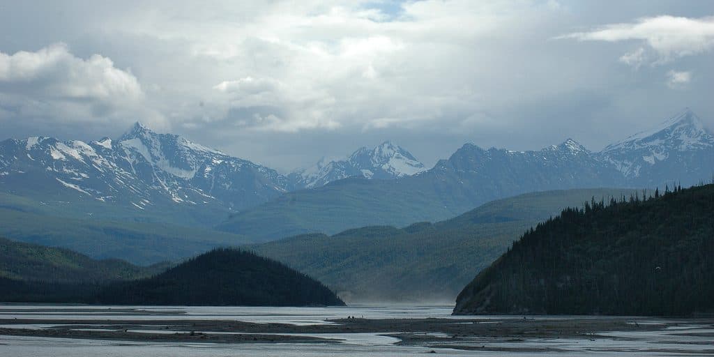
Clear days give you the best backdrop. Warm summer spells boost river volume and drama. This is a quick-stop viewpoint, so swing through whenever it fits your McCarthy Road day—light is constantly shifting on the silty water.
Scenic pullout · Wrangell-St. Elias National Park
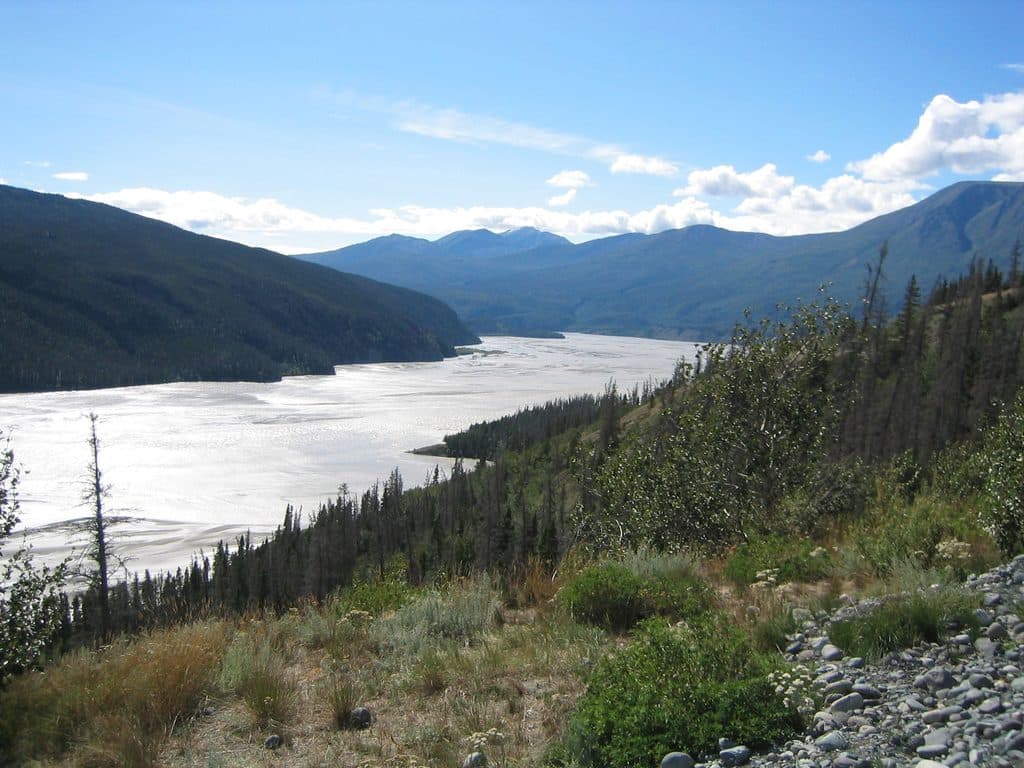
Quick pullout with big views of the braided Chitina River
Overview
A classic McCarthy Road pullout, the Chitina River Scenic Vista is all about big, braided-river views without a big time commitment. It’s a photo-forward stop—no formal trail—where you can step out, soak up the scene, and keep rolling.
It’s a simple, no-frills pullout with a satisfying payoff. If you’re already driving McCarthy Road, it’s an easy yes; just don’t expect services or a long linger.
 Parkwolf’s verdictBottom Line
Map
Local know-how
Watch for signed viewpoints along McCarthy Road; mileposts aren’t consistently published.
It can be very windy—stay well back from steep or unstable edges.
Check with park rangers for current road and pullout conditions before you go.
Bring water and pack out your trash; there are no facilities here.
If you’re short on time, treat it as a quick photo stop on the way to McCarthy/Kennecott.
Plan your stop

The highest, rockiest slopes around here are a summer buffet for grizzly bears.
Wrangell-St. Elias Tour Guide
Parkwolf is a GPS audio tour guide for Wrangell-St. Elias National Park. As you drive, it chimes in with what’s ahead: hidden gems, upcoming stops, history, geology, and wildlife, right through your car’s speakers.
See the Wrangell-St. Elias audio tourRecorded for this place
Chitina River Scenic Vista“The next scenic pullout offers a great view of the Chitina River. This is a classic braided river, where the channel splits into many smaller streams because of all the sediment carried down by glaciers.”
Plays as you drive up to Chitina River Scenic Vista in the Parkwolf Wrangell-St. Elias Tour Guide.
More stories near here in the app
“Fantastic app with many points of information… It’s great to just turn on while you’re driving and it gives you an audio tour of the national Park. We love it!!!!”


Guide
Expect wide, silty channels spreading across a broad valley—textbook glacial outwash. On clear days, you may catch mountain backdrops framing the river. Water levels run highest during warm summer spells when glacier melt accelerates, which makes the braids feel even more alive.
The Chitina is shaped by heavy glacial runoff and sediment, producing the classic braided pattern you’re looking at. In fact, despite its lower name recognition, the Chitina carries more water than the Copper River, and the name “Chitina” comes from the native word for copper. It’s a popular river for rafting trips staged from the McCarthy side of the park.
Be cautious around steep, potentially unstable riverbanks and when pulling in and out of narrow turnouts. Weather changes fast in this remote area; carry layers and basic emergency gear. If you need the latest on road conditions or pullouts, check in with park rangers before heading out.
Fold this into a McCarthy Road itinerary with other roadside highlights like the Kuskulana Bridge and Gilahina Trestle, or continue on to the McCarthy/Kennecott area for more glacial-river scenery and access.
Wildlife
 112 sightingsGrizzly BearMost seen around 9 PMSighting map
 63 sightingsMooseMost seen around 8 PMSighting map
 21 sightingsHumpback WhaleMost seen around 1 PMSighting map
 46 sightingsSteller Sea LionMost seen around 11 AMSighting map
 37 sightingsBlack BearMost seen around 8 PMSighting map
 48 sightingsBald EagleMost seen around 5 PMSighting map
Sighting maps show where each species has been reported across Wrangell-St. Elias. Wildlife moves, so no sighting is guaranteed.
Keep exploring
Parkwolf’s Wrangell-St. Elias ranking
The audio tour guide for the drive, plus offline maps, trails, and wildlife heatmaps for when the signal drops.