Place · 1.3 mi away
Moderate

A bite‑size adventure at the very end of Nabesna Road, the Rambler Mine Trail climbs quickly to weathered gold‑mine ruins and a sweeping overlook of the Nabesna River valley. It’s roughly 1.7 miles round trip (out and back) with about 528 feet of gain—short, but it punches uphill fast. If you like history with your views, this one delivers.
From the public turnaround at the road’s end, you’ll start on an old mining road that can be muddy, then turn right onto a narrower forested trail for the real climb. Expect steady, sometimes steep grades with a few rocky or rooted spots where you’ll want to watch your footing. Most hikers turn around at the mine site; a rough, unmaintained path continues above for even broader panoramas, but it’s steeper, looser, and can be overgrown.
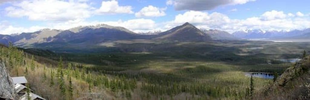
The mine ruins sit high on White Mountain and include buildings, blocked‑off shafts/adits, scattered equipment, and even a mostly standing pulley machine—an atmospheric snapshot of 1940s mining. Obey posted signs and treat every structure as unstable. The views open wide over the valley, and some hikers report spotting Dall sheep near the top; wildlife cameras are in the area to monitor the herd, so give animals extra space and keep noise down.
Drive Nabesna Road to its end. The last stretch can be rough, and after rain the final miles may require high‑clearance 4WD. Do not park on private lodge property or the airstrip at the road end; there’s designated public parking in a gravel turnaround just past the lodge. From there, walk the old road about a third of a mile to the signed trail.
Go on a clear, dry day for firm footing and the best valley views. Morning or late afternoon light is kinder for photos and often less buggy than midday. After sustained rain, reconsider the drive to the road end or be prepared to wait for creek levels to drop.
Yes—if you’re already tackling Nabesna Road. It’s a high‑reward, low‑time stop with real mining history and a big overlook. If you’re chasing deeper mining‑history immersion elsewhere in the park, the historic district at Kennecott offers a broader, in‑depth look, but it’s a much bigger commitment than this punchy ramble.
Park only in the public gravel turnaround just past the lodge at the end of Nabesna Road; do not park on private property or the airstrip. From parking, walk ~0.3 mi on the old road to the signed trail.
Unstable mine buildings and blocked shafts—do not enter. No cell service. Road’s final miles can be rough with high creek crossings after rain; carry extra supplies. Upper path is steep, loose, and overgrown. Respect private property near the trailhead.