Challenging

Trail Creek- Lost Creek Loop

Remote off-trail loop with a 6,000 ft pass and serious creek fords
Trail Creek- Lost Creek Loop, Wrangell-St. Elias National Park
Distance23.8 mi
Typical time60 hr
DifficultyChallenging
PetsNot allowed

Overview

This is a true Alaskan backcountry classic: roughly 22–24 miles total (commonly reported as 23.8), mostly off-trail, linking the Trail Creek and Lost Creek drainages over a broad 6,000-foot tundra pass. Most backpackers take 3–4 days. Expect braided creek walking, rocky gravel bars, and real route-finding. It’s rugged, committing, and incredibly scenic—if you’re comfortable with navigation and variable water.

Route Character (clockwise recommended)

  • Trail Creek approach: From Nabesna Road, you’ll follow the creekbed with multiple fords and long cobble stretches. Benches east of the main channel sometimes offer drier travel. Around 6 miles in the canyon tightens and any early vehicle tracks fade.
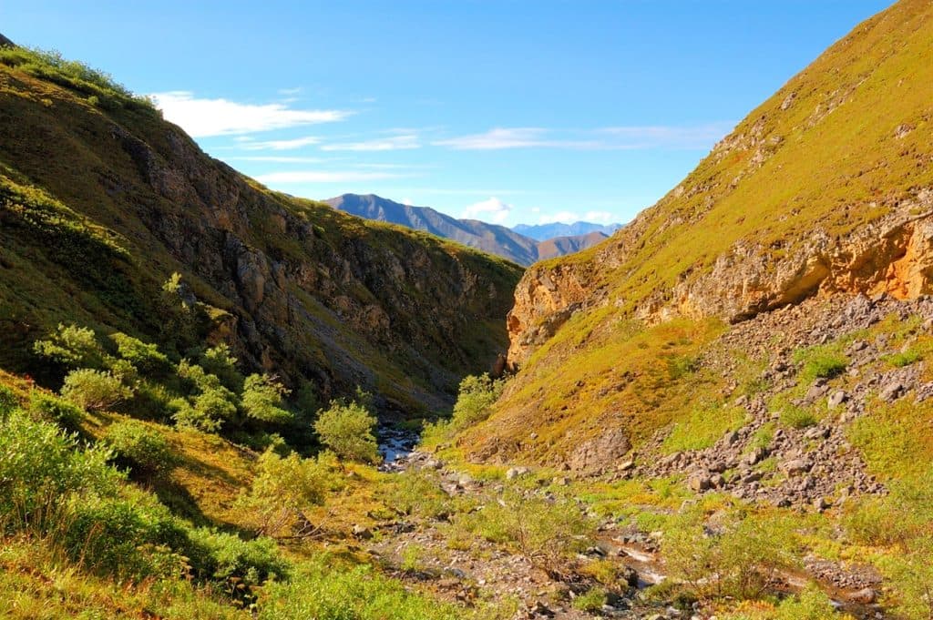
  • To the pass: Turn up the first major side canyon on the east (often described as the 4th drainage) and climb tundra and some scree to the broad 6,000' pass. Camps are excellent in the upper basins.
  • Lost Creek descent and gorge bypass: From the pass, a central tundra ridge gives easier walking before you drop toward the creek. Down-valley, the canyon pinches into an impassable gorge—bypass it on vegetated benches on the west side by climbing roughly 300 feet and traversing about 1.5 miles, then descend to the gravel bars to finish.

Access & Logistics

Trailheads are along Nabesna Road: Trail Creek at about Mile 29.8 and Lost Creek around Mile 31.2, roughly 1.4–1.5 miles apart—plan a short road walk or a simple shuttle. Stop at the Slana Ranger Station for the latest on water levels, the gorge bypass, and wildlife notes. Lower miles may show signs of designated ORV use; beyond those endpoints, you’re on foot. Water is constant along both drainages—treat everything. Favor tundra benches or higher terraces for camping; avoid low gravel bars if rain is in the forecast.

Conditions, Hazards, and Skills

  • Route-finding: There is no maintained trail for most of this loop. Carry paper topo, compass, and GPS—and know how to use them. Don’t blindly follow old tracks.
  • Creek crossings: Numerous fords that are often easiest early morning. Levels can rise dramatically with warm afternoons or rain; an easy AM crossing can be unsafe by evening. Be willing to turn back if water spikes.
  • Terrain and exposure: Expect sustained rock-hopping, some scree, and the west-side bench bypass above the Lost Creek gorge that feels exposed in spots. Fog can make that traverse spicier—wait it out or choose a safer line.
  • Variability: Sections wash out year-to-year. Parties have turned around in high water seasons; others report strenuous-but-stellar 3-day completions in better conditions. Check current conditions before committing.
  • Wildlife: Bears use these drainages; carry spray and store food properly. Dall sheep are often seen near the pass; marmots show up in the high basins.

Best Time to Hike

June through September is typical. In June, expect lingering snow and potentially higher, colder fords—sticking to lower elevations early season is smart. July is the sweet spot. August is also good, with fewer bugs if you stay high. By September, expect more rain and wintry conditions up high. Regardless of month, plan crossings early in the day.

Who Will Love (and Not Love) This Loop

If you crave wide-open tundra, solitude, and problem-solving, this loop is a gem. If you want a marked, maintained trail, look elsewhere—consider easier options on the McCarthy/Kennecott side of the park instead. Bring navigation redundancy, trekking poles, ford footwear, robust ankle support, and a satellite communicator. It’s the real deal—and worth it when conditions line up.

Pros

  • Tundra ridge option on Lost Creek offers faster, drier travel with big views
  • Abundant high bench camps in both upper basins for flexible itineraries

Cons

  • Exposed bench traverse above Lost Creek gorge can be serious in fog
  • Year-to-year washouts and high water can shut the route down

Parking

Roadside pullouts where Trail Creek (MP ~29.8) and Lost Creek (MP ~31.2) cross Nabesna Road; leave one car at each or plan a short road walk.

Caution

Mostly unmarked, off-trail travel with numerous fords; water can rise feet within hours. The Lost Creek gorge requires a west-side bench bypass with some exposure. Conditions vary year-to-year—check with Slana Ranger Station and be prepared to turn back.

The Parkwolf tour guide sitting on a phone mounted in a car

Parkwolf Tour Guide

Like a tour guide in your car.

Bring Wrangell-St. Elias trail research into the car, with offline maps and stories that play as you drive.Download Parkwolf on the App Store