Parking
Park at the Lost Creek Trailhead on the Nabesna Road near milepost 31.2. The Soda Lake route begins several miles up the Lost Creek corridor; use the current signed/re-routed access and do not take the old Big Grayling Lake access.
#6 of 13 trails in Wrangell-St. Elias
Wrangell-St. Elias National Park, AK
Remote 29-mile round trip to a landslide-dammed lake via creek crossings, tundra, and route-finding.
Overview
Soda Lake is a remote backcountry objective in the Nabesna district. From the Lost Creek Trailhead, the route follows the Lost Creek corridor, crosses open tundra and the Platinum Creek drainage, then turns up Soda Creek to a landslide-dammed lake surrounded by dramatic terrain. This is an out-and-back visitor route of about 29 miles total; the stored line follows the one-way corridor to Soda Lake and is not duplicated for the return. Allow 2–3 days or more, especially if exploring around the lake.
Map & elevation
Plan your hike

The highest, rockiest slopes around here are a summer buffet for grizzly bears.
Wrangell-St. Elias Tour Guide
Parkwolf is a GPS audio tour guide for Wrangell-St. Elias National Park. As you drive, it chimes in with what’s ahead: hidden gems, upcoming stops, history, geology, and wildlife, right through your car’s speakers.
See the Wrangell-St. Elias audio tourRecorded for this area
Lost Creek Trail: A Backcountry Classic“Coming up is the start of the Lost Creek Trail, which is considered a classic Alaskan backcountry adventure. It’s a rugged 24-mile loop that is mostly off-trail, meaning there isn't a clear path for large portions of it.”
Plays on the road 0.1 mi from the trailhead in the Parkwolf Wrangell-St. Elias Tour Guide.
More stories near here in the app
“Fantastic app with many points of information… It’s great to just turn on while you’re driving and it gives you an audio tour of the national Park. We love it!!!!”


Trail guide
Park at the Lost Creek Trailhead on the Nabesna Road (around milepost 31.2). The Soda Lake route begins several miles up the Lost Creek trail; follow the current signed/re-routed corridor rather than the old access toward Big Grayling Lake. The route leaves Lost Creek for the Platinum Creek drainage, crosses the unnamed creek draining the Karen Lakes area, and reaches the Soda Creek confluence. Follow Soda Creek upstream; recreational ORV use ends at a signed point, and the final section to Soda Lake is on foot. Near the red-cliff creek junction, cross to the east fork and look for the brushy horse trail toward the lake’s northwest corner. A steep scree alternative reaches the lake from the southwest but is loose and exposed.
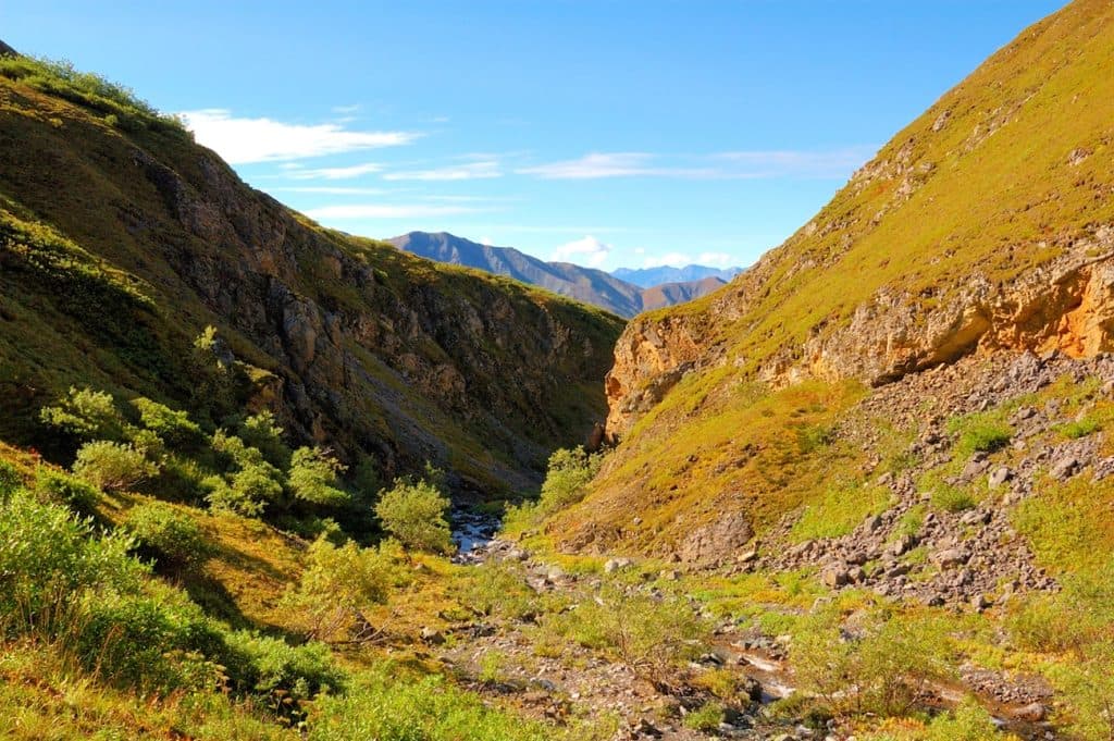
Expect spruce forest, sedge tussocks, open tundra, creek valleys, red cliffs, mineral deposits, and the turquoise water of Soda Lake. The lake occupies a landslide area associated with movement along the Totshunda Fault. Dall sheep are attracted to the mineral-rich ground, and bear, moose, and wolf sign may be present.
This is a remote route with limited help and no ordinary services. Lost Creek and Platinum Creek are gravel streambeds or faint/packed-dirt corridors that cross water repeatedly; the line can disappear in creek wash and brush. Carry water from Lost Creek because the middle section may be dry until Soda Creek. Respect the private parcels near Big Grayling Lake by staying on the route and not camping on private land. Recreational ORV access is limited to the designated corridor; hikers must continue on foot beyond the signed endpoint. Contact the Slana Ranger Station for trip-planning and current road information.
Plan for strenuous travel, route-finding, mud, tundra tussocks, repeated creek crossings, rapidly rising water after rain or warm afternoons, and changing Nabesna Road conditions. The horse trail near the lake is brushy; the scree alternative is steep and loose. Experienced backcountry navigation, a map and compass, bear-resistant food storage, and a conservative water/weather plan are essential.
Wildlife
 112 sightingsGrizzly BearMost seen around 9 PMSighting map
 63 sightingsMooseMost seen around 8 PMSighting map
 21 sightingsHumpback WhaleMost seen around 1 PMSighting map
 46 sightingsSteller Sea LionMost seen around 11 AMSighting map
 37 sightingsBlack BearMost seen around 8 PMSighting map
 48 sightingsBald EagleMost seen around 5 PMSighting map
Sighting maps show where each species has been reported across Wrangell-St. Elias. Wildlife moves, so no sighting is guaranteed.
Keep exploring
 ChallengingTrail Creek- Lost Creek Loop22.5 mi · 1.3 days · 0.1 mi awayStrenuous off-trail loop over a 6,000-foot pass between Trail and Lost Creeks
 ModerateSkookum Volcano Trail5 mi · 3.5 hr · 5 mi awayRemote volcanic pass hike with creek crossings and route-finding
 ModerateRambler Mine Trail1.5 mi · 1.8 hr · 10.1 mi awayShort, steep hike from Nabesna Road to historic mine ruins and valley views
 ModerateCaribou Creek Trail: Nabesna Road6 mi · 3 hr · 11.3 mi awayQuiet valley-to-cabin walk with creek hops and Wrangell views
Parkwolf’s Wrangell-St. Elias ranking

The audio tour guide for the drive, plus offline maps, trails, and wildlife heatmaps for when the signal drops.