
Place · 0 mi away
Moderate
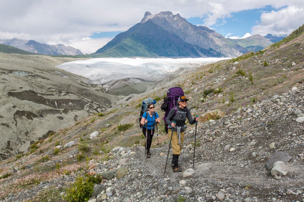
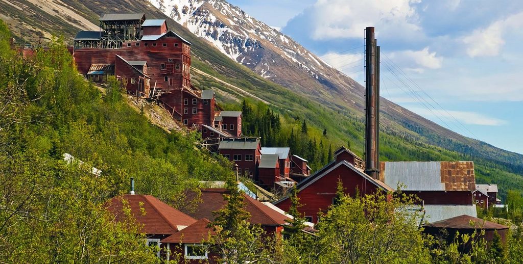
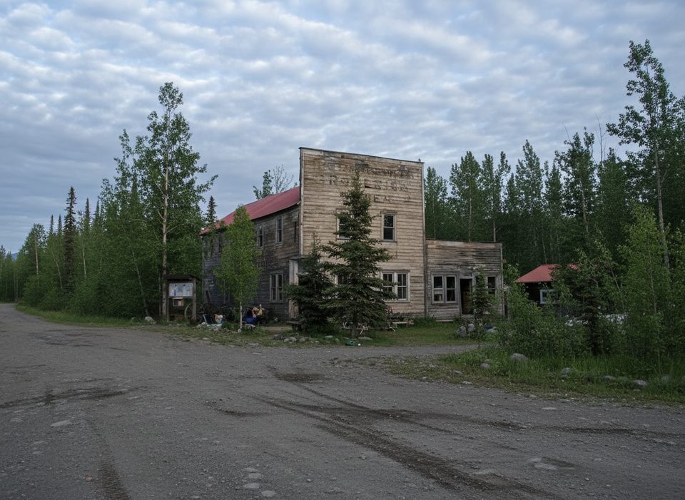
If you want a true Alaska glacier experience without a mountaineering resume, this is the move. Starting in the historic mill town of Kennecott, the Root Glacier Trail rolls out easy-to-moderate singletrack before dropping through rocky moraine to the glacier’s toe. Count on roughly 4.0 miles round-trip to reach the ice and return; many hikers extend to 5–6 miles total if they wander on the glacier. Plan around 2.5–4 hours depending on pace and on-ice time.
Reaching Kennecott is part of the adventure: drive the 60-mile unpaved McCarthy Road to the park footbridge and park for a fee. Private vehicles don’t continue past the bridge. From the footbridge, shuttle, bike, or walk about 5 miles up to Kennecott. The trailhead sits about 0.5 miles through the mill town. Cell service is spotty—download maps.
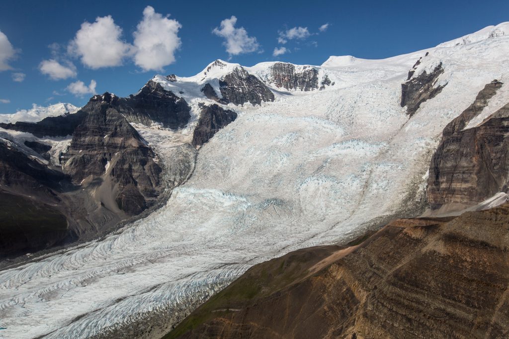
The path winds through brush and forest with occasional views. Around 0.4 miles, you’ll hit a junction with a pit toilet—continue straight for Root Glacier. At roughly 1.3 miles there’s a pretty waterfall (filter before drinking). Around 1.5 miles, the scenery blows open: big views toward Mt. Blackburn, Regal, Donoho, and the Stairway Icefall. From the signed “Glacier Access” turn, descend a short but steeper, loose section of moraine to the glacier’s edge. This final bit is the crux and takes extra time.
You’re allowed to step onto Root Glacier on your own. Do it only with traction (microspikes or crampons) and ideally poles—plain boots aren’t enough. Stay well back from the edges where ice is undercut by cold, swift meltwater. Expect low-angle exploring near the toe with sculpted runs, blue pools, crevasses, and the constant murmur of water under debris. Go with a partner, give any holes or moulins a wide berth, and turn around if surfaces look thin or fractured. Guided trips are available in town if you want instruction and gear.
Free, walk-in camping spots sit near the access just before the descent to the ice, with additional primitive camping farther along at Jumbo Creek. Bears frequent the area; travel in groups, make noise, and carry bear spray. You may also spot moose, Dall sheep, eagles, or even a lynx in the broader area. The trail itself is well trodden and popular in season, but the scale of the glacier keeps it feeling wild once you step onto the ice.
June to early September is the sweet spot: roads and services are up, and the glacier surface is generally friendlier. Start early for cooler temps on the approach and softer light on the ice. After rain or hot spells, expect higher meltwater and a more dynamic (read: trickier) toe. Weekdays see fewer people than weekends.
Park at the end of McCarthy Road near the footbridge (paid lots such as Base Camp Kennicott). Cross the footbridge; shuttle, bike, or walk ~5 miles to Kennecott. The trailhead is about 0.5 miles through the mill town.
Glacier margins have rotten, undermined ice and swift meltwater; stay well back. Traction (microspikes or crampons) is essential on ice. Expect a steep, loose moraine descent and possible seasonal stream crossing. Bears are common; carry spray. Weather shifts fast and it’s colder/windier on the ice.
Place · 0 mi away
Place · 0 mi away
Place · 3.8 mi away
Place · 3.9 mi away
Challenging · 0 mi away
Challenging · 3.8 mi away
Easy · 27.6 mi away
Challenging · 38.6 mi away

Parkwolf Tour Guide
