Malham in Yorkshire Dales National Park

Sight · Yorkshire Dales National Park

Malham

Beck-side stone village that launches walks to famous limestone cliffs

Photo: Wikimedia Commons
Type
Sight
Nearest trail
0.1 km
Audio stories
6 nearby
  • Parking
  • Restrooms
  • Visitor center
  • Exhibit

Hear the audio tour

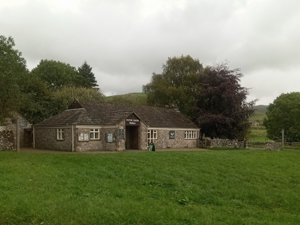
Malham Village and National Park Centre

Overview

About Malham

Why stop

  • The beck, bridges, and drystone walls give the village real character
  • Several major limestone walks start from the same compact base

Heads up

  • A very popular tiny village on good walking days
  • The headline scenery is beyond the centre, so plan to walk
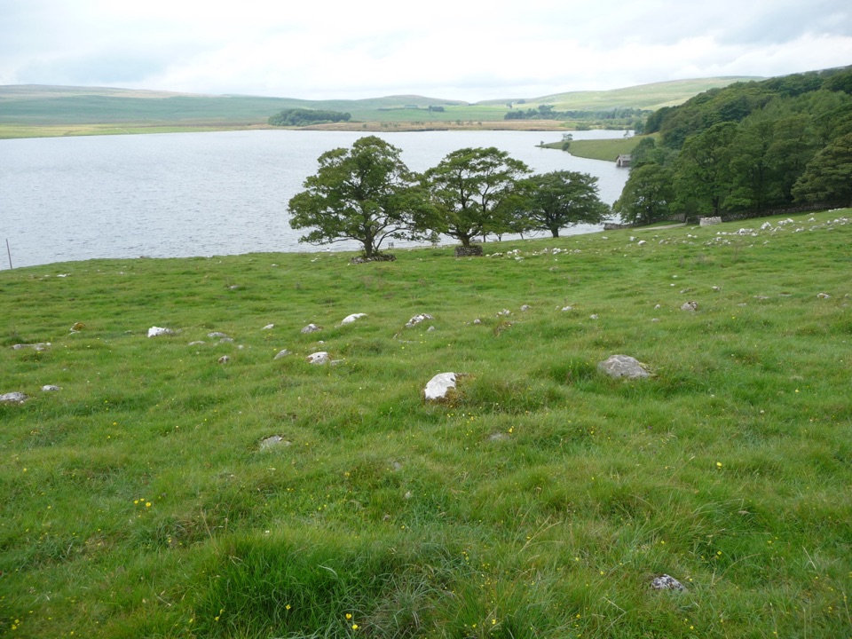
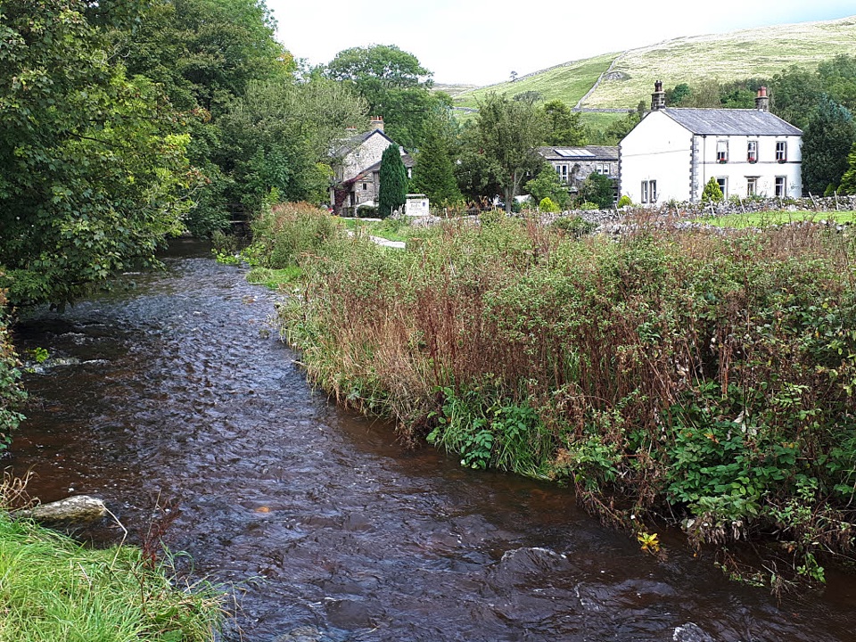
Malham is the working base for some of the most dramatic limestone scenery in the Dales, and it earns a stop in its own right. Malham Beck runs straight through the middle of the village, crossed by small bridges and hemmed in by drystone walls, grey stone houses, and pastures rising to the fells. It is compact enough to walk end to end in a few minutes, which is part of the appeal: park once, eat, gather information, then head out on foot.
Parkwolf’s verdictWhy stop

Map

Where it is

Loading the Yorkshire Dales map
Full map
SightMalham54.06127, -2.15290
Keep this map with you offline in the Parkwolf app

Plan your stop

Before you go

Best time to go

Weekday mornings are the calmest, and arriving early is the single best way to get a parking space. Late spring and early autumn give long light on the white limestone without full summer crowds. Sunny weekends and school holidays are busy, with slow lanes and a full car park by mid-morning. After heavy rain the waterfalls run hard but the tracks turn greasy. The car park is also a designated dark sky discovery site, so clear winter nights are worth staying for.


Wildlife and rules

Peregrines have nested at Malham Cove since 1993. Stay on the paths, respect any roped-off area below the cliff, and do not fly drones near the Cove.

1 active Yorkshire Dales alert

  • ClosureTemporary closures on public rights of wayAvoid the listed sections of public rights of way while their temporary closures or pedestrian prohibition are in force. - Public Bridleway No. 52 (05.Official details
Yorkshire Dales alerts
A park ranger sits on a dash-mounted phone, talking, as Parkwolf’s Tour Guide plays “Army Cutworm Moths: A Grizzly Bear Buffet” on Grand Loop Road below Dunraven Pass in Yellowstone
Parkwolf Tour GuideThe highest, rockiest slopes around here are a summer buffet for grizzly bears.

Yorkshire Dales Tour Guide

Your drive to Malham, narrated.

Parkwolf is a GPS audio tour guide for Yorkshire Dales National Park. As you drive, it chimes in with what’s ahead: hidden gems, upcoming stops, history, geology, and wildlife, right through your car’s speakers.

Recorded for this place

Malham Village and National Park Centre
0:00 / 0:35
“You're coming up on Malham village, where the beck runs between stone houses and little bridges. It's the base for the limestone walks, but I'd spend a few minutes in the village itself before setting off.”

Plays as you drive up to Malham in the Parkwolf Yorkshire Dales Tour Guide.

More stories near here in the app

  • Janet's Foss and Gordale Scar
  • Malham Cove
  • The Scream Above the Roofs
  • The Cuckoo's Other Call
  • 298 audio storiesacross Yorkshire Dales’s roads, triggered by GPS as you drive
  • Wildlife heatmapsfor Eurasian Otter, Atlantic Salmon, Short-eared Owl, and 13 more
  • Works offlinemaps, 99 trails, 63 places, and audio download before you lose signal
  • CarPlay readysimple controls built for the drive
★★★★★
“Fantastic app with many points of information… It’s great to just turn on while you’re driving and it gives you an audio tour of the national Park. We love it!!!!”
JMJamesApp Store review
Download Parkwolf on the App StoreGet Parkwolf on Google Play

4.7 from 8,600+ ratings

Guide

More about Malham

How it differs from the big-name sightsMalham Cove, Gordale Scar, Janet's Foss, and Malham Tarn are all separate places reached on…

Malham Cove, Gordale Scar, Janet's Foss, and Malham Tarn are all separate places reached on paths out of the village. What the village adds is the practical and social side: the National Park Centre with its geology exhibition and walking leaflets, two pubs, cafes, a shop, and hostel and inn beds. Think of it as the trailhead with a pulse, not the scenery itself.

What to see and doMalham Cove is roughly a half-hour gentle walk from the village, a huge curved limestone wall…
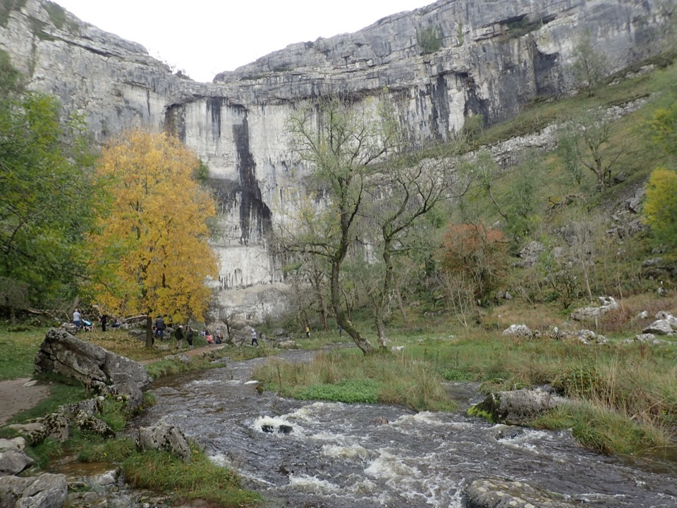
  • Malham Cove is roughly a half-hour gentle walk from the village, a huge curved limestone wall visible from far down the dale. The classic route continues up around 400 stone steps to the limestone pavement on top.
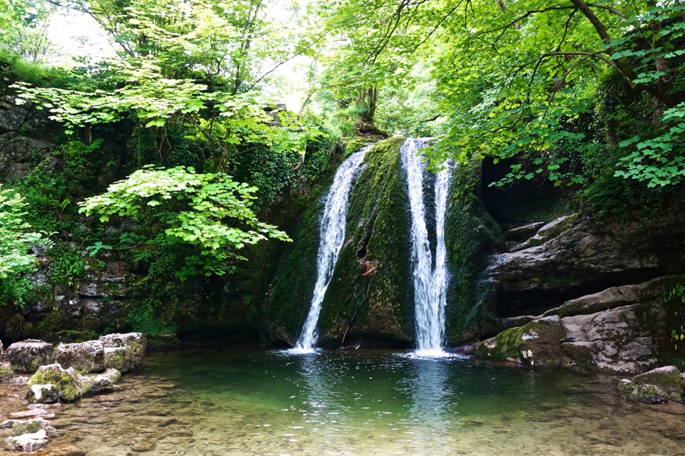
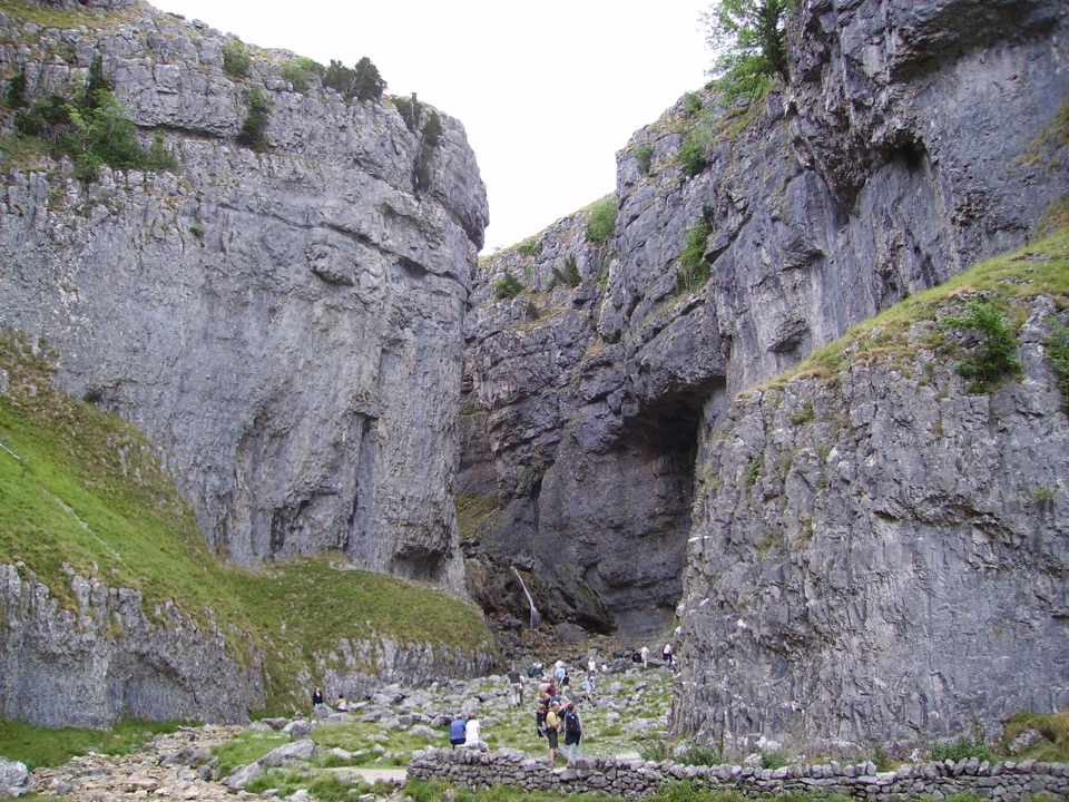
  • Janet's Foss and Gordale Scar lie east of the village, linked with the Cove on the Malham Landscape Trail, a circuit of about 5 miles that is heavily used and generally moderate. A shorter out-and-back to Janet's Foss is around 3 miles.
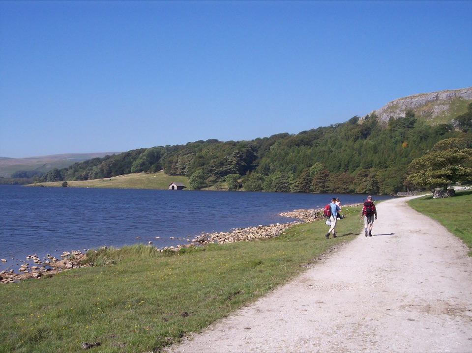
  • The Pennine Way passes through, heading north past the Cove toward Malham Tarn, a glacial lake and national nature reserve with quieter walking and waterbirds.
  • Wander the village itself for the beck, the bridges, the old field walls, and views up Malham Rakes.
History in the landscapeThe settlement appears in the Domesday Book as Malgun and has been lived in for at least a…

The settlement appears in the Domesday Book as Malgun and has been lived in for at least a thousand years. A century ago there were mills and mines here, and the pattern of drystone walls, pastures, and scattered farms around the village is the long result of farming this thin limestone soil.

Practical tipsThe National Park car park is pay and display, with toilets that stay open even when the…
  • The National Park car park is pay and display, with toilets that stay open even when the visitor centre is not, plus a Changing Places toilet and drinking water. Extra field parking sometimes appears at peak times, but total space is limited.
  • Wear proper footwear. Paths mix gravel and stone flags with rough, rocky, uneven woodland sections that get slippery when wet, and the Cove steps are a genuine climb.
  • If steps and stiles are a problem, ask at the centre about the easier access routes toward the Cove, Gordale Scar, and the Tarn.
  • Fields are grazed, so keep dogs on leads on footpaths, take litter home, and do not light fires or barbecues.
Honest drawbacksThis is a very small village absorbing a lot of visitors on good walking days, so it can feel…

This is a very small village absorbing a lot of visitors on good walking days, so it can feel crowded and the narrow approach roads get congested. Parking is paid and finite. And the headline scenery is all beyond the houses, so if you are not prepared to walk at least a couple of miles, you will only see a pretty hamlet.

Wildlife

Wildlife in Yorkshire Dales

All Yorkshire Dales wildlife maps

Sighting maps show where each species has been reported across Yorkshire Dales. Wildlife moves, so no sighting is guaranteed.

Keep exploring

Near Malham

See it all on the map

Trails nearby

More stops nearby

Parkwolf’s Yorkshire Dales ranking

Top sights in Yorkshire Dales

All 63 places
  1. 1Malham CoveSight
  2. 2Aysgarth FallsSight
  3. 3Ribblehead ViaductSight
  4. 4Gordale ScarSight
  5. 5Bolton CastleSight
  6. 6Janet's FossSight

Take Parkwolf to Yorkshire Dales.

The audio tour guide for the drive, plus offline maps, trails, and wildlife heatmaps for when the signal drops.

4.7 from 8,600+ ratings

Download Parkwolf on the App StoreGet Parkwolf on Google Play