Scaleber Force in Yorkshire Dales National Park

Sight · Yorkshire Dales National Park

Scaleber Force

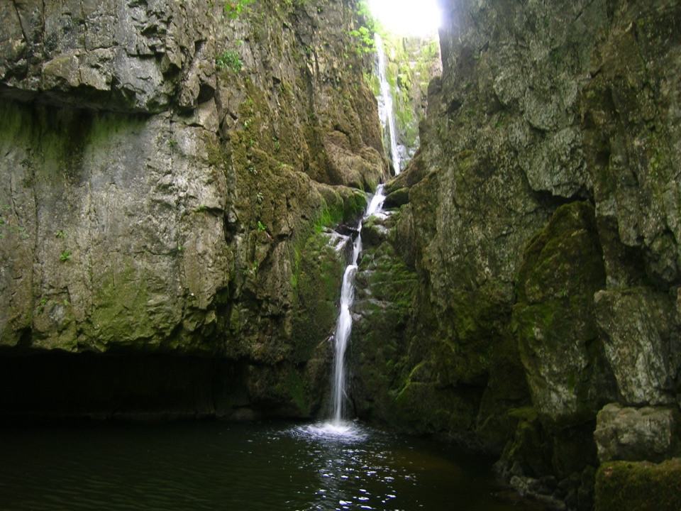
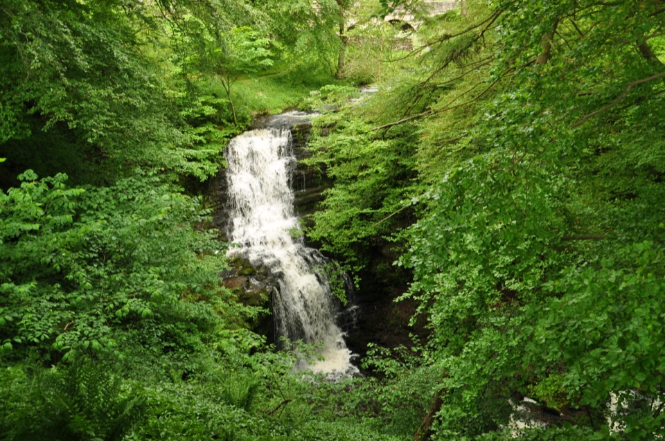
Twelve metres of limestone cascade hidden in a mossy roadside gorge

Photo: Wikimedia Commons
Type
Sight
Nearest trail
2.3 km
Audio stories
5 nearby
  • Pullout
  • Scenic viewpoint
  • #25 of 53 sights

Hear the audio tour

Scaleber Force

Overview

About Scaleber Force

Why stop

  • A hidden wooded gorge with several waterfall drops
  • The upper view is only a short walk from the road

Heads up

  • Narrow, steep descent with slippery roots and rough steps
  • Dry spells can reduce the falls to a thinner cascade
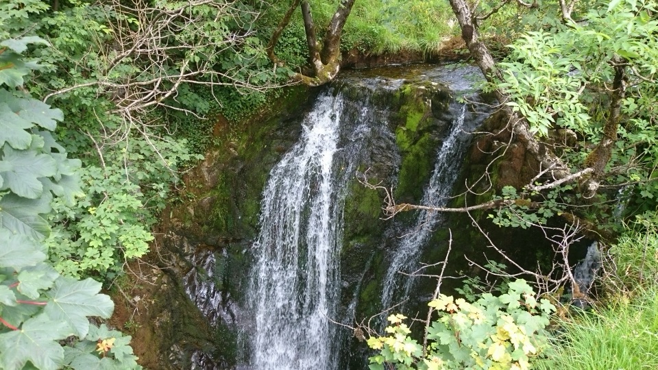
Scaleber Force, also known as Scaleber Foss, is the waterfall on Stockdale Beck in Scaleber Wood, a couple of miles from Settle in the Yorkshire Dales. It drops roughly 12 metres (40 feet) over stacked limestone ledges into a deep pool at the head of a wooded gorge, and the first viewpoint is only a short walk from the lane. Free to visit, with no ticket or gate.
Parkwolf’s verdictWhy stop

Map

Where it is

Loading the Yorkshire Dales map
Full map
SightScaleber Force54.05885, -2.24493
Keep this map with you offline in the Parkwolf app

Plan your stop

Before you go

Best time to go

After rain the beck runs forceful and loud; in dry spells it can thin to a modest cascade, so rain improves the water and worsens the footing. The tree canopy keeps the gorge shaded much of the day, and late afternoon light often works best for photographs. Early visits are the most peaceful, and they also give you the best chance at one of the two parking spots.


Access and parking reality

Access is from the minor road High Hill Lane, north of the wood, reached on the steep road out of Settle towards Malham. There is no car park: just two tiny roadside pull-ins with room for roughly two cars in total. Do not block the narrow lane, field entrances, or emergency access. If both spaces are taken, move on and return another time. Public transport does not make the falls easy to reach, though some visitors walk out from Settle instead of driving. Two stone step-over stiles lead into the wood.

1 active Yorkshire Dales alert

  • ClosureTemporary closures on public rights of wayAvoid the listed sections of public rights of way while their temporary closures or pedestrian prohibition are in force. - Public Bridleway No. 52 (05.Official details
Yorkshire Dales alerts
A park ranger sits on a dash-mounted phone, talking, as Parkwolf’s Tour Guide plays “Army Cutworm Moths: A Grizzly Bear Buffet” on Grand Loop Road below Dunraven Pass in Yellowstone
Parkwolf Tour GuideThe highest, rockiest slopes around here are a summer buffet for grizzly bears.

Yorkshire Dales Tour Guide

Your drive to Scaleber Force, narrated.

Parkwolf is a GPS audio tour guide for Yorkshire Dales National Park. As you drive, it chimes in with what’s ahead: hidden gems, upcoming stops, history, geology, and wildlife, right through your car’s speakers.

Recorded for this place

Scaleber Force
0:00 / 0:29
“You're approaching the lane access to Scaleber Force, a waterfall tucked into the wood above Settle. Here Stockdale Beck drops about twelve metres in steps over limestone raised along the South Craven Fault.”

Plays as you drive up to Scaleber Force in the Parkwolf Yorkshire Dales Tour Guide.

More stories near here in the app

  • Settle and Attermire Scar
  • The Moor That Fed Brassmakers
  • When Hyenas Used the Cave
  • The Lost Lake at Long Preston
  • 298 audio storiesacross Yorkshire Dales’s roads, triggered by GPS as you drive
  • Wildlife heatmapsfor Eurasian Otter, Atlantic Salmon, Short-eared Owl, and 13 more
  • Works offlinemaps, 99 trails, 63 places, and audio download before you lose signal
  • CarPlay readysimple controls built for the drive
★★★★★
“Fantastic app with many points of information… It’s great to just turn on while you’re driving and it gives you an audio tour of the national Park. We love it!!!!”
JMJamesApp Store review
Download Parkwolf on the App StoreGet Parkwolf on Google Play

4.7 from 8,600+ ratings

Guide

More about Scaleber Force

What makes it distinctThe falls sit on the South Craven Fault, where uplifted limestone gave the beck something hard…

The falls sit on the South Craven Fault, where uplifted limestone gave the beck something hard to work at. Over time the stream has cut the drop back into a steep-sided, tree-shaded ravine, so you get rugged pale-to-dark limestone walls, moss, and the sudden edge of the Craven uplands all in one small place. The water comes down in multiple drops with lower cascades rather than a single clean plunge.

What you see and doA quick upper viewpoint just inside the wood, looking down onto the main fall from the…
  • A quick upper viewpoint just inside the wood, looking down onto the main fall from the limestone outcrop above it.
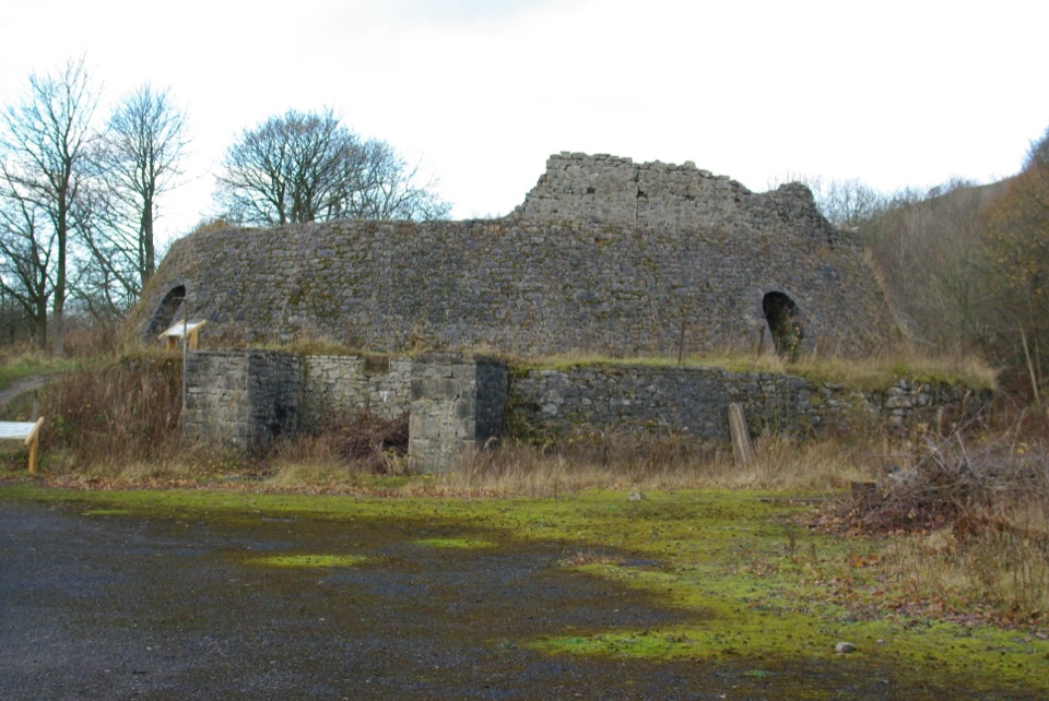
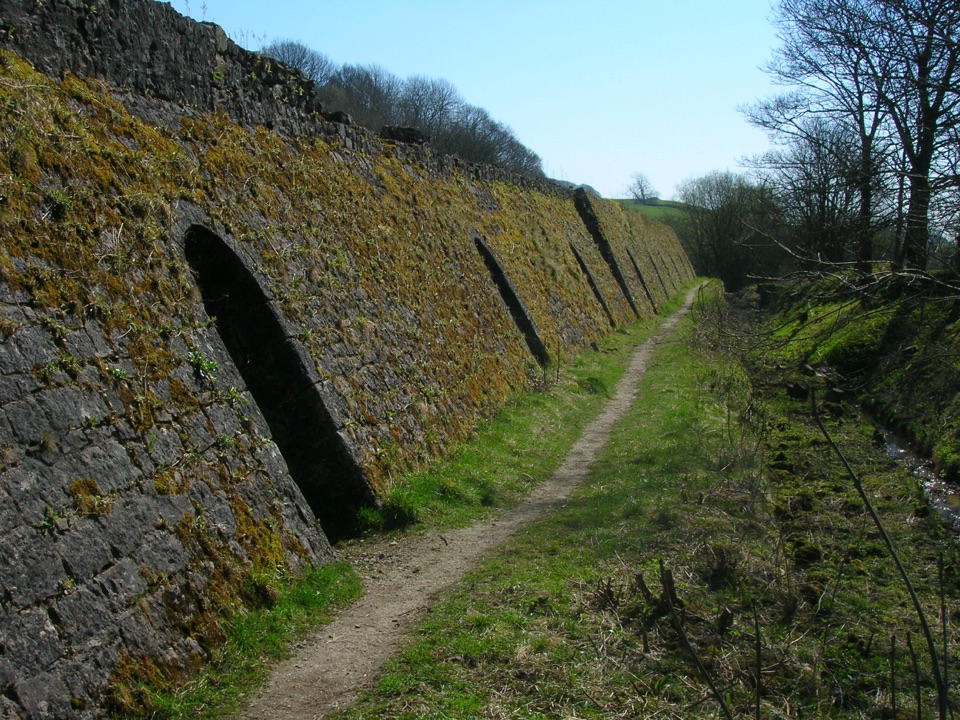
  • An unsurfaced upper path running along the top of the gorge, passing an old lime kiln.
  • A narrow lower descent to the pool and cascades for those confident on rough, steep ground.
  • Photography in a dark, mossy, enclosed setting where the water is the brightest thing in frame.
Practical safetyThe lower route is narrow, steep, rough and frequently slippery, with eroded roots, uneven…

The lower route is narrow, steep, rough and frequently slippery, with eroded roots, uneven steps and some unguarded drops above the gorge. Wear proper footwear with grip and keep children and dogs close. Stay back from wet rock and the pool edge; the falls are best appreciated from the paths, and the view from above is a genuine alternative if the descent looks beyond you. Not suitable for wheelchairs or pushchairs, and there are no toilets, cafe or facilities at the site. Nearest amenities are in Settle.

Honest drawbacksVisitors consistently praise how hidden and beautiful it feels and how close it is to the road,…

Visitors consistently praise how hidden and beautiful it feels and how close it is to the road, and just as consistently warn about the slippery, rocky descent and the extremely limited parking. It is a short stop rather than a day out; if you want more, a longer circular walk from Settle can link the wood with Sugar Loaf Hill and Jubilee Cave, but that walk is a choice, not a requirement for seeing the falls.

Wildlife

Wildlife in Yorkshire Dales

All Yorkshire Dales wildlife maps

Sighting maps show where each species has been reported across Yorkshire Dales. Wildlife moves, so no sighting is guaranteed.

Keep exploring

Near Scaleber Force

See it all on the map

Trails nearby

More stops nearby

Parkwolf’s Yorkshire Dales ranking

Top sights in Yorkshire Dales

All 63 places
  1. 1Malham CoveSight
  2. 2Aysgarth FallsSight
  3. 3Ribblehead ViaductSight
  4. 4Gordale ScarSight
  5. 5Bolton CastleSight
  6. 6Janet's FossSight

Take Parkwolf to Yorkshire Dales.

The audio tour guide for the drive, plus offline maps, trails, and wildlife heatmaps for when the signal drops.

4.7 from 8,600+ ratings

Download Parkwolf on the App StoreGet Parkwolf on Google Play