Overview
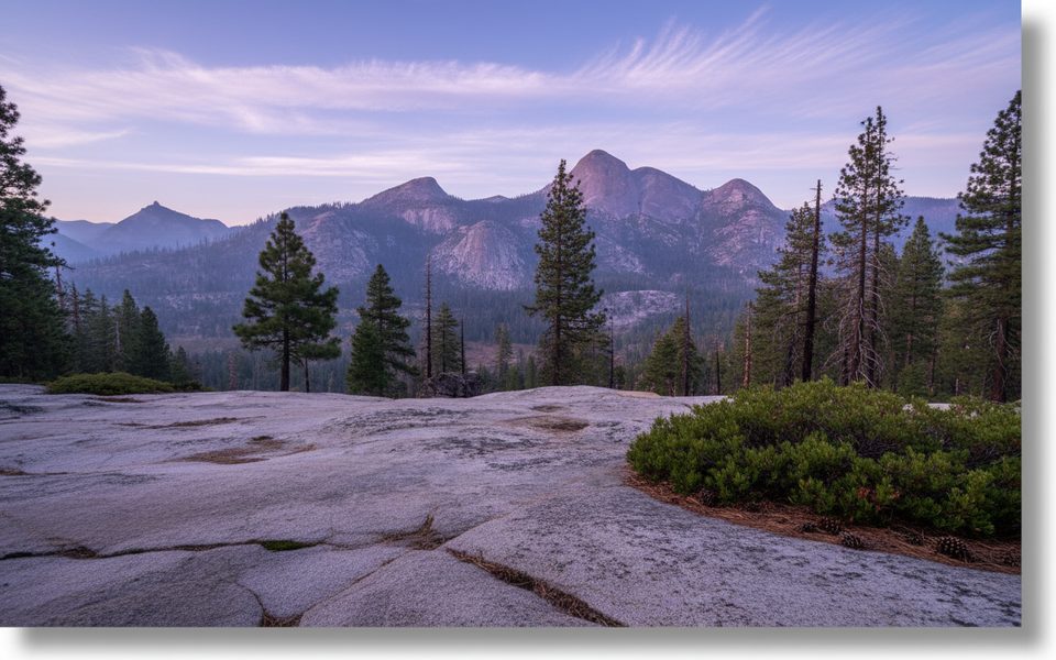
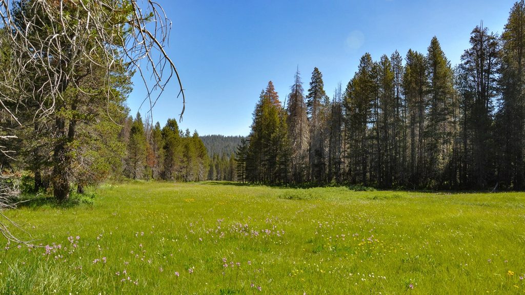
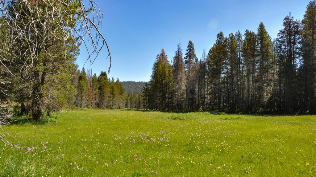
Mono Meadow is a quiet, wet montane meadow off Glacier Point Road that trades crowds for solitude and classic Sierra scenery. From the trailhead, the path drops through forest to the meadow, with options to continue to a broad granite slab overlook for wide views of the Clark Range, Mt. Starr King, and the back side of Half Dome.
Distances & Difficulty
- Quick sampler: About 1.2 miles round trip to reach the meadow and return. Remember you’ll climb back out.
- Best short outing: About 3.5 miles round trip to a granite-slab overlook with wider views.
- Longer variant: Many hikers continue toward Illilouette Creek; common routes run roughly 5.8 miles round trip with about 1,250 feet of gain.
- Elevation notes: Trailhead sits around 7,300 feet; expect an initial ~300-foot descent that you’ll feel on the way back.
Trail conditions are often wet and muddy, with a creek crossing (usually via a log), occasional downed trees, and some brush or burn-scar stretches. Trekking poles, waterproof footwear, and long pants are smart.
What You’ll See
- A lush, often soggy meadow that stays green well into summer
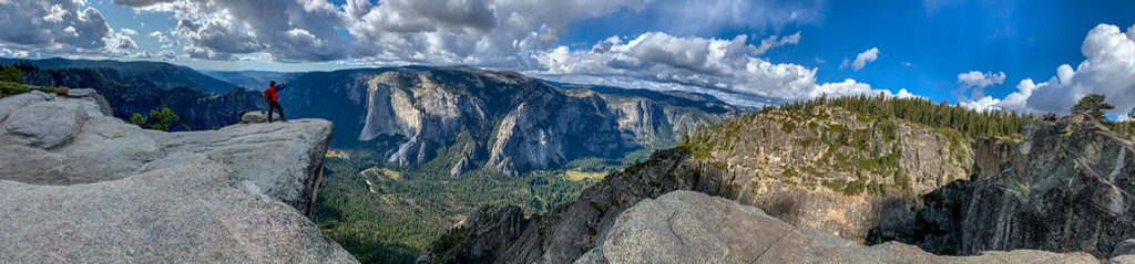
- Granite vistas toward the Clark Range, Mt. Starr King, and the backside of Half Dome from the unmarked overlook just under 2 miles from the trailhead
- Quiet wildlife corridor where bear, deer, and grouse are occasionally spotted—give them space and keep all scented items secured
Season & Access
Glacier Point Road access is seasonal, typically opening June through October. Earlier in the season the meadow is greener and wildflowers linger into July. The crowd factor is generally low here compared with the road’s marquee stops.
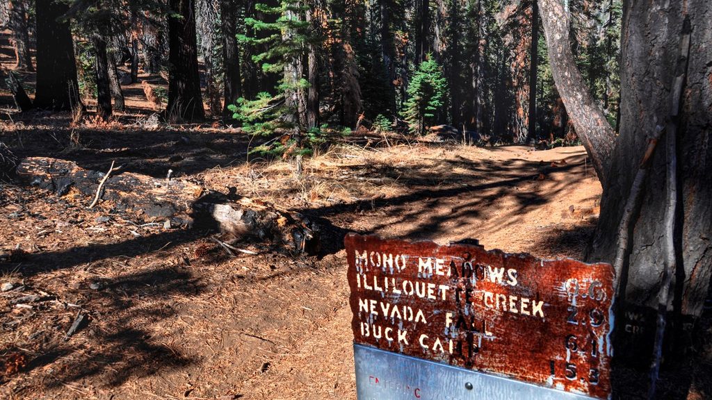
No regular park shuttle serves Glacier Point Road, so plan on a private vehicle. The trailhead is signed along Glacier Point Road, with a small lot that rarely fills.
Logistics & Amenities
- Trailhead: Food storage lockers are provided; use them for any scented items.
- Restrooms: None at the trailhead. Nearest vault toilet is at the Ostrander Lake trailhead about 1.2 miles west; flush toilets are at Chinquapin (Glacier Point Road/Highway 41 junction), roughly 10.5 miles west.
- Water: No potable water at the trailhead—carry what you need and treat any surface water.
Permits
- Day hiking: No permit required.
- Overnight trips: A wilderness permit is required, and proper bear-resistant food storage is mandatory.
Geology Snapshot
You’re walking across Yosemite’s granitic backbone—rocks emplaced deep underground and later sculpted by uplift, water, and glaciation. The meadow occupies poorly drained granitic terrain that stays wet with snowmelt, while the domes and ranges you see from the overlook are classic glacially polished granite features.
Navigation Note
The overlook isn’t signed—watch for a broad granite slab on the left just under two miles from the trailhead. If you start dropping on switchbacks toward Illilouette Canyon, you’ve gone a bit too far.
Best Time to Visit
- When the road is open (usually June–October). Earlier in summer offers greener meadow scenes and lingering wildflowers.
- For cooler temps and quieter parking, start early. This trail sees lighter use than nearby Glacier Point/Taft Point.
- Mosquitoes thrive near the meadow in season—bring repellent regardless of time of day.
Quick Tips
- Wear waterproof footwear and consider trekking poles for the muddy sections and log crossing.
- Start early for cooler temps and fewer bugs.
- Use the bear lockers at the trailhead; don’t leave scented items in your car.
- No water or toilets at the trailhead—plan your stops at Ostrander Lake TH or Chinquapin.
- Don’t confuse this with the Mono Pass Trail off Tioga Road (different trail entirely).