Parking
Use fee parking at Mono Village Resort at the end of Twin Lakes Road. Follow Robinson Creek Trail signs west through the resort property; the signed trailhead lies beyond it on National Forest land. There is no parking at the trailhead sign.

Yosemite National Park, CA
Five days of high passes, lake beaches and long backcountry miles.
Overview
Map & elevation
Plan your hike

Yosemite Tour Guide
Parkwolf is a GPS audio tour guide for Yosemite National Park. As you drive, it chimes in with what’s ahead: hidden gems, upcoming stops, history, geology, and wildlife, right through your car’s speakers.
See the Yosemite audio tour“We just drove through Yosemite and it made our trip listening to this app as we drove through. Like having a tour guide in the car with you.”


Trail guide
About 49 miles, this lollipop circuit begins at Robinson Creek Trailhead, climbs past Crown Lake and over Mule and Burro passes, then drops through Matterhorn Canyon to Benson Lake. It returns by Seavy Pass, Kerrick Meadow and Peeler Lake. Common itineraries take five days and four nights. Route descriptions range from about 48 to 54 miles; the stored mapped line is 48.5 miles. Expect roughly 10,000–13,000 feet of total climbing, depending on the line and how it is measured. This is an exceptionally strenuous, remote backpacking trip for experienced hikers comfortable with high passes and carrying several days of food.
The signed start is on National Forest land beyond Mono Village. An overnight Hoover Wilderness permit is required year-round, with trailhead quotas from June 15 through October 15. The standard route continues into Yosemite; a Hoover permit allows continuous travel there. If you extend the trip south of Highway 120, another permit or a continuous-wilderness addendum may be required. Carry an approved bear-resistant food canister. Dogs are not allowed on Yosemite trails or in its wilderness, so pets cannot accompany you on the complete loop.
Park at Mono Village Resort at the end of Twin Lakes Road and follow Robinson Creek Trail signs west through the resort property to the signed trailhead. The sign is beyond the property; there is no parking at the trail itself. Download maps before leaving because cell service is limited in the wilderness.
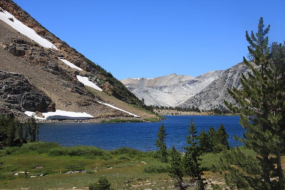
The route starts around 7,300 feet and climbs through Jeffrey pine, with meadows opening toward Little Slide Canyon and the Sawtooth Range. Switchbacks through aspen reach Barney Lake at roughly four miles. Beyond it, the trail follows Robinson Creek toward Robinson and Crown lakes, then leaves the busier approach for a steeper, quieter circuit. From Crown Lake, the climb to Mule Pass gains about 1,000 feet in roughly 1.5 miles. Open meadows can be wet and indistinct, and early-season snow can linger on the high trail.
Mule and Burro passes lead into the Yosemite backcountry. Burro Pass looks toward Matterhorn Peak; the trail then descends for more than five miles beside Matterhorn Creek before climbing Wilson Creek Canyon to Benson Pass. From there it reaches Smedberg Lake and drops steeply toward Benson Lake. A short spur leads to the lake’s long natural sand beach, a striking pause after the high passes. Expect cold water and mosquitoes around the lakes in season.
The loop climbs away from Benson Lake toward Seavy Pass, then descends to Rancheria Creek. This section can involve several broad stream crossings; depth and ease vary with season and snowmelt. The trail continues through pine forest beside Kerrick Meadow, then turns toward Peeler Lake on the Sierra crest. From Peeler, the final stretch loses about 2,400 feet over roughly 7.5 miles back to Robinson Creek. A useful shorter taste of the approach is an out-and-back to Barney Lake, about four miles each way; it does not include the loop’s remote passes or lakes.
Wildlife
 732 sightingsBlack BearMost seen around 7 PMSighting map
 1,747 sightingsMule DeerMost seen around 6 PMSighting map
 332 sightingsCoyoteMost seen around 7 PMSighting map
 11 sightingsPeregrine FalconMost seen around 8 AMSighting map
 276 sightingsPikaMost seen around 8 AMSighting map
 677 sightingsYellow-bellied MarmotMost seen around 8 AMSighting map
Sighting maps show where each species has been reported across Yosemite. Wildlife moves, so no sighting is guaranteed.
Keep exploring
 ChallengingCrown Lake, Kerrick Meadow and Peeler Lake Loop24.3 mi · 14 hr · At the trailheadA high Sierra loop links granite lakes, a pass and remote meadow.
 ChallengingVirginia Pass Loop16.7 mi · 16 hr · 6.7 mi awayAlpine lakes and a high pass reward skilled backcountry hikers.
 ModerateRodgers Lake Trail4.1 mi · 2.5 hr · 11.2 mi awayA small saddle opens onto granite slabs beside the lake.
Parkwolf’s Yosemite ranking

The audio tour guide for the drive, plus offline maps, trails, and wildlife heatmaps for when the signal drops.





