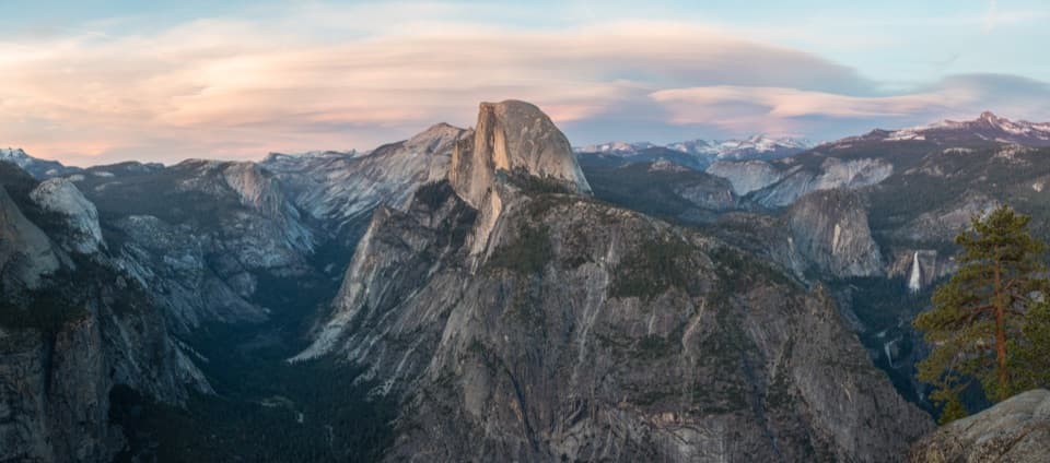
Half Dome Trail in Yosemite National Park

#1 of 141 trails in Yosemite

Yosemite National Park, CA

Half Dome Trail

Waterfalls first, then an exposed cable climb to a High Sierra summit.

Photo: Wikimedia Commons
Length
14.3mi
Time
11hr
Elev. change
4,780ft
Difficulty
Challenging
  • No dogs
  • High point 8,835 ft

Hear the audio tour

Happy Isles and Vernal Fall Footbridge

Overview

About Half Dome Trail

Why go

  • Vernal and Nevada Falls make the climb scenic before the summit
  • Big granite summit with Yosemite Valley and High Sierra views

Heads up

  • A 10–12 hour day with about 4,800 feet of climbing
  • The final cable slope is steep, exposed, and weather-sensitive

Map & elevation

The route

Loading the Yosemite map
Full map
Elevation4,055–8,835 ft
TrailheadHappy Isles shuttle stop 1637.73282, -119.55778
Keep this map with you offline in the Parkwolf app

Plan your hike

Before you go

Parking

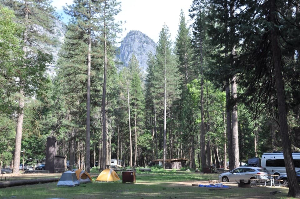
Begin at Happy Isles shuttle stop 16. The nearest trailhead parking is just beyond Curry Village, about half a mile from the start; there is no parking directly at Happy Isles. Curry Village is a separate nearby stop for a market and restaurants.

Safety

A permit is required beyond Sub Dome while the cables are up. Sub Dome and the final roughly 400-foot cable ascent are steep and exposed; wet granite, lightning, or storms make the cable route unsafe. Treat river water before drinking.

4 active Yosemite alerts

  • CautionMist Trail access limited during October repairsMentions Mist Trail, referenced in this guideThe Mist Trail between its John Muir Trail junction above the Vernal Fall footbridge and the top of Vernal Fall has limited access through October for repair work.Official details
  • ClosureDome Fire closes Glacier Point Road and trailsGlacier Point Road is temporarily closed because Dome Fire smoke reduces visibility and to allow firefighting operations; some trails south of the road are also closed.Official details
See all 4 alerts
The Parkwolf Tour Guide on a dash-mounted phone, driving into Yosemite Valley

“You're nearing the access for Happy Isles and the Vernal Fall hike. My pick for a shorter outing is the footbridge: one point six miles round trip from Happy Isles, with a steep climb taking one to one and a half hours.”

Yosemite Tour Guide

Yosemite, narrated.

Parkwolf is a GPS audio tour guide for Yosemite National Park. As you drive, it chimes in with what’s ahead: hidden gems, upcoming stops, history, geology, and wildlife, right through your car’s speakers.

See the Yosemite audio tour

Recorded for this trailhead

Happy Isles and Vernal Fall Footbridge
0:00 / 0:25
“You're nearing the access for Happy Isles and the Vernal Fall hike. My pick for a shorter outing is the footbridge: one point six miles round trip from Happy Isles, with a steep climb taking one to one and a half hours.”

Plays as you drive up to this trailhead in the Parkwolf Yosemite Tour Guide.

More stories near here in the app

  • Mirror Lake
  • Glacier Point
  • Curry Village and Stoneman Meadow
  • Washburn Point
  • 125 audio storiesacross Yosemite’s roads, triggered by GPS as you drive
  • Wildlife heatmapsfor Black Bear, Peregrine Falcon, Mule Deer, and 13 more
  • Works offlinemaps, 141 trails, 99 places, and audio download before you lose signal
  • CarPlay readysimple controls built for the drive
★★★★★
“We just drove through Yosemite and it made our trip listening to this app as we drove through. Like having a tour guide in the car with you.”
Roddy 3210App Store review
Download Parkwolf on the App StoreGet Parkwolf on Google Play

4.7 from 8,600+ ratings

Trail guide

Hiking Half Dome Trail

The whole day is the pointHalf Dome is a strenuous out-and-back day hike from Happy Isles in Yosemite Valley, climbing…

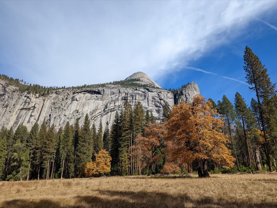
Half Dome is a strenuous out-and-back day hike from Happy Isles in Yosemite Valley, climbing past Vernal and Nevada Falls, through Little Yosemite Valley, over Sub Dome and up the summit cables. This stored route returns along the same 7.15-mile Mist Trail corridor, for 14.3 miles round trip; it does not include the longer John Muir Trail descent some hikers choose. Allow 10 to 12 hours and expect about 4,800 feet of climbing. This is a demanding summit day for fit, prepared hikers, not a waterfall stroll. Start early, set a turnaround time, and carry a headlamp so the return does not depend on daylight. The payoff is a broad granite summit with views across Yosemite Valley and the High Sierra.

Climbing past Vernal FallFrom Happy Isles the trail climbs toward Vernal Fall.

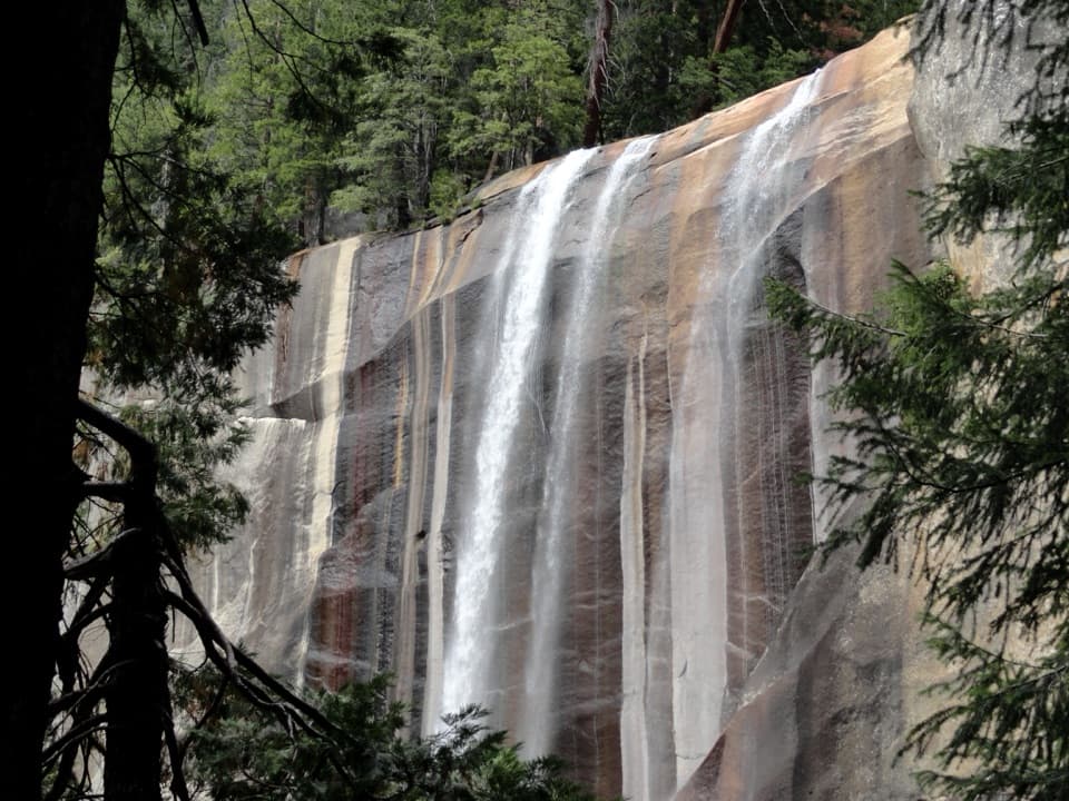
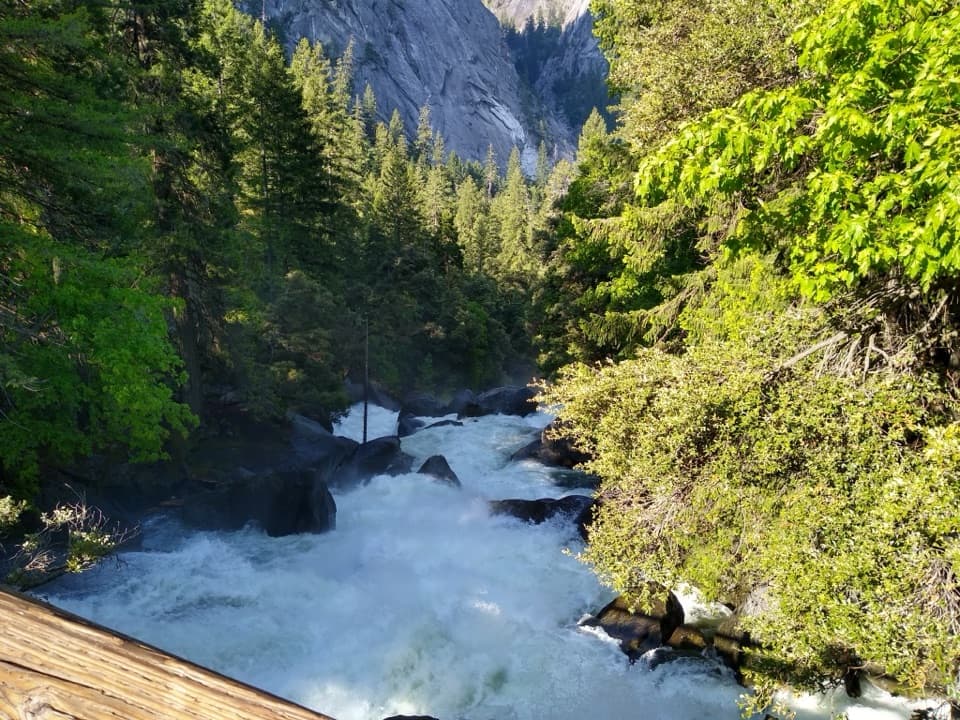
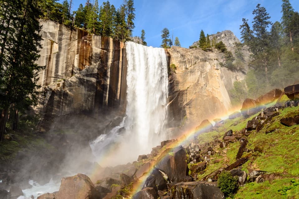
From Happy Isles the trail climbs toward Vernal Fall. The Mist Trail steepens into more than 600 granite steps beside the river, where spray can make the stairs and nearby rock slick. Keep to the established steps; entering Emerald Pool and the Silver Apron is prohibited. Pause where the falls open into view, but save energy for the much longer climb above them.

Nevada Fall and the quieter middleThe route continues uphill to Nevada Fall, with steep rocky switchbacks and views toward…

The route continues uphill to Nevada Fall, with steep rocky switchbacks and views toward Liberty Cap. Beyond the waterfall, Little Yosemite Valley gives you a relatively gentler stretch before the climb resumes toward the Half Dome junction and Sub Dome. The upper approach becomes more open and exposed, and steep granite steps lead to the permit checkpoint. This is a long way from the trailhead even before the cables begin, so keep checking your pace and turnaround plan.

The cables and the summitThe final ascent gains roughly 400 feet on a steep granite face using two cables and seasonal…

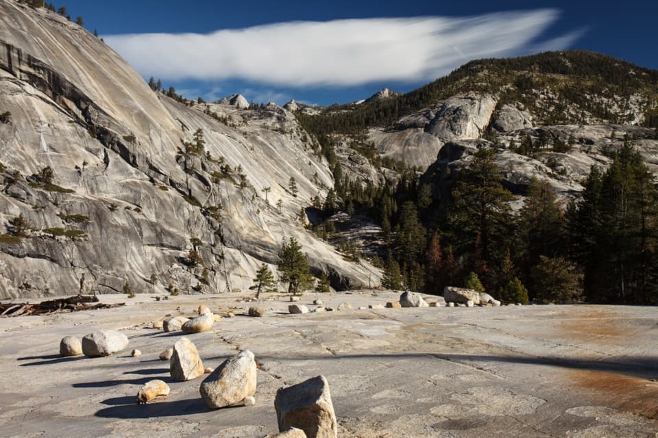
The final ascent gains roughly 400 feet on a steep granite face using two cables and seasonal footholds. A permit is required beyond Sub Dome when the cables are up. The rock is dangerously slick when wet, and the exposed summit is unsafe in storm conditions; do not start the cable climb with wet granite or nearby storms. Gloves make the metal cables easier to grip, and secure loose items before climbing. From the broad top, frame a granite slab in the foreground with Yosemite Valley and the High Sierra beyond it to show the scale of the view.

Choosing the returnThis listing represents the same Mist Trail corridor in both directions.

This listing represents the same Mist Trail corridor in both directions. Some hikers descend by the John Muir Trail instead, avoiding the steep Mist Trail stairs but adding distance; that is a different route variant from the 14.3-mile figure here. The shorter Vernal Fall Footbridge walk is a separate choice if the summit day is too much: it is about 1.6 miles round trip with 400 feet of climbing from Happy Isles.

Water, toilets, and getting to Happy IslesNPS recommends carrying at least a gallon of water for the Half Dome day.

NPS recommends carrying at least a gallon of water for the Half Dome day. The treated-water fountain at Vernal Fall Footbridge is seasonal; treat water taken from the Merced River. Toilets are available at Happy Isles and the footbridge, with composting toilets near Emerald Pool, the top of Nevada Fall, and Little Yosemite Valley. Start at Happy Isles shuttle stop 16. The nearest trailhead parking is just beyond Curry Village, about half a mile away; Curry Village has a market and restaurants as a separate stop, not on the trail.

The first cable routeAn 1865 report described Half Dome as likely never to be trodden by a person.

An 1865 report described Half Dome as likely never to be trodden by a person. George Anderson reached the summit in 1875 and laid the predecessor to today’s cable route. The cables made the final wall a hiking route, but they did not make it an ordinary finish: the last slope remains steep, exposed granite where weather and footing decide whether to continue.

Granite shaped by iceMuch of Yosemite’s granite crystallized underground between about 105 and 85 million years ago,…

Much of Yosemite’s granite crystallized underground between about 105 and 85 million years ago, then erosion exposed it. Later glaciers carved the valley and helped shape the domes and waterfalls on this route. Along the walk, squirrels, chipmunks, and Steller’s jays are among the wildlife noted around the trail; keep food attended and do not feed them.

Wildlife

Wildlife in Yosemite

All Yosemite wildlife maps

Sighting maps show where each species has been reported across Yosemite. Wildlife moves, so no sighting is guaranteed.

Keep exploring

Near Half Dome Trail

See it all on the map

Trails that start nearby

Places near the trailhead

Parkwolf’s Yosemite ranking

Top-rated trails in Yosemite

All 141 trails
  1. 2Clouds Rest TrailChallenging · 14 mi
  2. 3Nevada Fall Loop via Mist and John Muir TrailsChallenging · 6.4 mi
  3. 4Yosemite Falls TrailChallenging · 7.2 mi
  4. 5Panorama TrailChallenging · 8.2 mi
  5. 6Four Mile TrailChallenging · 4.8 mi
  6. 7Cathedral Lakes TrailModerate · 9 mi

Take Parkwolf to Yosemite.

The audio tour guide for the drive, plus offline maps, trails, and wildlife heatmaps for when the signal drops.

4.7 from 8,600+ ratings

Download Parkwolf on the App StoreGet Parkwolf on Google Play