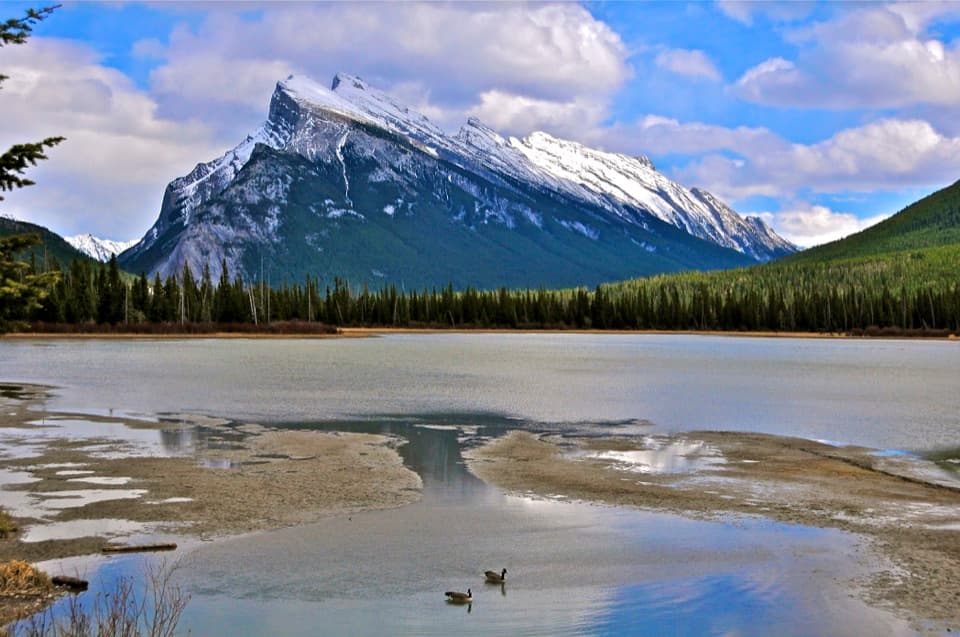
Vermilion Lakes in Banff National Park

#9 of 50 sights in Banff

Sight · Banff National Park

Vermilion Lakes

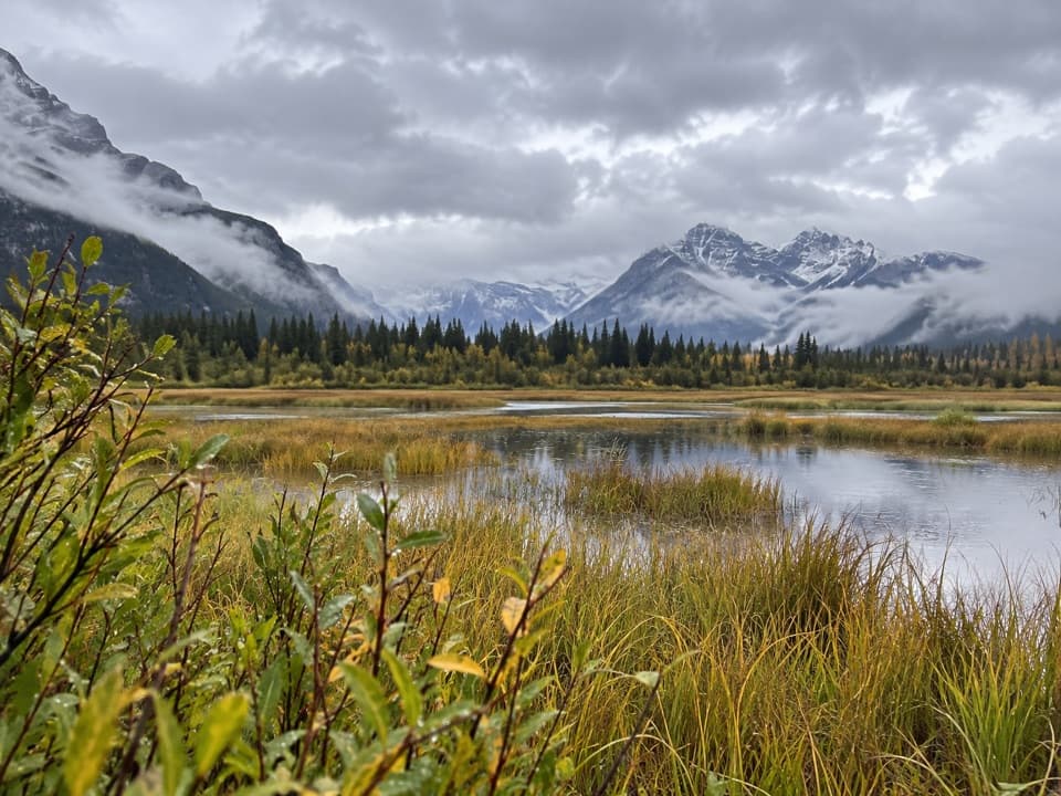
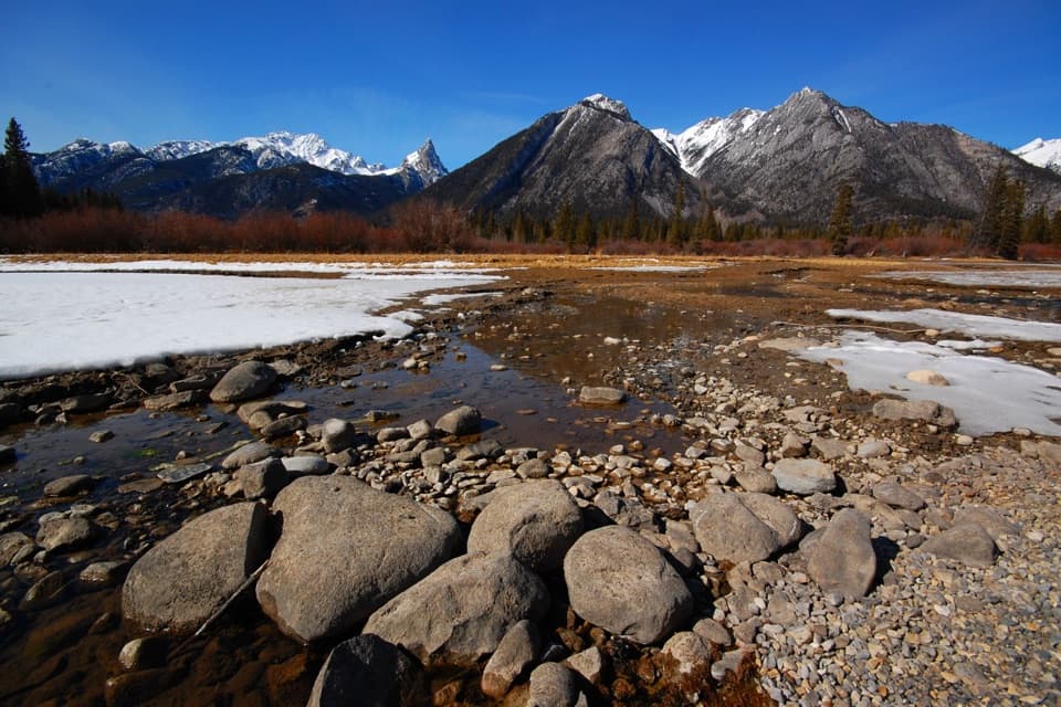
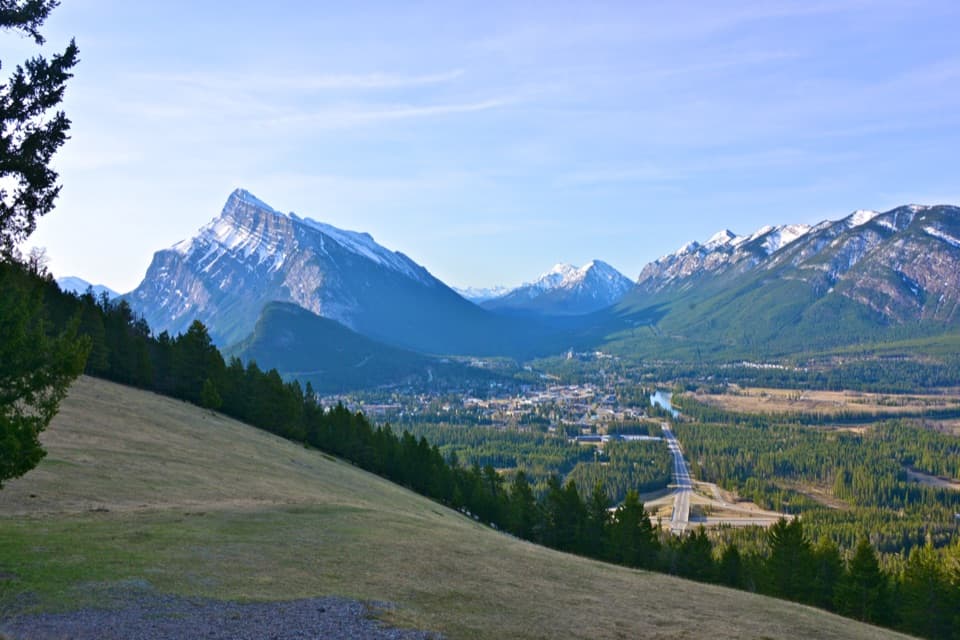
Docks and marsh reflections frame Mount Rundle.

Photo: Wikimedia Commons
Type
Sight
Nearest trail
1.6 km
Audio stories
14 nearby
  • Parking
  • Scenic viewpoint
  • Exhibit

Hear the audio tour

Vermilion Lakes: Docks and Wetlands

Overview

About Vermilion Lakes

Why stop

  • Docks and benches bring you close to the lakeshore.
  • A scenic mountain stop that also works by bike.

Heads up

  • Parking near First Vermilion Lake is limited.

Map

Where it is

Loading the Banff map
Full map
SightVermilion Lakes51.18141, -115.60483
Keep this map with you offline in the Parkwolf app

Plan your stop

Before you go

8 active Banff alerts

  • ClosureJohnston Canyon Trail and Day Use Area closedJohnston Canyon Trail and Day Use Area are closed to all traffic and travel through December 11, 2026, because construction work requires protecting public and workers’ safety.Official details
  • ClosureBaker Lake and Hidden Lake campgrounds closed to campingCamping is prohibited at Baker Lake and Hidden Lake campgrounds through December 1, 2026, because a grizzly bear entered campsites and investigated tents and gear; the closures reduce risk to…Official details

See all 8 alerts
A park ranger sits on a dash-mounted phone, talking, as Parkwolf’s Tour Guide plays “Army Cutworm Moths: A Grizzly Bear Buffet” on Grand Loop Road below Dunraven Pass in Yellowstone
Parkwolf Tour GuideThe highest, rockiest slopes around here are a summer buffet for grizzly bears.

Banff Tour Guide

Your drive to Vermilion Lakes, narrated.

Parkwolf is a GPS audio tour guide for Banff National Park. As you drive, it chimes in with what’s ahead: hidden gems, upcoming stops, history, geology, and wildlife, right through your car’s speakers.

See the Banff audio tour

Recorded for this place

Vermilion Lakes: Docks and Wetlands
0:00 / 0:31
“You're nearing Vermilion Lakes, where a short scenic drive gives you lakeside views of Mount Rundle.”

Plays as you drive up to Vermilion Lakes in the Parkwolf Banff Tour Guide.

More stories near here in the app

  • The Muskrat’s Winter Breathing Hole
  • The Fan at the Canyon Mouth
  • Fenland: Lunch and an Old Spruce Forest
  • Cave and Basin: Springs and Stories
  • 185 audio storiesacross Banff’s roads, triggered by GPS as you drive
  • Wildlife heatmapsfor Grizzly Bear, Brown Bear, Gray Wolf, and 13 more
  • Works offlinemaps, 162 trails, 90 places, and audio download before you lose signal
  • CarPlay readysimple controls built for the drive
★★★★★
“…Loved the commentary as you drove thru. I’m sure the app can do more than I know but the tips were very helpful. I’m gonna use it when we go to Banff next month.”
tesja22App Store review
Download Parkwolf on the App StoreGet Parkwolf on Google Play

4.7 from 8,600+ ratings

Guide

More about Vermilion Lakes

A short drive, or a slow oneVermilion Lakes is a cluster of three lakes close to Banff townsite.

Vermilion Lakes is a cluster of three lakes close to Banff townsite. Vermilion Lakes Drive follows the water for 4.3 kilometres and is a year-round scenic route. It works as a brief stop, but the better visit is to slow down for a few lakeside pauses. Use the drive's lakeside access for the docks and panels; the Trans-Canada Highway viewpoint is a separate pullout. Parking near First Vermilion Lake is limited. Nearby Fenland day-use area has its own parking and picnic tables.

Get down to the waterSmall docks and benches bring you to the lakeshore, with Mount Rundle as the main landmark…

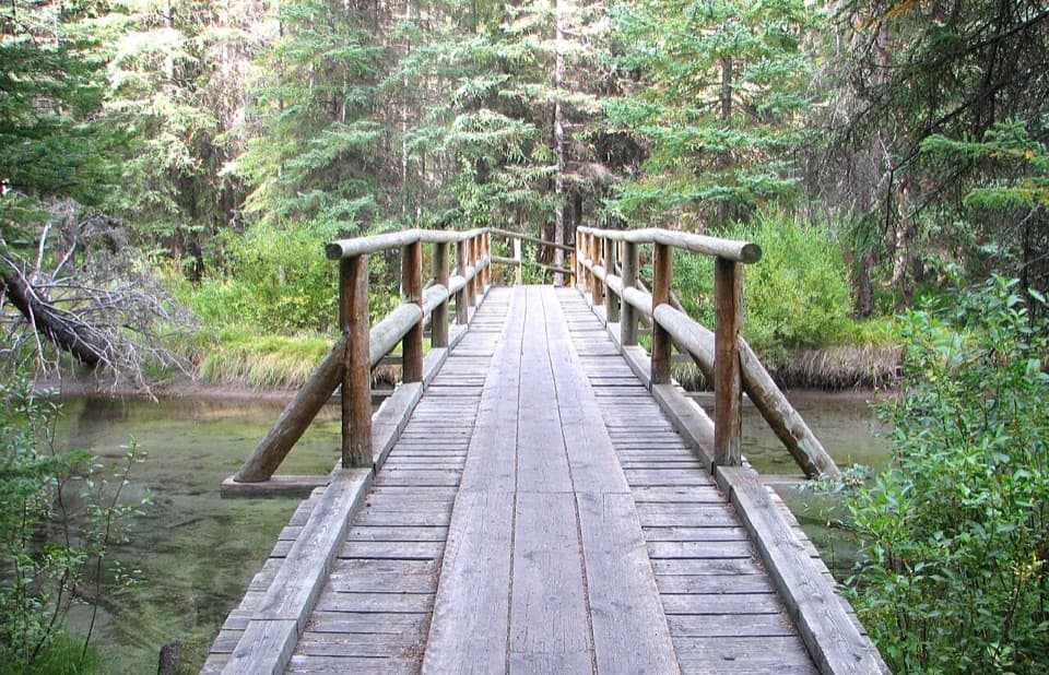
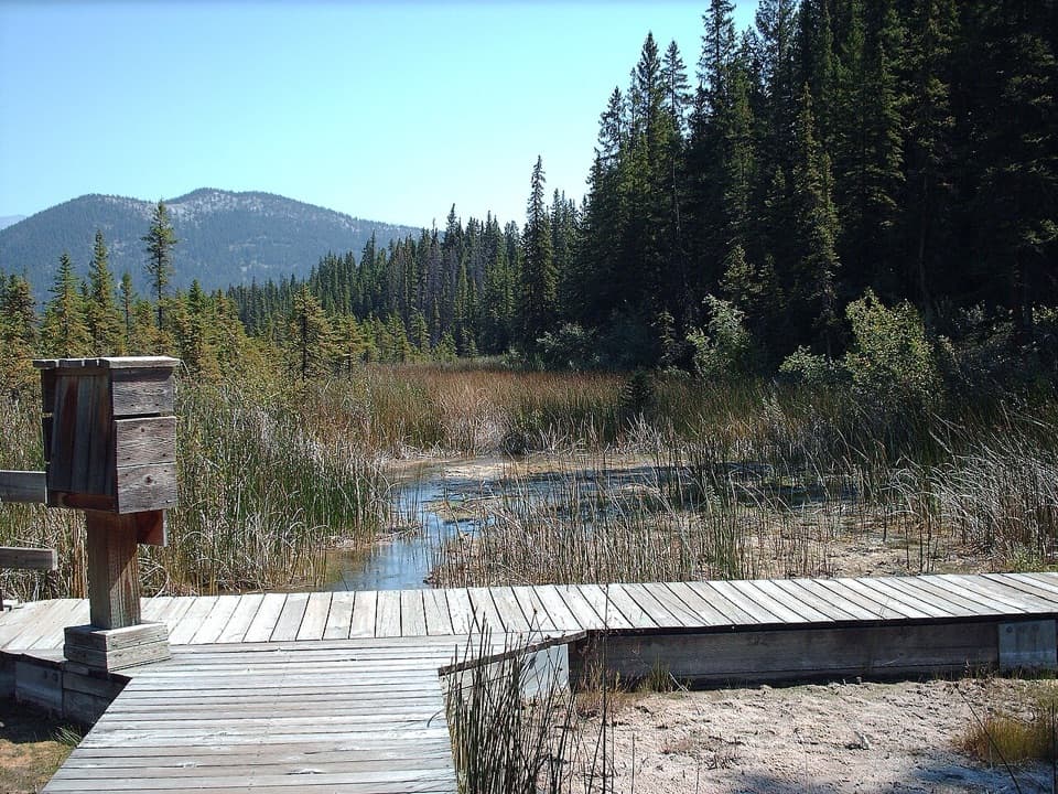
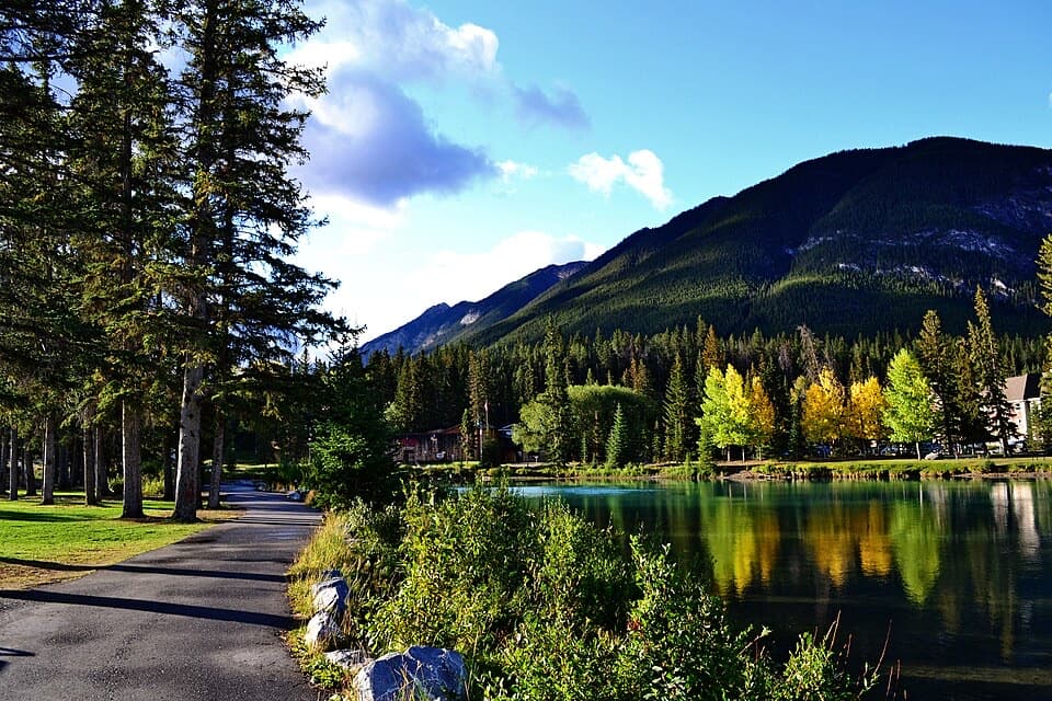
Small docks and benches bring you to the lakeshore, with Mount Rundle as the main landmark across the water. Self-guided panels cover the area's geology, wetland ecology and human presence. The drive is also part of the 26-kilometre Banff Legacy Trail, so it makes sense as a bike stop as well as a scenic detour.

Watch the reedsThese lakes sit among wetlands, channels and marshy shoreline.

These lakes sit among wetlands, channels and marshy shoreline. Muskrats, geese and other birdlife use the area, so give the water's edge a look as well as the peaks. Wildlife sightings are a bonus, not a schedule; the scenery is the reliable reason to stop.

A human story older than the parkThe Vermilion Lakes archaeological site preserves a much longer record than the road suggests.

The Vermilion Lakes archaeological site preserves a much longer record than the road suggests. Researchers identified six or more separate cultural layers dating roughly from 10,500 to 9,500 years ago. The evidence points to a possible focus on sheep hunting and shelters or windbreaks around 10,300 years ago. Debris flows helped separate and preserve those layers.

Frame Mount Rundle across the waterFrom a dock, put Mount Rundle above the lake and leave some of the wetland shoreline in the…

From a dock, put Mount Rundle above the lake and leave some of the wetland shoreline in the foreground. A still surface can reflect the mountain, but wind and ice change the water, so treat a mirror reflection as a lucky extra.

Wildlife

Wildlife in Banff

All Banff wildlife maps

Sighting maps show where each species has been reported across Banff. Wildlife moves, so no sighting is guaranteed.

Keep exploring

Near Vermilion Lakes

See it all on the map

Trails nearby

More stops nearby

Parkwolf’s Banff ranking

Top sights in Banff

All 90 places
  1. 1Lake LouiseSight
  2. 2Moraine LakeSight
  3. 3Peyto Lake ViewpointSight
  4. 4Johnston CanyonSight
  5. 5Banff GondolaSight
  6. 6Cave and Basin National Historic SiteSight

Take Parkwolf to Banff.

The audio tour guide for the drive, plus offline maps, trails, and wildlife heatmaps for when the signal drops.

4.7 from 8,600+ ratings

Download Parkwolf on the App StoreGet Parkwolf on Google Play