Sulphur Mountain Westside Trail in Banff National Park

Banff National Park, AB

Sulphur Mountain Westside Trail

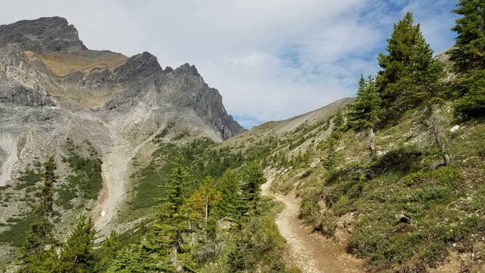
A steep, rocky west-side climb to the upper mountain.

Length
5.4km
Time
4hr
Elev. change
862m
Difficulty
Challenging
  • Dogs allowed
  • High point 2,266 m

Hear the audio tour

The Fan at the Canyon Mouth

Overview

About Sulphur Mountain Westside Trail

Why go

  • A distinct west-side line to the upper mountain boardwalk
  • A direct old-road climb with a clear, continuous route

Heads up

  • A hard 824 m climb on rocky footing
  • No loop; reaching the lower junction from Cave and Basin adds 2.6 km

Map & elevation

The route

Loading the Banff map
Full map
Elevation1,404–2,266 m
TrailheadSundance Trail junction (lower Westside trailhead)51.16238, -115.62133
Keep this map with you offline in the Parkwolf app

Plan your hike

Before you go

Parking

Use the Cave and Basin lot on the lower approach; paved parking is limited, with accessible stalls and gender-neutral outhouses at the site. Follow Sundance Trail west of the building for about 2.6 km to the Westside junction. The upper end is on the mountain boardwalk; this is a point-to-point route.

Safety

Steep, rocky footing with roughly 824 m of climbing over 5.4 km. Mountain bikes share the route. In winter, ice cleats are advised.

8 active Banff alerts

  • ClosureJohnston Canyon Trail and Day Use Area closedJohnston Canyon Trail and Day Use Area are closed to all traffic and travel through December 11, 2026, because construction work requires protecting public and workers’ safety.Official details
  • ClosureBaker Lake and Hidden Lake campgrounds closed to campingCamping is prohibited at Baker Lake and Hidden Lake campgrounds through December 1, 2026, because a grizzly bear entered campsites and investigated tents and gear; the closures reduce risk to…Official details
See all 8 alerts
A park ranger sits on a dash-mounted phone, talking, as Parkwolf’s Tour Guide plays “Army Cutworm Moths: A Grizzly Bear Buffet” on Grand Loop Road below Dunraven Pass in Yellowstone
Parkwolf Tour GuideThe highest, rockiest slopes around here are a summer buffet for grizzly bears.

Banff Tour Guide

Your drive to Sulphur Mountain Westside Trail, narrated.

Parkwolf is a GPS audio tour guide for Banff National Park. As you drive, it chimes in with what’s ahead: hidden gems, upcoming stops, history, geology, and wildlife, right through your car’s speakers.

See the Banff audio tour

Recorded for this area

The Fan at the Canyon Mouth
0:00 / 0:32
“At the foot of a narrow mountain canyon, look for a broad apron of ground spreading into the valley. It may be an alluvial fan, built from material carried down by water.”

Plays on the road 1.7 km from the trailhead in the Parkwolf Banff Tour Guide.

More stories near here in the app

  • The Branch That Takes Root
  • Cave and Basin: Springs and Stories
  • Banff Before Banff Avenue
  • Vermilion Lakes: Docks and Wetlands
  • 185 audio storiesacross Banff’s roads, triggered by GPS as you drive
  • Wildlife heatmapsfor Grizzly Bear, Brown Bear, Gray Wolf, and 13 more
  • Works offlinemaps, 162 trails, 90 places, and audio download before you lose signal
  • CarPlay readysimple controls built for the drive
★★★★★
“…Loved the commentary as you drove thru. I’m sure the app can do more than I know but the tips were very helpful. I’m gonna use it when we go to Banff next month.”
tesja22App Store review
Download Parkwolf on the App StoreGet Parkwolf on Google Play

4.7 from 8,600+ ratings

Trail guide

Hiking Sulphur Mountain Westside Trail

The climbThe Westside is the 5.4 km (3.

The Westside is the 5.4 km (3.4 mi) one-way road between the Sundance Trail junction and upper Sulphur Mountain. It gains about 824 m (2,700 ft) over that distance. The old fire road is rocky and steep for most of the climb; allow about four hours uphill. It is a hard route with a clear purpose: reaching the upper mountain by its west side.

Access and returnThe lower junction is about 2.6 km along Sundance Trail from Cave and Basin.

The lower junction is about 2.6 km along Sundance Trail from Cave and Basin. Starting there makes the walk to the upper mountain about 8 km one way by the component distances; winter route information rounds the full approach to 7.8 km, so use 8 km for planning. The 5.4 km recorded here is the Westside road itself. There is no loop: if you descend to Cave and Basin, arrange your own ride back to the upper trailhead or walk the route back.

Underfoot and shared useThis is a rocky old access road, also used by mountain bikers; yield to other trail users and…

This is a rocky old access road, also used by mountain bikers; yield to other trail users and take care on the steep descent. In winter, hikers and snowshoers are advised to use ice cleats. Dogs are permitted on leash.

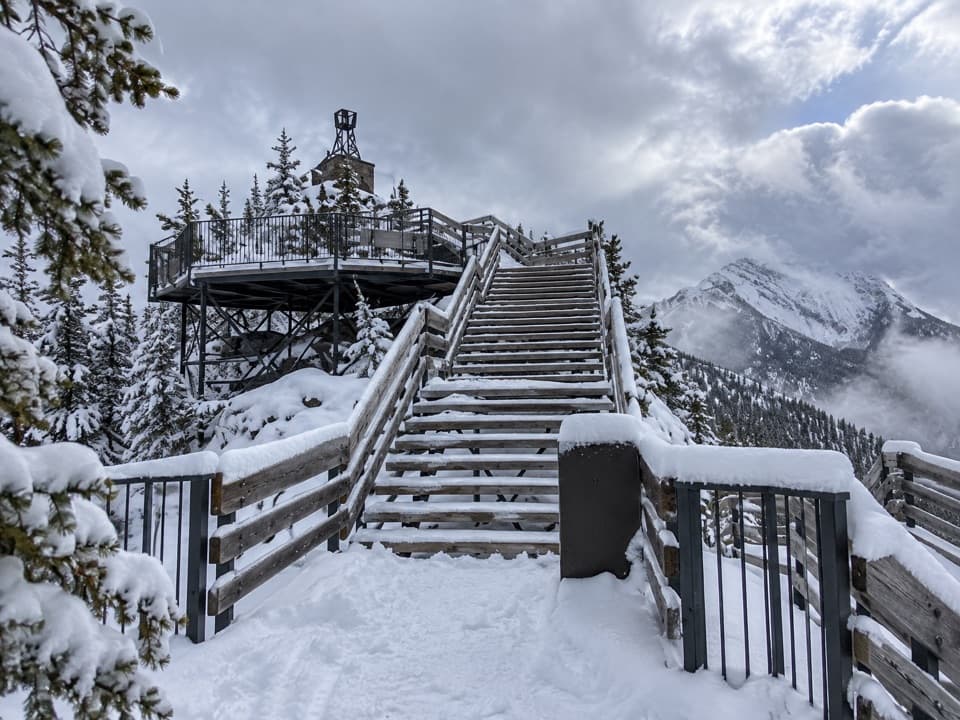
At the upper endThe route meets the Sulphur Mountain boardwalk area.

The route meets the Sulphur Mountain boardwalk area. Its separate ridge section runs about 500 m and includes 368 shallow steps, so leave time for it if you reach the summit from below.

Wildlife

Wildlife in Banff

All Banff wildlife maps

Sighting maps show where each species has been reported across Banff. Wildlife moves, so no sighting is guaranteed.

Keep exploring

Near Sulphur Mountain Westside Trail

See it all on the map

Trails that start nearby

Places near the trailhead

Parkwolf’s Banff ranking

Top-rated trails in Banff

All 162 trails
  1. 1Sentinel Pass via Larch Valley TrailChallenging · 11.2 km
  2. 2Plain of Six Glaciers TrailModerate · 11.6 km
  3. 3Lake Agnes TrailModerate · 7.8 km
  4. 4Johnston Canyon Trail to Upper FallsEasy · 4.8 km
  5. 5Larch Valley / Minnestimma Lakes TrailModerate · 9 km
  6. 6Parker Ridge TrailModerate · 5.6 km

Take Parkwolf to Banff.

The audio tour guide for the drive, plus offline maps, trails, and wildlife heatmaps for when the signal drops.

4.7 from 8,600+ ratings

Download Parkwolf on the App StoreGet Parkwolf on Google Play