Parking
Start at Kanangra Walls Lookout car park. The conventional finish is the locked vehicle gate on Narrow Neck; arrange a long car shuffle between the two ends.
Blue Mountains National Park, NSW
A remote three-day traverse from cliff tops to a river ford.
Overview
Map & elevation
Plan your hike

The highest, rockiest slopes around here are a summer buffet for grizzly bears.
Blue Mountains Tour Guide
Parkwolf is a GPS audio tour guide for Blue Mountains National Park. As you drive, it chimes in with what’s ahead: hidden gems, upcoming stops, history, geology, and wildlife, right through your car’s speakers.
See the Blue Mountains audio tour“Fantastic app with many points of information… It’s great to just turn on while you’re driving and it gives you an audio tour of the national Park. We love it!!!!”


Trail guide
Kanangra to Katoomba (K2K) is a 45 km, one-way wilderness traverse from Kanangra Walls Lookout car park to the locked gate on Narrow Neck. It crosses Kanangra-Boyd and Blue Mountains national parks, leaving the exposed plateau for remote sandstone ridges, the Coxs River and the Wild Dog Mountains before a long fire-road finish. Its reward is a cross-section of the southern ranges, but repeated steep climbs, navigation and scrub make this serious backcountry, not a marked day walk. Most parties allow three days; very fit, experienced walkers sometimes plan two.
Arrange a car shuttle; this route ends at the Narrow Neck gate, not Katoomba Station or the separate Narrow Neck Lookout extension.
Much of the route is unmarked or faint, and dense regrowth can hide the footpad, especially around Carra Top and Mount Strongleg. Carry reliable offline navigation and map skills, and be ready to stop and check the line at junctions. The route has no food outlets or supplied drinking water. Creeks and pools at Dex Creek and Mobbs Swamp are variable; carry enough capacity and treat natural water. Check current park alerts and river conditions shortly before departure.
Dogs are not permitted in national parks; trained assistance animals are allowed where public access permits. ### Across Kanangra Walls
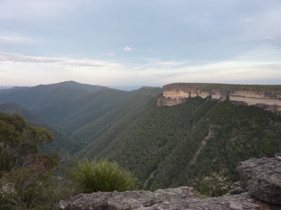
The walk begins with the broad panorama from Kanangra Walls, then follows rocky ground across the open plateau. The sheer escarpment and valley views are close to the route, with unfenced edges and no barriers. For a photo, keep the cliff in the foreground and Mount Cloudmaker on the ridge beyond; the scale reads better than a frame filled only with sky.
At Gordon Smith Pass the route drops off the plateau through a steep gully, with a short scramble. It then works below Crafts Wall and climbs over rough tops toward Mount High and Mighty. The granite can be slippery when wet, so take care on the descent and watch for the sharp turns.
The route continues over rocky rises known as Rip, Rack, Roar and Rumble before Mount Cloudmaker. Its tree-covered summit has no broad view, but it is a useful landmark on a long stretch of remote walking. The faint track toward Dex Creek can be confused with the branch toward Ti Willa Tops, so check the route before leaving the summit area. Small campsites sit near Dex Creek, but its flow is not dependable.
Between Dex Creek and Coxs River, route-finding becomes more demanding. Around Carra Top and Mount Strongleg, scrub can obscure the tread; the descent is steep, rough and easy to misread. The river crossing is an unbridged ford. If the water is above waist depth, it is dangerous; after rain, be prepared to wait or turn back rather than force a crossing.
The climb from Coxs River up Yellow Dog Ridge is steep, followed by more ups and downs through the Wild Dog ranges. There is a lot of rough walking between the named high points. Splendour Rock is an optional lookout spur near Mount Dingo. Mobbs Swamp is a usual camp stop, with a nearby non-flush toilet but no supplied water; natural water can be unreliable. A higher alternative over Mount Merrimerrigal, Mount Warrigal and Mount Mouin is more demanding and needs careful water planning.
From Mobbs Swamp the route contours around Blue Dog Ridge, reaches the White Dog Ridge fire trail and continues to Medlow Gap. After climbing Mount Debert and descending toward Little Cedar Gap, the track reaches Tarros Ladder, a steep, exposed scramble using bolted holds and a metal ladder. The rungs can be slippery when wet, and the height makes this a serious obstacle for anyone uncomfortable with exposure.
The final stretch follows the Narrow Neck fire road across open plateau. It is a hard-surface finish after days on rough tracks, with long views toward Lake Burragorang. The locked gate marks the standard end of the K2K; onward transport and any extra walking need separate planning.
Wildlife
 58 sightingsGrey KangarooMost seen around 6 AMSighting map
 43 sightingsWombatMost seen around 6 PMSighting map
 18 sightingsRed-necked WallabyMost seen around 6 PMSighting map
 53 sightingsSwamp WallabyMost seen around 7 AMSighting map
 23 sightingsBrushtail PossumMost seen around 7 PMSighting map
 30 sightingsRing-tailed PossumMost seen around 7 PMSighting map
Sighting maps show where each species has been reported across Blue Mountains. Wildlife moves, so no sighting is guaranteed.
Keep exploring
Parkwolf’s Blue Mountains ranking

The audio tour guide for the drive, plus offline maps, trails, and wildlife heatmaps for when the signal drops.