Parking
Park at the northeast-side Blue Ridge Parkway pull-off at milepost 355. A second vehicle can be staged at a pull-off on Forest Road 472 (South Toe River Road), about one mile from the Parkway, for a one-way hike.

Blue Ridge Parkway, NC · VA
A forested ridge walk with spruce, fir, and Black Mountains views.
Overview
Map & elevation
Plan your hike

The highest, rockiest slopes around here are a summer buffet for grizzly bears.
Blue Ridge Parkway Tour Guide
Parkwolf is a GPS audio tour guide for Blue Ridge Parkway. As you drive, it chimes in with what’s ahead: hidden gems, upcoming stops, history, geology, and wildlife, right through your car’s speakers.
See the Blue Ridge Parkway audio tourRecorded for this trailhead
Ridge Junction: A Roadside View or a Summit Walk“You're nearing the Ridge Junction area, where the overlook gives you a close view of the Black Mountains above South Toe Valley. Stop for a few minutes if you'd like to see the wooded slopes without a hike.”
Plays as you drive up to this trailhead in the Parkwolf Blue Ridge Parkway Tour Guide.
More stories near here in the app
“…We knew we wanted to drive the Blue Ridge Parkway. The narration was impeccably timed. The facts and info provided were meaningful. Without it, the trip would not have been near as awesome.”


Trail guide
Bald Knob Ridge Trail (TR 186) runs 2.8 miles one way between a Parkway pull-off at milepost 355 and Forest Road 472, also called South Toe River Road. Hiked out and back, it covers 5.6 miles. From the Parkway, the path descends toward the river; the return follows the same route uphill. Allow about six hours for the round trip, using the three-hour one-way estimate, and expect about 1,510 feet of elevation change.
The trail passes through stands of red spruce and Fraser fir and has views toward the Black Mountains. Around 0.1 mile, it enters the woods by an old cabin. Near 0.65 mile, it curves around Bald Knob into spruce and fir, then emerges from the forest near 0.95 mile.
Near 1.5 miles, the route winds through rhododendron; around 2 miles it follows an old roadbed. At 2.8 miles it reaches Forest Road 472, with the South Toe River across the road. Turn around here unless you have arranged a second vehicle: a pull-off on Forest Road 472 is about one mile from the Parkway. Otherwise, retrace the route to the northeast-side Parkway pull-off at milepost 355; the return is uphill.
Wildlife
 1,214 sightingsBlack BearMost seen around 7 AMSighting map
 1,021 sightingsElkMost seen around 7 AMSighting map
 2,266 sightingsWhite-tailed DeerMost seen around 6 PMSighting map
 200 sightingsCoyoteMost seen around 6 PMSighting map
 1,130 sightingsWild TurkeyMost seen around 7 AMSighting map
 255 sightingsRed-tailed HawkMost seen around 11 AMSighting map
Sighting maps show where each species has been reported across Blue Ridge Parkway. Wildlife moves, so no sighting is guaranteed.
Keep exploring
 ModerateBlue Ridge Pinnacle Trail1.5 mi · 1.3 hr · 0.2 mi awayA short, steep loop to a rocky Blue Ridge overlook.
 EasyCommissary Trail4 mi · 2 hr · 2.1 mi awayFour miles out and back on the gentle old railroad grade.
 ModerateOld Mitchell Trail4 mi · 3.5 hr · 2.1 mi awayA rocky 4-mile out-and-back to the East’s highest summit.
 ModerateGreen Knob Lookout Trail1 mi · 1 hr · 2.9 mi awayClimb to a 1931 fire tower and look toward the Black Mountains
 ChallengingCamp Alice Trail0.5 mi · 30 min · 3.3 mi awayA steep, rocky half-mile between Old Mitchell and Commissary.
 ModerateBalsam Nature Loop Trail0.7 mi · 42 min · 3.6 mi awayA short loop into mossy spruce-fir woods near the summit.
 EasyMount Mitchell Summit Trail0.4 mi · 24 min · 3.6 mi awayA short paved climb to the highest summit east of the Mississippi.
 ChallengingBlack Mountain Crest Trail11.3 mi · 10 hr · 3.7 mi awayTen peaks, fixed ropes, and a long descent to Bowlens Creek.
 Scenic pullout · 0.3 mi awayRidge Junction OverlookQuick roadside views across the Black Mountains and South Toe Valley.
 Scenic pullout · 2.9 mi awayGreen Knob OverlookA quick pull-off with wide ridges, Lake James, and Linville Gorge.
 Scenic pullout · 3.1 mi awayMount Mitchell OverlookA signed Parkway view toward Mount Mitchell, miles before its summit.
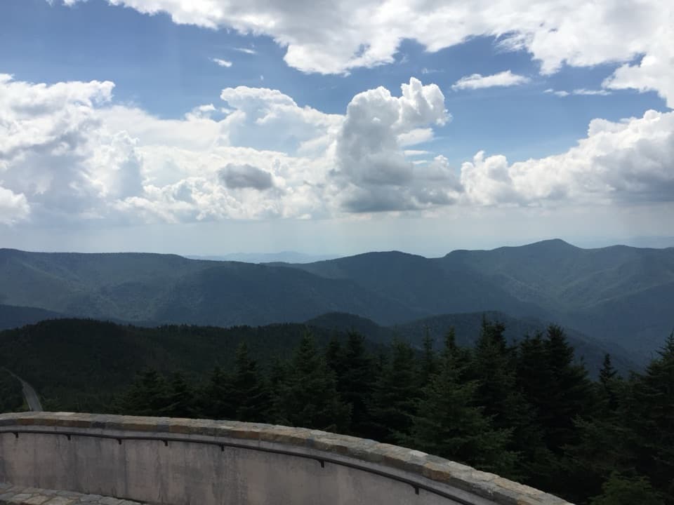 Sight · 3.5 mi awayMount Mitchell SummitStand on the highest summit east of the Mississippi.
 Sight · 3.8 mi awayLaurel Knob OverlookA roadside view with a landmark tree and a second name.
 Scenic pullout · 4.1 mi awayWalker Knob OverlookAt milepost 359.8, this is a better trailhead than viewpoint.
 Sight · 4.2 mi awayGlassmine Falls OverlookAfter rain, look for the falls across Horse Range Ridge.
 Sight · 5.1 mi awayGraybeard Mountain OverlookSeven peaks below Graybeard, sometimes capped by a gray cloud.
Parkwolf’s Blue Ridge Parkway ranking

The audio tour guide for the drive, plus offline maps, trails, and wildlife heatmaps for when the signal drops.





