Parking
Mount Mitchell Summit Parking at the end of NC 128, reached from Blue Ridge Parkway milepost 355.3. Start from the south end of the lot. The Parkway approach can close during winter snow and ice.

Blue Ridge Parkway, NC · VA
A short paved climb to the highest summit east of the Mississippi.
Photo: Thomson200, CC0, via Wikimedia Commons
Overview
Map & elevation
Plan your hike

The highest, rockiest slopes around here are a summer buffet for grizzly bears.
Blue Ridge Parkway Tour Guide
Parkwolf is a GPS audio tour guide for Blue Ridge Parkway. As you drive, it chimes in with what’s ahead: hidden gems, upcoming stops, history, geology, and wildlife, right through your car’s speakers.
See the Blue Ridge Parkway audio tourRecorded for this trailhead
Mount Mitchell: The Road to the Summit“You're approaching the turnoff onto North Carolina one twenty-eight for Mount Mitchell State Park.”
Plays as you drive up to this trailhead in the Parkwolf Blue Ridge Parkway Tour Guide.
More stories near here in the app
“…We knew we wanted to drive the Blue Ridge Parkway. The narration was impeccably timed. The facts and info provided were meaningful. Without it, the trip would not have been near as awesome.”


Trail guide
Mount Mitchell Summit Trail is a paved out-and-back from the summit parking area to the observation deck and back. The mapped route is about 0.4 mile round trip, gaining roughly 105 feet over a steady climb; allow 20–30 minutes for the walk and time on the deck. This is the quick way to reach Mount Mitchell’s 6,684-foot summit, the highest point east of the Mississippi. The path is short, but it keeps rising, so it feels more like a small summit hike than a level overlook stroll.
Start at the south end of the summit lot. A broad paved path passes through tall grass and Fraser fir, bends toward the top and crosses a short bridge before reaching the platform. The surface is smooth and obvious, so route-finding is simple; the steady grade is the part that catches people out. Go up at a pace that lets you enjoy the trees, then leave time to look around before returning the same way. The smooth surface helps, but the path is not level; paved does not mean this is a flat roll to the summit.
On a clear day, the deck opens onto broad, layered ridges in every direction. Fog and low cloud can hide the panorama entirely, while wind and cold feel stronger at this exposed height. If visibility is good, walk around the whole deck before heading back. For a photo, include one of the summit markers with the ridges beyond; the foreground gives the view a sense of place. Sunrise can bring light across the eastern ridges, but it depends on clear conditions.
The peak honors Elisha Mitchell, a University of North Carolina professor and geologist. He measured the Black Mountains several times and recorded a 6,708-foot summit in 1844, then returned in 1857 after a rival disputed his claim. Mitchell died during that last expedition after a fall at a waterfall elsewhere on the mountain. The following year he was reburied on the summit he had measured. His grave and memorial are in the summit area, a reminder that this quick walk ends at the center of a much longer scientific and personal story.
At 6,684 feet, the summit’s Fraser fir and spruce-fir forest stands apart from the lower mountain slopes. The high elevation supports plant communities with a more northern character, compressed into a small patch of the Southern Appalachians. It is worth looking into the trees even when cloud blocks the distant views. This is also why the summit can feel wintry when the lower park feels mild; the exposure and elevation change the experience as much as the short climb does.
The nearby Balsam Nature Loop is a separate 0.7-mile circuit through rocky evergreen woods, with a short spur to a spring. A combined summit-and-Balsam outing is about a mile, but that includes both routes; it is not the Summit Trail’s distance. Add Balsam if you want more walking after the platform. The Mount Mitchell Trail is a different hike altogether: a strenuous 5.6-mile one-way ascent from the South Toe, not an extension from summit parking.
Mount Mitchell State Park is reached by NC 128 from Blue Ridge Parkway milepost 355.3. Park at Mount Mitchell Summit Parking and start at the southern end of the lot. A seasonal restaurant and concession stand are near the summit, but do not count on them outside their operating season. Winter snow and ice can close Parkway sections for long periods, so check road access before driving up. Dogs may join the outdoor trail on a leash no longer than six feet; pets cannot enter park buildings.
Wildlife
 1,214 sightingsBlack BearMost seen around 7 AMSighting map
 1,021 sightingsElkMost seen around 7 AMSighting map
 2,266 sightingsWhite-tailed DeerMost seen around 6 PMSighting map
 200 sightingsCoyoteMost seen around 6 PMSighting map
 1,130 sightingsWild TurkeyMost seen around 7 AMSighting map
 255 sightingsRed-tailed HawkMost seen around 11 AMSighting map
Sighting maps show where each species has been reported across Blue Ridge Parkway. Wildlife moves, so no sighting is guaranteed.
Keep exploring
 ModerateBalsam Nature Loop Trail0.7 mi · 42 min · At the trailheadA short loop into mossy spruce-fir woods near the summit.
 ChallengingBlack Mountain Crest Trail11.3 mi · 10 hr · 0.1 mi awayTen peaks, fixed ropes, and a long descent to Bowlens Creek.
 ModerateDeep Gap Trail to Mount Craig1.7 mi · 1.8 hr · 0.1 mi awayA short ridge walk to a summit view back toward Mount Mitchell.
 ChallengingCamp Alice Trail0.5 mi · 30 min · 0.3 mi awayA steep, rocky half-mile between Old Mitchell and Commissary.
 ModerateOld Mitchell Trail4 mi · 3.5 hr · 1.6 mi awayA rocky 4-mile out-and-back to the East’s highest summit.
 EasyCommissary Trail4 mi · 2 hr · 1.6 mi awayFour miles out and back on the gentle old railroad grade.
 ChallengingMount Mitchell Trail11.2 mi · 10 hr · 2.8 mi awayEarn the East's highest summit one switchback at a time
 ModerateBald Knob Ridge Trail5.6 mi · 6 hr · 3.6 mi awayA forested ridge walk with spruce, fir, and Black Mountains views.
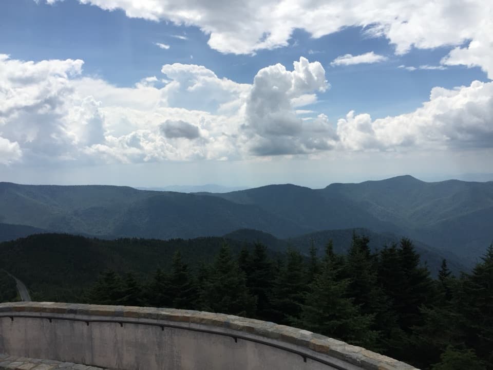 Sight · 0.1 mi awayMount Mitchell SummitStand on the highest summit east of the Mississippi.
 Scenic pullout · 3.5 mi awayRidge Junction OverlookQuick roadside views across the Black Mountains and South Toe Valley.
 Scenic pullout · 4 mi awayMount Mitchell OverlookA signed Parkway view toward Mount Mitchell, miles before its summit.
 Scenic pullout · 4 mi awayWalker Knob OverlookAt milepost 359.8, this is a better trailhead than viewpoint.
 Scenic pullout · 4.1 mi awayGreen Knob OverlookA quick pull-off with wide ridges, Lake James, and Linville Gorge.
 Sight · 4.3 mi awayLaurel Knob OverlookA roadside view with a landmark tree and a second name.
 Sight · 4.9 mi awayGlassmine Falls OverlookAfter rain, look for the falls across Horse Range Ridge.
 Scenic pullout · 5 mi awaySingecat Ridge OverlookMackey Mountain and Onion Knob frame this roadside view.
Parkwolf’s Blue Ridge Parkway ranking

The audio tour guide for the drive, plus offline maps, trails, and wildlife heatmaps for when the signal drops.





