Parking
Start at Mount Mitchell Summit Parking, at the end of N.C. 128. The paved day-use lot is the loop’s access; Mount Mitchell State Park charges no day-use fee.

Blue Ridge Parkway, NC · VA
A short loop into mossy spruce-fir woods near the summit.
Photo: DiscoA340, CC BY-SA 4.0, via Wikimedia Commons
Overview
Map & elevation
Plan your hike

The highest, rockiest slopes around here are a summer buffet for grizzly bears.
Blue Ridge Parkway Tour Guide
Parkwolf is a GPS audio tour guide for Blue Ridge Parkway. As you drive, it chimes in with what’s ahead: hidden gems, upcoming stops, history, geology, and wildlife, right through your car’s speakers.
See the Blue Ridge Parkway audio tourRecorded for this trailhead
Mount Mitchell: The Road to the Summit“You're approaching the turnoff onto North Carolina one twenty-eight for Mount Mitchell State Park.”
Plays as you drive up to this trailhead in the Parkwolf Blue Ridge Parkway Tour Guide.
More stories near here in the app
“…We knew we wanted to drive the Blue Ridge Parkway. The narration was impeccably timed. The facts and info provided were meaningful. Without it, the trip would not have been near as awesome.”


Trail guide
Balsam Nature Loop is the state park’s 0.7-mile circuit from Mount Mitchell Summit Parking. The marked route uses the summit-area footpaths to reach the white-triangle nature trail, then returns through spruce-fir woods to the lot. Allow about 40 minutes if you stop at the interpretive stations. It’s a good extra walk when you want to get into the high-elevation forest; the nearby observation deck has the open mountain view, while the loop’s reward is the woods.
Stay with the white triangle blazes at the junctions. The loop briefly meets the Mount Mitchell Trail, whose blue diamonds continue farther down the mountain; that longer route is not part of this short circuit. The nature path drops into the forest and climbs back toward the summit access. Expect uneven dirt, exposed roots and rocks, steps, and a few short steep sections. The park rates it moderate and does not list it as accessible.
Under the canopy, the walk feels much more enclosed than the summit deck. Interpretive signs explain the plants and forest, and moss-covered rocks, roots and the scent of fir are recurring details of the walk. Visitors consistently value this quiet forest stretch more than any long-distance view from the trail itself.
Pets are allowed on park trails but must stay on an attended leash no longer than six feet. The park lists a seasonal concession stand and restaurant by the summit parking area, separate from the trail. At 6,684 feet, the summit can be windy, foggy and much colder than lower elevations. Winter ice can close sections of the Blue Ridge Parkway, the main access route, so check the park and road status before a winter drive.
Wildlife
 1,214 sightingsBlack BearMost seen around 7 AMSighting map
 1,021 sightingsElkMost seen around 7 AMSighting map
 2,266 sightingsWhite-tailed DeerMost seen around 6 PMSighting map
 200 sightingsCoyoteMost seen around 6 PMSighting map
 1,130 sightingsWild TurkeyMost seen around 7 AMSighting map
 255 sightingsRed-tailed HawkMost seen around 11 AMSighting map
Sighting maps show where each species has been reported across Blue Ridge Parkway. Wildlife moves, so no sighting is guaranteed.
Keep exploring
 EasyMount Mitchell Summit Trail0.4 mi · 24 min · At the trailheadA short paved climb to the highest summit east of the Mississippi.
 ChallengingBlack Mountain Crest Trail11.3 mi · 10 hr · 0.1 mi awayTen peaks, fixed ropes, and a long descent to Bowlens Creek.
 ModerateDeep Gap Trail to Mount Craig1.7 mi · 1.8 hr · 0.1 mi awayA short ridge walk to a summit view back toward Mount Mitchell.
 ChallengingCamp Alice Trail0.5 mi · 30 min · 0.4 mi awayA steep, rocky half-mile between Old Mitchell and Commissary.
 ModerateOld Mitchell Trail4 mi · 3.5 hr · 1.6 mi awayA rocky 4-mile out-and-back to the East’s highest summit.
 EasyCommissary Trail4 mi · 2 hr · 1.6 mi awayFour miles out and back on the gentle old railroad grade.
 ChallengingMount Mitchell Trail11.2 mi · 10 hr · 2.7 mi awayEarn the East's highest summit one switchback at a time
 ModerateBald Knob Ridge Trail5.6 mi · 6 hr · 3.6 mi awayA forested ridge walk with spruce, fir, and Black Mountains views.
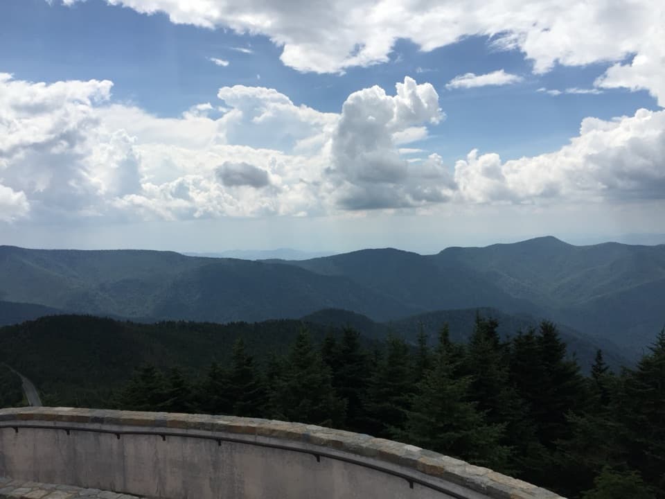 Sight · 0.1 mi awayMount Mitchell SummitStand on the highest summit east of the Mississippi.
 Scenic pullout · 3.5 mi awayRidge Junction OverlookQuick roadside views across the Black Mountains and South Toe Valley.
 Scenic pullout · 3.9 mi awayMount Mitchell OverlookA signed Parkway view toward Mount Mitchell, miles before its summit.
 Scenic pullout · 4.1 mi awayWalker Knob OverlookAt milepost 359.8, this is a better trailhead than viewpoint.
 Scenic pullout · 4.1 mi awayGreen Knob OverlookA quick pull-off with wide ridges, Lake James, and Linville Gorge.
 Sight · 4.3 mi awayLaurel Knob OverlookA roadside view with a landmark tree and a second name.
 Sight · 4.9 mi awayGlassmine Falls OverlookAfter rain, look for the falls across Horse Range Ridge.
 Scenic pullout · 5 mi awaySingecat Ridge OverlookMackey Mountain and Onion Knob frame this roadside view.
Parkwolf’s Blue Ridge Parkway ranking

The audio tour guide for the drive, plus offline maps, trails, and wildlife heatmaps for when the signal drops.





