Parking
Use the trail parking across the South Toe River from the Black Mountain Campground entrance. Cross the vehicle bridge, turn left, and look for the trail on the right side of Briar Bottom Camp Road.

Blue Ridge Parkway, NC · VA
Earn the East's highest summit one switchback at a time
Photo: NPS Photo / A. Armstrong
Overview
Map & elevation
Plan your hike

The highest, rockiest slopes around here are a summer buffet for grizzly bears.
Blue Ridge Parkway Tour Guide
Parkwolf is a GPS audio tour guide for Blue Ridge Parkway. As you drive, it chimes in with what’s ahead: hidden gems, upcoming stops, history, geology, and wildlife, right through your car’s speakers.
See the Blue Ridge Parkway audio tourRecorded for this area
Flowers Before the Leaves“On a spring woodland walk, look down before the trees have fully leafed out. Trout lilies and other early wildflowers use that brief spell of sunshine reaching the forest floor. They're called spring ephemerals.”
Plays on the road 1.6 mi from the trailhead in the Parkwolf Blue Ridge Parkway Tour Guide.
More stories near here in the app
“…We knew we wanted to drive the Blue Ridge Parkway. The narration was impeccably timed. The facts and info provided were meaningful. Without it, the trip would not have been near as awesome.”


Trail guide
The Mount Mitchell Trail is a strenuous out-and-back from Black Mountain Campground in the South Toe River valley to the 6,684-foot summit: 5.6 miles each way, or 11.2 miles for the usual round trip, with about 3,630 feet of climbing. It follows blue diamond blazes through hardwood forest, a historic clearing and high-elevation spruce-fir woods before joining the paved summit approach. This is a full-day climb to the highest peak east of the Mississippi, not the short summit walk from the upper parking area. Plan on roughly 9–11 hours, depending on your pace and breaks.
The trail parking is across the South Toe River from the campground entrance. Cross the vehicle bridge, turn left, and look for the trail on the right side of Briar Bottom Camp Road. The first miles climb steadily through cove hardwoods and oak-hickory forest on repeated switchbacks. Blue diamonds mark the route. A side path toward Higgins Bald branches off around mile two; it is not part of the summit route. Expect uneven rocks and roots, and occasional mud, underfoot. The climb is sustained, while broad views are scarce for much of this wooded stretch.
Around mile four, the trees open into Camp Alice, a broad grassy clearing that makes a natural pause on the climb. It was first a logging camp and later a small tourist camp in the early 1900s; no camp buildings remain. Beyond the clearing the trail keeps gaining height, but the grade eases somewhat. Oak and other hardwoods give way to red spruce and Fraser fir in the cooler high-elevation forest. These mountaintop woods are a remnant of a much colder era, and many Fraser firs have been affected by an invasive insect.
Near the top, the route meets the Balsam Nature Trail and continues along a short paved approach to the stone observation deck. The deck sits at 6,684 feet. On a clear day you can look across the Craggy ranges and layers of distant ridges; fog can close in and hide the view. This final panorama is the main open vista of a hike that spends most of its miles under trees. The summit is also the burial place of professor Elisha Mitchell, who died in 1857 while studying the mountain that now bears his name.
Carry enough water from the start: no dependable refill has been verified on the climbing route. Bring a warm layer and rain protection because the summit can be much colder than the valley and mountain weather can change quickly. Winter ice can make the rocky trail and paved summit approach slippery. Dogs are allowed, but keep them attended on a leash no longer than six feet. Summit restrooms, a museum and food service are seasonal facilities reached from the summit road; do not count on them as open or as a trail-side refill. Check current forest-road and campground access before setting out.
Wildlife
 1,214 sightingsBlack BearMost seen around 7 AMSighting map
 1,021 sightingsElkMost seen around 7 AMSighting map
 2,266 sightingsWhite-tailed DeerMost seen around 6 PMSighting map
 200 sightingsCoyoteMost seen around 6 PMSighting map
 1,130 sightingsWild TurkeyMost seen around 7 AMSighting map
 255 sightingsRed-tailed HawkMost seen around 11 AMSighting map
Sighting maps show where each species has been reported across Blue Ridge Parkway. Wildlife moves, so no sighting is guaranteed.
Keep exploring
 ModerateGreen Knob Lookout Trail1 mi · 1 hr · 2.3 mi awayClimb to a 1931 fire tower and look toward the Black Mountains
 ModerateBalsam Nature Loop Trail0.7 mi · 42 min · 2.7 mi awayA short loop into mossy spruce-fir woods near the summit.
 ChallengingBlack Mountain Crest Trail11.3 mi · 10 hr · 2.8 mi awayTen peaks, fixed ropes, and a long descent to Bowlens Creek.
 ModerateDeep Gap Trail to Mount Craig1.7 mi · 1.8 hr · 2.8 mi awayA short ridge walk to a summit view back toward Mount Mitchell.
 EasyMount Mitchell Summit Trail0.4 mi · 24 min · 2.8 mi awayA short paved climb to the highest summit east of the Mississippi.
 ChallengingCamp Alice Trail0.5 mi · 30 min · 2.8 mi awayA steep, rocky half-mile between Old Mitchell and Commissary.
 EasyCommissary Trail4 mi · 2 hr · 3.2 mi awayFour miles out and back on the gentle old railroad grade.
 ModerateOld Mitchell Trail4 mi · 3.5 hr · 3.2 mi awayA rocky 4-mile out-and-back to the East’s highest summit.
 Sight · 1.9 mi awayLaurel Knob OverlookA roadside view with a landmark tree and a second name.
 Scenic pullout · 1.9 mi awayMount Mitchell OverlookA signed Parkway view toward Mount Mitchell, miles before its summit.
 Scenic pullout · 2.3 mi awayGreen Knob OverlookA quick pull-off with wide ridges, Lake James, and Linville Gorge.
 Scenic pullout · 2.5 mi awaySingecat Ridge OverlookMackey Mountain and Onion Knob frame this roadside view.
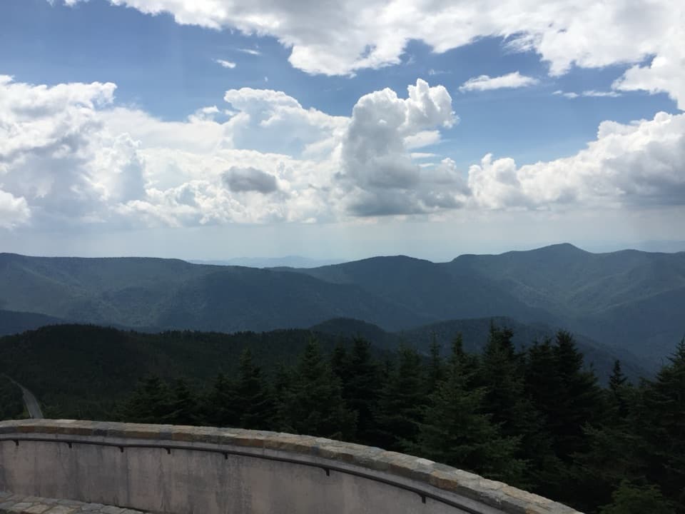 Sight · 2.7 mi awayMount Mitchell SummitStand on the highest summit east of the Mississippi.
 Scenic pullout · 3.8 mi awayBlack Mountains OverlookA west-facing panorama of the Black Mountains and South Toe valley.
 Scenic pullout · 4 mi awayRidge Junction OverlookQuick roadside views across the Black Mountains and South Toe Valley.
 Picnic area · 5.3 mi awayCrabtree Falls Picnic AreaA spread-out lunch stop with a few mountain views.
Parkwolf’s Blue Ridge Parkway ranking

The audio tour guide for the drive, plus offline maps, trails, and wildlife heatmaps for when the signal drops.





