MacKenzie Mountain Look-off — The Gulf of St. Lawrence in Cape Breton Highlands National Park

Scenic pullout · Cape Breton Highlands National Park

MacKenzie Mountain Look-off — The Gulf of St. Lawrence

A Gulf panorama with its own stop on the Cabot Trail.

Photo: Flickr
Type
Scenic pullout
Nearest trail
5.1 km
Audio stories
4 nearby
  • Scenic viewpoint
  • Exhibit
  • Pullout

Hear the audio tour

MacKenzie Mountain Look-offs

Overview

About MacKenzie Mountain Look-off — The Gulf of St. Lawrence

Why stop

  • A broad coastal view comes with specific marine interpretation.

Heads up

  • The middle deck is easy to confuse with two neighboring look-offs.

Map

Where it is

Loading the Cape Breton Highlands map
Full map
Scenic pulloutMacKenzie Mountain Look-off — The Gulf of St. Lawrence46.81755, -60.83378
Keep this map with you offline in the Parkwolf app

Plan your stop

Before you go

6 active Cape Breton Highlands alerts

  • CautionPedestrian prohibition on Cabot Trail near French LakeMentions Cabot Trail, referenced in this guidePedestrian use is prohibited at all times on the Cabot Trail between 19713 Cabot Trail (French Lake Look-Off) and 18865 Cabot Trail (Veteran’s Monument Look-Off) through October 25, 2026.Official details
  • ClosureCoyote-related area closuresMacIntosh Brook Campground and Trail, Lone Shieling, three Cabot Trail properties, and nearby pull-offs are closed because coyotes have approached people aggressively.Official details

See all 6 alerts
A park ranger sits on a dash-mounted phone, talking, as Parkwolf’s Tour Guide plays “Army Cutworm Moths: A Grizzly Bear Buffet” on Grand Loop Road below Dunraven Pass in Yellowstone
Parkwolf Tour GuideThe highest, rockiest slopes around here are a summer buffet for grizzly bears.

Cape Breton Highlands Tour Guide

Your drive to MacKenzie Mountain Look-off — The Gulf of St. Lawrence, narrated.

Parkwolf is a GPS audio tour guide for Cape Breton Highlands National Park. As you drive, it chimes in with what’s ahead: hidden gems, upcoming stops, history, geology, and wildlife, right through your car’s speakers.

See the Cape Breton Highlands audio tour

Recorded for this place

MacKenzie Mountain Look-offs
0:00 / 0:26
“MacKenzie Mountain's look-offs are coming up, with three separate accessible roadside decks. At the Highland Plateau deck, look for the MacKenzie River cutting into the uplands.”

Plays as you drive up to MacKenzie Mountain Look-off — The Gulf of St. Lawrence in the Parkwolf Cape Breton Highlands Tour Guide.

More stories near here in the app

  • Rusty Anchor Restaurant
  • The Whales That Stay Together
  • The Partnership on the Bark
  • Fishing Cove Look-off
  • 50 audio storiesacross Cape Breton Highlands’s roads, triggered by GPS as you drive
  • Wildlife heatmapsfor Moose, Black Bear, Bald Eagle, and 13 more
  • Works offlinemaps, 27 trails, 38 places, and audio download before you lose signal
  • CarPlay readysimple controls built for the drive
★★★★★
“Fantastic app with many points of information… It’s great to just turn on while you’re driving and it gives you an audio tour of the national Park. We love it!!!!”
JMJamesApp Store review
Download Parkwolf on the App StoreGet Parkwolf on Google Play

4.7 from 8,600+ ratings

Guide

More about MacKenzie Mountain Look-off — The Gulf of St. Lawrence

A stop for the GulfMacKenzie Mountain Look-off — The Gulf of St.

MacKenzie Mountain Look-off — The Gulf of St. Lawrence is the middle of three roadside viewing decks along this stretch of the Cabot Trail. It gives you a broad view over the Gulf and a panel about what lies beneath the water. Come here for the Gulf story; the separate Whales deck is the stop to scan for spouts.

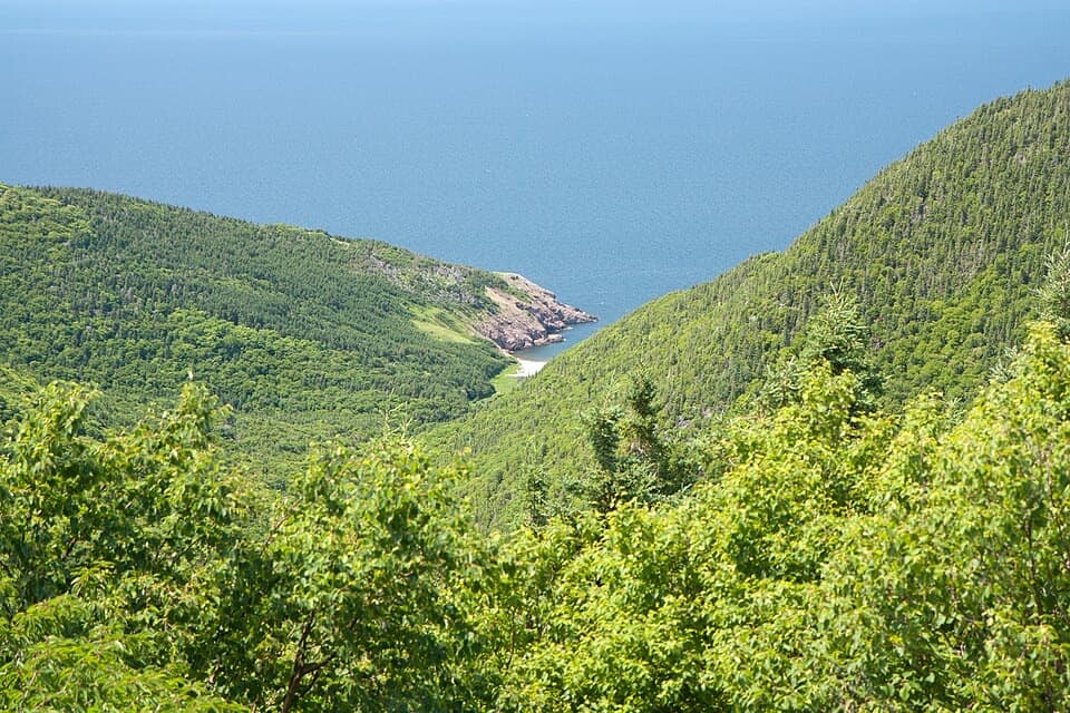
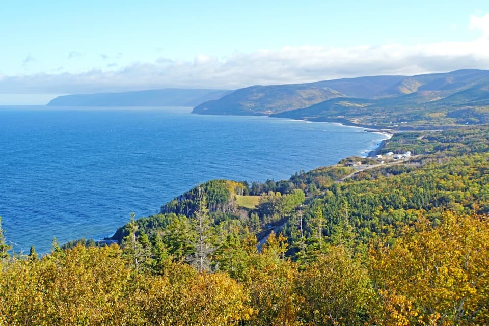
Take in the coastLook across Pleasant Bay and the coast beyond.

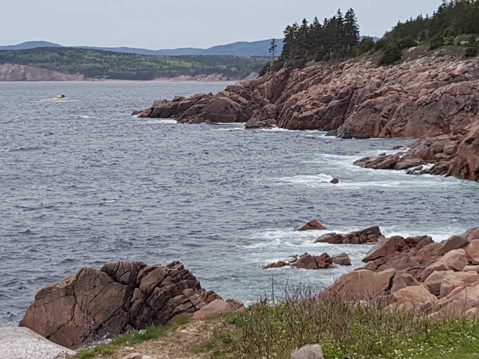
Look across Pleasant Bay and the coast beyond. The curve of the bay and the forested ridges give the view its scale. In a photo, keep some shoreline and foreground trees in frame; an all-water shot loses the shape of the coast.

What's under the GulfThe exhibit contrasts the Gulf with the Atlantic: its water is warmer and less salty.

The exhibit contrasts the Gulf with the Atlantic: its water is warmer and less salty. It explains the underwater troughs and shelves, like valleys and plateaus beneath the surface, and how currents create fish habitat. The Gulf is also an important transportation waterway and a route for migrating marine mammals.

Place it on the Cabot TrailMacKenzie has separate Highland Plateau, Gulf, and Whales interpretation stops; this is the…

MacKenzie has separate Highland Plateau, Gulf, and Whales interpretation stops; this is the middle one. Choose it for the broad water view and the Gulf's geology, and use the Whales deck if you want to scan for spouts. A park pass is required to tour the Cabot Trail through the park.

Wildlife

Wildlife in Cape Breton Highlands

All Cape Breton Highlands wildlife maps

Sighting maps show where each species has been reported across Cape Breton Highlands. Wildlife moves, so no sighting is guaranteed.

Parkwolf’s Cape Breton Highlands ranking

Top sights in Cape Breton Highlands

All 38 places
  1. 1Beulach Ban FallsSight
  2. 2Ingonish Beach and Freshwater LakeBeach
  3. 3Black Brook BeachBeach
  4. 4Lakie's HeadSight
  5. 5Lone ShielingSight
  6. 6Highlands LinksSight

Take Parkwolf to Cape Breton Highlands.

The audio tour guide for the drive, plus offline maps, trails, and wildlife heatmaps for when the signal drops.

4.7 from 8,600+ ratings

Download Parkwolf on the App StoreGet Parkwolf on Google Play