Rattlesnake Springs in Carlsbad Caverns National Park

Picnic area · Carlsbad Caverns National Park

Rattlesnake Springs

Cottonwood shade, picnic tables, and a surprisingly rich birding stop.

Photo: Public Domain
Type
Picnic area
Nearest trail
4.3 mi
Audio stories
4 nearby
  • Parking
  • Picnic tables
  • Restrooms

Hear the audio tour

Rattlesnake Springs

Overview

About Rattlesnake Springs

Why stop

  • A shady cottonwood grove with strong birding potential

Heads up

  • A small stop well south of the cavern area; swimming is not allowed

Map

Where it is

Loading the Carlsbad Caverns map
Full map
Picnic areaRattlesnake Springs32.11142, -104.46572
Keep this map with you offline in the Parkwolf app

Plan your stop

Before you go

Getting there

From Carlsbad, take U.S. 62/180 south about 26 miles to the signed Rattlesnake Springs turn, then continue about two miles to the grounds. This is a separate day-use area south of the cavern section, so plan for the drive. The neighboring Nature Conservancy preserve is a separate property reached on foot from the picnic parking; follow its access guidance and stay out of the marsh.

1 active Carlsbad Caverns alert

  • ClosureFlood damage closes Walnut Canyon road and trailsWalnut Canyon Desert Drive and several backcountry trails are closed because extensive damage from the August 2022 historic flood still requires major repairs.Official details
Carlsbad Caverns alerts
A park ranger sits on a dash-mounted phone, talking, as Parkwolf’s Tour Guide plays “Army Cutworm Moths: A Grizzly Bear Buffet” on Grand Loop Road below Dunraven Pass in Yellowstone
Parkwolf Tour GuideThe highest, rockiest slopes around here are a summer buffet for grizzly bears.

Carlsbad Caverns Tour Guide

Your drive to Rattlesnake Springs, narrated.

Parkwolf is a GPS audio tour guide for Carlsbad Caverns National Park. As you drive, it chimes in with what’s ahead: hidden gems, upcoming stops, history, geology, and wildlife, right through your car’s speakers.

Recorded for this place

Rattlesnake Springs
0:00 / 0:32
“Rattlesnake Springs is coming up, a cottonwood-shaded picnic spot gathered around water in the desert. I'd stop here for a picnic or some unhurried birdwatching, rather than expecting a long walk.”

Plays as you drive up to Rattlesnake Springs in the Parkwolf Carlsbad Caverns Tour Guide.

More stories near here in the app

  • Ancient Defenses in the Dark
  • One Bloom for Lechuguilla
  • From Bats to Citrus Groves
  • Sunset Reef Campground Access
  • 26 audio storiesacross Carlsbad Caverns’s roads, triggered by GPS as you drive
  • Wildlife heatmapsfor Mexican Free-tailed Bat, Aoudad, Mule Deer, and 13 more
  • Works offlinemaps, 12 trails, 12 places, and audio download before you lose signal
  • CarPlay readysimple controls built for the drive
★★★★★
“Fantastic app with many points of information… It’s great to just turn on while you’re driving and it gives you an audio tour of the national Park. We love it!!!!”
JMJamesApp Store review
Download Parkwolf on the App StoreGet Parkwolf on Google Play

4.7 from 8,600+ ratings

Guide

More about Rattlesnake Springs

A green break south of the cavernsRattlesnake Springs is a small day-use picnic area where a broad cottonwood grove gathers…

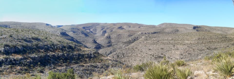
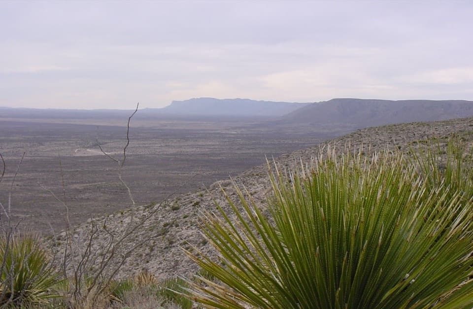
Rattlesnake Springs is a small day-use picnic area where a broad cottonwood grove gathers around water in the Chihuahuan Desert. Save it for a picnic or a slower birding stop; it’s a welcome change of scenery from the cave area, but not a long outing or a place to swim.

Make it a picnic stopThere are picnic tables, an accessible table, parking, and an accessible vault toilet.

There are picnic tables, an accessible table, parking, and an accessible vault toilet. Bring a picnic and give yourself time to look and listen around the grove. Dogs are allowed on leash, and the area is open during daylight hours. Swimming isn’t allowed.

Watch the trees for birdsMore than 330 bird species have been recorded around the springs, a cumulative list rather than…

More than 330 bird species have been recorded around the springs, a cumulative list rather than a promise for any one visit. Bell’s vireos nest here, and visitors also report wild turkeys and deer among the wildlife. This is the place to slow down and watch the cottonwoods, not rush through on the way to the next cave stop.

A landscape shaped by peopleWilliam Henry Harrison homesteaded and farmed here around 1880, building an irrigation ditch…

William Henry Harrison homesteaded and farmed here around 1880, building an irrigation ditch that still contributes to the landscape. The park acquired the property in 1930 as a water source for Carlsbad Caverns. The historic district was listed on the National Register in 1988.

From 1938 to 1942, Civilian Conservation Corps crews planted the cottonwoods and laid trails while improving the irrigation system. Most of the camp’s buildings are gone, but the trees they planted still make the picnic area feel like an oasis.

Wildlife

Wildlife in Carlsbad Caverns

All Carlsbad Caverns wildlife maps

Sighting maps show where each species has been reported across Carlsbad Caverns. Wildlife moves, so no sighting is guaranteed.

Parkwolf’s Carlsbad Caverns ranking

Top sights in Carlsbad Caverns

All 12 places
  1. 1Carlsbad CavernSight
  2. 2Bat Flight AmphitheaterSight
  3. 3Slaughter Canyon CaveSight
  4. 4Walnut Canyon OverlookSight
  5. 5Walnut Canyon Rock ShelterSight
  6. 6Big Hill SeepSight

Take Parkwolf to Carlsbad Caverns.

The audio tour guide for the drive, plus offline maps, trails, and wildlife heatmaps for when the signal drops.

4.7 from 8,600+ ratings

Download Parkwolf on the App StoreGet Parkwolf on Google Play