Cuyler Harbor in Channel Islands National Park

Beach · Channel Islands National Park

Cuyler Harbor

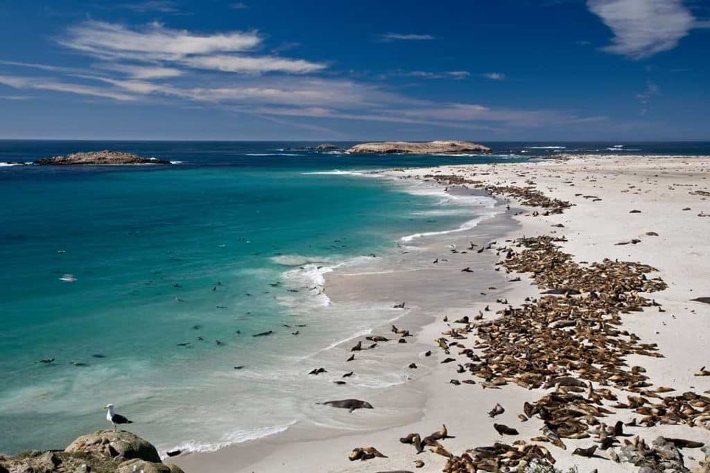
San Miguel’s wild white‑sand landing with seals and sweeping cliffs

Type
Beach
Nearest trail
0.3 mi
Audio stories
6 nearby
  • Trailhead
  • Campground

Hear the audio tour

Cuyler Harbor: San Miguel's Wild Front Door

Overview

About Cuyler Harbor

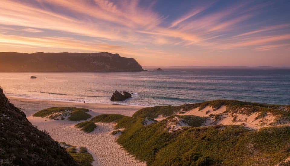
Cuyler Harbor is San Miguel Island’s wild front door: a sweep of white sand tucked beneath sheer cliffs, offshore rocks, and the silhouette of Prince Island. It’s often called the most beautiful anchorage in the islands—and also one of the most demanding. Come for the solitude, the wildlife, and the unfiltered ocean energy; stay only if you’re ready for raw conditions and zero amenities.

Why stop

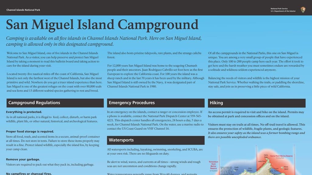
  • Long white‑sand beach framed by dramatic cliffs and rock formations
  • Reliable marine wildlife viewing (seals, sea lions, seabirds)
  • Primary landing and gateway to exploring San Miguel Island

Heads up

  • Harsh, windy, foggy conditions are common
  • Strict access rules and limited areas without a ranger escort
  • No services whatsoever—bring everything and pack it all out

Map

Where it is

Loading the Channel Islands map
Full map
BeachCuyler Harbor34.05119, -120.35154
Keep this map with you offline in the Parkwolf app

Local know-how

Tips for visiting Cuyler Harbor

  1. Expect a wet skiff landing; waterproof bags and spare dry layers are essential.

  2. Bring all water, food, and trash bags—there are no services or bins.

  3. Check that the island is open and rangers are present before you go.

  4. Stay on designated trails or the beach due to unexploded ordnance hazards.

  5. You can roam the beach and Nidever Canyon independently; most other areas require a ranger escort.

Plan your stop

Before you go

Best time to visit

Plan around fair-weather windows and confirmed ranger presence. Mornings often offer gentler light for photography and fewer people on the beach, but the bigger factor here is wind and swell. Always check current access status and day‑of logistics before committing to the crossing.

Access and Rules

This is the island’s only visitor landing, and it’s a wet skiff landing directly onto the beach—plan to waterproof everything. All visitors must have permits; private boaters self‑register at the Nidever Canyon trailhead just up from the beach. You must stay on designated trails or the beach due to unexploded ordnance hazards. You can explore the beach, Nidever Canyon, the Cabrillo Monument, and the Lester Ranch site on your own; most other areas require a ranger escort. The island is only open when National Park Service personnel are present.

3 active Channel Islands alerts

  • ClosureSanta Rosa Island wildfire-recovery closuresAvoid closed routes and shorelines on Santa Rosa Island during recovery from the 2026 wildfire.Official details
  • ClosureSanta Barbara Island dock closed; landings restrictedThe Santa Barbara Island dock is closed; landings are restricted to the adjacent rocky ledge. - Severe winter storm damage caused the closure, and repairs are not expected in the near future.Official details
See all 3 alerts
A park ranger sits on a dash-mounted phone, talking, as Parkwolf’s Tour Guide plays “Army Cutworm Moths: A Grizzly Bear Buffet” on Grand Loop Road below Dunraven Pass in Yellowstone
Parkwolf Tour GuideThe highest, rockiest slopes around here are a summer buffet for grizzly bears.

Channel Islands Tour Guide

Your drive to Cuyler Harbor, narrated.

Parkwolf is a GPS audio tour guide for Channel Islands National Park. As you drive, it chimes in with what’s ahead: hidden gems, upcoming stops, history, geology, and wildlife, right through your car’s speakers.

See the Channel Islands audio tour

Recorded for this place

Cuyler Harbor: San Miguel's Wild Front Door
Listen
“You're arriving at Cuyler Harbor, the wild front door to San Miguel Island. This place is famous for its stunning two-mile white-sand beach tucked under sheer cliffs.”

Plays as you drive up to Cuyler Harbor in the Parkwolf Channel Islands Tour Guide.

More stories near here in the app

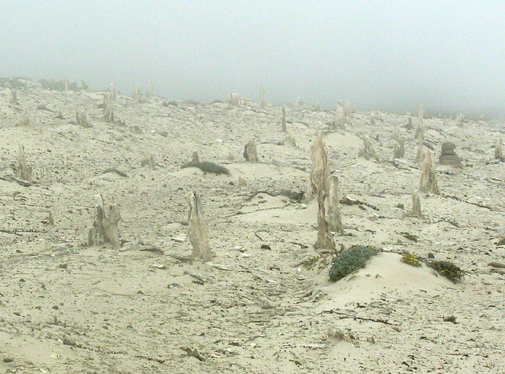
  • The Ranger-Led Walk to the Caliche Forest
  • San Miguel Island Campground: A Wild and Windy Stay
  • Harris Point Trail and Coastal Bluffs
  • The Unique Ghost Forest of Caliche
  • 47 audio storiesacross Channel Islands’s roads, triggered by GPS as you drive
  • Wildlife heatmapsfor Island Fox, Humpback Whale, Blue Whale, and 13 more
  • Works offlinemaps, 31 trails, 49 places, and audio download before you lose signal
  • CarPlay readysimple controls built for the drive
★★★★★
“Fantastic app with many points of information… It’s great to just turn on while you’re driving and it gives you an audio tour of the national Park. We love it!!!!”
JMJamesApp Store review
Download Parkwolf on the App StoreGet Parkwolf on Google Play

4.7 from 8,600+ ratings

Guide

More about Cuyler Harbor

What You’ll SeeExpect big coastal drama: Harris Point and Prince Island guard the harbor, while features like…

Expect big coastal drama: Harris Point and Prince Island guard the harbor, while features like Nifty Rock and Hare Rock punctuate the view. The two‑mile beach is prime for walking and beachcombing. Wildlife is the headline—seals and sea lions frequently haul out on the sand, seabirds swirl around the cliffs and islets, and the nearshore kelp forests teem with marine life. Keep your distance from marine mammals and give them the beach when they need it.

Amenities (or lack thereof)There are no services at Cuyler Harbor—no water, no restrooms, no food, no store, no trash…

There are no services at Cuyler Harbor—no water, no restrooms, no food, no store, no trash facilities, no Wi‑Fi. Bring every drop of water and all supplies, and pack everything out. A small campground (10 sites) sits inland near the historic Lester Ranch site, reached from the harbor.

Weather and SafetyThis is an open‑ocean outpost. High winds, cold, and fog are normal—gusts can be severe.

This is an open‑ocean outpost. High winds, cold, and fog are normal—gusts can be severe. Dress for wind and spray, and expect conditions to change quickly. Never leave designated routes; the off‑trail ordnance risk is real. Treat the surf with respect, and give hauled‑out animals plenty of space.

History and Sense of PlaceNamed for Lt. Cmdr. Richard M.

Named for Lt. Cmdr. Richard M. Cuyler in the 1850s, the harbor later served island ranching operations; you can still spot remnants like an old pier foundation. Today, its isolation is the point: Cuyler Harbor feels like California before roads—raw, quiet, and full of life.

Wildlife

Wildlife in Channel Islands

All Channel Islands wildlife maps

Sighting maps show where each species has been reported across Channel Islands. Wildlife moves, so no sighting is guaranteed.

Parkwolf’s Channel Islands ranking

Top sights in Channel Islands

All 49 places
  1. 1Inspiration PointSight
  2. 2Arch Rock (Anacapa Island)Sight
  3. 3Point BennettSight
  4. 4Santa Cruz IslandSight
  5. 5Scorpion AnchorageSight
  6. 6Potato Harbor OverlookSight

Take Parkwolf to Channel Islands.

The audio tour guide for the drive, plus offline maps, trails, and wildlife heatmaps for when the signal drops.

4.7 from 8,600+ ratings

Download Parkwolf on the App StoreGet Parkwolf on Google Play