Pros & cons
PROS
- Striking volcanic plain unlike the surrounding forest
- Easy roadside viewing along the North Entrance Road
CONS
- No facilities; entirely undeveloped
- Full sun and wind exposure with little shade
Overview
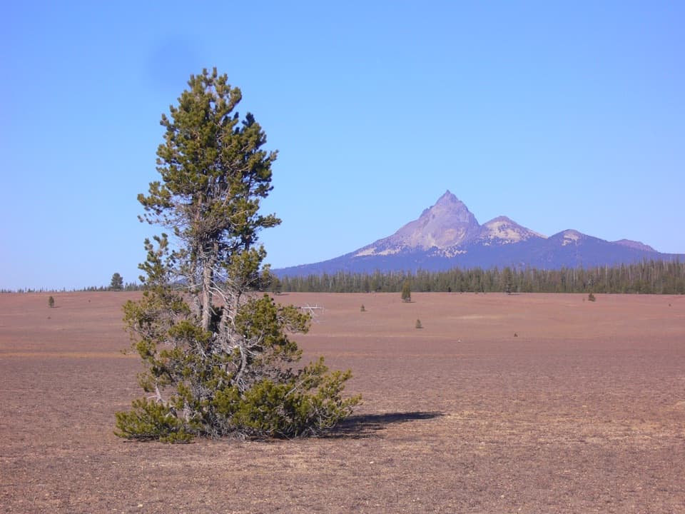
Pumice Desert is a broad, pale expanse of volcanic debris in the park’s north sector, visible right from the North Entrance Road. Covering about 3,055 acres and designated as a Research Natural Area, it’s a stark counterpoint to the dense conifer forest around it.
What You’ll See
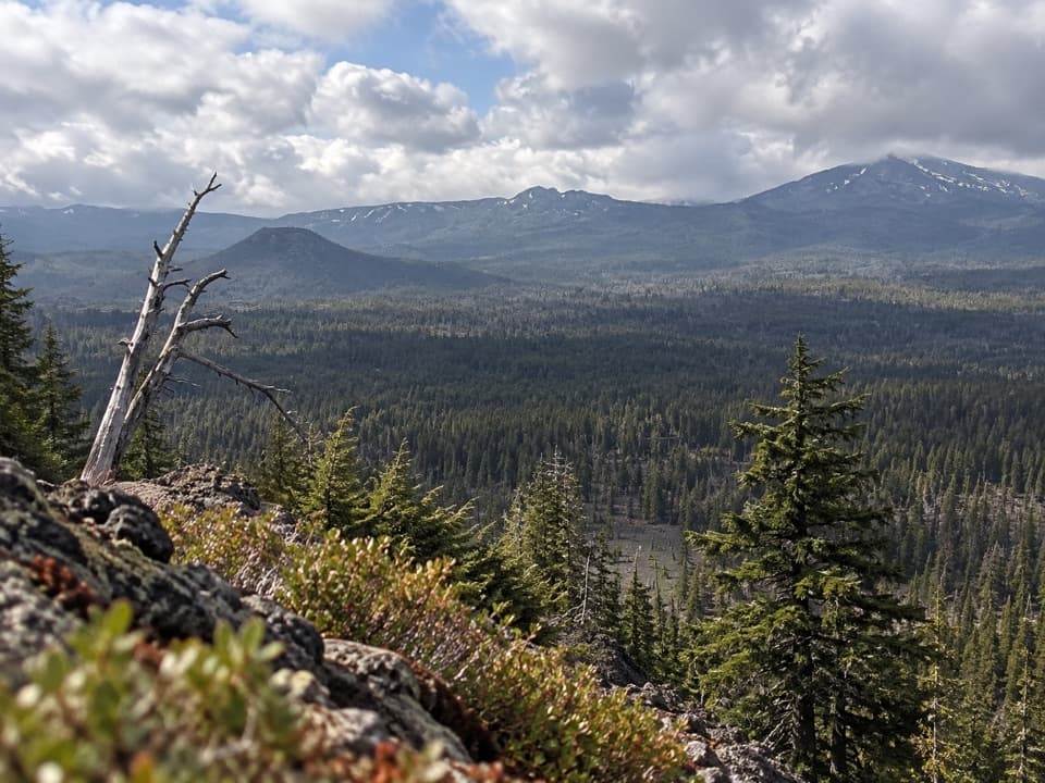
Expect a sweeping, nearly treeless plain of light-colored pumice and ash, with only scattered grasses and a few hardy trees. The contrast between this open, pumice-covered floor and the surrounding green slopes is dramatic, and distant Cascade peaks can frame the scene.
How It Formed
Before Mount Mazama’s cataclysmic eruption over 7,700 years ago, this was a glacial valley. The eruption buried it in thick, porous pumice and scoria, leaving soils so well-drained and nutrient-poor that vegetation struggles to take hold—hence the "desert" look. Its RNA status protects it as a living laboratory for slow plant succession in harsh conditions.
Is It Worth a Stop?
If you’re into geology, big landscapes, or minimalist photography, yes—this is a quick, fascinating pull-by. If you want lush scenery or wildlife viewing, you may find it bleak. Most visitors experience it as a short roadside stop en route to the rim.
Tips for Visiting
- There are no services here—bring water, sun protection, and layers for wind.
- Treat the Research Natural Area gently: stick to existing roadside viewing areas and avoid trampling vegetation.
- Photographers: early or late light adds contrast; midday glare washes out the pumice.
- On clear nights, the open horizon can make a good stargazing stop.
Best Time to Visit
Anytime you’re passing the North Entrance Road. For photos and a quieter feel, aim for early morning or late afternoon when light is softer and traffic is lighter.
Where it is
43.0311, -122.1321Tips for Pumice Desert
- 01Bring water and sun protection—there are no facilities here.
- 02View it from the North Entrance Road and avoid trampling the pumice.
- 03Shoot at golden hour for texture and contrast; midday light is harsh.
- 04Treat it as a quick stop rather than a major detour.
Near Pumice Desert
All places →All trails →
4 mi awayLlao Rock OverlookRoadside rim pullout with sweeping views and a textbook dacite cliffPullout · Parking
4.3 mi awayCleetwood Cove TrailSteep switchbacks to the only legal shore access on Crater LakeChallenging · 2.2 mi · 1.3 hr
4.3 mi awayWizard Island Fumarole Bay TrailRugged lava shoreline to a crystal-clear, swimmable bayModerate · 1 mi · 1 hr
4.3 mi awayCleetwood Cove TrailheadSteep path to the lake’s only legal shore access and boat toursTrailhead · Restroom
4.4 mi awayWizard Island Summit TrailShort, steep cinder-cone climb to 360° views from an island summitModerate · 1.2 mi · 1.3 hr
4.4 mi awayFumarole Bay TrailShort, quiet Wizard Island shoreline walk to a swimworthy blue bayEasy · 1.6 mi · 1 hr
4.7 mi awayMerriam PointFirst north rim pullout with sweeping views of lake and Wizard IslandPullout · Parking
4.7 mi awayCleetwood CoveOnly spot to touch the lake, swim, and catch boat toursTrailhead · Restroom