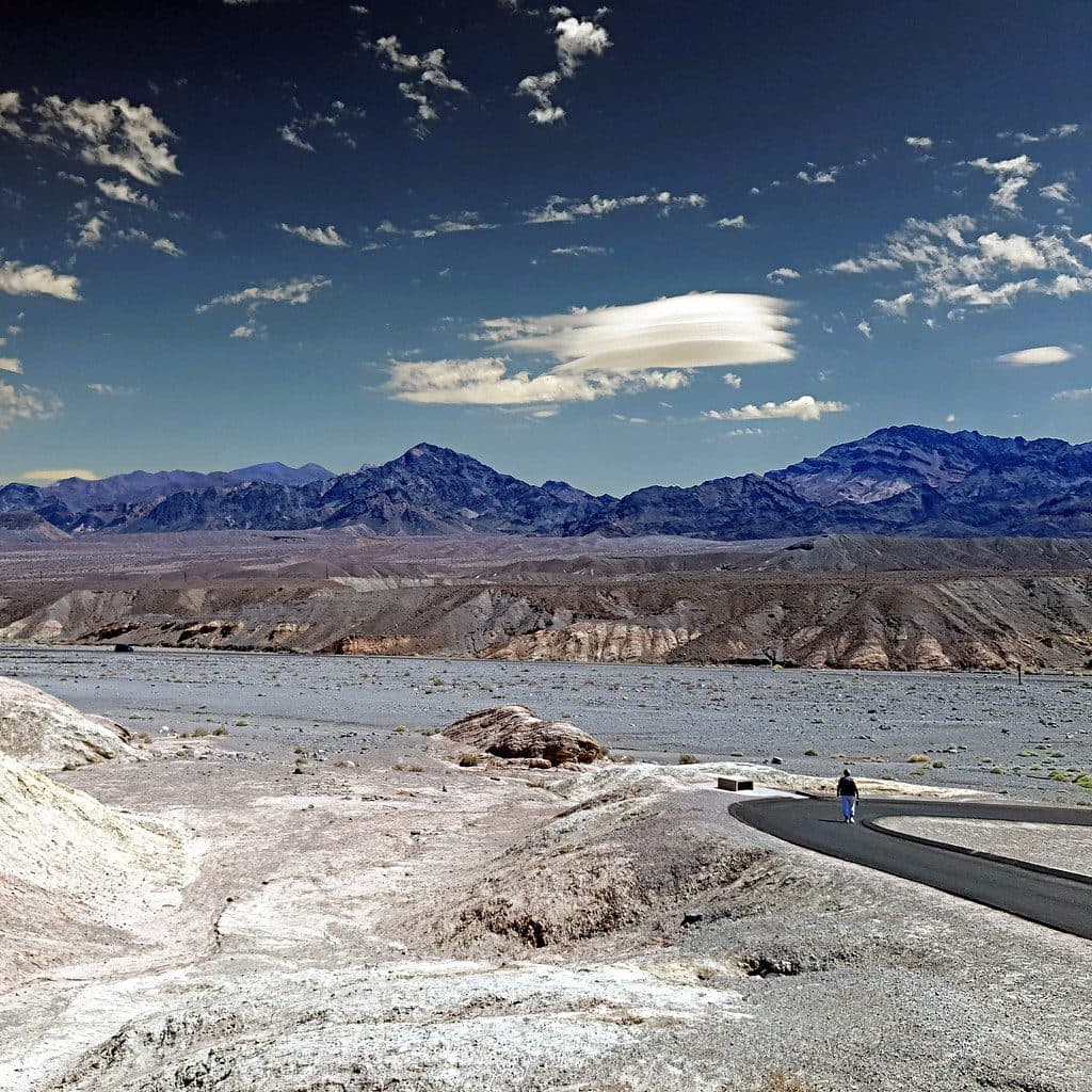
Devil's Golf Course in Death Valley National Park

Sight · Death Valley National Park

Devil's Golf Course

A jagged salt labyrinth where the ground crackles under the sun

Photo: Wikimedia Commons
Type
Sight
Nearest trail
4 mi
  • Parking
  • Scenic viewpoint
  • Exhibit
  • #25 of 74 sights
Parkwolf audio tour130 stories across Death Valley’s roads

Overview

About Devil's Golf Course

Devil's Golf Course is Death Valley’s roughest slice of salt country—an endless field of serrated halite mounds carved by wind, rain, and time. It’s a quick, worthwhile stop that punches above its weight for sheer weirdness and geology.

Why stop

  • Otherworldly jagged halite formations you can see up close
  • Quick detour via a short gravel spur with small parking
  • Great texture-rich photography, sometimes with audible salt crackling

Heads up

  • No shade or services at the site
  • Razor‑sharp, uneven surface; a fall can mean nasty cuts

Map

Where it is

Loading the Death Valley map
Full map
SightDevil's Golf Course36.32829, -116.86006
Keep this map with you offline in the Parkwolf app

Local know-how

Tips for visiting Devil's Golf Course

  1. Wear sturdy, closed‑toe shoes and watch every step on the sharp crust.

  2. Limit time here during heat; there’s no shade or water.

  3. For photos, come at sunrise or sunset to bring out the salt textures.

  4. Stay near the parking area and avoid running or climbing the spires.

  5. After rains, confirm the gravel spur is open and drivable.

Plan your stop

Before you go

Best time to visit

Early and late light rake the salt, throwing long shadows that make the textures pop—prime time for photos. Midday can be brutally hot and visually flat. It’s usually a short stop, so weaving it between Badwater Basin and other nearby sights works well. After rains, the spur road can be rough—check conditions before you commit.

Planning & Safety

Access is via a short, unpaved spur off Badwater Road, typically passable in dry conditions. There’s a small parking area and that’s about it—no shade, no water, no restrooms. If you step onto the crust, move slowly and wear sturdy, closed‑toe shoes; the surface is sharp and breaks unpredictably. In summer, keep visits brief and bring plenty of water.

3 active Death Valley alerts

  • ClosurePark roads closed or hazardousPlan around multiple closed roads and use extra caution on damaged routes. - Paved roads: North Highway and Beatty Cut-off are closed due to flooding and debris from the October 22 storm.Official details
  • ClosureSaline Valley Lower Springs closed after wildfireLower Springs at Saline Valley Warm Springs remains closed after the September 15 wildfire; stay out because the fire left safety hazards, including potential hazardous chemicals.Official details
See all 3 alerts
A park ranger sits on a dash-mounted phone, talking, as Parkwolf’s Tour Guide plays “Army Cutworm Moths: A Grizzly Bear Buffet” on Grand Loop Road below Dunraven Pass in Yellowstone
Parkwolf Tour GuideThe highest, rockiest slopes around here are a summer buffet for grizzly bears.

Death Valley Tour Guide

Your drive to Devil's Golf Course, narrated.

Parkwolf is a GPS audio tour guide for Death Valley National Park. As you drive, it chimes in with what’s ahead: hidden gems, upcoming stops, history, geology, and wildlife, right through your car’s speakers.

See the Death Valley audio tour

More stories near here in the app

  • Death Valley's Chemistry Set
  • Mushroom Rock: A Hidden Roadside Oddity
  • Artists Drive Scenic Loop and Palette
  • Desolation Canyon: A Quieter Badlands Hike
  • 130 audio storiesacross Death Valley’s roads, triggered by GPS as you drive
  • Wildlife heatmapsfor Bighorn Sheep, Desert Tortoise, Coyote, and 13 more
  • Works offlinemaps, 36 trails, 114 places, and audio download before you lose signal
  • CarPlay readysimple controls built for the drive
★★★★★
“Fantastic app with many points of information… It’s great to just turn on while you’re driving and it gives you an audio tour of the national Park. We love it!!!!”
JMJamesApp Store review
Download Parkwolf on the App StoreGet Parkwolf on Google Play

4.7 from 8,600+ ratings

Guide

More about Devil's Golf Course

What You’ll SeeStep out to a horizon of jagged brown-and-white salt knolls and spiky crust with mountains…

Step out to a horizon of jagged brown-and-white salt knolls and spiky crust with mountains framing the basin. Close to the parking area, informational signs set the scene, but the star is the texture—gnarled, toothy crystals everywhere. On hot, calm days, stand still and you might hear faint pops and crackles as the salt expands and contracts.

How It FormedThis is the remnant of ancient Lake Manly.

This is the remnant of ancient Lake Manly. As the lake evaporated, dissolved minerals precipitated into salt, later weathered into today’s chaotic spires and ridges. Beneath your feet lie deep layers of salt and gravel, testament to millennia of drying and reworking in this extreme basin.

WildlifeDon’t expect wildlife here.

Don’t expect wildlife here. The salinity and exposure make this a harsh, largely lifeless patch compared to friendlier corners of the valley.

Wildlife

Wildlife in Death Valley

All Death Valley wildlife maps

Sighting maps show where each species has been reported across Death Valley. Wildlife moves, so no sighting is guaranteed.

Parkwolf’s Death Valley ranking

Top sights in Death Valley

All 114 places
  1. 1Badwater BasinSight
  2. 2Dante's ViewSight
  3. 3Mesquite Flat Sand DunesSight
  4. 4Zabriskie PointSight
  5. 5Golden CanyonSight
  6. 6Artists PaletteSight

Take Parkwolf to Death Valley.

The audio tour guide for the drive, plus offline maps, trails, and wildlife heatmaps for when the signal drops.

4.7 from 8,600+ ratings

Download Parkwolf on the App StoreGet Parkwolf on Google Play