Best time to visit
Late afternoon into early evening is prime—the low sun makes the colors pop and temps ease. Fall through spring is the sweet spot. Avoid summer’s midday heat.

Sight · Death Valley National Park
Colorful, quiet badlands hike with late-afternoon glow and big views
Overview
Desolation Canyon is the underrated, colorful-badlands alternative to nearby Golden Canyon. It rises toward the area just north of Artists Palette, trading crowds for quiet and color. Expect a moderate out-and-back with a touch of scrambling and a big-view payoff.
Map
Local know-how
Time it for late afternoon light to make the colors explode.
Bring 2–3 liters of water per person; there’s no water on-site.
The route is unmarked—just stay in the main wash up-canyon.
Expect two short dryfall scrambles; descending them is trickier.
There are no restrooms or shade structures at the trailhead.
Plan your stop

The highest, rockiest slopes around here are a summer buffet for grizzly bears.
Death Valley Tour Guide
Parkwolf is a GPS audio tour guide for Death Valley National Park. As you drive, it chimes in with what’s ahead: hidden gems, upcoming stops, history, geology, and wildlife, right through your car’s speakers.
See the Death Valley audio tourRecorded for this area
Desolation Canyon: A Quieter Badlands Hike“The turnoff ahead is for Desolation Canyon. If you're looking for a great hike that gets you deep into some colorful badlands without the crowds you find at other trailheads, this is a fantastic choice.”
Plays on the road 0.4 mi from Desolation Canyon in the Parkwolf Death Valley Tour Guide.
More stories near here in the app
“Fantastic app with many points of information… It’s great to just turn on while you’re driving and it gives you an audio tour of the national Park. We love it!!!!”


Guide
The route starts in a broad, sun-exposed wash, then funnels into sculpted badlands where the walls shift from golden to striking greens, reds, and purples as you climb. Higher up, you’ll negotiate two dryfalls (think 6–8 ft rocky steps) using hands and feet. The upper end rewards you with a panoramic overlook across the valley toward the Panamint range and Telescope Peak.
These badlands are made of fine lakebed sediments from an ancient lake that once covered much of this area. Volcanic ash and minerals oxidized over time, painting the canyon walls in those rainbow hues. Because the sediments are soft and crumbly, flash floods reshape the canyon quickly, leaving mud-crack polygons and fresh debris after storms.
Heat and dehydration are the big risks here. Carry plenty of water, sun protection, and sturdy footwear for sand, gravel, and downclimbing the dryfalls. The terrain is fragile and flood-prone: don’t enter if storms threaten. Pets aren’t allowed on park trails.
Life clings on the margins here—expect very sparse vegetation (think desert holly) and little wildlife activity in the open heat.
Wildlife
 71 sightingsBighorn SheepMost seen around 6 PMSighting map
 101 sightingsDesert TortoiseMost seen around 8 AMSighting map
 458 sightingsCoyoteMost seen around 6 PMSighting map
 28 sightingsFeral BurroMost seen around 5 PMSighting map
 30 sightingsMule DeerMost seen around 7 PMSighting map
 62 sightingsKit FoxMost seen around 7 PMSighting map
Sighting maps show where each species has been reported across Death Valley. Wildlife moves, so no sighting is guaranteed.
Keep exploring
 ModerateDesolation Canyon Trail3.6 mi · 2.5 hr · 0.4 mi awayColor-drenched badlands and a quiet canyon with easy scrambles
 ModerateGolden Canyon to Red Cathedral3 mi · 1.8 hr · 2 mi awayA 3-mile Golden Canyon out-and-back to the red walls of Red Cathedral.
 ModerateGolden Canyon and Gower Gulch Loop4.3 mi · 2.5 hr · 2 mi awayModerate badlands loop linking Golden Canyon and Gower Gulch
 ChallengingZabriskie Point to Golden Canyon7.8 mi · 4.5 hr · 2.1 mi awayStrenuous 7.8-mile loop from Zabriskie Point through Gower Gulch and Golden Canyon
 ModerateBadlands Loop (Zabriskie Point)2.7 mi · 1.8 hr · 2.1 mi awayA 2.7-mile moderate loop through colorful badlands below Zabriskie Point.
 EasyZabriskie Point Overlook Trail0.3 mi · 8 min · 2.2 mi awayA short paved out-and-back from the Zabriskie Point parking area to Death Valley's iconic badlands overlook.
 EasyArtist's Palette Wash0.4 mi · 48 min · 2.7 mi awayExplore a short, unmaintained loop through Death Valley's rainbow badlands.
 Sight · 1.2 mi awayMushroom RockHidden roadside pedestal rock with a storied past
 Sight · 1.3 mi awayGower GulchBadlands canyon with dryfalls, color, and a classic loop finish
 Sight · 2.1 mi awayGolden CanyonGolden badlands to Red Cathedral with a classic loop option
 Sight · 2.1 mi awayManly BeaconA sharp badlands spire near Zabriskie Point’s trails
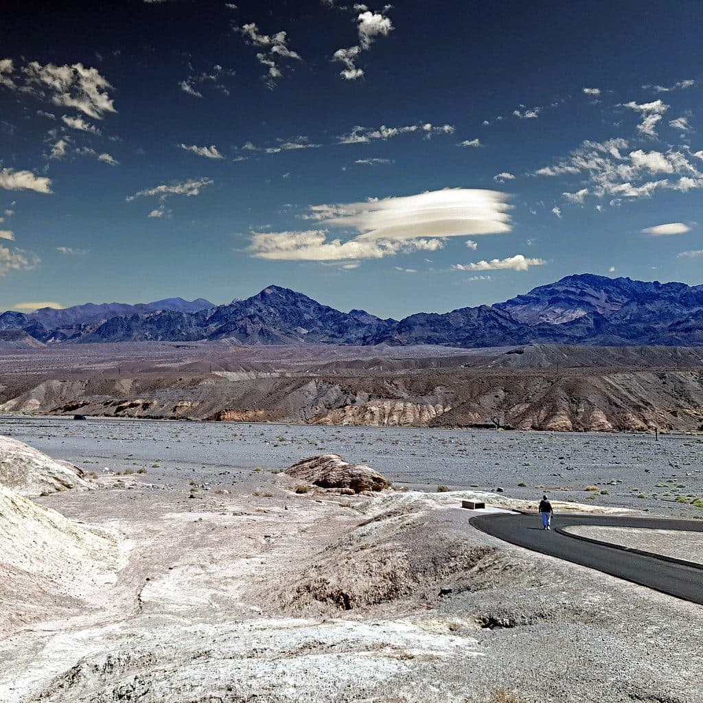 Sight · 2.1 mi awayZabriskie PointSignature badlands vista that lights up at sunrise
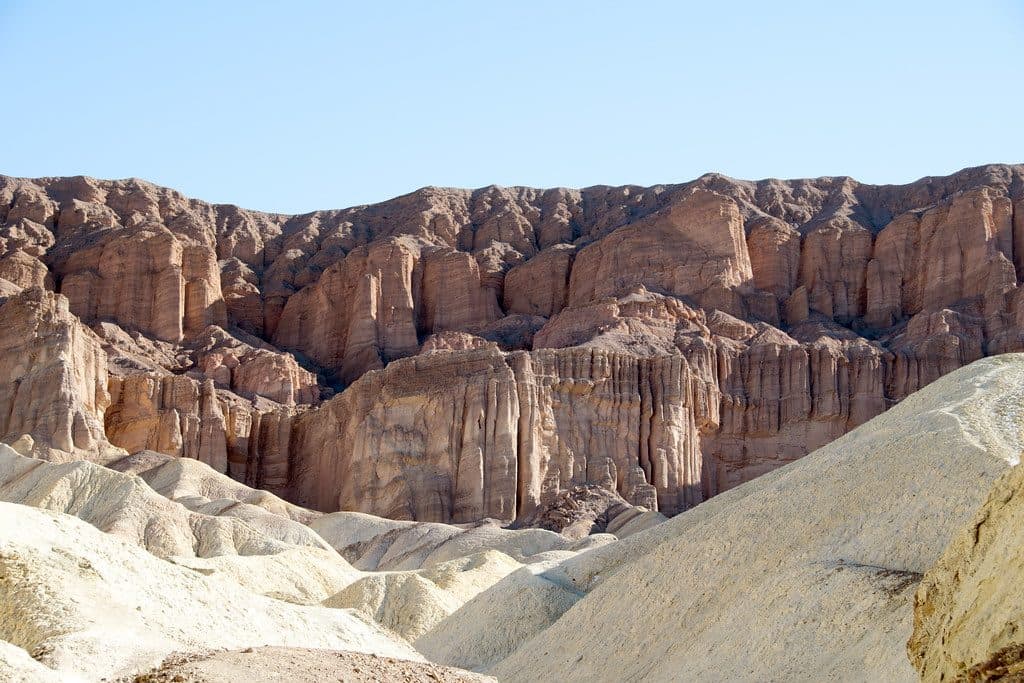 Sight · 2.2 mi awayRed CathedralFluted crimson walls capping Golden Canyon with a fun scramble
 Sight · 2.3 mi awayTwenty Mule Team CanyonShort, roller-coaster dirt drive through yellow badlands
 Sight · 2.4 mi awayArtists PaletteRainbow badlands you can wander right from the car
Parkwolf’s Death Valley ranking

The audio tour guide for the drive, plus offline maps, trails, and wildlife heatmaps for when the signal drops.


