
Place · 1.2 mi away
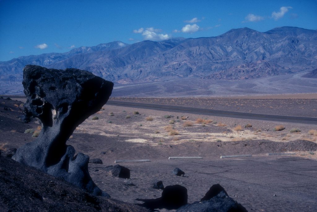
A once‑promoted roadside oddity, Mushroom Rock is a small volcanic pedestal that really does look like a toadstool—narrow stem, broader cap. It sits about 150 feet off Badwater Road and blends into the background, which is why most people drive right past it these days.
It used to have a big pullout and signage, and it even appeared on park brochures. After years of vandalism and wear, the Park Service removed the parking area and the signs, and it’s no longer shown on official maps. Today it’s an unsigned, low‑key stop for those who know where to look.
The rock is porphyritic andesite—think a fine‑grained matrix studded with plagioclase crystals—sculpted into a classic “mushroom” by sand‑blasting winds over thousands of years. The harder cap protects the softer base, so the stem erodes faster and the cap overhangs.
There’s no trail, no restroom, no services—just a short, flat stroll from the roadside shoulder to the formation. The surrounding views are pure Death Valley: broad valley floor with rugged mountains framing the scene. Don’t climb or chip at the rock.
Early morning or late afternoon gives the most forgiving light for photos and a more comfortable temperature. Midday light is harsh and flattens the texture.
If you enjoy quick geologic curios with a bit of backstory, yes. If you’re tight on time and chasing the park’s headliners, you won’t miss much by skipping it.
Place · 1.2 mi away
Place · 1.8 mi away
Place · 2.4 mi away
Place · 2.9 mi away
Moderate · 1 mi away
Moderate · 2.4 mi away
Moderate · 2.4 mi away
Easy · 3 mi away

Parkwolf Tour Guide
