Bryn Cader Faner in Eryri National Park

Sight · Eryri National Park

Bryn Cader Faner

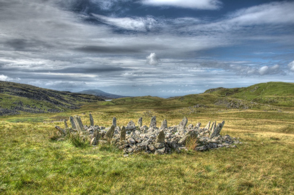
A spiky Bronze Age cairn crowning a lonely Rhinogydd hillside

Photo: Wikimedia Commons
Type
Sight
Nearest trail
4.3 km
Audio stories
2 nearby

Hear the audio tour

The Lizard Back in Harlech's Dunes

Overview

About Bryn Cader Faner

Why stop

  • Striking crown-like stones make an unforgettable moorland photograph

Heads up

  • Long, boggy approach with uncertain footing in wet weather
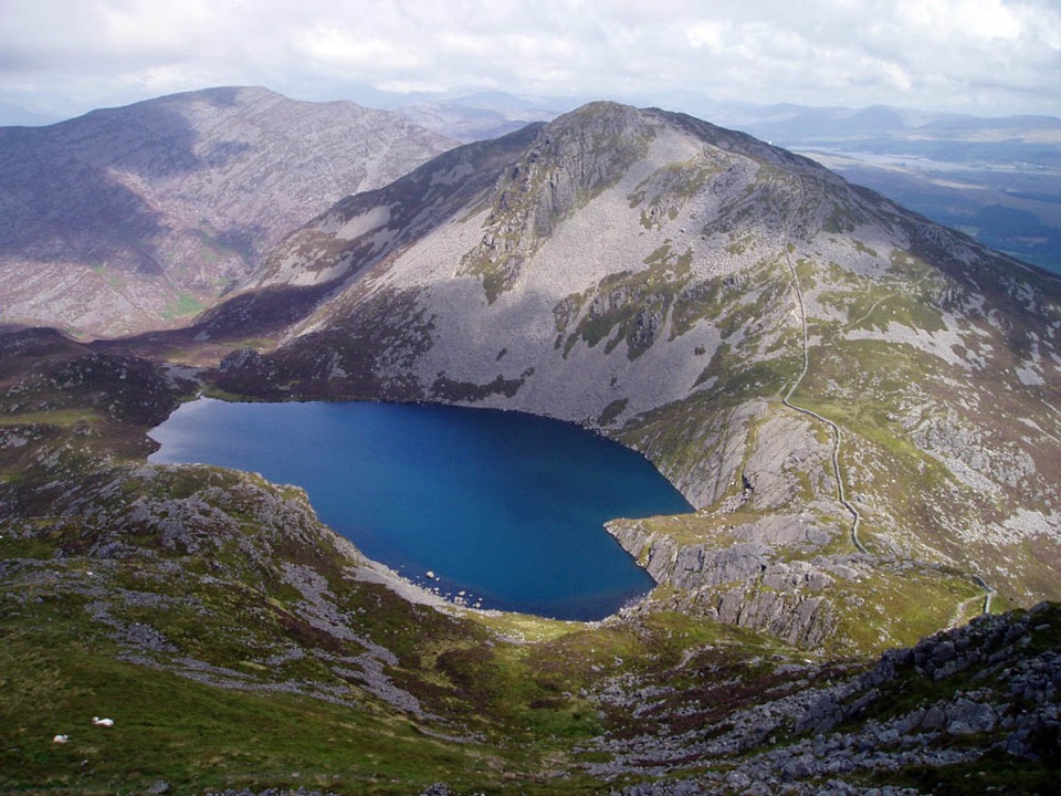
Bryn Cader Faner is an Early Bronze Age burial monument on a rough moorland ridge above Talsarnau. A low cairn sits inside a dramatic ring of angled upright stones, giving the site its crown-like outline. It is small, stark and wonderfully different from Eryri's castles, lakes and mountain summits.
Parkwolf’s verdictWhy stop

Map

Where it is

Loading the Eryri map
Full map
SightBryn Cader Faner52.89823, -4.01138
Keep this map with you offline in the Parkwolf app

Plan your stop

Before you go

Best time to go

Choose a dry, clear day when the ground is firmer and the surrounding hills are visible. Early or late light picks out the angled stones; overcast weather can make atmospheric photographs, but low cloud makes navigation harder. Waterproof boots, warm layers, food, water and a charged phone are sensible minimums. Expect a quiet, self-sufficient visit, and leave the stones and the surrounding ground exactly as you found them.


A park ranger sits on a dash-mounted phone, talking, as Parkwolf’s Tour Guide plays “Army Cutworm Moths: A Grizzly Bear Buffet” on Grand Loop Road below Dunraven Pass in Yellowstone
Parkwolf Tour GuideThe highest, rockiest slopes around here are a summer buffet for grizzly bears.

Eryri Tour Guide

Your drive to Bryn Cader Faner, narrated.

Parkwolf is a GPS audio tour guide for Eryri National Park. As you drive, it chimes in with what’s ahead: hidden gems, upcoming stops, history, geology, and wildlife, right through your car’s speakers.

Recorded for this area

The Lizard Back in Harlech's Dunes
0:00 / 0:28
“Morfa Harlech's dunes shelter a lizard many beach walkers never notice. Sand lizards were reintroduced here after habitat loss shrank their range.”

Plays on the road 2.7 km from Bryn Cader Faner in the Parkwolf Eryri Tour Guide.

More stories near here in the app

  • The Wedding Castle at Brondanw
  • Flowers Between the Dunes
  • The Train That Ran Downhill
  • The Old Seabed of the Rhinogydd
  • 298 audio storiesacross Eryri’s roads, triggered by GPS as you drive
  • Wildlife heatmapsfor Grey Heron, Tawny Owl, Common Raven, and 9 more
  • Works offlinemaps, 120 trails, 82 places, and audio download before you lose signal
  • CarPlay readysimple controls built for the drive
★★★★★
“Fantastic app with many points of information… It’s great to just turn on while you’re driving and it gives you an audio tour of the national Park. We love it!!!!”
JMJamesApp Store review
Download Parkwolf on the App StoreGet Parkwolf on Google Play

4.7 from 8,600+ ratings

Guide

More about Bryn Cader Faner

The walk inThis is a walk-in visit, not a roadside attraction.

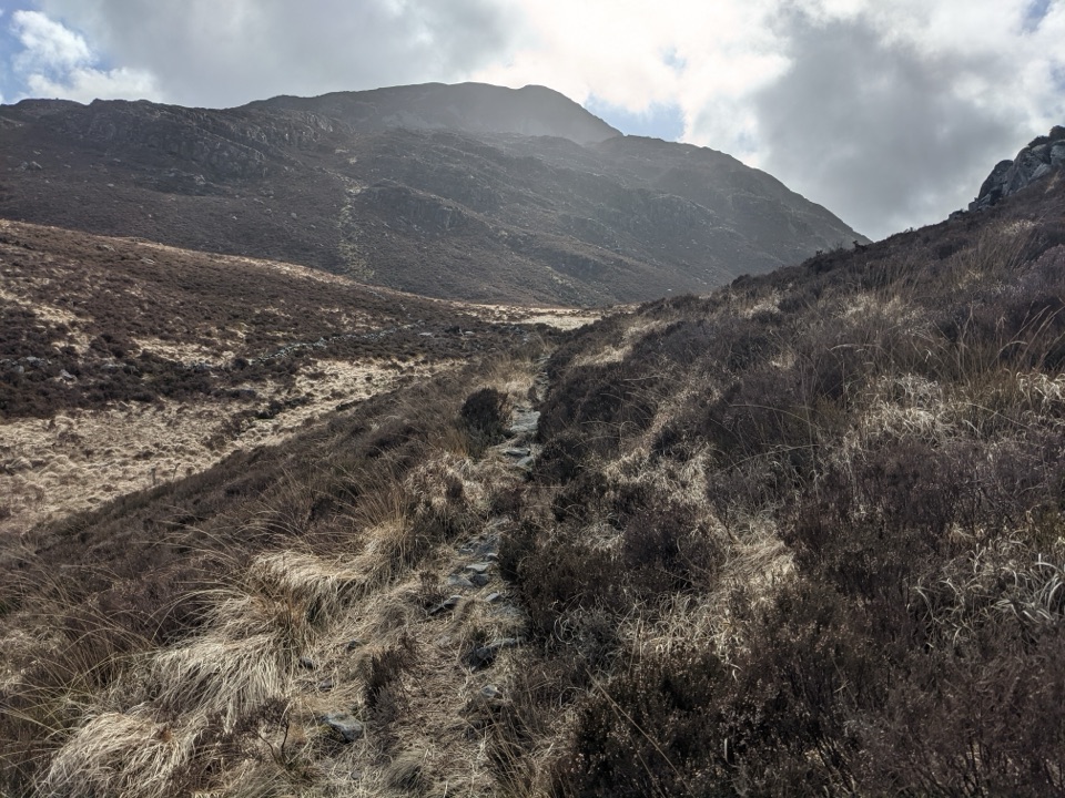
This is a walk-in visit, not a roadside attraction. Approaches lead from the Eisingrug and Talsarnau area along narrow lanes, rough tracks and open moorland paths. Published routes use different starting points, so allow several hours return and bring a proper map or offline route. The final ground can be wet, uneven and indistinct, especially after rain or in low cloud. Do not assume that a map pin means you can drive to the stones.

There is no visitor centre, toilet or other facility at the monument. Parking is limited near the approach roads and may depend on the route you choose. Use only a clearly permitted place, keep gates and farm access clear, and follow signs at the lane. The site itself is an exposed hilltop with no shelter, shop or reliable water source.

History and viewsThe cairn is about 9 metres across and contains the remains of a small stone cist where a…

The cairn is about 9 metres across and contains the remains of a small stone cist where a burial or cremation was placed. The ring is made from roughly fifteen upright slabs, set at striking angles around the mound. Treasure seekers dug into the centre in the nineteenth century, and army manoeuvres damaged the monument in 1939, but the surviving stones still make an unusually powerful silhouette. From the knoll, the open setting gives broad views toward the coast and the surrounding Rhinogydd.

Wildlife

Wildlife in Eryri

All Eryri wildlife maps

Sighting maps show where each species has been reported across Eryri. Wildlife moves, so no sighting is guaranteed.

Keep exploring

Near Bryn Cader Faner

See it all on the map

Trails nearby

More stops nearby

Parkwolf’s Eryri ranking

Top sights in Eryri

All 82 places
  1. 1Yr Wyddfa (Snowdon)Sight
  2. 2Snowdon Mountain RailwaySight
  3. 3Cader IdrisSight
  4. 4Harlech CastleSight
  5. 5Betws-y-CoedSight
  6. 6LlanberisSight

Take Parkwolf to Eryri.

The audio tour guide for the drive, plus offline maps, trails, and wildlife heatmaps for when the signal drops.

4.7 from 8,600+ ratings

Download Parkwolf on the App StoreGet Parkwolf on Google Play