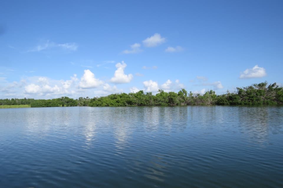
Nine Mile Pond in Everglades National Park

#7 of 18 sights in Everglades

Sight · Everglades National Park

Nine Mile Pond

A quick bird stop or a full paddle into mangrove channels.

Photo: Wikimedia Commons
Type
Sight
Nearest trail
4.3 mi
Audio stories
4 nearby
  • Parking
  • Picnic tables
  • Scenic viewpoint
  • Trailhead

Hear the audio tour

Nine Mile Pond: A Shore Stop or a Paddle

Overview

About Nine Mile Pond

Why stop

  • The marked loop reaches both open marsh and sheltered mangrove channels.

Heads up

  • Low water and hard-to-spot route markers can make the paddle difficult.

Map

Where it is

Loading the Everglades map
Full map
SightNine Mile Pond25.25382, -80.79802
Keep this map with you offline in the Parkwolf app

Plan your stop

Before you go

4 active Everglades alerts

  • ClosureEast Everglades Day Use Area closedThe East Everglades Day Use Area is closed to all public use from SW 168 Street westbound to SW 237 Avenue, including the entire roadway of SW 237 Avenue.Official details
  • ClosureGulf Coast wilderness sites closed or restrictedClosures and restrictions affect several Gulf Coast wilderness areas and sites. - Hog Key: Camping is open, but the middle of the key is closed.Official details
See all 4 alerts
A park ranger sits on a dash-mounted phone, talking, as Parkwolf’s Tour Guide plays “Army Cutworm Moths: A Grizzly Bear Buffet” on Grand Loop Road below Dunraven Pass in Yellowstone
Parkwolf Tour GuideThe highest, rockiest slopes around here are a summer buffet for grizzly bears.

Everglades Tour Guide

Your drive to Nine Mile Pond, narrated.

Parkwolf is a GPS audio tour guide for Everglades National Park. As you drive, it chimes in with what’s ahead: hidden gems, upcoming stops, history, geology, and wildlife, right through your car’s speakers.

See the Everglades audio tour

Recorded for this place

Nine Mile Pond: A Shore Stop or a Paddle
0:00 / 0:30
“Up ahead is Nine Mile Pond, where you can pause by the water or start a much longer canoe outing. For a quick break, enjoy the open-water view from shore.”

Plays as you drive up to Nine Mile Pond in the Parkwolf Everglades Tour Guide.

More stories near here in the app

  • Where a Spoonbill Gets Its Pink
  • A Manatee’s Marching Molars
  • Paurotis Pond: Watch the Nesting Shore
  • How Mangroves Handle Salt
  • 62 audio storiesacross Everglades’s roads, triggered by GPS as you drive
  • Wildlife heatmapsfor Mountain Lion, West Indian Manatee, Alligator, and 13 more
  • Works offlinemaps, 19 trails, 33 places, and audio download before you lose signal
  • CarPlay readysimple controls built for the drive
★★★★★
“Fantastic app with many points of information… It’s great to just turn on while you’re driving and it gives you an audio tour of the national Park. We love it!!!!”
JMJamesApp Store review
Download Parkwolf on the App StoreGet Parkwolf on Google Play

4.7 from 8,600+ ratings

Guide

More about Nine Mile Pond

A roadside pond or a longer paddleNine Mile Pond is a freshwater pond and canoe launch beside Main Park Road in the Flamingo area…

Nine Mile Pond is a freshwater pond and canoe launch beside Main Park Road in the Flamingo area of Everglades National Park. You can pause at the shore and scan across the water for birds, or launch onto the marked 5.2-mile loop through shallow marsh and mangrove islands. The roadside view is a quick stop; the paddle is a real outing with sun exposure, changing water levels and route-finding to consider.

There is surface parking and a picnic table. No restroom, drinking water or food service is listed for the stop, so plan those needs elsewhere.

From the shorelineThe pond gives you a wide, open-water view, with mangroves along the far edge.

The pond gives you a wide, open-water view, with mangroves along the far edge. Birds sometimes gather in the trees across the water, but the numbers change; this is a better birding pause when activity is visible than a guaranteed wildlife stop. For a photo, keep some water in the foreground and the opposite tree line in the frame. It shows the scale of the pond and gives you a chance to catch reflections or birds if they're there.

Out on the loopThe canoe route crosses the open pond, then threads through shallow grassy marsh, mangrove…

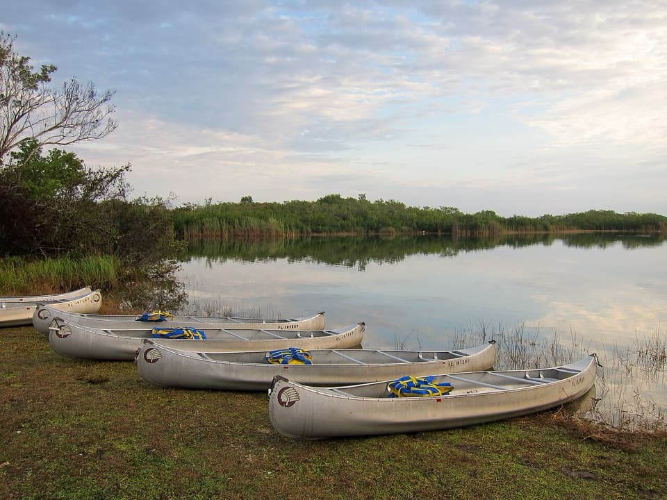
The canoe route crosses the open pond, then threads through shallow grassy marsh, mangrove islands, narrow channels and small connecting ponds. The open-water crossing is the most demanding stretch described in the park's older route brochure, and much of the paddle is exposed to sun. The route is a marked loop, but it takes several hours rather than a quick lap from shore.

Water levels and route findingFall and winter generally bring better passage.

Fall and winter generally bring better passage. Low water can make sections difficult or impossible, and paddlers have repeatedly reported poles that are hard to spot or missing. Check current water and route conditions before launching; don't assume the markers will make every turn obvious. A guided paddle is sometimes offered when water levels allow.

Mangroves, limestone and a tiny food webThis is where freshwater marsh and mangroves meet.

This is where freshwater marsh and mangroves meet. The pond's water can shift from fresh to slightly brackish with rainfall and season, and the route crosses limestone bedrock. Beige periphyton mats among the rushes feed apple snails, small fish and tadpoles; the endangered snail kite depends on apple snails for food. Air plants collect rainwater and debris in their leaf cups, making miniature habitat for insects, frogs, lizards and birds. Alligators, crocodiles and wading birds are among the wildlife to watch for, though sightings vary.

Following an old airboat trailParts of the canoe route follow an old airboat track.

Parts of the canoe route follow an old airboat track. The park's brochure explains that airboat use inside the park was restricted to research and emergencies because of its effects on plants, wildlife and solitude. On the water, that old route now links open marsh with sheltered mangrove channels.

Wildlife

Wildlife in Everglades

All Everglades wildlife maps

Sighting maps show where each species has been reported across Everglades. Wildlife moves, so no sighting is guaranteed.

Parkwolf’s Everglades ranking

Top sights in Everglades

All 33 places
  1. 1Shark Valley Observation TowerSight
  2. 2Pa-hay-okee OverlookSight
  3. 3Historic Nike Missile Site HM-69Sight
  4. 4Flamingo MarinaSight
  5. 5Eco PondSight
  6. 6Paurotis PondSight

Take Parkwolf to Everglades.

The audio tour guide for the drive, plus offline maps, trails, and wildlife heatmaps for when the signal drops.

4.7 from 8,600+ ratings

Download Parkwolf on the App StoreGet Parkwolf on Google Play