Pros & cons
PROS
- Primitive beach camping used by guided kayak and boat expeditions
- Boat- and kayak-only access keeps it quiet and undeveloped
- A true wilderness stop with no built infrastructure
CONS
- No facilities: no restrooms, water, store, or campground infrastructure
- Challenging surf and limited safe landing beaches
- No road access or parking; weather can delay boat travel
Overview
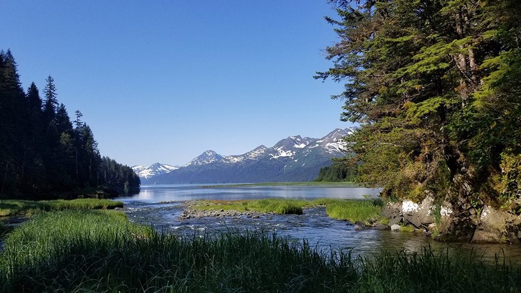
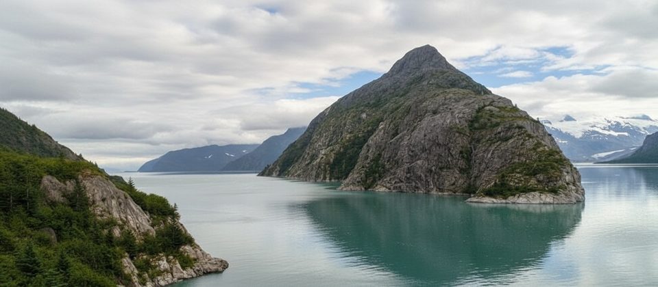
Yalik Bay is a remote coastal embayment on the park’s outer shoreline—wild, quiet, and completely undeveloped. Think broad gravel and cobble beaches backed by forested slopes and the open Gulf just around the corner. If you’re looking for a civilized pull-in with amenities, this isn’t it. If you want a wild camp and sea-level perspective on Kenai Fjords’ rugged coast, you’re in the right place.
Getting There
There are no roads to Yalik Bay. Visitors arrive by water—typically sea kayak or boat. Expect water-taxi logistics out of town, or to paddle as part of a guided expedition. Landings can be tricky; surf and swell are real factors, and safe landing spots are limited along this coast. Nautical charts and careful tide/surf planning are essential per NPS coastal guidance.
Camping and What’s (Not) Here
Yalik Bay is used as a primitive beach-camping stop on multi-day kayak and boat trips. There’s no developed campground, no tables, no bear boxes, no fire rings, and no restrooms. Plan to pack out all waste and follow Leave No Trace. There’s no potable water—bring it or properly treat natural sources. There’s also no cell service or WiFi.
What It Feels Like
The appeal is simplicity: beach, tide, weather, and the steady rhythm of a remote shoreline. Guided groups highlight the solitude and immersion in wilderness. Nights are about listening to the surf and watching the tide line creep, not walking to a lodge for dinner.
Conditions and Safety
- Landings: Expect cobble or gravel beaches with surf; choose approach and timing with tides and swell in mind.
- Weather: Marine conditions can change quickly; build slack in your schedule for delays.
- Navigation: Bring charts and know how to use them. This is boat-in country, not a roadside stop.
- Water: No taps; filter/treat if sourcing from streams.
Who It’s For
Paddlers and boat-based campers who value raw coastline and can be self-sufficient. If you’re comfortable with primitive camping, tide and surf planning, and no services, Yalik Bay is a rewarding waypoint on a longer coastal circuit.
Planning Notes
- Coordinate water taxi or go with a guided kayak outfitter if you’re new to this coastline.
- Pack out all waste; plan for no facilities of any kind.
- Check tides and swell forecasts before committing to a landing or departure window.
Where it is
59.4615, -150.6171Tips for Yalik Bay
- 01Arrange a water taxi or guided trip; there’s no road access.
- 02Carry nautical charts and plan landings around tides and surf.
- 03Bring all drinking water or a robust filtration/purification setup.
- 04Expect no cell service; bring satellite comms if you need a safety net.
- 05Pack out all waste—there are no restrooms or campground facilities.
Near Yalik Bay
All places →All trails →
5.6 mi awayNuka BayRemote, wildlife-rich fjord with steep walls and zero services
25.4 mi awayMcCarty GlacierRemote fjord glacier offering solitude and dramatic retreat
31.3 mi awayNorthwestern FjordRemote fjord with calving glaciers and prolific wildlife, reached by boat
31.9 mi awayNorthwestern GlacierRemote tidewater glacier with thunderous calving in a pristine fjord
60.8 mi awayHarding Icefield TrailSteep climb above Exit Glacier to a vast, unforgettable icefield viewChallenging · 8.2 mi · 7 hr
60.8 mi awayGlacier Overlook TrailShort, view-rich climb to sweeping views of Exit Glacier.Easy · 1.8 mi · 1.3 hr
60.8 mi awayEdge of the Glacier TrailEasy walk to Exit Glacier’s icy terminus and retreat markersEasy · 2 mi · 1.3 hr
60.8 mi awayGlacier View LoopEasy, paved loop to a broad view of Exit Glacier from valley.Easy · 1.1 mi · 30 min