Parking
Use the J54 Maxson Trailhead parking area at Courtright Reservoir. From Courtright Road, continue to the south end of the reservoir, cross the spillway, and go 1.2 miles to the trailhead; parking is available there.
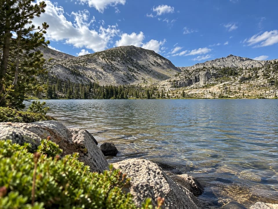
Kings Canyon National Park, CA
A three-day climb to a pass above Goddard Canyon.
Overview
Map & elevation
Plan your hike

The highest, rockiest slopes around here are a summer buffet for grizzly bears.
Kings Canyon Tour Guide
Parkwolf is a GPS audio tour guide for Kings Canyon National Park. As you drive, it chimes in with what’s ahead: hidden gems, upcoming stops, history, geology, and wildlife, right through your car’s speakers.
See the Kings Canyon audio tour“…The kids and my husband and I all agree that the narration really added to our experience driving through the parks. We learned so much about the history and the flora & fauna.”


Trail guide
Hell for Sure Pass Trail is a remote out-and-back from J54 Maxson Trailhead at Courtright Reservoir to an 11,286-foot pass above Goddard Canyon. The pass is about 16 miles from the start, so plan on roughly 32 miles round trip and about three days with two nights out. The route climbs from around 8,184 feet through forest and open basins, past Post Corral Creek and a chain of alpine lakes, to a rocky saddle with a long view east. The pass sits about 3,100 feet above the start, and the upper route is faint enough that this is a serious wilderness hike for backpackers who can navigate, not a casual day walk.
The trail drops into trees and small meadows, briefly follows the Dusy-Ershim OHV track, then leaves it for a dirt hiking path. Expect a quiet forest stretch without a big view right away. Post Corral Creek, the first major creek crossing, is about seven miles in. The path climbs again after the creek; at the junction just beyond it, take the branch toward Hell for Sure Pass rather than Blackcap Basin.
The climb to Fleming Lake gains about 1,500 feet over roughly 4.5 miles. The route winds through timber and small meadows before the country opens around the lake. From there it continues toward Disappointment Lake and Hell for Sure Lake, with smooth granite and cairn-marked stretches. Primitive campsites are reported near the lakes; plan this as a self-supported trip. Carry a way to treat water and do not assume a creek will be flowing when you arrive.
From Hell for Sure Lake, the pass is roughly 1.5 miles and 1,000 feet higher. The upper route turns across open rock and can be easy to lose; follow the cairns and use your map instead of treating this like a signed trail. At the 11,286-foot saddle, look east down Goddard Canyon toward the LeConte Divide and Mount Goddard. Turn north for Red Mountain. For a photo, keep a little of the rocky pass foreground in the frame so the canyon's depth reads.
Start at J54 Maxson Trailhead at Courtright Reservoir, where parking is available. The Forest Service lists June through October, snow conditions permitting. An overnight wilderness permit is required and the Maxson trailhead has a quota; hikers starting here can get the permit for the full itinerary from the Forest Service even though the route enters Kings Canyon National Park. Pets are prohibited on National Park trails, so dogs cannot complete this route. Store food in a bear-resistant container, and do not build fires above 10,000 feet. The mapped outing turns around at the pass; the path continues east into Goddard Canyon, but that is a separate through-hike and needs its own exit plan.
Wildlife
 227 sightingsBlack BearMost seen around 7 PMSighting map
 385 sightingsMule DeerMost seen around 7 PMSighting map
 188 sightingsMarmotMost seen around 8 AMSighting map
 118 sightingsPikaMost seen around 7 AMSighting map
 14 sightingsGolden TroutMost seen around 7 PMSighting map
 32 sightingsRainbow TroutMost seen around 7 PMSighting map
Sighting maps show where each species has been reported across Kings Canyon. Wildlife moves, so no sighting is guaranteed.
Keep exploring
 ChallengingTehipite Valley Trail32.9 mi · 1 day · 7.4 mi awayBackpack 33 miles round trip into Tehipite Valley
 ChallengingBlue Canyon Trail18.8 mi · 15 hr · 8.6 mi awayA remote, brushy 18.8-mile wilderness route into Blue Canyon.
 ChallengingGoddard Canyon Trail8.9 mi · 8 hr · 10 mi awayA faint High Sierra path links a remote pass to the JMT.
 ChallengingFlorence Lake to McClure Meadow37.7 mi · 1.2 days · 13.4 mi awayA long JMT backpack route from Florence Lake to McClure Meadow.
Parkwolf’s Kings Canyon ranking

The audio tour guide for the drive, plus offline maps, trails, and wildlife heatmaps for when the signal drops.





