Mount Defiance in Lake George NY

Sight · Lake George NY

Mount Defiance

See the height that helped force Fort Ticonderoga’s 1777 retreat.

Photo: Wikimedia Commons
Type
Sight
Nearest trail
1.4 mi
Audio stories
3 nearby
  • Parking
  • Scenic viewpoint
  • Picnic tables
  • #12 of 39 sights

Hear the audio tour

A Camera and a Traveling Workshop

Overview

About Mount Defiance

Why stop

  • The view makes Fort Ticonderoga’s exposed position clear
  • Historic cannons frame the lake and fort

Heads up

  • A short, steep climb remains from the upper parking lot
  • No food service; toilets and drinking water aren’t listed

Map

Where it is

Loading the Lake George map
Full map
SightMount Defiance43.83145, -73.40679
Keep this map with you offline in the Parkwolf app

Plan your stop

Before you go

2 active Lake George alerts

  • ClosureFishbrook Pond North Lean-to site closedThe entire Fishbrook Pond North Lean-to site is closed because the lean-to burned down. - No camping or campfires are allowed at the site until further notice.Official details
  • CautionNo Parking Zones enforced along River RoadDo not park in the No Parking Zones along River Road in the Hudson River Special Management Area in the Towns of Lake Luzerne and Warrensburg; DEC is enforcing the restriction.Official details

Lake George alerts
A park ranger sits on a dash-mounted phone, talking, as Parkwolf’s Tour Guide plays “Army Cutworm Moths: A Grizzly Bear Buffet” on Grand Loop Road below Dunraven Pass in Yellowstone
Parkwolf Tour GuideThe highest, rockiest slopes around here are a summer buffet for grizzly bears.

Lake George Tour Guide

Your drive to Mount Defiance, narrated.

Parkwolf is a GPS audio tour guide for Lake George NY. As you drive, it chimes in with what’s ahead: hidden gems, upcoming stops, history, geology, and wildlife, right through your car’s speakers.

See the Lake George audio tour

Recorded for this area

A Camera and a Traveling Workshop
0:00 / 0:32
“By eighteen sixty-eight, Seneca Ray Stoddard was photographing Lake George with equipment that could make a modern camera bag seem weightless. His camera could weigh fifty pounds or more.”

Plays on the road 0.9 mi from Mount Defiance in the Parkwolf Lake George Tour Guide.

More stories near here in the app

  • Mossy Point Boat Launch
  • Cook Mountain Preserve
  • The River That Ran the Mills
  • The Nursery That Dries Up
  • 113 audio storiesacross Lake George’s roads, triggered by GPS as you drive
  • Wildlife heatmapsfor White-tailed Deer, Timber Rattlesnake, Osprey, and 13 more
  • Works offlinemaps, 67 trails, 64 places, and audio download before you lose signal
  • CarPlay readysimple controls built for the drive
★★★★★
“Fantastic app with many points of information… It’s great to just turn on while you’re driving and it gives you an audio tour of the national Park. We love it!!!!”
JMJamesApp Store review
Download Parkwolf on the App StoreGet Parkwolf on Google Play

4.7 from 8,600+ ratings

Guide

More about Mount Defiance

Why make the climbMount Defiance is a low summit with cannons and a picnic pavilion above Fort Ticonderoga and…

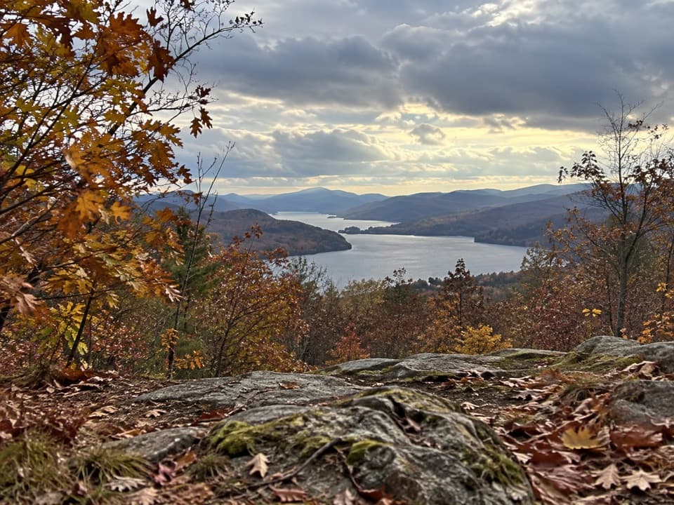
Mount Defiance is a low summit with cannons and a picnic pavilion above Fort Ticonderoga and Lake Champlain. If you’re visiting the fort, go up for the view: from the ridge, you can see the fort’s narrow peninsula below and understand why control of this hill mattered. It’s a focused viewpoint stop with a short final climb.

Drive up or walk the roadThe seasonal access road reaches the upper parking lot, or you can walk from its gate, about a…

The seasonal access road reaches the upper parking lot, or you can walk from its gate, about a mile each way (roughly 2.2 miles round trip). The road is narrow and steep, and RVs and buses aren’t permitted. The pavilion is still a short, steep walk uphill from the upper lot, so the last part isn’t step-free. Mount Defiance is included with Fort Ticonderoga admission or can be bought separately at the base; check the current schedule before making the detour.

Take in the viewThe summit looks over Fort Ticonderoga, Lake Champlain, and Vermont’s Green Mountains.

The summit looks over Fort Ticonderoga, Lake Champlain, and Vermont’s Green Mountains. For a photo, put one of the cannons in the foreground with the fort on its peninsula beyond; a wide frame shows the lake and mountains but makes the fort tiny.

Why the height mattered in 1777During the 1777 Siege of Fort Ticonderoga, British forces positioned artillery on Mount…

During the 1777 Siege of Fort Ticonderoga, British forces positioned artillery on Mount Defiance. The American garrison withdrew from the fort once the heights above it were occupied. From the pavilion, the gap between the wooded summit and the low peninsula gives that choice some scale.

Bring a picnicA pavilion and picnic tables at the summit make lunch an easy fit, but there’s no food service…

A pavilion and picnic tables at the summit make lunch an easy fit, but there’s no food service described. Restrooms and drinking water aren’t identified for the summit, so plan a restroom stop and bring water before heading up.

Wildlife

Wildlife in Lake George

All Lake George wildlife maps

Sighting maps show where each species has been reported across Lake George. Wildlife moves, so no sighting is guaranteed.

Keep exploring

Near Mount Defiance

See it all on the map

Trails nearby

More stops nearby

Parkwolf’s Lake George ranking

Top sights in Lake George

All 64 places
  1. 1Lake George Steamboat CompanySight
  2. 2Fort William Henry MuseumSight
  3. 3Prospect Mountain SummitSight
  4. 4Million Dollar BeachBeach
  5. 5Fort TiconderogaSight
  6. 6Shepard Park and BeachBeach

Take Parkwolf to Lake George.

The audio tour guide for the drive, plus offline maps, trails, and wildlife heatmaps for when the signal drops.

4.7 from 8,600+ ratings

Download Parkwolf on the App StoreGet Parkwolf on Google Play