Redstone Picnic Area in Lake Mead National Recreation Area

Picnic area · Lake Mead National Recreation Area

Redstone Picnic Area

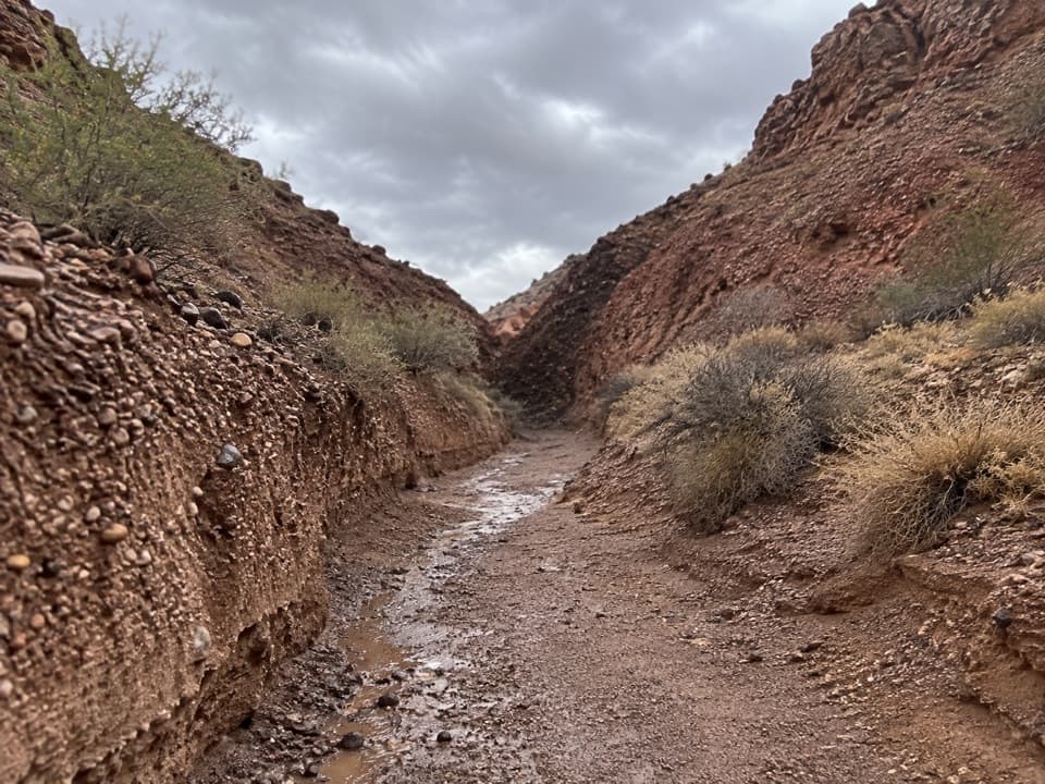
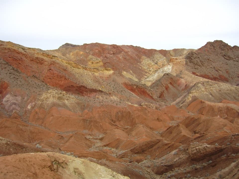
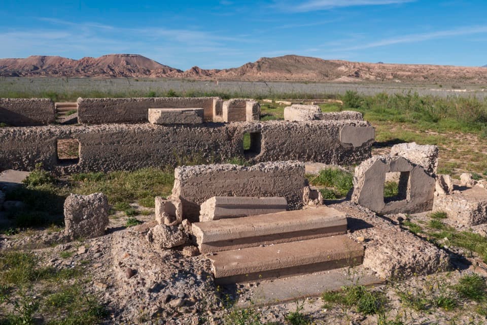
A picnic among 140-million-year-old red sandstone outcrops.

Photo: National Park Service
Type
Picnic area
Nearest trail
Right here
Audio stories
3 nearby
  • Parking
  • Restrooms
  • Picnic tables
  • Scenic viewpoint

Hear the audio tour

Redstone Picnic Area: Dunes Turned to Rock

Overview

About Redstone Picnic Area

Why stop

  • Red sandstone formations sit beside the picnic tables.

Heads up

  • There is no drinking water, and the trail is mostly loose sand and gravel.

Map

Where it is

Loading the Lake Mead map
Full map
Picnic areaRedstone Picnic Area36.24203, -114.51601
Keep this map with you offline in the Parkwolf app

Plan your stop

Before you go

4 active Lake Mead alerts

  • CautionHarmful algae bloom at Nelson’s Landing and Cottonwood CoveA harmful algae bloom has been confirmed in recent samples from Nelson’s Landing and Cottonwood Cove; avoid contact with water where algae is visible.Official details
  • CautionArizona Hot Springs bacteria advisoryLimit body contact with Arizona Hot Springs water: fecal bacteria in samples frequently reach high levels and can transmit human diseases.Official details

See all 4 alerts
A park ranger sits on a dash-mounted phone, talking, as Parkwolf’s Tour Guide plays “Army Cutworm Moths: A Grizzly Bear Buffet” on Grand Loop Road below Dunraven Pass in Yellowstone
Parkwolf Tour GuideThe highest, rockiest slopes around here are a summer buffet for grizzly bears.

Lake Mead Tour Guide

Your drive to Redstone Picnic Area, narrated.

Parkwolf is a GPS audio tour guide for Lake Mead National Recreation Area. As you drive, it chimes in with what’s ahead: hidden gems, upcoming stops, history, geology, and wildlife, right through your car’s speakers.

See the Lake Mead audio tour

Recorded for this place

Redstone Picnic Area: Dunes Turned to Rock
0:00 / 0:30
“Redstone Picnic Area is just ahead, with tables right beside red sandstone outcrops. I'd stop here for a picnic and a short wander among the rocks.”

Plays as you drive up to Redstone Picnic Area in the Parkwolf Lake Mead Tour Guide.

More stories near here in the app

  • Pinto Valley: A One-Way Desert Crossing
  • The Lizard That Wedges Itself In
  • The Smell of Desert Rain
  • Water from a Dry Seed
  • 153 audio storiesacross Lake Mead’s roads, triggered by GPS as you drive
  • Wildlife heatmapsfor Bighorn Sheep, Burro, Bald Eagle, and 13 more
  • Works offlinemaps, 42 trails, 70 places, and audio download before you lose signal
  • CarPlay readysimple controls built for the drive
★★★★★
“Fantastic app with many points of information… It’s great to just turn on while you’re driving and it gives you an audio tour of the national Park. We love it!!!!”
JMJamesApp Store review
Download Parkwolf on the App StoreGet Parkwolf on Google Play

4.7 from 8,600+ ratings

Guide

More about Redstone Picnic Area

A picnic among the red rocksRedstone Picnic Area is a roadside stop along Northshore Road in Pinto Valley Wilderness, where…

Redstone Picnic Area is a roadside stop along Northshore Road in Pinto Valley Wilderness, where eroded red sandstone rises beside the picnic tables. It’s a good place to break the drive for lunch or a short wander among the formations.

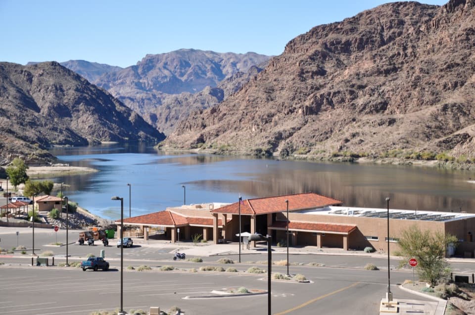
Set up for a picnicThere are three picnic tables, three grills and pit toilets, but no drinking water.

There are three picnic tables, three grills and pit toilets, but no drinking water. Bring water and your meal. Summer heat can be dangerous, so plan a walk for the cooler part of the day. Redstone is inside the park fee area; keep your park pass or admission proof in the vehicle. The site is listed as year-round with no reservations. Dogs are allowed on leashes no longer than six feet.

Walk around the formationsThe Redstone Trail is an easy, unmaintained route over mostly loose sand and gravel.

The Redstone Trail is an easy, unmaintained route over mostly loose sand and gravel. A local route guide notes that flash floods can wash out sections and make the path harder to follow. Parking and toilets are at the trailhead, so you can turn back after a short look among the rocks. The loose surface means you shouldn’t assume the full walk is accessible.

Dunes turned to sandstoneThese outcrops are eroded remains of dunes formed about 140 million years ago.

These outcrops are eroded remains of dunes formed about 140 million years ago. Wind-blown sand later hardened into Aztec sandstone; the sweeping layers and folds are still visible in the rock.

Look for tracks in the sandAfter a windstorm smooths the sand, you may see tracks from kangaroo rats, pocket mice, lizards…

After a windstorm smooths the sand, you may see tracks from kangaroo rats, pocket mice, lizards or beetles. Prints can reveal how much small wildlife passes through even when the animals stay hidden.

Frame the red and grayThe red sandstone stands out against the nearby gray limestone mountains.

The red sandstone stands out against the nearby gray limestone mountains. Walk around the main outcrop for changing angles: a close view shows the layered walls and small openings, while a wider frame brings in the desert basin beyond. Sunlight changes the rocks’ color, so try another side as the light shifts.

Wildlife

Wildlife in Lake Mead

All Lake Mead wildlife maps

Sighting maps show where each species has been reported across Lake Mead. Wildlife moves, so no sighting is guaranteed.

Parkwolf’s Lake Mead ranking

Top sights in Lake Mead

All 70 places
  1. 1Hoover DamSight
  2. 2Emerald CaveSight
  3. 3Willow BeachBeach
  4. 4Boulder BeachBeach
  5. 5St. Thomas TownsiteSight
  6. 6Mike O’Callaghan–Pat Tillman Memorial BridgeSight

Take Parkwolf to Lake Mead.

The audio tour guide for the drive, plus offline maps, trails, and wildlife heatmaps for when the signal drops.

4.7 from 8,600+ ratings

Download Parkwolf on the App StoreGet Parkwolf on Google Play