Cleopatra Wash Trail in Lake Mead National Recreation Area

Lake Mead National Recreation Area, AZ · NV

Cleopatra Wash Trail

A volcanic wash narrows, then opens onto Lake Mead.

Length
5.9mi
Time
4hr
Elev. change
863ft
Difficulty
Challenging
  • Dogs allowed
  • High point 1,991 ft

Hear the audio tour

The Lizard That Wedges Itself In

Overview

About Cleopatra Wash Trail

Why go

  • Red volcanic narrows, small pour-overs, and a lakeshore finish
  • The ridge bypass avoids the technical terminal canyon

Heads up

  • Rough road access and faint route-finding near the lake
  • Rocky wash footing with repeated short scrambles

Map & elevation

The route

Loading the Lake Mead map
Full map
Elevation1,129–1,991 ft
TrailheadCleopatra Wash 4WD Trailhead36.23639, -114.46529
Keep this map with you offline in the Parkwolf app

Plan your hike

Before you go

Parking

From Northshore Road near Mile Marker 30, turn onto Boathouse Cove Road. The 2WD trailhead is about 2.4 miles in; the 4WD trailhead used for the 5.9-mile route is about 3.0 miles in, with informal roadside parking. The road beyond the 2WD point is rough; the 2024 access report says high clearance and 4WD are needed to reach the full start. Conditions can change. A high-clearance vehicle can stop about 0.13 mile short and walk. Starting at the 2WD trailhead adds about 0.7 mile round trip.

Safety

Avoid the deep wash when storms threaten because flash floods can arrive from distant rain. The lower canyon continues into technical rope-down pour-overs; take the faint ridge-and-saddle bypass instead. Summer heat is extreme, and no dependable water source is identified on route.

4 active Lake Mead alerts

  • CautionHarmful algae bloom at Nelson’s Landing and Cottonwood CoveA harmful algae bloom has been confirmed in recent samples from Nelson’s Landing and Cottonwood Cove; avoid contact with water where algae is visible.Official details
  • CautionArizona Hot Springs bacteria advisoryLimit body contact with Arizona Hot Springs water: fecal bacteria in samples frequently reach high levels and can transmit human diseases.Official details
See all 4 alerts
A park ranger sits on a dash-mounted phone, talking, as Parkwolf’s Tour Guide plays “Army Cutworm Moths: A Grizzly Bear Buffet” on Grand Loop Road below Dunraven Pass in Yellowstone
Parkwolf Tour GuideThe highest, rockiest slopes around here are a summer buffet for grizzly bears.

Lake Mead Tour Guide

Your drive to Cleopatra Wash Trail, narrated.

Parkwolf is a GPS audio tour guide for Lake Mead National Recreation Area. As you drive, it chimes in with what’s ahead: hidden gems, upcoming stops, history, geology, and wildlife, right through your car’s speakers.

See the Lake Mead audio tour

Recorded for this area

The Lizard That Wedges Itself In
0:00 / 0:31
“A chuckwalla has a clever way to make itself hard to catch. When a predator approaches, this chunky desert lizard can squeeze into a rock crevice and inflate its lungs.”

Plays on the road 1.6 mi from the trailhead in the Parkwolf Lake Mead Tour Guide.

More stories near here in the app

  • The Smell of Desert Rain
  • Redstone Picnic Area: Dunes Turned to Rock
  • The Lake Holds Summer’s Heat
  • Pinto Valley: A One-Way Desert Crossing
  • 153 audio storiesacross Lake Mead’s roads, triggered by GPS as you drive
  • Wildlife heatmapsfor Bighorn Sheep, Burro, Bald Eagle, and 13 more
  • Works offlinemaps, 42 trails, 70 places, and audio download before you lose signal
  • CarPlay readysimple controls built for the drive
★★★★★
“Fantastic app with many points of information… It’s great to just turn on while you’re driving and it gives you an audio tour of the national Park. We love it!!!!”
JMJamesApp Store review
Download Parkwolf on the App StoreGet Parkwolf on Google Play

4.7 from 8,600+ ratings

Trail guide

Hiking Cleopatra Wash Trail

A rugged wash-to-lake walkCleopatra Wash is an about 5.9-mile out-and-back from the 4WD trailhead to Lake Mead and back.

Cleopatra Wash is an about 5.9-mile out-and-back from the 4WD trailhead to Lake Mead and back. Allow about three to four hours for the rocky wash, short scrambles, and the climb out to the lake. This is a remote, lightly marked route through the Black Mountains, not a maintained canyon path.

The 5.9-mile figure starts at the 4WD trailhead on Boathouse Cove Road. The 2WD trailhead is farther back; starting there adds about 0.7 mile round trip. The road beyond the 2WD start is rough; the 2024 access report says high clearance and 4WD are needed to reach the full trailhead. Road conditions can change.

Stay on the hiking routeThe walk follows the wash past small rock ledges and pour-overs, a broad sandy stretch with a…

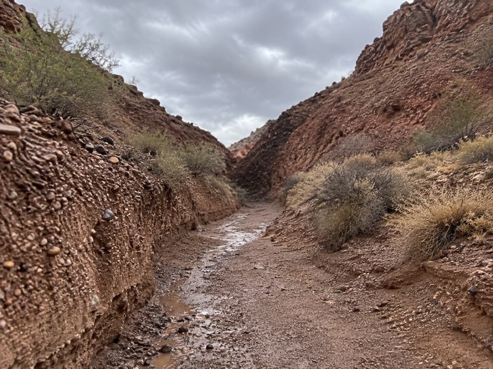
The walk follows the wash past small rock ledges and pour-overs, a broad sandy stretch with a large boulder, and two shallow narrows. The footing is loose and uneven. Some drops are bypassable, but the bigger obstacles take route-finding and short scrambles.

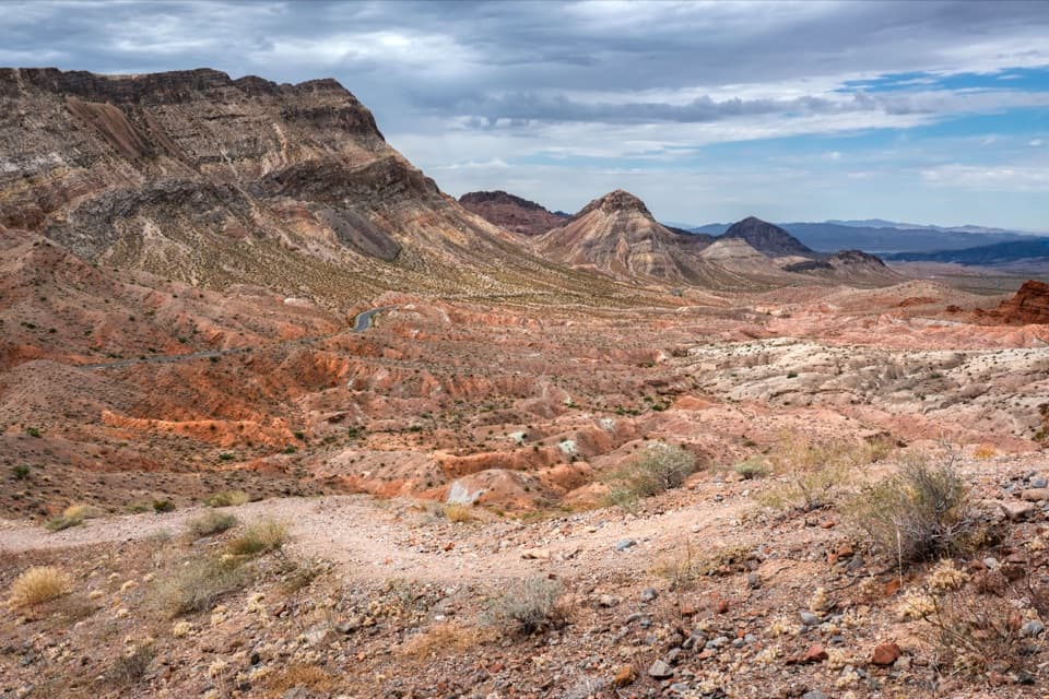
Near the lower canyon, the hiking line leaves the wash and climbs about 75 feet to a low saddle, then follows faint tracks down the ridge to the shore. Do not continue down the terminal canyon: that line reaches high pour-overs requiring a rope and technical climbing. The ridge is the no-rope hiking bypass.

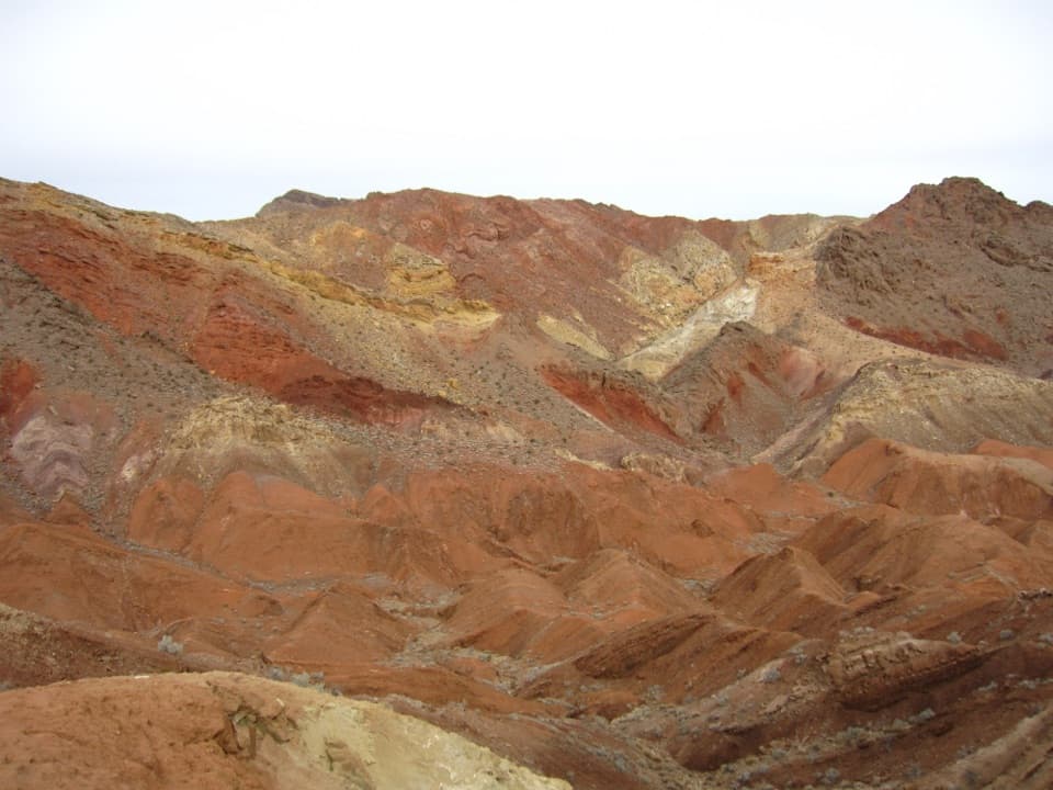
Volcanic rock in the washHard volcanic dikes cut across the wash and form the small ledges.

Hard volcanic dikes cut across the wash and form the small ledges. In the red narrows, look for purple and green fragments set into the volcanic rock. The route crosses the Cleopatra part of an ancient stratovolcano; faulting split the original volcano into three sections, with the Hamblin and Cleopatra sections now about 12 miles apart. Bighorn sheep sign has been noted in the narrows, though sightings are never guaranteed.

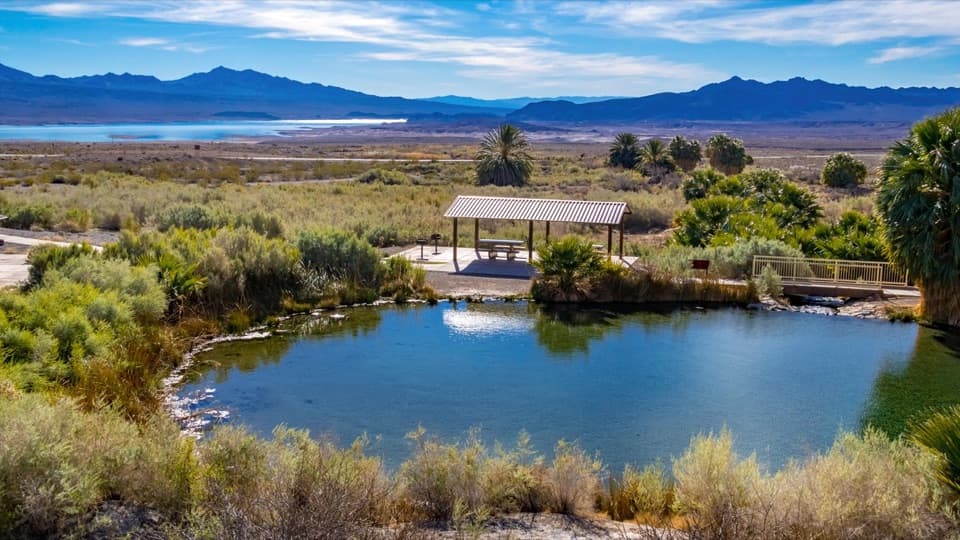
First view of the lakeThe lake first appears around a bend in the canyon, before the final climb to the saddle.

The lake first appears around a bend in the canyon, before the final climb to the saddle. From the ridge, the wash and cove open up below; the descent ends on a gravel shore. Lake level and floods move that shoreline, so treat the mapped endpoint as approximate. The colored narrows and the view back toward the lake are the strongest places to frame the canyon walls with the wash or trail in the foreground.

Heat, storms and petsLake Mead’s desert heat can become extreme in summer.

Lake Mead’s desert heat can become extreme in summer. Avoid this deep wash when storms threaten: flash floods can strike even when rain is falling elsewhere. There is no dependable water source on the route. Pets are allowed on park trails on a leash six feet or shorter.

Wildlife

Wildlife in Lake Mead

All Lake Mead wildlife maps

Sighting maps show where each species has been reported across Lake Mead. Wildlife moves, so no sighting is guaranteed.

Keep exploring

Near Cleopatra Wash Trail

See it all on the map

Trails that start nearby

Places near the trailhead

Parkwolf’s Lake Mead ranking

Top-rated trails in Lake Mead

All 42 trails
  1. 1Historic Railroad TrailEasy · 7.5 mi
  2. 2Anniversary Narrows TrailModerate · 5.8 mi
  3. 3Liberty Bell Arch TrailChallenging · 5.5 mi
  4. 4Arizona Hot Spring TrailChallenging · 5 mi
  5. 5Owl Canyon TrailModerate · 2.2 mi
  6. 6Fortification Hill TrailChallenging · 4 mi

Take Parkwolf to Lake Mead.

The audio tour guide for the drive, plus offline maps, trails, and wildlife heatmaps for when the signal drops.

4.7 from 8,600+ ratings

Download Parkwolf on the App StoreGet Parkwolf on Google Play