Razorback Wash South Trail in Lake Mead National Recreation Area

Lake Mead National Recreation Area, AZ · NV

Razorback Wash South Trail

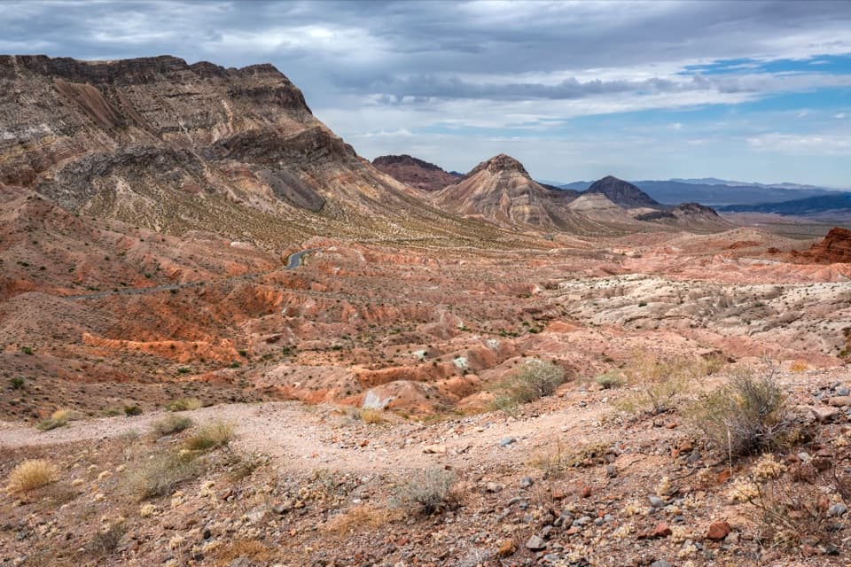
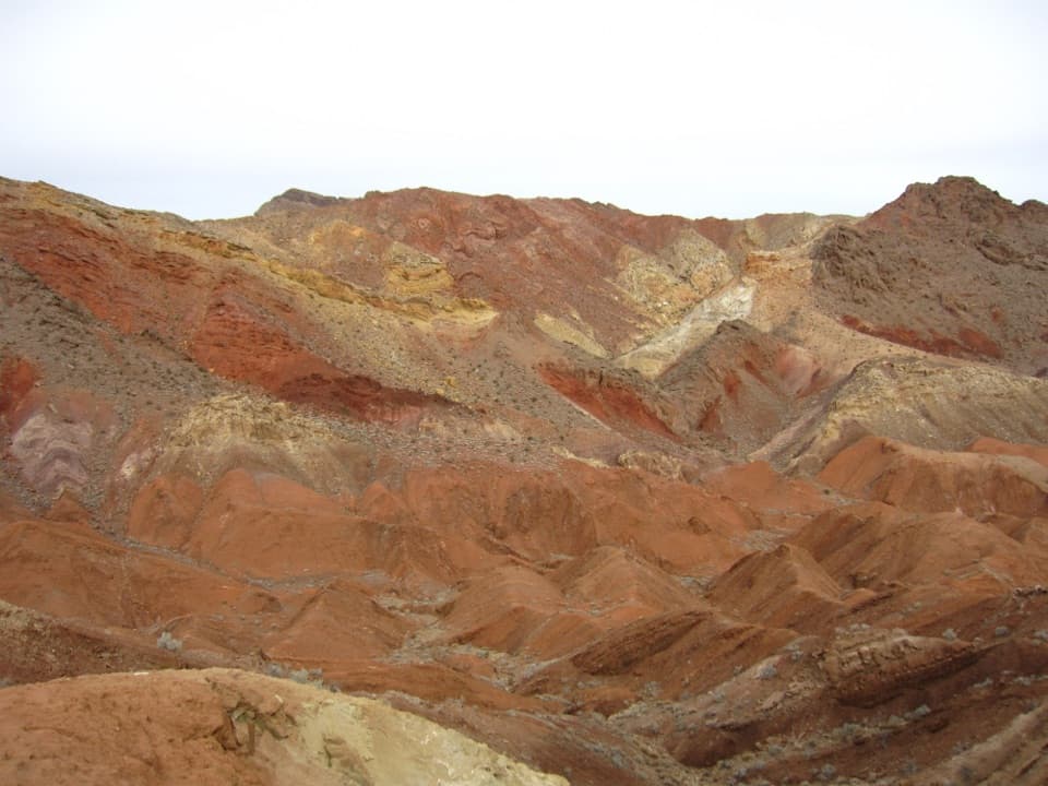
A remote traverse through red, yellow and green mud hills.

Photo: Wikimedia Commons
Length
6.3mi
Time
5hr
Elev. change
640ft
Difficulty
Moderate
  • Dogs allowed
  • High point 2,572 ft

Hear the audio tour

Razorback Wash: A One-Way Wilderness Hike

Overview

About Razorback Wash South Trail

Why go

  • A varied wash-to-wash traverse through colorful mudstone and gypsum hills.
  • The saddle opens a clear view down the route toward Hamblin Mountain.

Heads up

  • A second vehicle is essential, and much of the route has no maintained tread.

Map & elevation

The route

Loading the Lake Mead map
Full map
Elevation1,932–2,572 ft
TrailheadNorthshore Road Mile 22.6 Trailhead36.22774, -114.58672
Keep this map with you offline in the Parkwolf app

Plan your hike

Before you go

Parking

Use the roadside pullout on the south side of Northshore Road at Mile 22.6. Leave another vehicle at Mile 18.2, then drive 4.4 road miles north to the start. This is a through-route, not a loop. A Lake Mead recreation-use pass is required for park entry.

Safety

Remote cross-country route with no cell service. Expect uneven wash walking, an easy-to-miss fork, a high pour-over bypass and a steep, intermittent game-trail climb to Red Saddle. Use offline navigation; do not rely on Cottonwood Spring for drinking water. The park advises against daytime summer hiking because temperatures can reach 120°F in the shade, and recommends at least one gallon of water per person.

4 active Lake Mead alerts

  • CautionHarmful algae bloom at Nelson’s Landing and Cottonwood CoveA harmful algae bloom has been confirmed in recent samples from Nelson’s Landing and Cottonwood Cove; avoid contact with water where algae is visible.Official details
  • CautionArizona Hot Springs bacteria advisoryLimit body contact with Arizona Hot Springs water: fecal bacteria in samples frequently reach high levels and can transmit human diseases.Official details
See all 4 alerts
A park ranger sits on a dash-mounted phone, talking, as Parkwolf’s Tour Guide plays “Army Cutworm Moths: A Grizzly Bear Buffet” on Grand Loop Road below Dunraven Pass in Yellowstone
Parkwolf Tour GuideThe highest, rockiest slopes around here are a summer buffet for grizzly bears.

Lake Mead Tour Guide

Your drive to Razorback Wash South Trail, narrated.

Parkwolf is a GPS audio tour guide for Lake Mead National Recreation Area. As you drive, it chimes in with what’s ahead: hidden gems, upcoming stops, history, geology, and wildlife, right through your car’s speakers.

See the Lake Mead audio tour

Recorded for this trailhead

Razorback Wash: A One-Way Wilderness Hike
0:00 / 0:29
“You're nearing the Razorback Wash hiking access on Northshore Road. The north route crosses red mudhills and white gypsum veins in about five point four miles, taking roughly three and a half hours.”

Plays as you drive up to this trailhead in the Parkwolf Lake Mead Tour Guide.

More stories near here in the app

  • The Flowers Waiting in the Soil
  • Water from a Dry Seed
  • Northshore Summit: A Short Desert Panorama
  • The Coot's Folding Feet
  • 153 audio storiesacross Lake Mead’s roads, triggered by GPS as you drive
  • Wildlife heatmapsfor Bighorn Sheep, Burro, Bald Eagle, and 13 more
  • Works offlinemaps, 42 trails, 70 places, and audio download before you lose signal
  • CarPlay readysimple controls built for the drive
★★★★★
“Fantastic app with many points of information… It’s great to just turn on while you’re driving and it gives you an audio tour of the national Park. We love it!!!!”
JMJamesApp Store review
Download Parkwolf on the App StoreGet Parkwolf on Google Play

4.7 from 8,600+ ratings

Trail guide

Hiking Razorback Wash South Trail

Why take this routeRazorback Wash South is a 6.28-mile point-to-point traverse from Northshore Road Mile 22.

Razorback Wash South is a 6.28-mile point-to-point traverse from Northshore Road Mile 22.6 to Mile 18.2, threading broad washes, the south side of Razorback Ridge, a rocky canyon and Cottonwood Wash. It’s a good choice if you want a real cross-country walk with striking geology, but it takes planning: leave one car at Mile 18.2, drive 4.4 road miles north to the start and allow about five hours on foot, plus the shuttle and stops.

Stay with the south-side washFrom the pullout on the south side of Northshore Road, cross desert pavement to the broad, flat…

From the pullout on the south side of Northshore Road, cross desert pavement to the broad, flat wash and follow it southwest, upstream. Around 1.75 miles in, at the toe of Razorback Ridge, stay to the right. The other wash heads south and belongs to a different line. An old road climbs from here to the route’s high saddle at 2,511 feet.

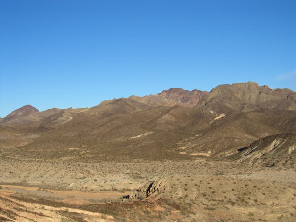
The saddle and the colorful hillsLook southwest from the saddle: Hamblin Mountain sits in the distance, with a red mountain…

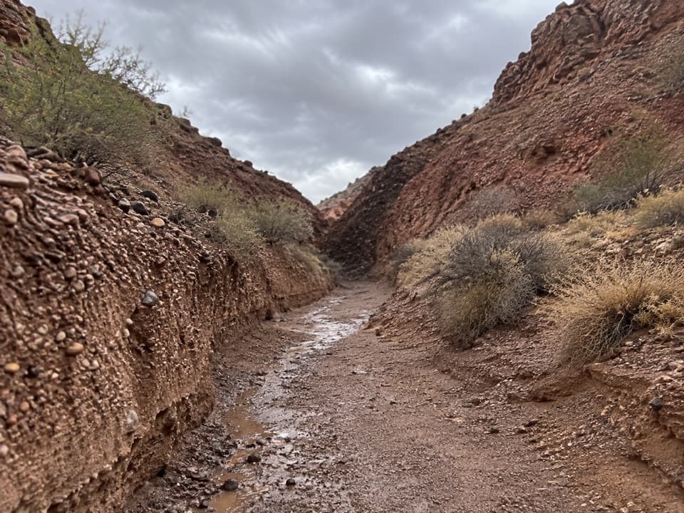
Look southwest from the saddle: Hamblin Mountain sits in the distance, with a red mountain lower in front. The route passes to the red mountain’s right, then drops into a narrow, winding, rocky canyon. The walls shift through red, purple, yellow and green as volcanic ash and mudstone show through. From this high point, the wash hides most long views, so the close-up layers and white gypsum crystals are the payoff.

Get around the pour-overAt about 3.14 miles, the wash ends at a high pour-over.

At about 3.14 miles, the wash ends at a high pour-over. Backtrack a few steps and climb out on the west side over a low ridge, then drop into the next wash. Follow it around the yellow-capped red mountain; an intermittent, steep game trail climbs to Red Saddle. This is the route’s fussiest footing and the spot where the directions matter most.

Finish through Cottonwood WashFrom Red Saddle, descend into the more open East Fork of Cottonwood Wash.

From Red Saddle, descend into the more open East Fork of Cottonwood Wash. Cross the old Pinto Valley Road, join the West Fork at about 4.30 miles and continue past Cottonwood Spring at 5.23 miles. When the highway bridge comes into view, look for the use trail up the northeast bank to the Mile 18.2 pullout. The spring is a landmark, not a dependable drinking-water source.

Heat, navigation and dogsThis remote route has no cell service and follows natural washes rather than a continuous…

This remote route has no cell service and follows natural washes rather than a continuous maintained trail. Use offline navigation, carry plenty of water—the park recommends at least a gallon per person—and don’t count on finding water at Cottonwood Spring. The National Park Service warns against daytime summer hikes because temperatures can reach 120°F in the shade. Dogs are allowed on park hiking trails on a leash no longer than six feet; bring water for them too. A Lake Mead recreation-use pass is required for park entry.

Wildlife

Wildlife in Lake Mead

All Lake Mead wildlife maps

Sighting maps show where each species has been reported across Lake Mead. Wildlife moves, so no sighting is guaranteed.

Parkwolf’s Lake Mead ranking

Top-rated trails in Lake Mead

All 42 trails
  1. 1Historic Railroad TrailEasy · 7.5 mi
  2. 2Anniversary Narrows TrailModerate · 5.8 mi
  3. 3Liberty Bell Arch TrailChallenging · 5.5 mi
  4. 4Arizona Hot Spring TrailChallenging · 5 mi
  5. 5Owl Canyon TrailModerate · 2.2 mi
  6. 6Fortification Hill TrailChallenging · 4 mi

Take Parkwolf to Lake Mead.

The audio tour guide for the drive, plus offline maps, trails, and wildlife heatmaps for when the signal drops.

4.7 from 8,600+ ratings

Download Parkwolf on the App StoreGet Parkwolf on Google Play