River Mountains Loop Trail in Lake Mead National Recreation Area

Lake Mead National Recreation Area, AZ · NV

River Mountains Loop Trail

A paved circuit linking Lake Mead, Boulder City and Henderson.

Length
34.4mi
Time
13hr
Elev. change
1,339ft
Difficulty
Challenging
  • Loop
  • Dogs allowed
  • High point 2,579 ft

Hear the audio tour

Lake Mead Visitor Center and Desert Garden

Overview

About River Mountains Loop Trail

Why go

  • Long paved circuit with recurring desert, mountain and Lake Mead views.
  • Many access points make shorter visits practical.
  • Some trailheads offer water, restrooms or bike repair stations.

Heads up

  • The roughly 34-mile full loop is an all-day walk.
  • Desert exposure, elevation changes and scarce refill points need planning.
  • Several jurisdictions mean access, facilities and rules vary by section.

Map & elevation

The route

Loading the Lake Mead map
Full map
Elevation1,240–2,579 ft
TrailheadAlan Bible Visitor Center / River Mountains Loop Trail access36.01002, -114.79676
Keep this map with you offline in the Parkwolf app

Plan your hike

Before you go

Parking

There is no single required start; official trailheads access the loop at several points. The mapped route begins near the Alan Bible Visitor Center access, shared with the Historic Railroad Trail. Its lower lot can fill on weekends. Boulder Harbor has parking, a restroom and water; the Lake Mead Parkway fee-station access has a pit toilet but no water. Vehicle admission fees apply within Lake Mead National Recreation Area.

Safety

Carry ample water and food; confirmed refill points are limited. Plan around desert heat and the full loop’s long distance and elevation changes.

4 active Lake Mead alerts

  • CautionHarmful algae bloom at Nelson’s Landing and Cottonwood CoveA harmful algae bloom has been confirmed in recent samples from Nelson’s Landing and Cottonwood Cove; avoid contact with water where algae is visible.Official details
  • CautionArizona Hot Springs bacteria advisoryLimit body contact with Arizona Hot Springs water: fecal bacteria in samples frequently reach high levels and can transmit human diseases.Official details
See all 4 alerts
A park ranger sits on a dash-mounted phone, talking, as Parkwolf’s Tour Guide plays “Army Cutworm Moths: A Grizzly Bear Buffet” on Grand Loop Road below Dunraven Pass in Yellowstone
Parkwolf Tour GuideThe highest, rockiest slopes around here are a summer buffet for grizzly bears.

Lake Mead Tour Guide

Your drive to River Mountains Loop Trail, narrated.

Parkwolf is a GPS audio tour guide for Lake Mead National Recreation Area. As you drive, it chimes in with what’s ahead: hidden gems, upcoming stops, history, geology, and wildlife, right through your car’s speakers.

See the Lake Mead audio tour

Recorded for this trailhead

Lake Mead Visitor Center and Desert Garden
0:00 / 0:31
“You're coming up on Lake Mead Visitor Center, also called the Alan Bible Visitor Center. Stop here if you'd like ranger advice or a closer look at the desert around the lake.”

Plays as you drive up to this trailhead in the Parkwolf Lake Mead Tour Guide.

More stories near here in the app

  • A Verdin's Sleeping Nest
  • Gold Strike Hot Springs: A Serious Scramble
  • Hemenway Harbor: Floating Cafés and a Dock Walk
  • Magma in the Cracks
  • 153 audio storiesacross Lake Mead’s roads, triggered by GPS as you drive
  • Wildlife heatmapsfor Bighorn Sheep, Burro, Bald Eagle, and 13 more
  • Works offlinemaps, 42 trails, 70 places, and audio download before you lose signal
  • CarPlay readysimple controls built for the drive
★★★★★
“Fantastic app with many points of information… It’s great to just turn on while you’re driving and it gives you an audio tour of the national Park. We love it!!!!”
JMJamesApp Store review
Download Parkwolf on the App StoreGet Parkwolf on Google Play

4.7 from 8,600+ ratings

Trail guide

Hiking River Mountains Loop Trail

The whole loopThe River Mountains Loop Trail is a roughly 34.

The River Mountains Loop Trail is a roughly 34.4-mile paved, nonmotorized circuit around the River Mountains, linking Lake Mead, Boulder City, Henderson and the Las Vegas Valley. There is no required start. The saved route begins at the Alan Bible Visitor Center access and follows the full loop back to that area. The Historic Railroad Trail and its tunnels connect nearby as a separate spur; they are not part of this mileage. This is a regional route crossing several jurisdictions, so access, rules and facilities vary along the way.

Choose a manageable dayThe full circuit is most practical as a long-distance cycling route or as several shorter…

The full circuit is most practical as a long-distance cycling route or as several shorter outings. Walking every mile is an all-day undertaking; about 13 hours is a rough walking estimate for the full loop, based on the park’s shorter in-park timing and the mapped distance. The 16.2-mile one-way Lake Mead section has a 4–8 hour estimate; that range is for the in-park portion, not the whole circuit. Multiple trailheads make it easy to choose a shorter segment instead. The loop has broad elevation changes and a few short steep sections, so plan for more than a flat urban path even though much of it is paved.

The Lake Mead sectionWithin Lake Mead National Recreation Area, the route covers 16.2 miles one way.

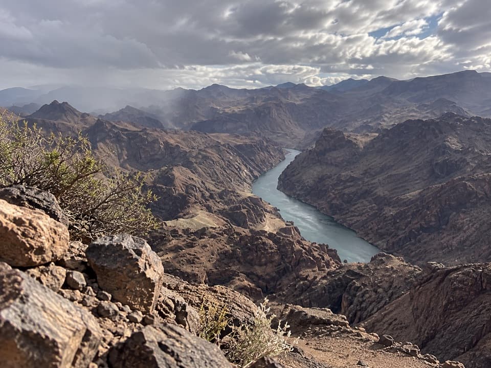
Within Lake Mead National Recreation Area, the route covers 16.2 miles one way. This portion is described as easy, with a 750-foot elevation change. It gives access to several trailheads, including the Alan Bible Visitor Center area, Boulder Harbor and the Lake Mead Parkway fee station. Views of the lake, open Mojave terrain and surrounding mountain ridges are recurring highlights. The route is shared with cyclists and other nonmotorized users; expect to watch for faster riders and check road crossings where the trail meets local streets.

Volcanic countryThe River Mountains are volcanic, and the loop passes through a landscape shaped by old lava…

The River Mountains are volcanic, and the loop passes through a landscape shaped by old lava flows. Lava Butte is visible from roughly mile markers 12 to 14, a good stretch to pause and pick out the low volcanic cone beside the broader ridges. The area’s volcanic flows formed about 12–15 million years ago. The route’s changing elevation opens different views across Lake Mead and the desert rather than staying beside the water for the full circuit.

Water, parking and trail etiquetteCarry enough water for the segment you choose; refill points are not spread evenly along the…

Carry enough water for the segment you choose; refill points are not spread evenly along the loop. The visitor center area and Boulder Harbor have water and restrooms, while the Lake Mead Parkway fee-station access has a pit toilet but no water. The lower lot near Alan Bible is shared with the Historic Railroad Trail and can fill on weekends. Vehicle admission fees apply to the Lake Mead National Recreation Area portion. Dogs are allowed on the park section on a leash no longer than six feet; keep them leashed and check local rules through the other jurisdictions. Bring food and sun protection, especially for a long ride or walk in warm weather.

A shared regional projectThe trail was planned as a connected route across public lands and local communities, rather…

The trail was planned as a connected route across public lands and local communities, rather than a single park path. Planning began in 1996, a multi-agency advisory council formed the following year, and the complete loop opened in 2012 after earlier sections were dedicated in 2000 and 2001. That shared history explains why the trail links several recreation areas and towns and why users should check the access and facility details for their chosen section before setting out.

Wildlife

Wildlife in Lake Mead

All Lake Mead wildlife maps

Sighting maps show where each species has been reported across Lake Mead. Wildlife moves, so no sighting is guaranteed.

Keep exploring

Near River Mountains Loop Trail

See it all on the map

Trails that start nearby

Places near the trailhead

Parkwolf’s Lake Mead ranking

Top-rated trails in Lake Mead

All 42 trails
  1. 1Historic Railroad TrailEasy · 7.5 mi
  2. 2Anniversary Narrows TrailModerate · 5.8 mi
  3. 3Liberty Bell Arch TrailChallenging · 5.5 mi
  4. 4Arizona Hot Spring TrailChallenging · 5 mi
  5. 5Owl Canyon TrailModerate · 2.2 mi
  6. 6Fortification Hill TrailChallenging · 4 mi

Take Parkwolf to Lake Mead.

The audio tour guide for the drive, plus offline maps, trails, and wildlife heatmaps for when the signal drops.

4.7 from 8,600+ ratings

Download Parkwolf on the App StoreGet Parkwolf on Google Play