Boy Scout Canyon Trail in Lake Mead National Recreation Area

Lake Mead National Recreation Area, AZ · NV

Boy Scout Canyon Trail

A sandy volcanic wash ends above a 330-foot plunge.

Length
3.6mi
Time
3.5hr
Elev. change
351ft
Difficulty
Moderate
  • Dogs allowed
  • High point 1,732 ft
Parkwolf audio tour153 stories across Lake Mead’s roads

Overview

About Boy Scout Canyon Trail

Why go

  • A narrow volcanic gorge and a dramatic upper-canyon turnaround.
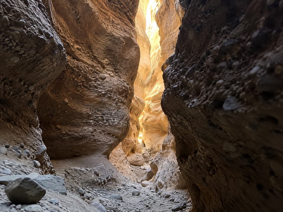
  • Water-polished rock and shallow slots make the wash more than a sandy walk.

Heads up

  • Loose sand and a 15-foot third-class downclimb that must be reclimbed.
  • Little shade and a rough access road.
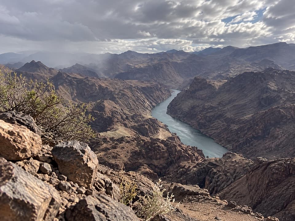
Boy Scout Canyon Trail is a 3.6-mile out-and-back from the end of Boy Scout Canyon Road, following a sandy wash into a narrow volcanic gorge. The turnaround is a perch above the lower canyon’s 330-foot pour-over. Allow about three to four hours. This is a rough backcountry walk, not a built trail; loose sand and a short third-class downclimb make it a poor fit if you want an easy stroll.
Parkwolf’s verdictIs this the hike for you?

Map & elevation

The route

Loading the Lake Mead map
Full map
Elevation1,381–1,732 ft
TrailheadEnd of Boy Scout Canyon Road35.97285, -114.76946
Keep this map with you offline in the Parkwolf app

Plan your hike

Before you go

Parking

The documented start is at the end of Boy Scout Canyon Road. Reaching it involves a sandy backcountry road; current passability and formal parking capacity were not confirmed. Walking from the Lake Mead boundary signs adds about 2.2 miles each way, for roughly 8 miles round trip. Check current access and use only NPS-approved roads.

Safety

Little shade and no potable water are documented. The 15-foot third-class downclimb at about 0.8 mile must be climbed back on the return. End at the top of the 20-foot pour-over; its slick rock and few holds lead toward a separate 330-foot drop. Do not descend toward Boy Scout Hot Spring as part of this hike.

4 active Lake Mead alerts

  • CautionHarmful algae bloom at Nelson’s Landing and Cottonwood CoveA harmful algae bloom has been confirmed in recent samples from Nelson’s Landing and Cottonwood Cove; avoid contact with water where algae is visible.Official details
  • CautionArizona Hot Springs bacteria advisoryLimit body contact with Arizona Hot Springs water: fecal bacteria in samples frequently reach high levels and can transmit human diseases.Official details
See all 4 alerts
A park ranger sits on a dash-mounted phone, talking, as Parkwolf’s Tour Guide plays “Army Cutworm Moths: A Grizzly Bear Buffet” on Grand Loop Road below Dunraven Pass in Yellowstone
Parkwolf Tour GuideThe highest, rockiest slopes around here are a summer buffet for grizzly bears.

Lake Mead Tour Guide

Your drive to Boy Scout Canyon Trail, narrated.

Parkwolf is a GPS audio tour guide for Lake Mead National Recreation Area. As you drive, it chimes in with what’s ahead: hidden gems, upcoming stops, history, geology, and wildlife, right through your car’s speakers.

See the Lake Mead audio tour

More stories near here in the app

  • A Verdin's Sleeping Nest
  • Gold Strike Hot Springs: A Serious Scramble
  • Lake Mead Visitor Center and Desert Garden
  • Lakeview Scenic Overlook: Islands and an Old Tunnel
  • 153 audio storiesacross Lake Mead’s roads, triggered by GPS as you drive
  • Wildlife heatmapsfor Bighorn Sheep, Burro, Bald Eagle, and 13 more
  • Works offlinemaps, 42 trails, 70 places, and audio download before you lose signal
  • CarPlay readysimple controls built for the drive
★★★★★
“Fantastic app with many points of information… It’s great to just turn on while you’re driving and it gives you an audio tour of the national Park. We love it!!!!”
JMJamesApp Store review
Download Parkwolf on the App StoreGet Parkwolf on Google Play

4.7 from 8,600+ ratings

Trail guide

Hiking Boy Scout Canyon Trail

Follow the washFrom the road end, head east down the wash. It narrows at about 0.34 mile. At roughly 0.

From the road end, head east down the wash. It narrows at about 0.34 mile. At roughly 0.8 mile, a 15-foot pour-over makes an easy third-class downclimb; you have to climb back up it on the return. At about 1.5 miles, the wash spreads across flat, water-polished rock and shallow slots. A fork leads toward the separate Colorado River Overlook; stay in the main canyon for this route.

Stop above the lower canyonPast the fork, the wash bends north into a gorge only about 20 to 25 feet wide at its floor,…

Past the fork, the wash bends north into a gorge only about 20 to 25 feet wide at its floor, with walls rising 200 to 300 feet. The hiking route ends at the top of a 20-foot pour-over. A sandy shelf lies below it, then the canyon drops about 330 feet into Lower Boy Scout Canyon. The 20-foot pour-over is slick and has few good holds; the hot spring below is a technical canyon route, not an ordinary continuation of this hike.

The rocks and plantsReddish-brown and black volcanic slopes frame the wash, where the rock is polished gray-green.

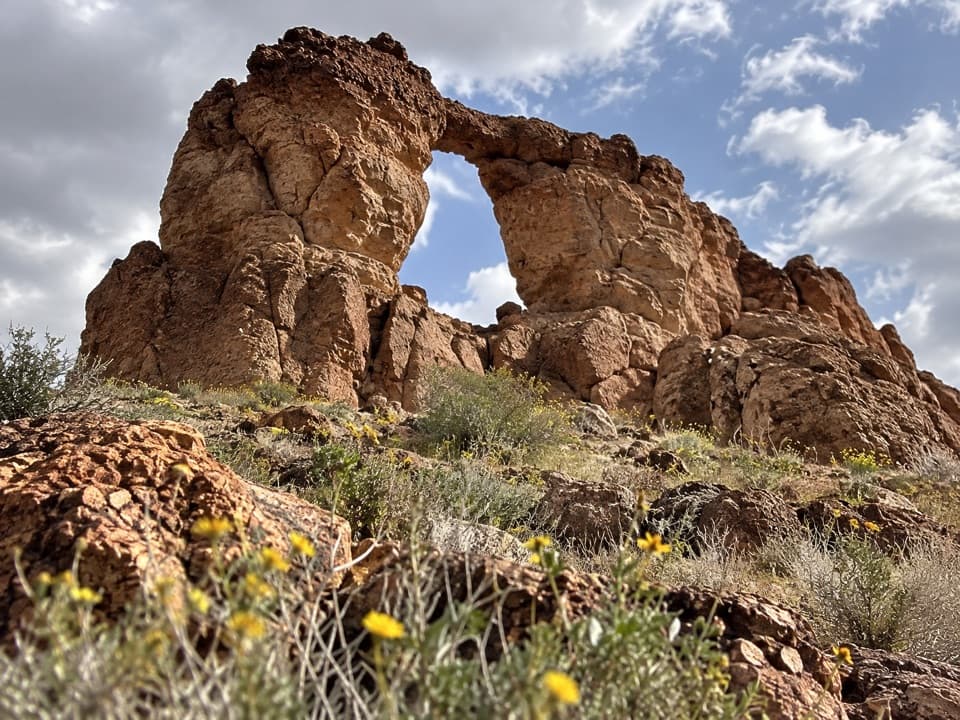
Reddish-brown and black volcanic slopes frame the wash, where the rock is polished gray-green. The narrow gorge exposes layers of pyroclastic and ash-fall material. Creosote and catclaw acacia are common along the hillsides and wash edges; brittlebush, Mormon tea and spring wildflowers add color when they are in season.

Access and a practical planThe distance above starts at the road end.

The distance above starts at the road end. Walking from the Lake Mead boundary signs adds about 2.2 miles each way, making the full outing about 8 miles. The sandy access road’s current passability was not confirmed; check access before driving and stay on roads approved for vehicles. No water or facilities are documented at the start or along the canyon, so bring what you need. Dogs are allowed on Lake Mead hiking trails on a leash no longer than six feet.

Wildlife

Wildlife in Lake Mead

All Lake Mead wildlife maps

Sighting maps show where each species has been reported across Lake Mead. Wildlife moves, so no sighting is guaranteed.

Keep exploring

Near Boy Scout Canyon Trail

See it all on the map

Trails that start nearby

Places near the trailhead

Parkwolf’s Lake Mead ranking

Top-rated trails in Lake Mead

All 42 trails
  1. 1Historic Railroad TrailEasy · 7.5 mi
  2. 2Anniversary Narrows TrailModerate · 5.8 mi
  3. 3Liberty Bell Arch TrailChallenging · 5.5 mi
  4. 4Arizona Hot Spring TrailChallenging · 5 mi
  5. 5Owl Canyon TrailModerate · 2.2 mi
  6. 6Fortification Hill TrailChallenging · 4 mi

Take Parkwolf to Lake Mead.

The audio tour guide for the drive, plus offline maps, trails, and wildlife heatmaps for when the signal drops.

4.7 from 8,600+ ratings

Download Parkwolf on the App StoreGet Parkwolf on Google Play