Long House Loop in Mesa Verde National Park

Mesa Verde National Park, CO

Long House Loop

A paved mesa loop to cliff dwellings and ancestral villages.

Photo: Wikimedia Commons
Length
5mi
Time
3hr
Elev. change
240ft
Difficulty
Moderate
  • Loop
  • Dogs allowed
  • High point 7,224 ft

Hear the audio tour

Wetherill Mesa and Long House

Overview

About Long House Loop

Why go

  • Paved circuit reaches Badger House and two cliff-dwelling overlooks.
  • Four excavated mesa-top villages add a substantial history stop.

Heads up

  • The exposed mesa has no shade and limited trail water.
  • Seasonal access adds a long, winding drive to the hike.

Map & elevation

The route

Loading the Mesa Verde map
Full map
Elevation6,985–7,224 ft
TrailheadWetherill Mesa Information Pavilion37.19578, -108.53748
Keep this map with you offline in the Parkwolf app

Plan your hike

Before you go

Parking

Start at the Wetherill Mesa parking lot and information pavilion at the end of Wetherill Mesa Road. The approach road is 12 miles, winding, with tight curves and hills; vehicles over 25 feet or 8,000 pounds are not permitted. Gate hours and opening dates vary by season.

Best time to go

Wetherill Mesa is open seasonally, and its entry-gate schedule changes. The approach from the main park road is a long, winding drive. There is little shade and water is limited along the trails; summer thunderstorms can bring lightning, with few places to shelter away from the car, pavilion or Badger House shelters. Carry water and check current access before driving out. A seasonal pavilion snack bar offers packaged food and drinks, but do not count on trail water.

Safety

Little shade and limited water at about 7,240 feet. Summer thunderstorms often bring lightning, and shelter is limited away from the car, pavilion and Badger House shelters. Carry water and leave overlooks when storms approach.

2 active Mesa Verde alerts

  • ClosureRoad improvements close Far View and Cedar Tree Tower access roadsRoad improvements have closed the access roads to Far View Sites and Cedar Tree Tower to all traffic. - Road work on the first four miles of Main Park Road may cause delays of up to 15 minutes.Official details
  • CautionRockfall area on Knife Edge Trail—keep outDo not enter the rockfall area along the last quarter of Knife Edge Trail; a serious rockfall occurred there. Check current trail information before hiking.Official details
Mesa Verde alerts
A park ranger sits on a dash-mounted phone, talking, as Parkwolf’s Tour Guide plays “Army Cutworm Moths: A Grizzly Bear Buffet” on Grand Loop Road below Dunraven Pass in Yellowstone
Parkwolf Tour GuideThe highest, rockiest slopes around here are a summer buffet for grizzly bears.

Mesa Verde Tour Guide

Your drive to Long House Loop, narrated.

Parkwolf is a GPS audio tour guide for Mesa Verde National Park. As you drive, it chimes in with what’s ahead: hidden gems, upcoming stops, history, geology, and wildlife, right through your car’s speakers.

See the Mesa Verde audio tour

Recorded for this trailhead

Wetherill Mesa and Long House
0:00 / 0:37
“You're approaching Wetherill Mesa Pavilion, the starting point for walks to the cliff dwellings. If you've reserved Long House, allow about two hours including the walk to the ranger meeting point.”

Plays as you drive up to this trailhead in the Parkwolf Mesa Verde Tour Guide.

More stories near here in the app

  • How the Rock Made Room
  • The Date Inside a Roof Beam
  • Spruce Tree House and Mesa Verde Museum
  • Spruce Tree Terrace Café and Chapin Mesa Picnic Area
  • 43 audio storiesacross Mesa Verde’s roads, triggered by GPS as you drive
  • Wildlife heatmapsfor Black Bear, Mule Deer, Golden Eagle, and 13 more
  • Works offlinemaps, 22 trails, 48 places, and audio download before you lose signal
  • CarPlay readysimple controls built for the drive
★★★★★
“Fantastic app with many points of information… It’s great to just turn on while you’re driving and it gives you an audio tour of the national Park. We love it!!!!”
JMJamesApp Store review
Download Parkwolf on the App StoreGet Parkwolf on Google Play

4.7 from 8,600+ ratings

Trail guide

Hiking Long House Loop

The full circuitLong House Loop is a paved, roughly 5-mile circuit around the top of Wetherill Mesa, starting…

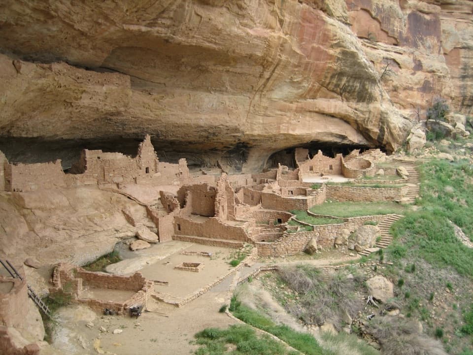
Long House Loop is a paved, roughly 5-mile circuit around the top of Wetherill Mesa, starting by the information pavilion and reaching the Badger House Community and the Long House and Kodak House overlooks. Published estimates range from about 5 to 6 miles. Use 5 miles as the planning figure for this full loop. Allow about three hours if you stop at the sites.

Across the mesaThe path is paved and open to hikers and bikes.

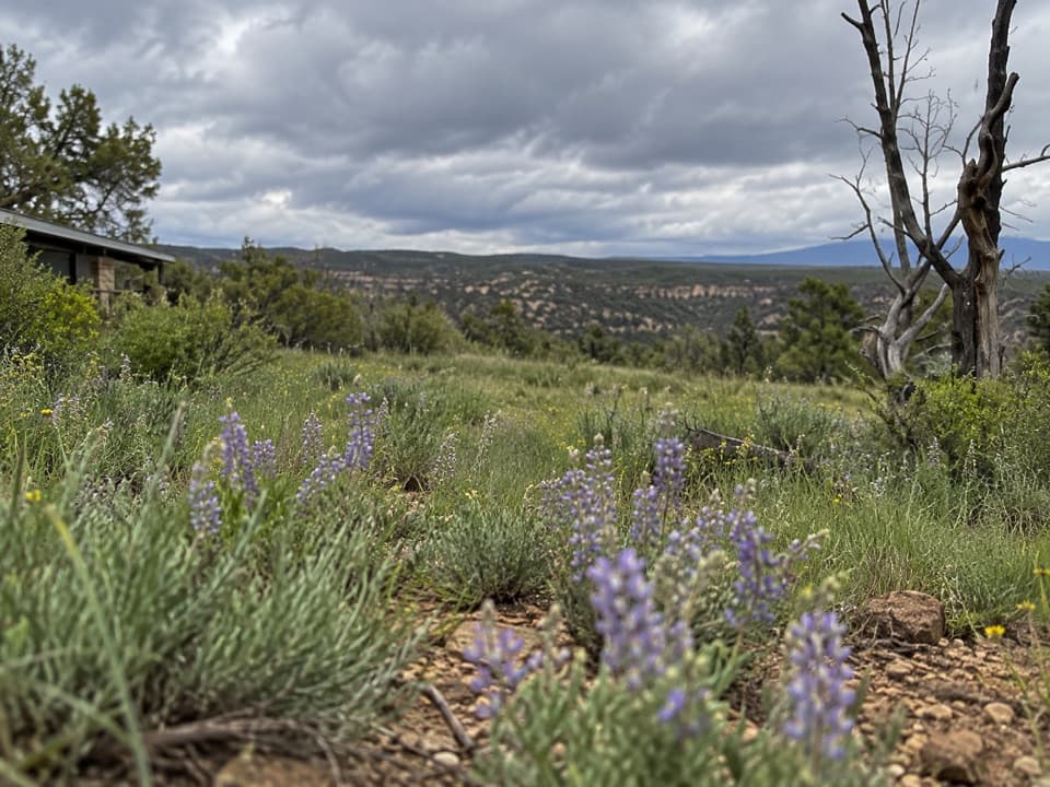
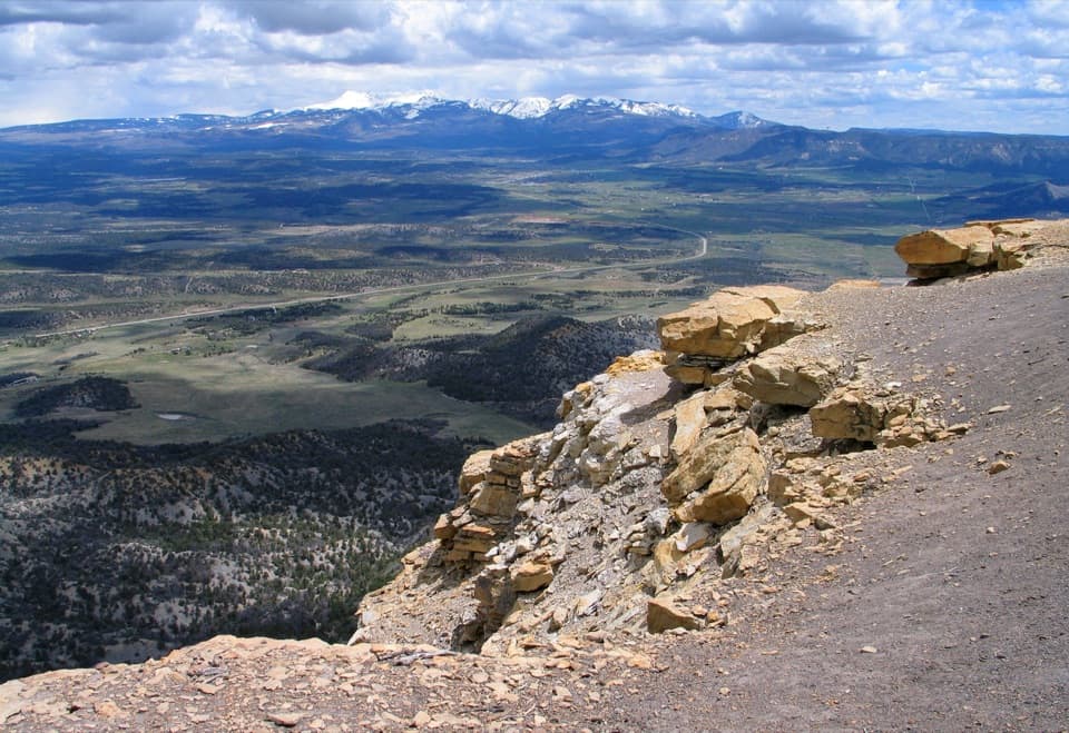
The path is paved and open to hikers and bikes. The park rates it moderate and lists 177 feet of elevation change. The route crosses an open mesa landscape with scattered fire-scarred woodland; the 2000 fire left the trail without shade. The smooth surface helps, but the distance, sun and altitude make this more than a quick stroll.

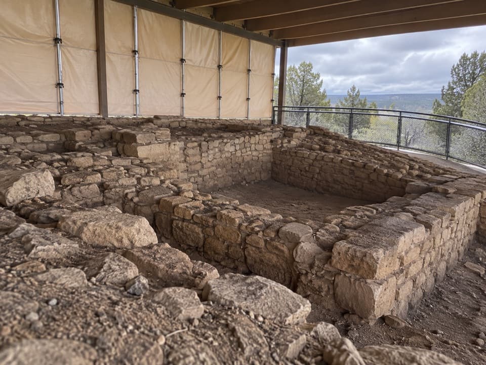
Badger House CommunityThe circuit reaches four excavated mesa-top villages at Badger House, representing about 600…

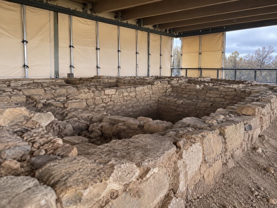
The circuit reaches four excavated mesa-top villages at Badger House, representing about 600 years of Ancestral Pueblo history. Wetherill Mesa itself preserves nearly 700 years of that history. Take time to look at the village remains before heading back onto the loop.

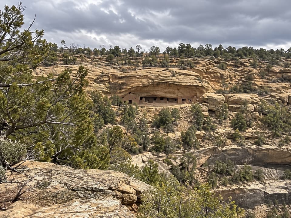
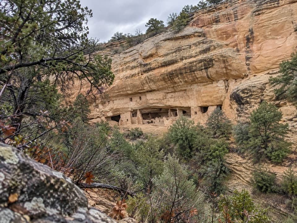
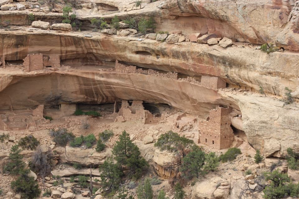
Long House and Kodak House overlooksThe overlooks face cliff dwellings across the canyons.

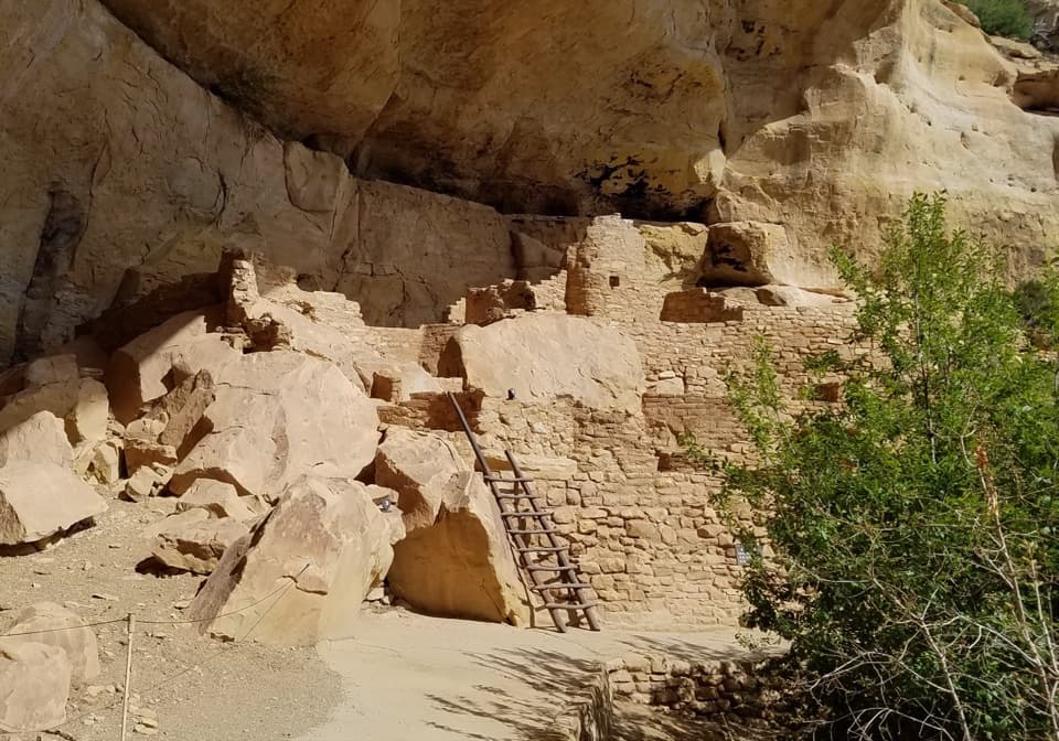
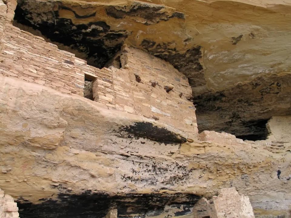
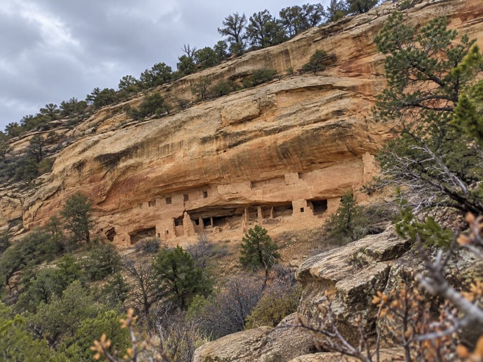
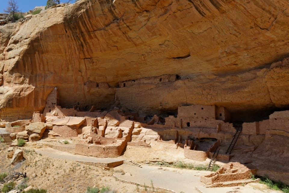
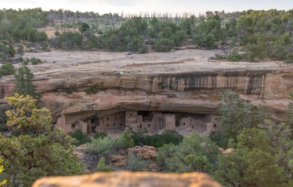
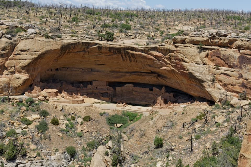
The overlooks face cliff dwellings across the canyons. Long House is the park’s second-largest cliff dwelling; the overlook is not the ticketed ranger tour into its alcove. At Long House Overlook, include the canyon below the alcove in a phone photo to show the scale of the setting. Kodak House is another overlook stop on the paved circuit.

Dogs and bikesLeashed pets and bicycles are allowed on this paved loop.

Leashed pets and bicycles are allowed on this paved loop. Pets are not allowed on the separate Long House alcove tour. Bikes are allowed on the trails beyond the pavilion, not on Wetherill Mesa Road.

Wildlife

Wildlife in Mesa Verde

All Mesa Verde wildlife maps

Sighting maps show where each species has been reported across Mesa Verde. Wildlife moves, so no sighting is guaranteed.

Keep exploring

Near Long House Loop

See it all on the map

Trails that start nearby

Places near the trailhead

Parkwolf’s Mesa Verde ranking

Top-rated trails in Mesa Verde

All 22 trails
  1. 1Petroglyph Point TrailChallenging · 2.4 mi
  2. 2Long House TourChallenging · 2.3 mi
  3. 3Point Lookout TrailModerate · 2.2 mi
  4. 4Step House TrailModerate · 1 mi
  5. 5Spruce Tree House TrailEasy · 0.5 mi
  6. 6Balcony House TourChallenging · 0.3 mi

Take Parkwolf to Mesa Verde.

The audio tour guide for the drive, plus offline maps, trails, and wildlife heatmaps for when the signal drops.

4.7 from 8,600+ ratings

Download Parkwolf on the App StoreGet Parkwolf on Google Play