Cullite Creek Camp in Pacific Rim National Park Reserve

Campground · Pacific Rim National Park Reserve

Cullite Creek Camp

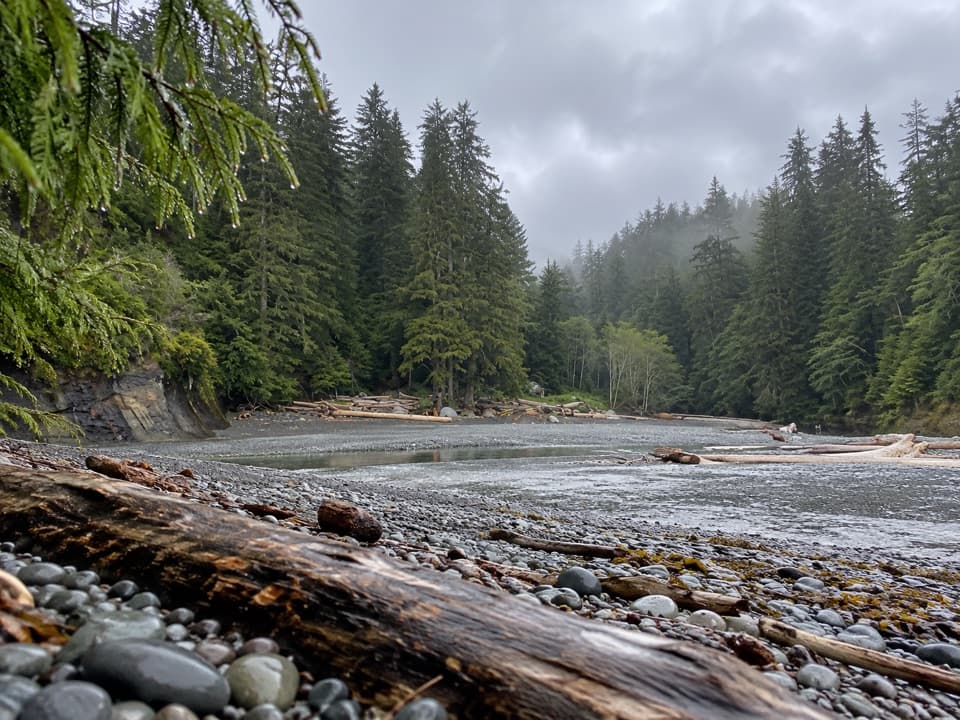
A pebble-cove camp tucked into the West Coast Trail.

Overview

About Cullite Creek Camp

Why stop

  • A creek-side camp beside a small pebble cove.

Heads up

  • A rough side-path detour and very limited tent clearings.

Map

Where it is

Loading the Pacific Rim map
Full map
CampgroundCullite Creek Camp48.56527, -124.59833
Keep this map with you offline in the Parkwolf app

Plan your stop

Before you go

7 active Pacific Rim alerts

  • ClosureWest Coast Trail winter access restrictionMentions West Coast Trail, referenced in this guideFrom October 7 through April 30, only day use between Pachena Bay trailhead and km 8 is permitted; overnight use and the remainder of the West Coast Trail are closed.Official details
  • ClosureWest Coast Trail lightstations closedMentions West Coast Trail, referenced in this guideCarmanah Point and Pachena Point Lightstations and their surrounding grounds in the West Coast Trail Unit are closed to public use at all times; do not enter.Official details

See all 7 alerts
A park ranger sits on a dash-mounted phone, talking, as Parkwolf’s Tour Guide plays “Army Cutworm Moths: A Grizzly Bear Buffet” on Grand Loop Road below Dunraven Pass in Yellowstone
Parkwolf Tour GuideThe highest, rockiest slopes around here are a summer buffet for grizzly bears.

Pacific Rim Tour Guide

Your drive to Cullite Creek Camp, narrated.

Parkwolf is a GPS audio tour guide for Pacific Rim National Park Reserve. As you drive, it chimes in with what’s ahead: hidden gems, upcoming stops, history, geology, and wildlife, right through your car’s speakers.

See the Pacific Rim audio tour
  • 34 audio storiesacross Pacific Rim’s roads, triggered by GPS as you drive
  • Wildlife heatmapsfor Orca, Humpback Whale, Black Bear, and 13 more
  • Works offlinemaps, 19 trails, 52 places, and audio download before you lose signal
  • CarPlay readysimple controls built for the drive
★★★★★
“Fantastic app with many points of information… It’s great to just turn on while you’re driving and it gives you an audio tour of the national Park. We love it!!!!”
JMJamesApp Store review
Download Parkwolf on the App StoreGet Parkwolf on Google Play

4.7 from 8,600+ ratings

Guide

More about Cullite Creek Camp

A small camp off the trailCullite Creek Camp is a backcountry campsite at kilometre 58 of the West Coast Trail, where…

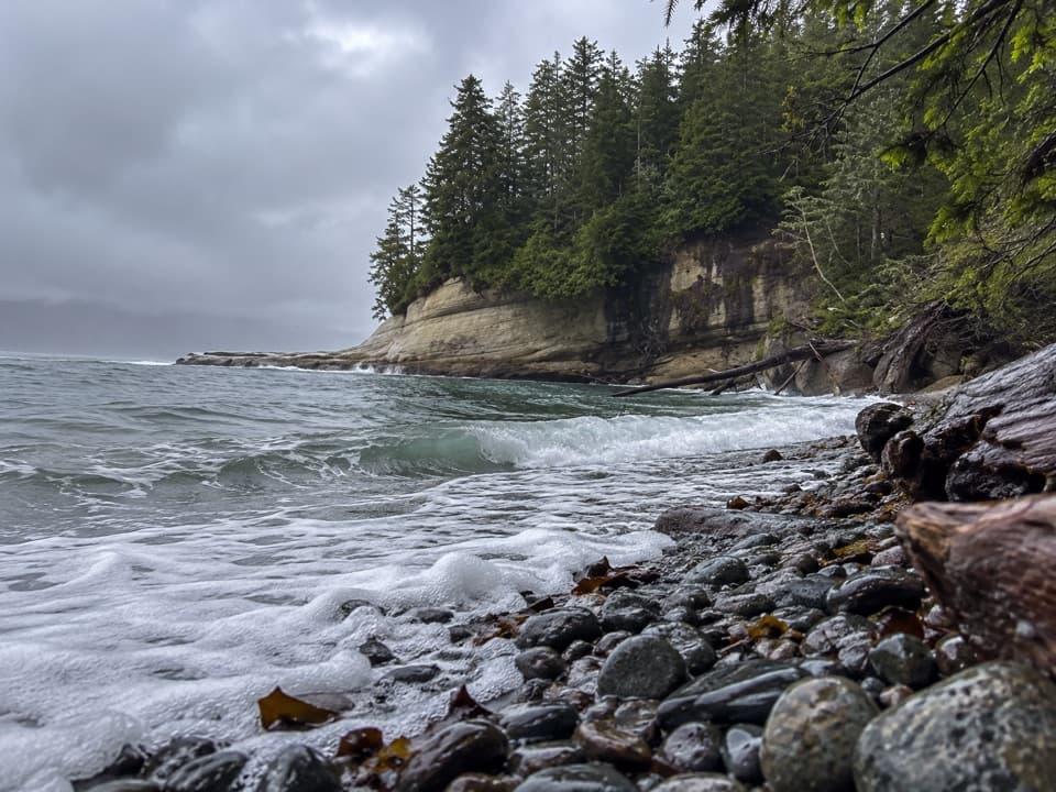
Cullite Creek Camp is a backcountry campsite at kilometre 58 of the West Coast Trail, where Cullite Creek meets a small pebble cove beneath forested headlands. It suits hikers who want a night beside the water; this is not a drive-in campground or a separate day-trip stop. A rough side path leads down from the main route, and the camp is hidden from the trail. Coming from the north, you'll cross the creek on the cable car before taking the turnoff.

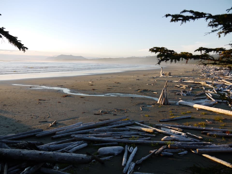
The cove and campThere is a small pebble beach and just a few sandy tent clearings in the trees.

There is a small pebble beach and just a few sandy tent clearings in the trees. An outhouse and bear-proof food-storage boxes are reported at the camp. Cullite Creek is the nearby water source, but its potability is not established, so plan to treat it before drinking. Carry your food and supplies; there is no food service here.

A tough stretch of trailAccess is on foot as part of the West Coast Trail, whose permitted entry and exit points are…

Access is on foot as part of the West Coast Trail, whose permitted entry and exit points are Pachena Bay, Balaats’adt and Gordon River. A reservation, West Coast Trail backcountry use permit and park entry pass are required. The overnight season is May 1 through September 30. Cullite lies within the muddy, rooty kilometre 53–62 section, one of the trail’s most challenging stretches, with many ladders. Check trail and campsite conditions before you set out.

An older travel routeThe West Coast Trail follows First Nations travel and trade routes.

The West Coast Trail follows First Nations travel and trade routes. Huu-ay-aht, Ditidaht and Pacheedaht communities had villages and camps along this coast long before foreign ships arrived. After the 1906 Valencia wreck killed more than 125 people, the government built Pachena Lighthouse in 1907 and turned the telegraph corridor into the Dominion Life Saving Trail, with six provisioned shelters. The route became a park hiking trail in 1973.

Wildlife

Wildlife in Pacific Rim

All Pacific Rim wildlife maps

Sighting maps show where each species has been reported across Pacific Rim. Wildlife moves, so no sighting is guaranteed.

Parkwolf’s Pacific Rim ranking

Top sights in Pacific Rim

All 52 places
  1. 1Long BeachBeach
  2. 2Wickaninnish BeachBeach
  3. 3Tsusiat FallsSight
  4. 4Incinerator RockSight
  5. 5Owen Point Sea CavesSight
  6. 6Radar HillSight

Take Parkwolf to Pacific Rim.

The audio tour guide for the drive, plus offline maps, trails, and wildlife heatmaps for when the signal drops.

4.7 from 8,600+ ratings

Download Parkwolf on the App StoreGet Parkwolf on Google Play