Howden Reservoir in Peak District National Park

Sight · Peak District National Park

Howden Reservoir

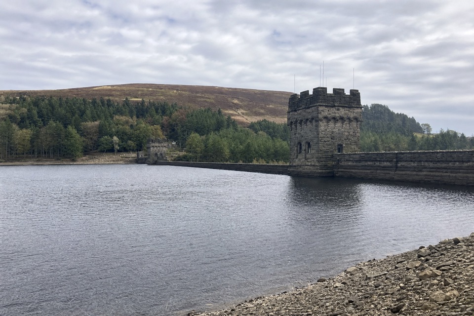
The quiet uppermost reservoir, ending at a 1912 Grade II dam

Photo: Wikimedia Commons
Type
Sight
Nearest trail
4.2 km
  • Parking
  • Restrooms
  • Food
Parkwolf audio tour298 stories across Peak District’s roads

Overview

About Howden Reservoir

Why stop

  • Historic Grade II dam with a memorable reservoir setting
  • Peaceful woodland and moorland scenery

Heads up

  • About five miles out and back to the dam
  • Remote upper-valley conditions and variable vehicle access

Map

Where it is

Loading the Peak District map
Full map
SightHowden Reservoir53.43774, -1.75297
Keep this map with you offline in the Parkwolf app

Plan your stop

Before you go

Best time to go

Autumn is the standout, when the wooded slopes take on autumn colour and the light on the water is at its best. Early in the day gives you the quietest scenery and softer light either way. If you want the full three-reservoir circuit, budget a whole day rather than squeezing it around other stops; the shorter out-and-back to Howden Dam is the sensible half-day version.


5 active Peak District alerts

  • ClosureA54 Cat and Fiddle road closureThe A54 Macclesfield Main Road (Cat and Fiddle) is fully closed to all traffic from 27 July through 30 October 2026 during phase 1 improvement works.Official details
  • ClosureHooks Carr (Stanage Popular) car park closureHooks Carr (Stanage Popular) car park will be partially or fully closed from 6 October for four weeks.Official details
See all 5 alerts
A park ranger sits on a dash-mounted phone, talking, as Parkwolf’s Tour Guide plays “Army Cutworm Moths: A Grizzly Bear Buffet” on Grand Loop Road below Dunraven Pass in Yellowstone
Parkwolf Tour GuideThe highest, rockiest slopes around here are a summer buffet for grizzly bears.

Peak District Tour Guide

Your drive to Howden Reservoir, narrated.

Parkwolf is a GPS audio tour guide for Peak District National Park. As you drive, it chimes in with what’s ahead: hidden gems, upcoming stops, history, geology, and wildlife, right through your car’s speakers.

More stories near here in the app

  • Derwent Dam from Fairholmes
  • Alport Castles from Fairholmes
  • The Snake on the Sign
  • The Village That Built the Dams
  • 298 audio storiesacross Peak District’s roads, triggered by GPS as you drive
  • Wildlife heatmapsfor Red Deer, Red Fox, Eurasian Otter, and 13 more
  • Works offlinemaps, 88 trails, 76 places, and audio download before you lose signal
  • CarPlay readysimple controls built for the drive
★★★★★
“Fantastic app with many points of information… It’s great to just turn on while you’re driving and it gives you an audio tour of the national Park. We love it!!!!”
JMJamesApp Store review
Download Parkwolf on the App StoreGet Parkwolf on Google Play

4.7 from 8,600+ ratings

Guide

More about Howden Reservoir

What makes Howden differentHowden is the uppermost of the three Upper Derwent Valley reservoirs, sitting above Derwent and…

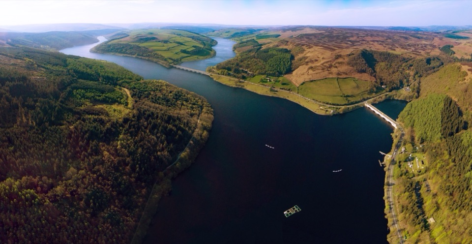
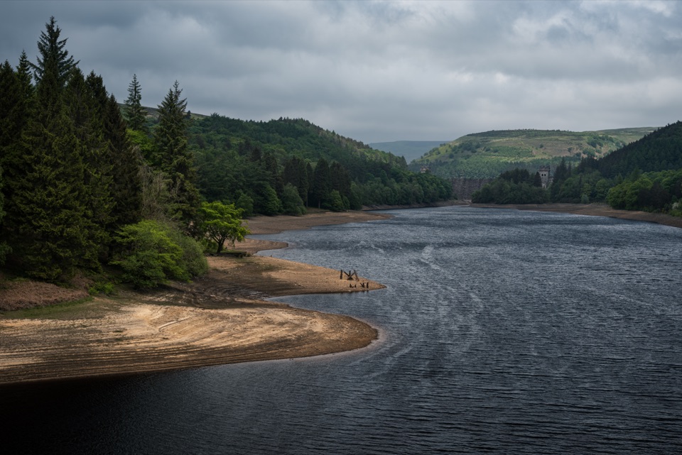
Howden is the uppermost of the three Upper Derwent Valley reservoirs, sitting above Derwent and Ladybower in the drowned valley of the River Derwent. That position is the whole point: it takes effort to reach, so it stays quieter than the busier dam-side crowds lower down. The county boundary runs straight through the middle of the water, and the shoreline is all forested slope, still water and open moorland above.

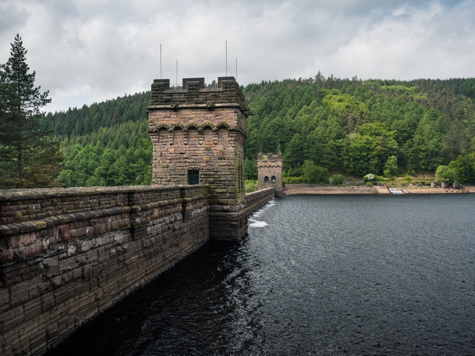
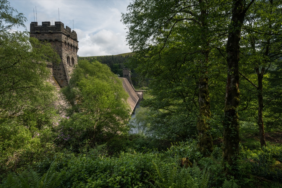
The dam and its historyHowden Dam was completed in July 1912, two years after work began, and it is now Grade II…

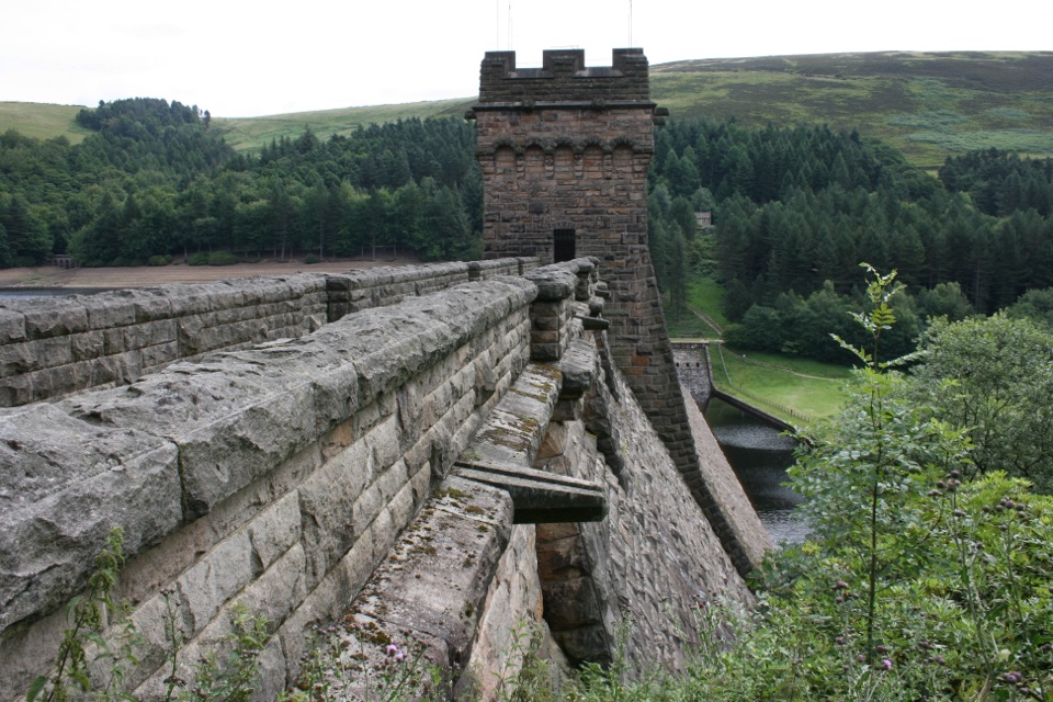
Howden Dam was completed in July 1912, two years after work began, and it is now Grade II listed. Its foundation stone carries the inscription "Glory to thee in the highest in the year of the Lord 1902-1912". The reservoir was built by the Derwent Valley Water Board to supply Derby, Leicester, Nottingham, Sheffield and Derbyshire, and standing at the head of the valley you get a real sense of that scale. The dam is one of the most photographic points on the walk.

How to approach itThe usual starting point is Fairholmes, the main access point for the Upper Derwent Valley,…
  • The usual starting point is Fairholmes, the main access point for the Upper Derwent Valley, with a pay-and-display car park, toilets, a refreshment kiosk and bike hire.
  • The classic version is an approximately five-mile walk from Fairholmes to Howden Dam that does not climb a hill, following the water past woodland and hill views.
  • The longer option is the 10.5-mile Derwent, Howden and Slippery Stones Trail, walkable or cyclable, continuing north to Slippery Stones at the head of the valley. Note that the west half of the Lost Villages route is footpath only, so cyclists cannot ride it.
  • The road north of the Fairholmes roundabout has a recurring pattern of seasonal, weekend and bank holiday motor-vehicle restrictions, with exceptions for residents and blue-badge holders, and the road in front of Derwent Dam is closed to non-residents. On quieter weekdays some people drive part way before a gate or barrier, but treat that as variable and plan to walk or cycle.
What you actually do hereWalk or ride, look at water and hills, and stop at the dam.

Walk or ride, look at water and hills, and stop at the dam. Water sports are not permitted on these reservoirs, so this is not a swimming, paddling or kayaking destination. The toilets, refreshment kiosk and bike hire are all at Fairholmes, the main access point, so it makes sense to eat, use the facilities and sort out bikes there before you set off up the valley.

Honest tradeoffsThe reward is quiet, not variety, and the walk in is long enough that people expecting a quick…

The reward is quiet, not variety, and the walk in is long enough that people expecting a quick dam-side stroll should stay lower in the valley. The upper valley is remote and exposed in places, weather can change quickly, and there is no mobile signal, so take layers, water and a map rather than relying on your phone.

Wildlife

Wildlife in Peak District

All Peak District wildlife maps

Sighting maps show where each species has been reported across Peak District. Wildlife moves, so no sighting is guaranteed.

Parkwolf’s Peak District ranking

Top sights in Peak District

All 76 places
  1. 1Chatsworth HouseSight
  2. 2Mam TorSight
  3. 3Dovedale Stepping StonesSight
  4. 4Ladybower ReservoirSight
  5. 5Stanage EdgeSight
  6. 6Kinder ScoutSight

Take Parkwolf to Peak District.

The audio tour guide for the drive, plus offline maps, trails, and wildlife heatmaps for when the signal drops.

4.7 from 8,600+ ratings

Download Parkwolf on the App StoreGet Parkwolf on Google Play