Derwent Dam Red Route in Peak District National Park

Peak District National Park, EN

Derwent Dam Red Route

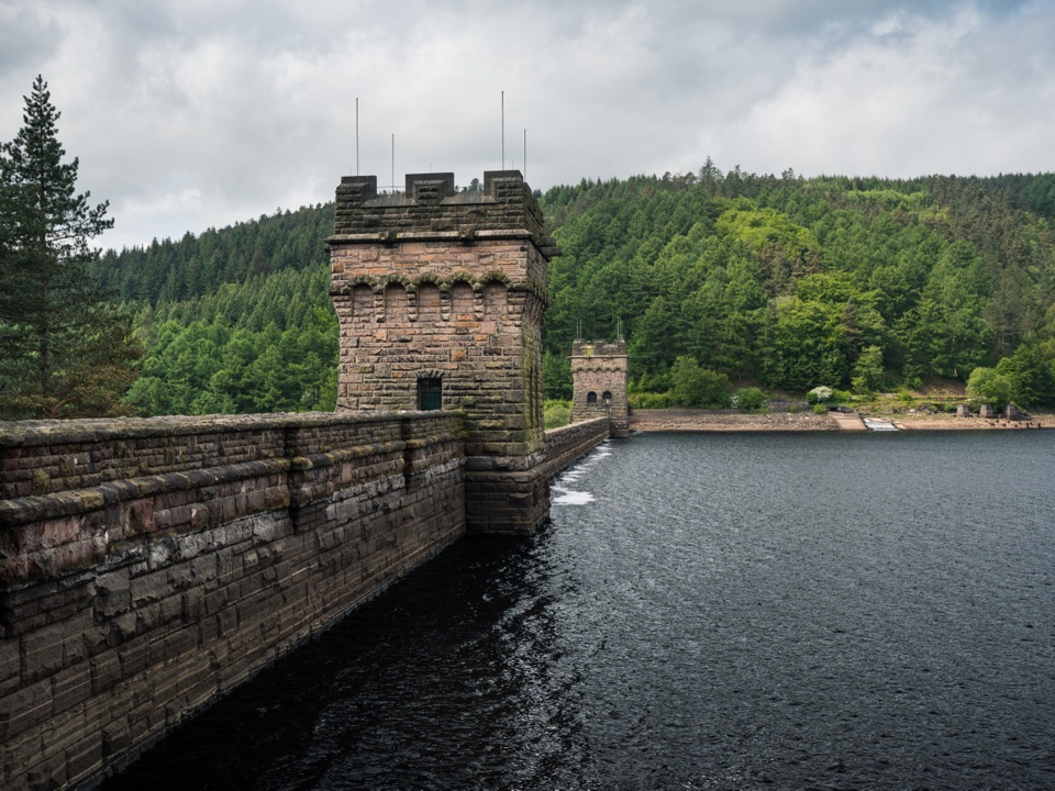
A short loop to Peak District’s twin-towered dam

Photo: Wikimedia Commons
Length
1.9km
Time
36min
Elev. change
88m
Difficulty
Easy
  • Loop
  • High point 298 m

Hear the audio tour

Derwent Dam from Fairholmes

Overview

About Derwent Dam Red Route

Why go

  • Distinctive twin-towered dam and reservoir views
  • Short loop with a clear destination

Heads up

  • Three short stair flights and mixed surfaces
  • Not the separate step-free dam access route

Map & elevation

The route

Loading the Peak District map
Full map
Elevation210–298 m
TrailheadFairholmes Visitor Centre / Fairholmes car park53.40021, -1.74349
Keep this map with you offline in the Parkwolf app

Plan your hike

Before you go

Parking

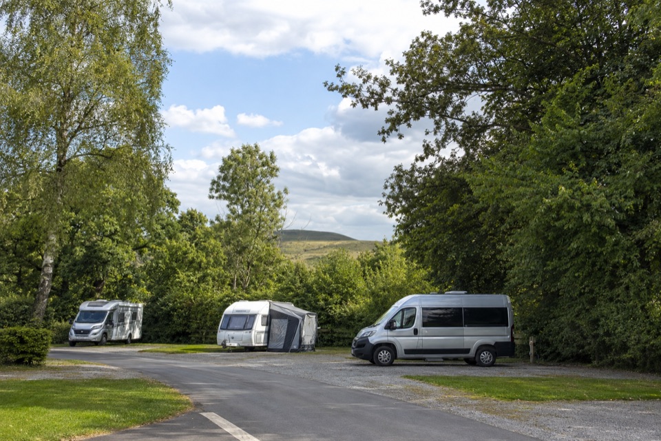
Start at Fairholmes Visitor Centre and car park, north of the Snake Road. Follow the signed path from the visitor centre. Pay-and-display parking, disabled spaces, toilets and a refreshment kiosk are at the start. Do not drive to the dam road, which is closed to non-residents.


Safety

The loop has three short stair flights of 8, 2 and 20 steps, mixed gravel and dirt surfaces, and a road section with local traffic. It is not the separate step-free access route to the dam base.

5 active Peak District alerts

  • ClosureA54 Cat and Fiddle road closureThe A54 Macclesfield Main Road (Cat and Fiddle) is fully closed to all traffic from 27 July through 30 October 2026 during phase 1 improvement works.Official details
  • ClosureHooks Carr (Stanage Popular) car park closureHooks Carr (Stanage Popular) car park will be partially or fully closed from 6 October for four weeks.Official details
See all 5 alerts
A park ranger sits on a dash-mounted phone, talking, as Parkwolf’s Tour Guide plays “Army Cutworm Moths: A Grizzly Bear Buffet” on Grand Loop Road below Dunraven Pass in Yellowstone
Parkwolf Tour GuideThe highest, rockiest slopes around here are a summer buffet for grizzly bears.

Peak District Tour Guide

Your drive to Derwent Dam Red Route, narrated.

Parkwolf is a GPS audio tour guide for Peak District National Park. As you drive, it chimes in with what’s ahead: hidden gems, upcoming stops, history, geology, and wildlife, right through your car’s speakers.

Recorded for this trailhead

Derwent Dam from Fairholmes
0:00 / 0:35
“You're coming up on Fairholmes, the starting point for a short walk to Derwent Dam. Its twin stone towers make the wall look almost like a castle, and from below you get a sense of its scale.”

Plays as you drive up to this trailhead in the Parkwolf Peak District Tour Guide.

More stories near here in the app

  • Alport Castles from Fairholmes
  • The Village That Built the Dams
  • The Spire Above Ladybower
  • The Snake on the Sign
  • 298 audio storiesacross Peak District’s roads, triggered by GPS as you drive
  • Wildlife heatmapsfor Red Deer, Red Fox, Eurasian Otter, and 13 more
  • Works offlinemaps, 88 trails, 76 places, and audio download before you lose signal
  • CarPlay readysimple controls built for the drive
★★★★★
“Fantastic app with many points of information… It’s great to just turn on while you’re driving and it gives you an audio tour of the national Park. We love it!!!!”
JMJamesApp Store review
Download Parkwolf on the App StoreGet Parkwolf on Google Play

4.7 from 8,600+ ratings

Trail guide

Hiking Derwent Dam Red Route

A short loop to a big damDerwent Dam Red Route is a roughly 1.

Derwent Dam Red Route is a roughly 1.2-mile (2 km) loop from Fairholmes Visitor Centre to the twin-towered Derwent Dam and back. Allow 30 to 45 minutes. It is an easy, low-level walk with a clear payoff: the dam’s stone towers, reservoir and spillway, without committing to the longer reservoir circuits.

The routeFrom Fairholmes, the loop uses smooth asphalt, a bridge, a short road section and paths towards…

From Fairholmes, the loop uses smooth asphalt, a bridge, a short road section and paths towards the dam meadow. Surfaces change to compacted track, gravel and dirt. Near the dam, three short flights totalling 30 steps (8, 2 and 20) climb to the higher path before the return through trees and paved paths. The red loop is not step-free; the separate step-free dam-base route is a different walk.

The dam and the storyAt the end, two castellated towers make this feel like a destination, not just a reservoir…

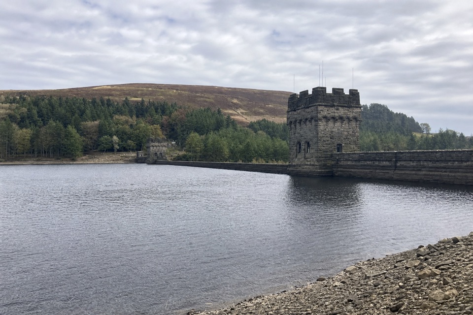
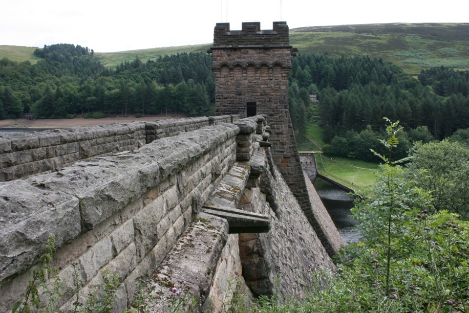
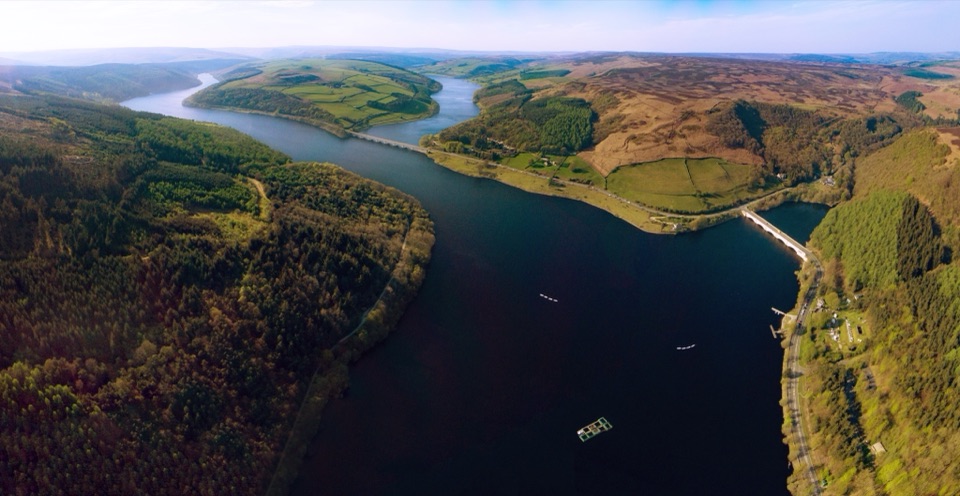
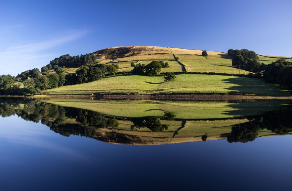
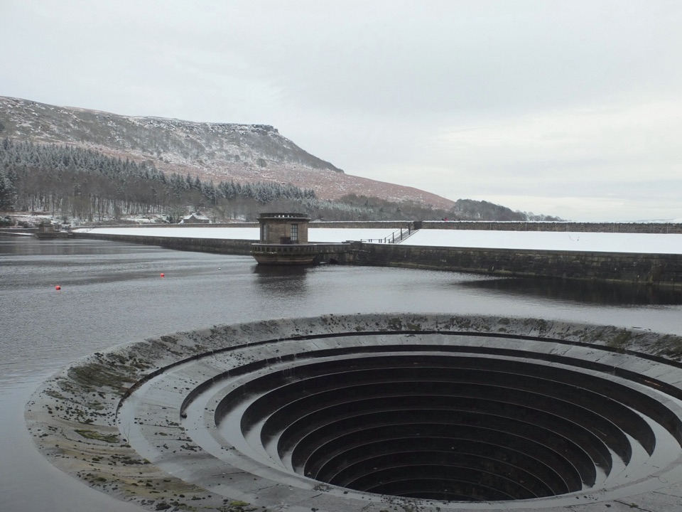
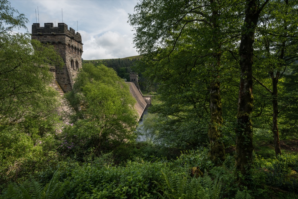
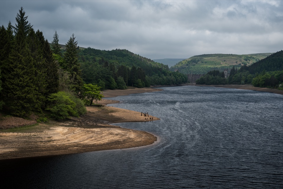
At the end, two castellated towers make this feel like a destination, not just a reservoir stroll. The lower approach brings you close to the masonry and spillway, while the upper path gives a different angle over the water. RAF 617 Squadron practised its bouncing-bomb attacks here before the 1943 raid on the Ruhr dams. For a phone photo, include one tower, the second tower and the wooded reservoir valley.

Starting pointUse Fairholmes Visitor Centre and car park.

Use Fairholmes Visitor Centre and car park. It has pay-and-display parking, disabled spaces, toilets and a refreshment kiosk. The road in front of the dam is closed to non-residents, so drive to Fairholmes and walk from there.

Wildlife

Wildlife in Peak District

All Peak District wildlife maps

Sighting maps show where each species has been reported across Peak District. Wildlife moves, so no sighting is guaranteed.

Keep exploring

Near Derwent Dam Red Route

See it all on the map

Trails that start nearby

Places near the trailhead

Parkwolf’s Peak District ranking

Top-rated trails in Peak District

All 88 trails
  1. 1The Roaches and Lud’s Church Circular from Hen CloudModerate · 12.2 km
  2. 2Mam Tor Circular WalkModerate · 4.8 km
  3. 3Castleton, Mam Tor & the Great Ridge WalkModerate · 10.5 km
  4. 4Stanage Edge from HathersageModerate · 10.6 km
  5. 5Kinder Scout Circular via Jacob’s LadderChallenging · 12.1 km
  6. 6Padley Gorge and Burbage Brook WalkEasy · 3.7 km

Take Parkwolf to Peak District.

The audio tour guide for the drive, plus offline maps, trails, and wildlife heatmaps for when the signal drops.

4.7 from 8,600+ ratings

Download Parkwolf on the App StoreGet Parkwolf on Google Play