Stanage Edge in Peak District National Park

#5 of 69 sights in Peak District

Sight · Peak District National Park

Stanage Edge

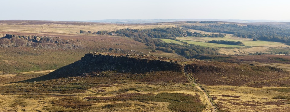
Three and a half miles of gritstone cliff above Hope Valley

Photo: Wikimedia Commons
Type
Sight
Nearest trail
2.2 km
Audio stories
5 nearby
  • Parking

Hear the audio tour

Stanage Edge

Overview

About Stanage Edge

Why stop

  • Long, continuous edge with huge moorland views
  • Exceptional climbing and bouldering variety

Heads up

  • Exposed, rocky ground and an uphill scramble
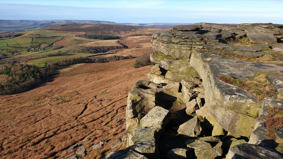
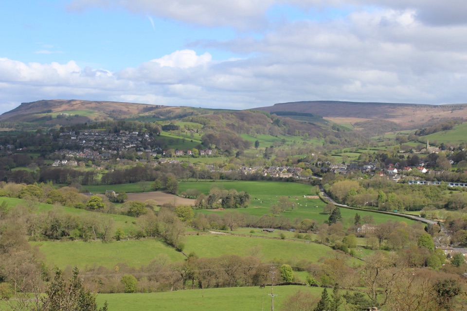
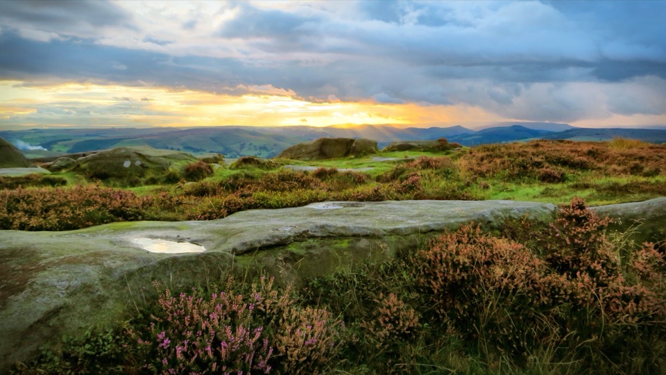
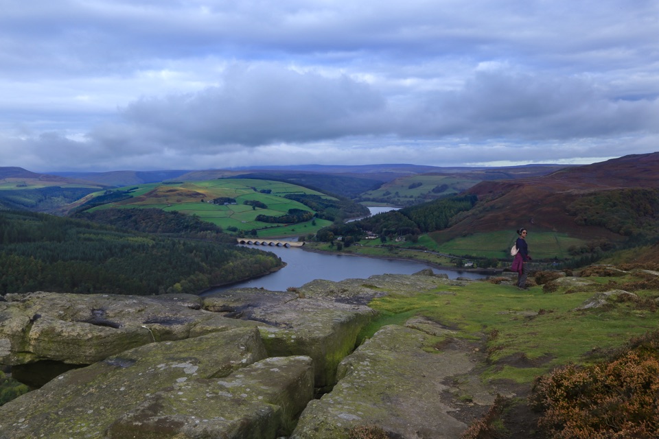
This is the long one. Where most gritstone spots in the area are a single compact tor you can walk around in ten minutes, this is a 3.5 mile escarpment running above the moors north of Hathersage, with a cliff edge you can follow for as long as your legs hold out. It is widely considered the home of rock climbing, with more than 1,200 documented climbing and bouldering routes spread along the edge and the Plantation area below it. Even if you never touch the rock, the scale is the point: layered gritstone below you, Dark Peak moorland behind, and big open views down into Hope Valley.
Parkwolf’s verdictWhy stop here

Map

Where it is

Loading the Peak District map
Full map
SightStanage Edge53.35552, -1.64235
Keep this map with you offline in the Parkwolf app

Plan your stop

Before you go

Best time to go

Early morning or late afternoon is the smart call. The low light rakes across the gritstone and makes the layering obvious, the paths are quieter, and you dodge the parking crush that builds through the middle of the day at the popular car parks. The top is genuinely exposed and windy, often noticeably colder than the car park, so bring a windproof layer even when it feels mild below.


5 active Peak District alerts

  • ClosureHooks Carr (Stanage Popular) car park closureMentions Hooks Carr, referenced in this guideHooks Carr (Stanage Popular) car park will be partially or fully closed from 6 October for four weeks.Official details
  • ClosureA54 Cat and Fiddle road closureThe A54 Macclesfield Main Road (Cat and Fiddle) is fully closed to all traffic from 27 July through 30 October 2026 during phase 1 improvement works.Official details
See all 5 alerts
A park ranger sits on a dash-mounted phone, talking, as Parkwolf’s Tour Guide plays “Army Cutworm Moths: A Grizzly Bear Buffet” on Grand Loop Road below Dunraven Pass in Yellowstone
Parkwolf Tour GuideThe highest, rockiest slopes around here are a summer buffet for grizzly bears.

Peak District Tour Guide

Your drive to Stanage Edge, narrated.

Parkwolf is a GPS audio tour guide for Peak District National Park. As you drive, it chimes in with what’s ahead: hidden gems, upcoming stops, history, geology, and wildlife, right through your car’s speakers.

Recorded for this place

Stanage Edge
0:00 / 0:26
“You're coming up on Stanage Edge, a long gritstone cliff above the Hope Valley with more than twelve hundred climbing and bouldering routes.”

Plays as you drive up to Stanage Edge in the Parkwolf Peak District Tour Guide.

More stories near here in the app

  • Redmires Reservoir and Moorland Walks
  • Higger Tor and Carl Wark
  • Hathersage Village, Pool and Stories
  • The House Behind Thornfield
  • 298 audio storiesacross Peak District’s roads, triggered by GPS as you drive
  • Wildlife heatmapsfor Red Deer, Red Fox, Eurasian Otter, and 13 more
  • Works offlinemaps, 88 trails, 76 places, and audio download before you lose signal
  • CarPlay readysimple controls built for the drive
★★★★★
“Fantastic app with many points of information… It’s great to just turn on while you’re driving and it gives you an audio tour of the national Park. We love it!!!!”
JMJamesApp Store review
Download Parkwolf on the App StoreGet Parkwolf on Google Play

4.7 from 8,600+ ratings

Guide

More about Stanage Edge

What it actually feels likeA walk, not a viewpoint.
  • A walk, not a viewpoint. You park, you climb up, and then you choose how far along the top to go. The edge keeps unfolding, so people often walk further than they planned.
  • Weathered blocks and slabs at the top, cracked and rounded, good for sitting on and looking out from.
  • Climbers and walkers together. On decent days you will see ropes below and boots above, and the two coexist happily.
  • The wider Stanage-North Lees Estate (542 hectares) carries a durable Pride and Prejudice filming association, which is worth knowing if you are pairing the edge with a drive around the estate.
Getting up thereHollin Bank and Hooks Carr are the main car parks, with smaller access at Dennis Knoll and…
  • Hollin Bank and Hooks Carr are the main car parks, with smaller access at Dennis Knoll and Upper Burbage. Hooks Carr is the one people mention for convenience.
  • Officially it is around 20 to 30 minutes on foot from the car parks to the edge, with short scrambling where you meet the rocks.
  • There are no formal or surfaced paths and the terrain is rugged. No accessible routes are available and pushchairs are not recommended.
  • Wear sturdy, grippy footwear. Gritstone is superb underfoot when dry and slick when wet, and the approach is stony and uneven.
  • Dogs on leads. No wild camping, no barbecues or fires. There is a picnic site on the estate.
Toilets and food, preciselyPublic toilets are about 250m east of Hollin Bank car park, on The Dale road.

Public toilets are about 250m east of Hollin Bank car park, on The Dale road. There are no visitor facilities on top of the edge and no permanent food or drink at the main car parks, so sort out water and snacks before you climb. Hathersage is roughly 10 minutes by car from the estate and is where you go for a proper meal or a coffee afterwards.

Things to know before you commitParking fills early on fine days and weekends. Have a second car park in mind.
  • Parking fills early on fine days and weekends. Have a second car park in mind.
  • There is an uphill pull to reach the edge, then a walk along the top. It is not a step out of the car and look.
  • Ring ouzels arrive from North Africa in late March or early April and stay until late summer, nesting among rocks and vegetation. Some climbing routes can carry temporary signed restrictions, so read the signs on the day rather than assuming. Sightings are never a given.
  • If you want a short, tidy, surfaced stroll to a single rock formation, this is not that. If you want distance, exposure and a proper edge to follow, it is hard to beat.

Wildlife

Wildlife in Peak District

All Peak District wildlife maps

Sighting maps show where each species has been reported across Peak District. Wildlife moves, so no sighting is guaranteed.

Keep exploring

Near Stanage Edge

See it all on the map

Trails nearby

More stops nearby

Parkwolf’s Peak District ranking

Top sights in Peak District

All 76 places
  1. 1Chatsworth HouseSight
  2. 2Mam TorSight
  3. 3Dovedale Stepping StonesSight
  4. 4Ladybower ReservoirSight
  5. 6Kinder ScoutSight
  6. 7CastletonSight

Take Parkwolf to Peak District.

The audio tour guide for the drive, plus offline maps, trails, and wildlife heatmaps for when the signal drops.

4.7 from 8,600+ ratings

Download Parkwolf on the App StoreGet Parkwolf on Google Play