False Klamath Cove in Redwood National Park

Beach · Redwood National Park

False Klamath Cove

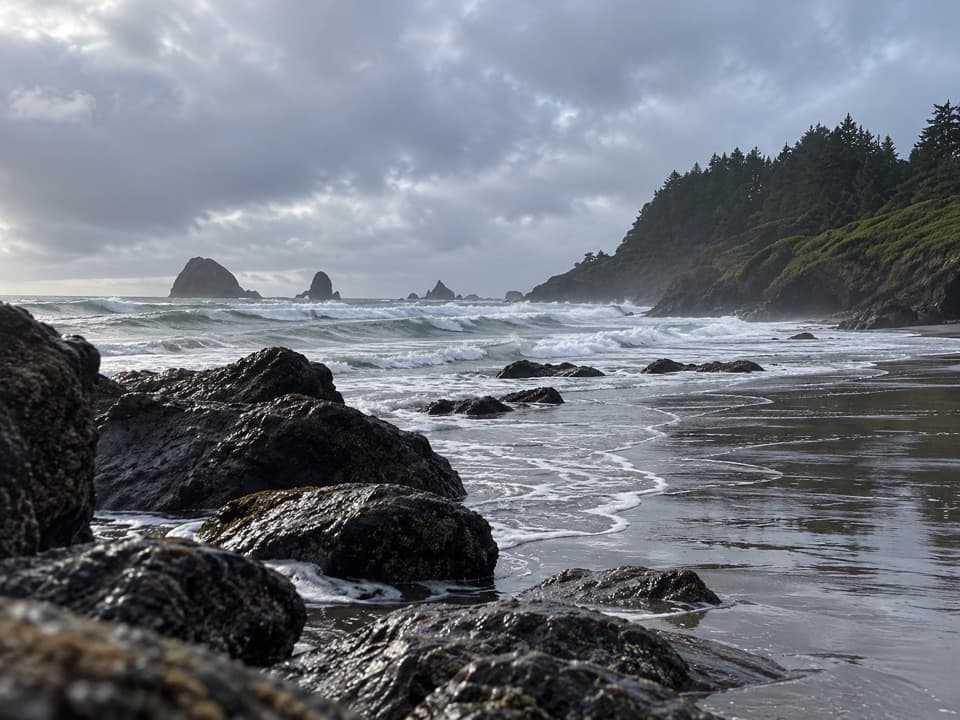
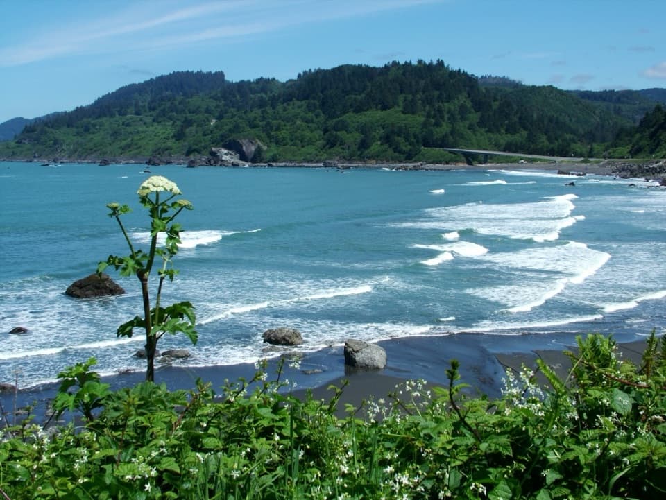
Low tide opens a rocky cove of pools, driftwood, and offshore stacks.

Photo: National Park Service
Type
Beach
Nearest trail
0.4 mi
Audio stories
4 nearby
  • Parking
  • Exhibit

Hear the audio tour

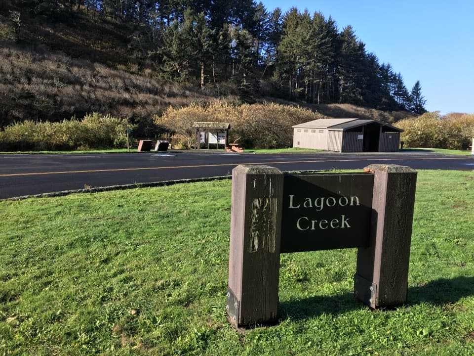
Lagoon Creek and Hidden Beach

Overview

About False Klamath Cove

Why stop

  • Low-tide pools, dark sand and offshore rocks make this more than a quick coast pullout.

Heads up

  • The steep, rocky shore and cold, rough water make swimming unsafe.
  • The designated highway pullout serves southbound traffic only.

Map

Where it is

Loading the Redwood map
Full map
BeachFalse Klamath Cove41.59912, -124.10543
Keep this map with you offline in the Parkwolf app

Plan your stop

Before you go

6 active Redwood alerts

  • CautionU.S. 101 construction traffic controlsExpect construction-related traffic stops and one-way controlled traffic on U.S. 101; allow extra time and drive cautiously. - NPS reports multiple stops between Orick and Crescent City; delays vary.Official details
  • CautionU.S. 199 construction traffic controlsExpect 24/7 one-way controlled traffic on three U.S. 199 segments because of construction. - 6–6.2 miles north of Gasquet: through 6:00 p.m. December 15, 2026; delays up to 10 minutes. - 9.6–9.Official details

See all 6 alerts
A park ranger sits on a dash-mounted phone, talking, as Parkwolf’s Tour Guide plays “Army Cutworm Moths: A Grizzly Bear Buffet” on Grand Loop Road below Dunraven Pass in Yellowstone
Parkwolf Tour GuideThe highest, rockiest slopes around here are a summer buffet for grizzly bears.

Redwood Tour Guide

Your drive to False Klamath Cove, narrated.

Parkwolf is a GPS audio tour guide for Redwood National Park. As you drive, it chimes in with what’s ahead: hidden gems, upcoming stops, history, geology, and wildlife, right through your car’s speakers.

See the Redwood audio tour

Recorded for this place

Lagoon Creek and Hidden Beach
0:00 / 0:30
“You're approaching Lagoon Creek, the starting point for a walk to Hidden Beach.”

Plays as you drive up to False Klamath Cove in the Parkwolf Redwood Tour Guide.

More stories near here in the app

  • Wilson Creek and the DeMartin Coastal Trail
  • Trees of Mystery
  • Ocean Floor Beneath the Forest
  • How a Sea Star Eats a Mussel
  • 85 audio storiesacross Redwood’s roads, triggered by GPS as you drive
  • Wildlife heatmapsfor Black Bear, Elk, California Condor, and 13 more
  • Works offlinemaps, 83 trails, 48 places, and audio download before you lose signal
  • CarPlay readysimple controls built for the drive
★★★★★
“Fantastic app with many points of information… It’s great to just turn on while you’re driving and it gives you an audio tour of the national Park. We love it!!!!”
JMJamesApp Store review
Download Parkwolf on the App StoreGet Parkwolf on Google Play

4.7 from 8,600+ ratings

Guide

More about False Klamath Cove

A dark, rocky beachFalse Klamath Cove is a roughly half-mile stretch of Pacific shore beside U.S.

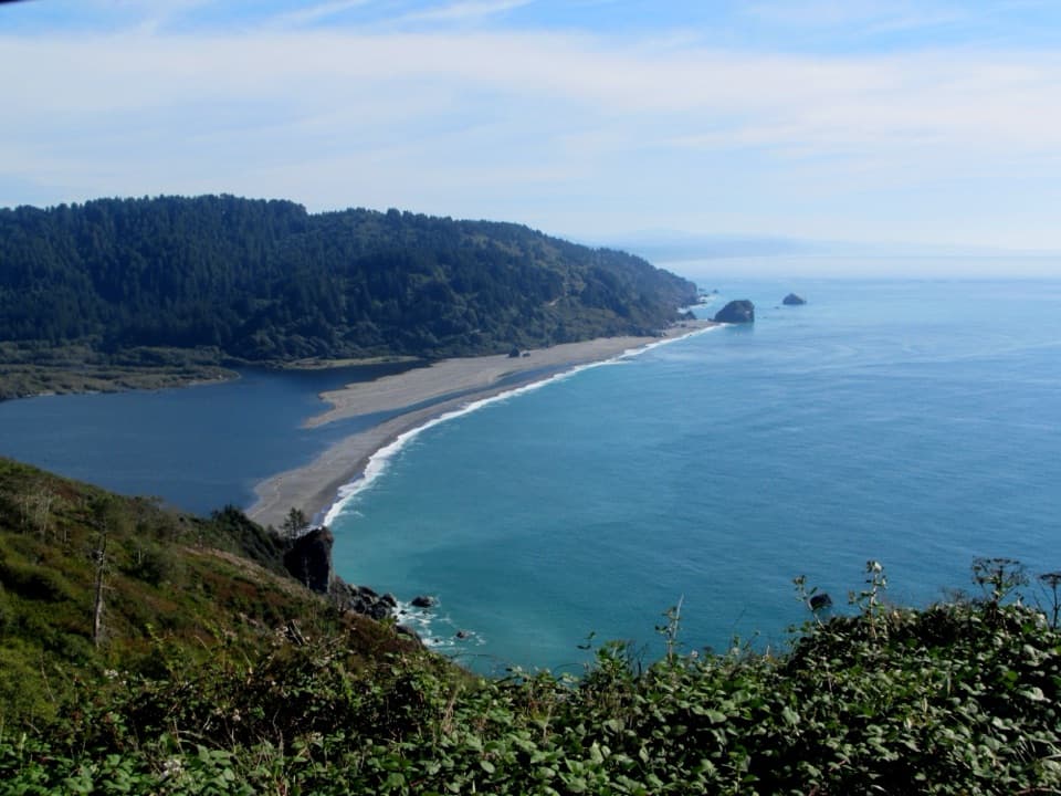
False Klamath Cove is a roughly half-mile stretch of Pacific shore beside U.S. 101, between Klamath and Crescent City. Dark gray sand mixes with cobbles, boulders and exposed bedrock, and the beach slopes steeply. Think rugged shoreline walk, tidepools and surf watching, not a soft-sand swimming stop.

Reach it in the right directionThe designated highway pullout is for southbound traffic only; northbound drivers cannot enter…

The designated highway pullout is for southbound traffic only; northbound drivers cannot enter it, and both entering and leaving call for care. The pullout has parking and signs about local marine life. Food, drinking water and restrooms are not listed for this specific stop.

Go at low tideLow tide can reveal tidepools in the northern part of the cove when sea conditions cooperate.

Low tide can reveal tidepools in the northern part of the cove when sea conditions cooperate. The shore is uneven, and wet rocks are slippery, so keep an eye on the waves and leave yourself room to turn back. Swimming is unsafe here because of the steep rocky beach, rough seas and very cold water.

A living intertidal shoreThis shoreline is in Yurok ancestral territory.

This shoreline is in Yurok ancestral territory. Long-term intertidal surveys began here in 2004; the rocky shore they monitor includes acorn barnacles, California mussels, rockweeds and ochre sea stars. Cormorants and pelicans fish in the surf, and bald eagles are occasionally seen over the water.

The offshore rookeryFalse Klamath Rock supports a rookery of nearly 45,000 birds across at least eight species.

False Klamath Rock supports a rookery of nearly 45,000 birds across at least eight species. A 300-foot special-closure buffer protects the rock each year from March 1 through August 31, so keep out of the closure area during that season.

A photo with the whole cove in itFrom the beach, put dark sand or driftwood in the foreground and include the surf and offshore…

From the beach, put dark sand or driftwood in the foreground and include the surf and offshore rocks beyond. That gives a phone photo more sense of the cove's shape than a frame filled only with water.

Wildlife

Wildlife in Redwood

All Redwood wildlife maps

Sighting maps show where each species has been reported across Redwood. Wildlife moves, so no sighting is guaranteed.

Parkwolf’s Redwood ranking

Top sights in Redwood

All 48 places
  1. 1Fern CanyonSight
  2. 2Stout Memorial GroveSight
  3. 3Big Tree WaysideSight
  4. 4Lady Bird Johnson GroveSight
  5. 5Grove of TitansSight
  6. 6Tall Trees GroveSight

Take Parkwolf to Redwood.

The audio tour guide for the drive, plus offline maps, trails, and wildlife heatmaps for when the signal drops.

4.7 from 8,600+ ratings

Download Parkwolf on the App StoreGet Parkwolf on Google Play