West Ridge Trail in Redwood National Park

Redwood National Park, CA

West Ridge Trail

Seven miles of redwood ridge, steep climbs, and a Coastal Trail finish.

Photo: Flickr
Length
7mi
Time
4.5hr
Elev. change
804ft
Difficulty
Moderate
  • No dogs
  • High point 864 ft
  • #30 of 83 in Redwood

Hear the audio tour

Prairie Creek Visitor Center and Elk Prairie

Overview

About West Ridge Trail

Why go

  • A varied old-growth traverse from a creek valley to an elevated redwood ridge.
  • Multiple trail junctions make shorter loops and longer connections possible.

Heads up

  • Steep climbs at both ends and repeated ups and downs across the ridge.
  • The seven-mile point-to-point route needs a planned return or connection.

Map & elevation

The route

Loading the Redwood map
Full map
Elevation60–864 ft
TrailheadPrairie Creek Visitor Center41.36399, -124.02316
Keep this map with you offline in the Parkwolf app

Plan your hike

Before you go

Parking

Use Prairie Creek Visitor Center parking on Newton B. Drury Scenic Parkway; the signed West Ridge trailhead is behind the center. The parkway closes to vehicles on the first Saturday of each month from October through May for Hike and Bike, so check event-day access before driving.

Safety

Steep grades and switchbacks at both ends, with more climbing and descending along the ridge. The north end is a Coastal Trail junction, not the starting lot; plan a return or trail connection. Dogs are prohibited on park trails.

6 active Redwood alerts

  • ClosureJames Irvine, Miners Ridge and Dolason Prairie trail restrictionsMentions James Irvine, referenced in this guideConstruction, downed trees and a bridge failure restrict three trails; plan alternate routes and obey closures.Official details
  • CautionU.S. 101 construction traffic controlsExpect construction-related traffic stops and one-way controlled traffic on U.S. 101; allow extra time and drive cautiously. - NPS reports multiple stops between Orick and Crescent City; delays vary.Official details
See all 6 alerts
A park ranger sits on a dash-mounted phone, talking, as Parkwolf’s Tour Guide plays “Army Cutworm Moths: A Grizzly Bear Buffet” on Grand Loop Road below Dunraven Pass in Yellowstone
Parkwolf Tour GuideThe highest, rockiest slopes around here are a summer buffet for grizzly bears.

Redwood Tour Guide

Your drive to West Ridge Trail, narrated.

Parkwolf is a GPS audio tour guide for Redwood National Park. As you drive, it chimes in with what’s ahead: hidden gems, upcoming stops, history, geology, and wildlife, right through your car’s speakers.

See the Redwood audio tour

Recorded for this trailhead

Prairie Creek Visitor Center and Elk Prairie
0:00 / 0:35
“You're coming up on Prairie Creek Visitor Center and Elk Prairie, a good stop for forest history and a chance to see Roosevelt elk grazing in the meadow.”

Plays as you drive up to this trailhead in the Parkwolf Redwood Tour Guide.

More stories near here in the app

  • Cal Barrel Road and Foothill Trail
  • Big Tree Wayside
  • Corkscrew Tree
  • Find the Wren by Ear
  • 85 audio storiesacross Redwood’s roads, triggered by GPS as you drive
  • Wildlife heatmapsfor Black Bear, Elk, California Condor, and 13 more
  • Works offlinemaps, 83 trails, 48 places, and audio download before you lose signal
  • CarPlay readysimple controls built for the drive
★★★★★
“Fantastic app with many points of information… It’s great to just turn on while you’re driving and it gives you an audio tour of the national Park. We love it!!!!”
JMJamesApp Store review
Download Parkwolf on the App StoreGet Parkwolf on Google Play

4.7 from 8,600+ ratings

Trail guide

Hiking West Ridge Trail

The full trailWest Ridge Trail is a roughly 7-mile point-to-point hike from Prairie Creek Visitor Center to…

West Ridge Trail is a roughly 7-mile point-to-point hike from Prairie Creek Visitor Center to its northern junction with the Coastal Trail. It runs nearly the length of Newton B. Drury Scenic Parkway, climbing from a creek valley into old-growth redwood uplands, following an undulating ridge, then descending toward the coast-side trails. Treat 7 miles as one way. The mapped line is 7.1 miles, and published figures range from 6.8 to 7.2 miles. That is a reasonable rounding spread for the same traverse. This is not the West Ridge–Karl Knapp loop: that shorter walk turns off at Zig Zag Trail #1 after about 2.2 miles on West Ridge and returns through the creek valley.

Plan the finish firstStart behind the Visitor Center and cross the large bridge over Prairie Creek.

Start behind the Visitor Center and cross the large bridge over Prairie Creek. The northern end meets the Coastal Trail, not the starting parking lot. Allow about 4 to 5 hours for the one-way route; that estimate reflects seven miles, roughly 1,300 feet of ascent and descent, and repeated climbs. If you simply retrace the route, expect about 14 miles and another full round of the steep sections. A separate 12.5-mile loop links West Ridge with James Irvine and Friendship Ridge if you want to return to the Visitor Center on other trails. The northern junction is remote; no direct road pickup was verified, so map your connection or turnaround before setting out.

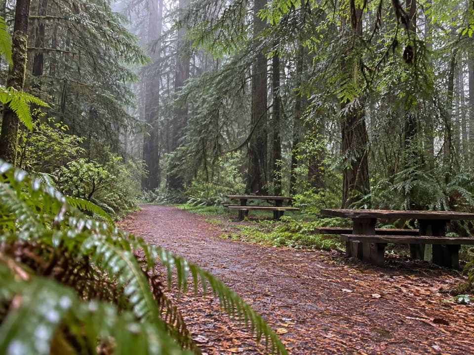
Climb out of the creek valleyThe opening stretch follows Godwood Creek through a broad, shallow valley of large redwoods.

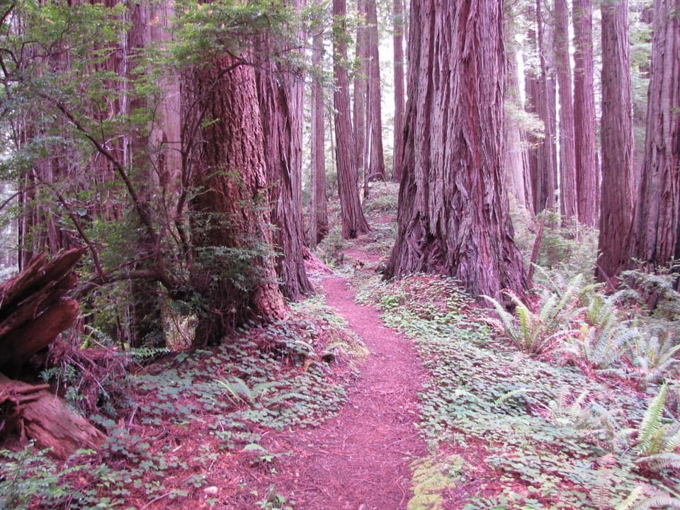
The opening stretch follows Godwood Creek through a broad, shallow valley of large redwoods. At a bench, West Ridge turns sharply uphill. The first two or three switchbacks look down over the big trees below, one of the route’s best places to compose a photo with both tread and canopy in frame. The climb enters a small glen, then a dense upland stand where the trees are smaller and the scenery is less varied for about a mile.

The ridge keeps changingFarther along, the redwoods grow larger again, and a wide saddle holds especially big trees.

Farther along, the redwoods grow larger again, and a wide saddle holds especially big trees. Huckleberry shrubs line the trail. Don’t expect a level walk just because the route follows a ridge: it rises and dips repeatedly, with several steep sections. The hardest climbs and descents come near both ends; the middle is more rolling but still takes work. The trail parallels the parkway for much of its length, so traffic can be heard in some stretches; that sound usually fades farther north.

Use the trail connectionsZig Zag Trails 1 and 2, Cathedral Trees, and Butler Creek provide access to other park walks,…

Zig Zag Trails #1 and #2, Cathedral Trees, and Butler Creek provide access to other park walks, so you can build a shorter loop or a longer traverse. The long James Irvine–West Ridge–Friendship Ridge circuit is a different hike from this seven-mile point-to-point segment. Plan the exact junctions before starting, especially if you need to return to your car; the marked endpoint is at the Coastal Trail connection.

Access and rulesThe signed West Ridge start is behind Prairie Creek Visitor Center.

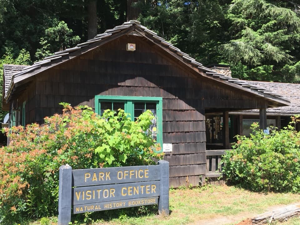
The signed West Ridge start is behind Prairie Creek Visitor Center. The center has redwood ecology and Civilian Conservation Corps exhibits, park information, and a bookstore beside the trail. Dogs are not allowed on national or state park trails. On the first Saturday of each month from October through May, Newton B. Drury Scenic Parkway closes to vehicles for the park’s Hike and Bike event, so check event-day access before driving to the Visitor Center.

Wildlife

Wildlife in Redwood

All Redwood wildlife maps

Sighting maps show where each species has been reported across Redwood. Wildlife moves, so no sighting is guaranteed.

Keep exploring

Near West Ridge Trail

See it all on the map

Trails that start nearby

Places near the trailhead

Parkwolf’s Redwood ranking

Top-rated trails in Redwood

All 83 trails
  1. 1Fern Canyon Loop TrailModerate · 1 mi
  2. 2Miners Ridge and James Irvine LoopChallenging · 12 mi
  3. 3Boy Scout Tree TrailModerate · 5.6 mi
  4. 4Stout Memorial Grove TrailEasy · 0.6 mi
  5. 5Grove of Titans TrailEasy · 1.8 mi
  6. 6Tall Trees TrailChallenging · 3.7 mi

Take Parkwolf to Redwood.

The audio tour guide for the drive, plus offline maps, trails, and wildlife heatmaps for when the signal drops.

4.7 from 8,600+ ratings

Download Parkwolf on the App StoreGet Parkwolf on Google Play