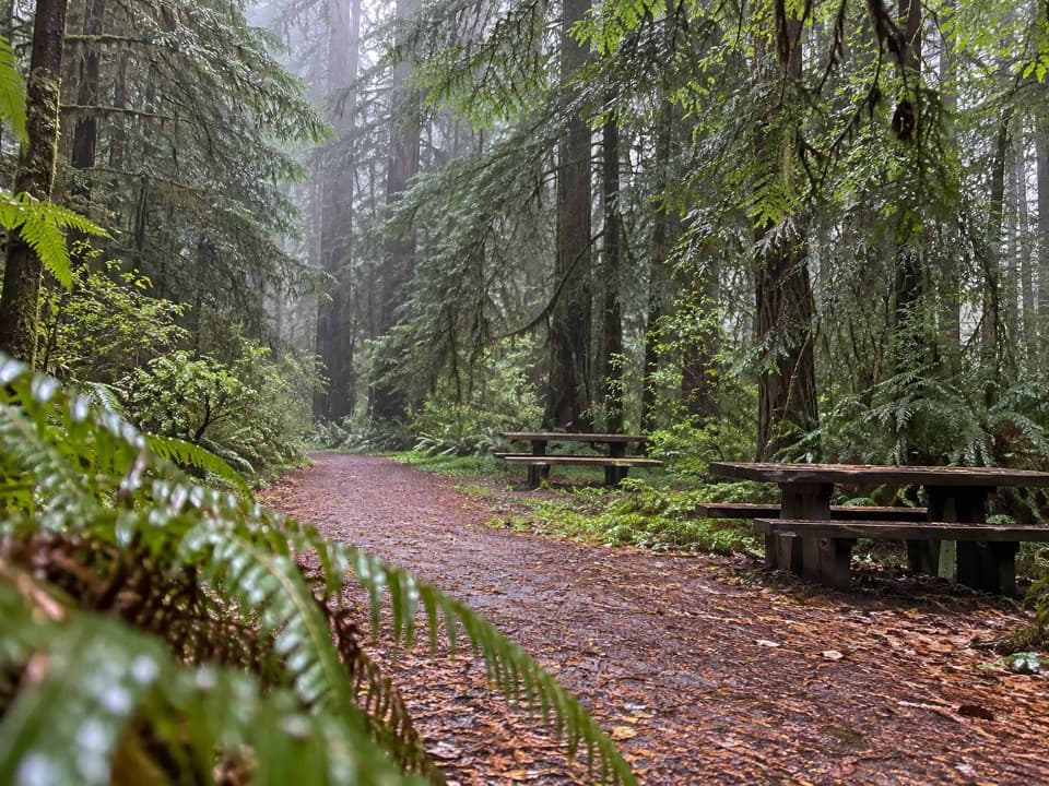
Karl Knapp Trail in Redwood National Park

Redwood National Park, CA

Karl Knapp Trail

A gentle creek walk with a tunnel through a fallen redwood.

Photo: National Park Service
Length
2.4mi
Time
1.5hr
Elev. change
60ft
Difficulty
Easy
  • No dogs
  • High point 215 ft
  • #11 of 83 in Redwood

Hear the audio tour

Prairie Creek Visitor Center and Elk Prairie

Overview

About Karl Knapp Trail

Why go

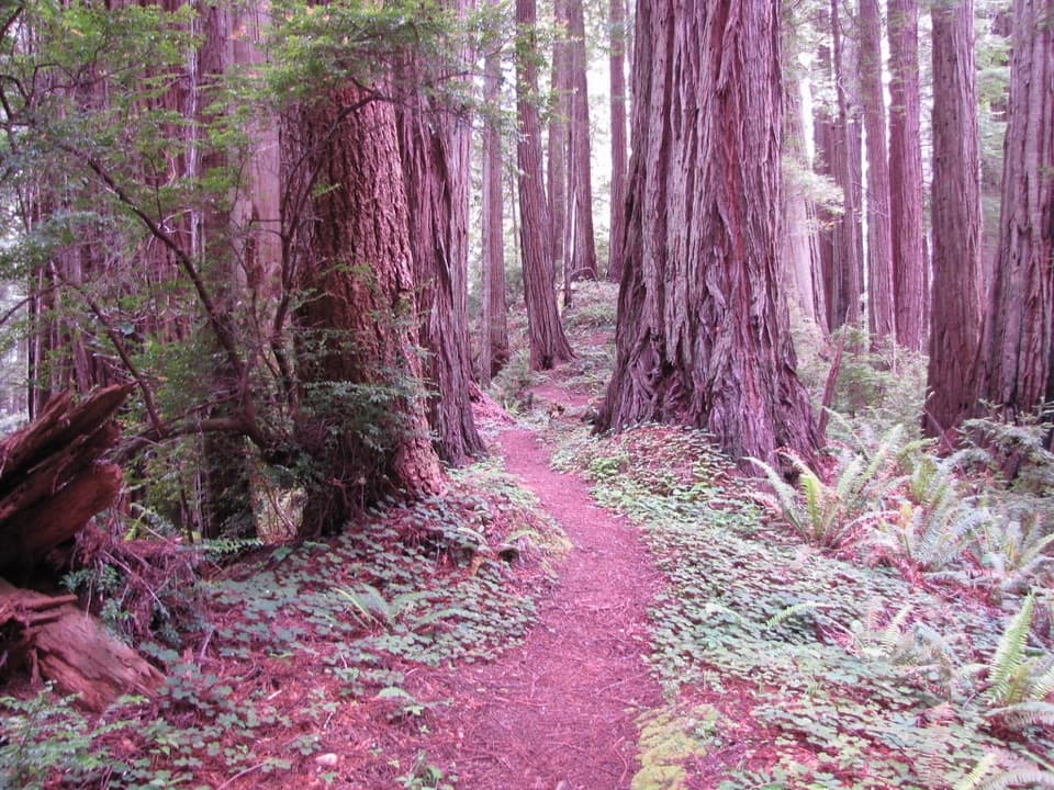
  • Old-growth redwoods, creek bridges and a distinctive fallen-tree tunnel.
  • The visitor-center section is designated accessible and mostly gentle.

Heads up

  • The defined 2.38-mile outing retraces the same route; the loop adds trail segments and road crossings.

Map & elevation

The route

Loading the Redwood map
Full map
Elevation154–215 ft
TrailheadPrairie Creek Visitor Center / Karl Knapp Trailhead41.36422, -124.02330
Keep this map with you offline in the Parkwolf app

Plan your hike

Before you go

Parking

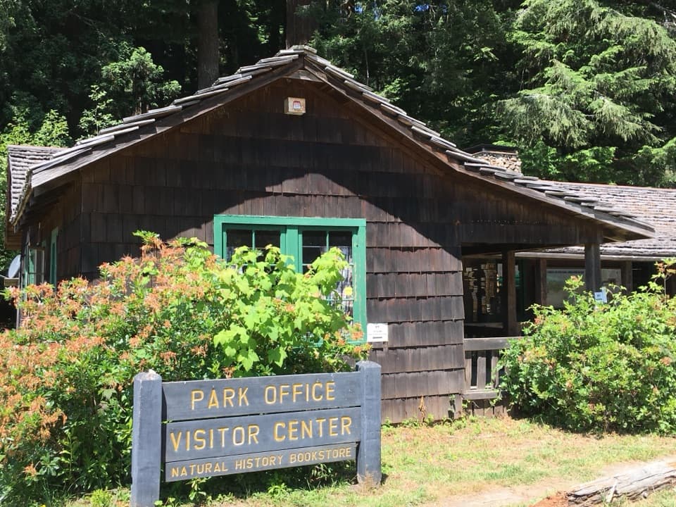
Start at Prairie Creek Visitor Center, beside the Karl Knapp trailhead. It has accessible spaces and RV/bus parking. Parking close to the trailhead can be difficult in summer; additional RV and trailer parking is along the Elk Prairie section of Newton B. Drury Scenic Parkway.

Safety

Armored crossings can carry water over the trail during rain. Pets are prohibited on park trails; service animals are allowed.

6 active Redwood alerts

  • CautionU.S. 101 construction traffic controlsExpect construction-related traffic stops and one-way controlled traffic on U.S. 101; allow extra time and drive cautiously. - NPS reports multiple stops between Orick and Crescent City; delays vary.Official details
  • CautionU.S. 199 construction traffic controlsExpect 24/7 one-way controlled traffic on three U.S. 199 segments because of construction. - 6–6.2 miles north of Gasquet: through 6:00 p.m. December 15, 2026; delays up to 10 minutes. - 9.6–9.Official details
See all 6 alerts
A park ranger sits on a dash-mounted phone, talking, as Parkwolf’s Tour Guide plays “Army Cutworm Moths: A Grizzly Bear Buffet” on Grand Loop Road below Dunraven Pass in Yellowstone
Parkwolf Tour GuideThe highest, rockiest slopes around here are a summer buffet for grizzly bears.

Redwood Tour Guide

Your drive to Karl Knapp Trail, narrated.

Parkwolf is a GPS audio tour guide for Redwood National Park. As you drive, it chimes in with what’s ahead: hidden gems, upcoming stops, history, geology, and wildlife, right through your car’s speakers.

See the Redwood audio tour

Recorded for this trailhead

Prairie Creek Visitor Center and Elk Prairie
0:00 / 0:35
“You're coming up on Prairie Creek Visitor Center and Elk Prairie, a good stop for forest history and a chance to see Roosevelt elk grazing in the meadow.”

Plays as you drive up to this trailhead in the Parkwolf Redwood Tour Guide.

More stories near here in the app

  • Cal Barrel Road and Foothill Trail
  • Big Tree Wayside
  • Corkscrew Tree
  • Find the Wren by Ear
  • 85 audio storiesacross Redwood’s roads, triggered by GPS as you drive
  • Wildlife heatmapsfor Black Bear, Elk, California Condor, and 13 more
  • Works offlinemaps, 83 trails, 48 places, and audio download before you lose signal
  • CarPlay readysimple controls built for the drive
★★★★★
“Fantastic app with many points of information… It’s great to just turn on while you’re driving and it gives you an audio tour of the national Park. We love it!!!!”
JMJamesApp Store review
Download Parkwolf on the App StoreGet Parkwolf on Google Play

4.7 from 8,600+ ratings

Trail guide

Hiking Karl Knapp Trail

A short creekside out-and-backKarl Knapp Trail is a 2.

Karl Knapp Trail is a 2.38-mile out-and-back from Prairie Creek Visitor Center, following the same creekside path for 1.19 miles each way. It is a gentle walk through old-growth redwoods with only a modest climb; allow about an hour and a half. This route covers the clearly measured visitor-center section and returns the way it came.

Prairie Creek and the redwoodsThe path runs north beside Prairie Creek and crosses it on bridges.

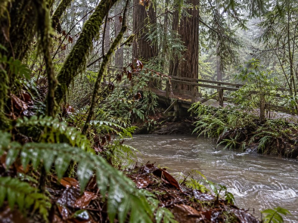
The path runs north beside Prairie Creek and crosses it on bridges. Pause on a bridge to look into the water; Coho salmon may be spawning here in autumn. One landmark is a fallen redwood with a tunnel cut through its trunk. Ferns and redwoods keep the walk focused on the creekside forest rather than distant views.

Surface and gradeThe trail surface is compacted aggregate, rock and wood.

The trail surface is compacted aggregate, rock and wood. Most grades are under 5%, with intermittent 5–8% stretches and one short, 12-foot section at 9%. Armored crossings can carry water over the tread during rain, which may be challenging. The visitor-center segment is designated accessible, though the mixed surface and flowing crossings will not suit every visitor.

A separate loop optionA 2.

A 2.5-mile loop follows Karl Knapp north, then returns on Foothill and a short section of Cathedral Trees. It crosses Newton B. Drury Scenic Parkway twice, so watch for traffic, and adds the Big Tree stop. Some park hiking information lists a longer 4-mile Karl Knapp corridor without stating its endpoints or whether that distance is one way or round trip; this description follows the specifically measured visitor-center out-and-back.

Starting at Prairie Creek Visitor CenterThe trailhead is beside the visitor center, which has accessible parking, RV and bus parking,…

The trailhead is beside the visitor center, which has accessible parking, RV and bus parking, restrooms, benches and maps. Parking close to the trailhead can be hard to find in summer; additional RV and trailer parking is along the Elk Prairie section of Newton B. Drury Scenic Parkway. Pets are not allowed on park trails; service animals are allowed.

Wildlife

Wildlife in Redwood

All Redwood wildlife maps

Sighting maps show where each species has been reported across Redwood. Wildlife moves, so no sighting is guaranteed.

Keep exploring

Near Karl Knapp Trail

See it all on the map

Trails that start nearby

Places near the trailhead

Parkwolf’s Redwood ranking

Top-rated trails in Redwood

All 83 trails
  1. 1Fern Canyon Loop TrailModerate · 1 mi
  2. 2Miners Ridge and James Irvine LoopChallenging · 12 mi
  3. 3Boy Scout Tree TrailModerate · 5.6 mi
  4. 4Stout Memorial Grove TrailEasy · 0.6 mi
  5. 5Grove of Titans TrailEasy · 1.8 mi
  6. 6Tall Trees TrailChallenging · 3.7 mi

Take Parkwolf to Redwood.

The audio tour guide for the drive, plus offline maps, trails, and wildlife heatmaps for when the signal drops.

4.7 from 8,600+ ratings

Download Parkwolf on the App StoreGet Parkwolf on Google Play