Finch Lake via Allenspark Trail in Rocky Mountain National Park

Rocky Mountain National Park, CO

Finch Lake via Allenspark Trail

A long forest climb reaches Finch Lake from Allenspark.

Length
7.3mi
Time
4hr
Elev. change
1,198ft
Difficulty
Moderate
  • No dogs
  • High point 10,135 ft

Hear the audio tour

Finch Lake Trailhead: The Long Walk to Pear Lake

Overview

About Finch Lake via Allenspark Trail

Why go

  • A distinct Allenspark-side approach to Finch Lake

Heads up

  • Very limited and uncertain neighborhood parking
  • A sustained high-altitude climb

Map & elevation

The route

Loading the Rocky Mountain map
Full map
Elevation8,937–10,135 ft
TrailheadAllenspark Trailhead40.19365, -105.54226
Keep this map with you offline in the Parkwolf app

Plan your hike

Before you go

Parking

Allenspark Trailhead is off Meadow Mountain Drive. No dedicated public lot was confirmed; roadside parking is limited, and no-parking/private-property signs have been reported. Confirm legal access and parking before starting; do not block driveways or enter private property.

Safety

The climb reaches above 10,000 feet; Finch Lake is about 9,910 feet. Pets are prohibited on park trails.

3 active Rocky Mountain alerts

  • ClosureOld Fall River Road closed to vehiclesOld Fall River Road is closed to motor vehicles for the season.Official details
  • ClosureSun Valley burn-area access remains closedThe area and trail west of Sun Valley Trail remain closed, including the route used for angler access to the Colorado River, because of impacts from the 2020 East Troublesome and Cameron Peak Fires;…Official details
See all 3 alerts
A park ranger sits on a dash-mounted phone, talking, as Parkwolf’s Tour Guide plays “Army Cutworm Moths: A Grizzly Bear Buffet” on Grand Loop Road below Dunraven Pass in Yellowstone
Parkwolf Tour GuideThe highest, rockiest slopes around here are a summer buffet for grizzly bears.

Rocky Mountain Tour Guide

Your drive to Finch Lake via Allenspark Trail, narrated.

Parkwolf is a GPS audio tour guide for Rocky Mountain National Park. As you drive, it chimes in with what’s ahead: hidden gems, upcoming stops, history, geology, and wildlife, right through your car’s speakers.

See the Rocky Mountain audio tour

Recorded for this area

Finch Lake Trailhead: The Long Walk to Pear Lake
0:00 / 0:23
“Finch Lake Trailhead is coming up, for a long hike to Pear Lake below Mount Copeland. Plan on twelve point eight miles round trip and eight to nine hours, with about twenty-one hundred feet of climbing.”

Plays on the road 1.5 mi from the trailhead in the Parkwolf Rocky Mountain Tour Guide.

More stories near here in the app

  • The Fire That Turned Toward Allenspark
  • Wild Basin: A Short Walk or Ouzel Falls
  • Sandbeach Lake Trailhead and a Copeland Lake Picnic
  • The Tunnels Under the Bark
  • 79 audio storiesacross Rocky Mountain’s roads, triggered by GPS as you drive
  • Wildlife heatmapsfor Elk, Moose, Mountain Goat, and 13 more
  • Works offlinemaps, 136 trails, 88 places, and audio download before you lose signal
  • CarPlay readysimple controls built for the drive
★★★★★
“…No cell service for majority of the day but had continuous access to the app - the maps, the tour guide as you drive is amazing. Highly recommend purchasing the subscription.”
jkatnerApp Store review
Download Parkwolf on the App StoreGet Parkwolf on Google Play

4.7 from 8,600+ ratings

Trail guide

Hiking Finch Lake via Allenspark Trail

The Allenspark approachThis is an out-and-back from Allenspark Trailhead to Finch Lake via Allenspark Trail and the…

This is an out-and-back from Allenspark Trailhead to Finch Lake via Allenspark Trail and the Finch Lake–Pear Lake trail. Use 7.3 miles round trip and allow 3½–4½ hours for the GPS-mapped route; the stored path is about 3.6 miles each way. A park trail sign lists Finch Lake at 4.0 miles from this entry, so its rounded distance and the mapped line do not match exactly. The Finch Lake and Wild Basin trailheads are separate starting points with their own distances.

The climb and viewThe route climbs under timberline through dense forest, with some steep sections.

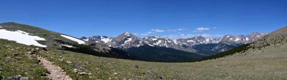
The route climbs under timberline through dense forest, with some steep sections. A granite outcrop opens a view toward Longs Peak and Mount Meeker; it is the best place to pause for the view. At the junction, turn left toward Finch Lake. The climb reaches above 10,000 feet, so the altitude adds to the effort.

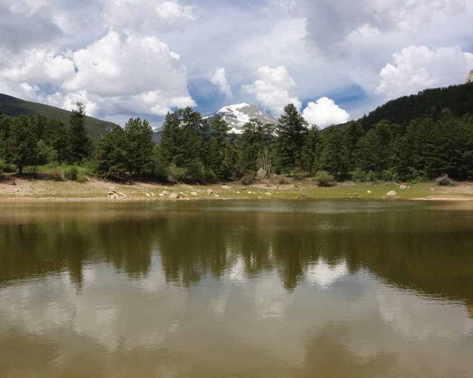
At Finch LakeFinch Lake is a shallow, high-elevation lake in thick lodgepole pine forest.

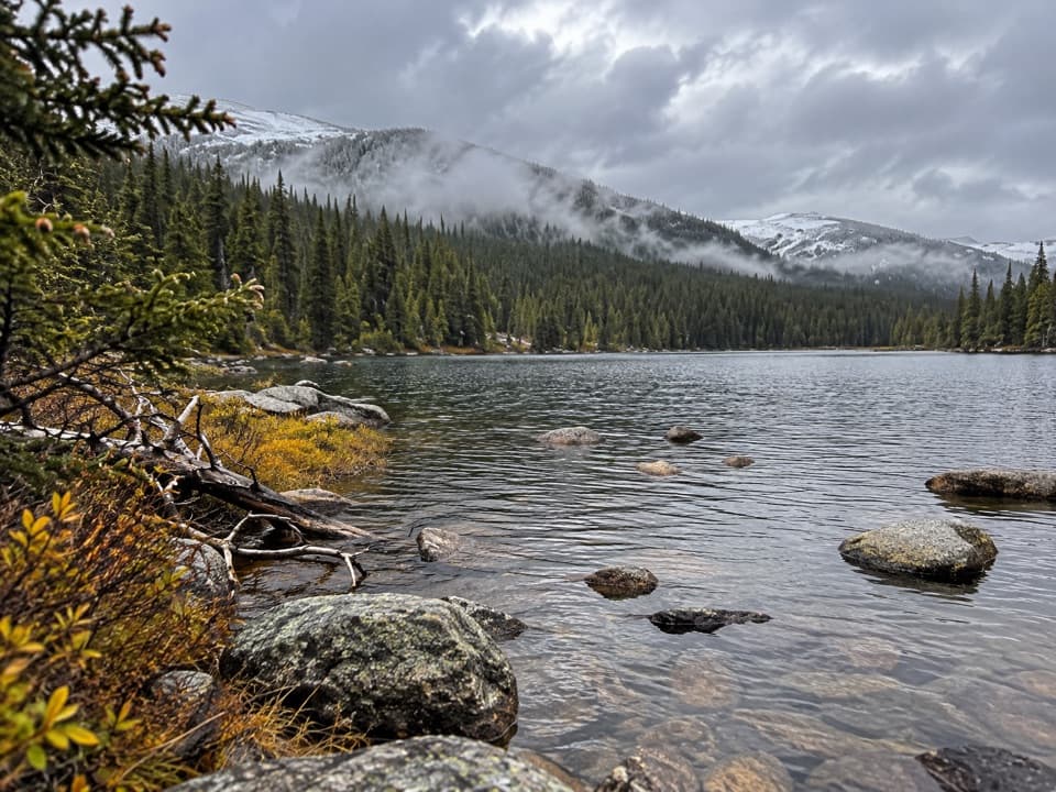
Finch Lake is a shallow, high-elevation lake in thick lodgepole pine forest. Backcountry campsites sit on its north side. The trail continues toward Pear Lake; the park sign lists that destination at 6 miles from Allenspark, making it a separate, much longer outing. Turn around at Finch Lake for the route described here.

Access and rulesAllenspark Trailhead is off Meadow Mountain Drive at the edge of a residential area.

Allenspark Trailhead is off Meadow Mountain Drive at the edge of a residential area. No dedicated public lot was confirmed, and limited roadside parking plus no-parking and private-property signs have been reported. Confirm legal parking before setting out, and do not block driveways or use signed private spaces. Pets are prohibited on all Rocky Mountain National Park trails.

Wildlife

Wildlife in Rocky Mountain

All Rocky Mountain wildlife maps

Sighting maps show where each species has been reported across Rocky Mountain. Wildlife moves, so no sighting is guaranteed.

Keep exploring

Near Finch Lake via Allenspark Trail

See it all on the map

Trails that start nearby

Places near the trailhead

Parkwolf’s Rocky Mountain ranking

Top-rated trails in Rocky Mountain

All 136 trails
  1. 1Emerald Lake TrailModerate · 3.4 mi
  2. 2Sky Pond TrailChallenging · 9 mi
  3. 3Chasm Lake TrailChallenging · 8.4 mi
  4. 4Bear Lake LoopEasy · 0.6 mi
  5. 5Dream Lake TrailModerate · 2.2 mi
  6. 6Alberta Falls TrailEasy · 1.7 mi

Take Parkwolf to Rocky Mountain.

The audio tour guide for the drive, plus offline maps, trails, and wildlife heatmaps for when the signal drops.

4.7 from 8,600+ ratings

Download Parkwolf on the App StoreGet Parkwolf on Google Play