Gjósta – Vonarskarð in Vatnajökull National Park

Vatnajökull National Park

Gjósta – Vonarskarð

A remote pass where waters split between north and south Iceland.

Length
16km
Time
5.5hr
Elev. change
119m
Difficulty
Challenging
  • High point 1,053 m
Parkwolf audio tour298 stories across Vatnajökull’s roads

Overview

About Gjósta – Vonarskarð

Why go

  • Crosses the watershed between northern and southern Iceland.
  • Reaches a high-temperature geothermal landscape beneath Eggja.

Heads up

  • A challenging remote return hike with no phone or TETRA signal.
  • The start requires a 4WD highland-road approach.

Map & elevation

The route

Loading the Vatnajökull map
Full map
Elevation934–1,053 m
TrailheadGjóstuklif/Gjósta car park64.70682, -17.75474
Keep this map with you offline in the Parkwolf app

Plan your hike

Before you go

Parking

Start at the Gjóstuklif/Gjósta car park, reached by a mountain track from F910. Roads in this part of the park require 4WD, and some require a large jeep. The regional map says road access is usually open from mid-June through autumn, weather permitting.

Safety

There is no phone or TETRA signal in Vonarskarð. The route approaches high-temperature geothermal terrain; stay on the marked path and give hot ground and water space.

A park ranger sits on a dash-mounted phone, talking, as Parkwolf’s Tour Guide plays “Army Cutworm Moths: A Grizzly Bear Buffet” on Grand Loop Road below Dunraven Pass in Yellowstone
Parkwolf Tour GuideThe highest, rockiest slopes around here are a summer buffet for grizzly bears.

Vatnajökull Tour Guide

Your drive to Gjósta – Vonarskarð, narrated.

Parkwolf is a GPS audio tour guide for Vatnajökull National Park. As you drive, it chimes in with what’s ahead: hidden gems, upcoming stops, history, geology, and wildlife, right through your car’s speakers.

  • 298 audio storiesacross Vatnajökull’s roads, triggered by GPS as you drive
  • Wildlife heatmapsfor Grey Seal, Harbor Seal, Caribou, and 13 more
  • Works offlinemaps, 92 trails, 75 places, and audio download before you lose signal
  • CarPlay readysimple controls built for the drive
★★★★★
“Fantastic app with many points of information… It’s great to just turn on while you’re driving and it gives you an audio tour of the national Park. We love it!!!!”
JMJamesApp Store review
Download Parkwolf on the App StoreGet Parkwolf on Google Play

4.7 from 8,600+ ratings

Trail guide

Hiking Gjósta – Vonarskarð

What this hike isN9 is a challenging highland out-and-back from the Gjóstuklif/Gjósta car park into Vonarskarð…

N9 is a challenging highland out-and-back from the Gjóstuklif/Gjósta car park into Vonarskarð and toward the Hverahlíð geothermal area. The current route page lists 8 km but does not say whether that includes a return. An older park map names the matching walk Gjósta–Vonarskarð–Gjósta, and the mapped leg is about 7.4 km, so plan on about 16 km (10 mi) round trip by retracing the route. The time estimates are 4–6 hours on the current page and 5–6 hours on the older map; allow five to six hours.

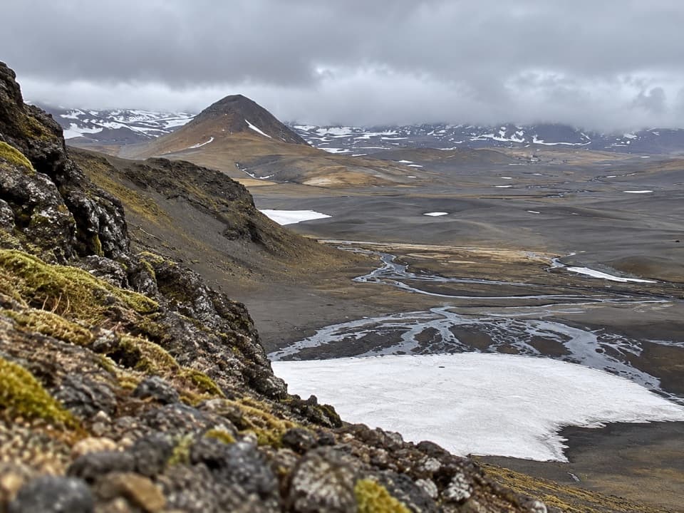
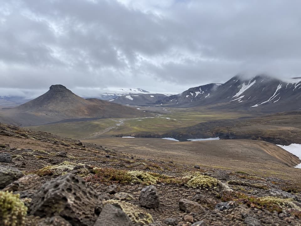
Down into VonarskarðThe marked route follows Gjóstukleif down into the pass, then continues toward Hverahlíð.

The marked route follows Gjóstukleif down into the pass, then continues toward Hverahlíð. It is a remote highland walk. The park rates it challenging, and its route notes do not spell out the footing or stream crossings, so the distance alone is a poor guide to effort. This is the Gjósta return route, not the longer crossing onward to Nýidalur.

Where the water dividesVonarskarð is the watershed between north and south Iceland.

Vonarskarð is the watershed between north and south Iceland. The sources of Skjálfandafljót and Kaldakvísl rise here; their water flows toward opposite sides of the country. That divide is the reason to look across the whole basin, not just at the trail under your feet.

Heat below EggjaHverahlíð is the high-temperature geothermal area beneath Eggja.

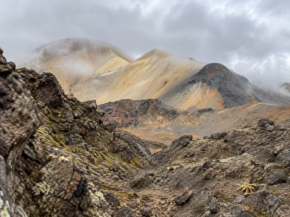
Hverahlíð is the high-temperature geothermal area beneath Eggja. The strongest activity is higher up in Hverabotn, the hollow under Eggjaskarð, and two conspicuous streams drain the slope: Varmilækur to the north and Rauðilækur to the south. Stay on the marked route around the hot ground and water.

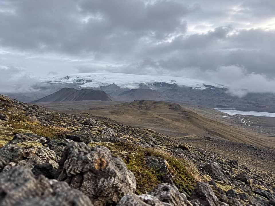
The view and the nameFrom Gjósta, the route looks toward the broad Bárðarbunga ice cap over dark volcanic ridges and…

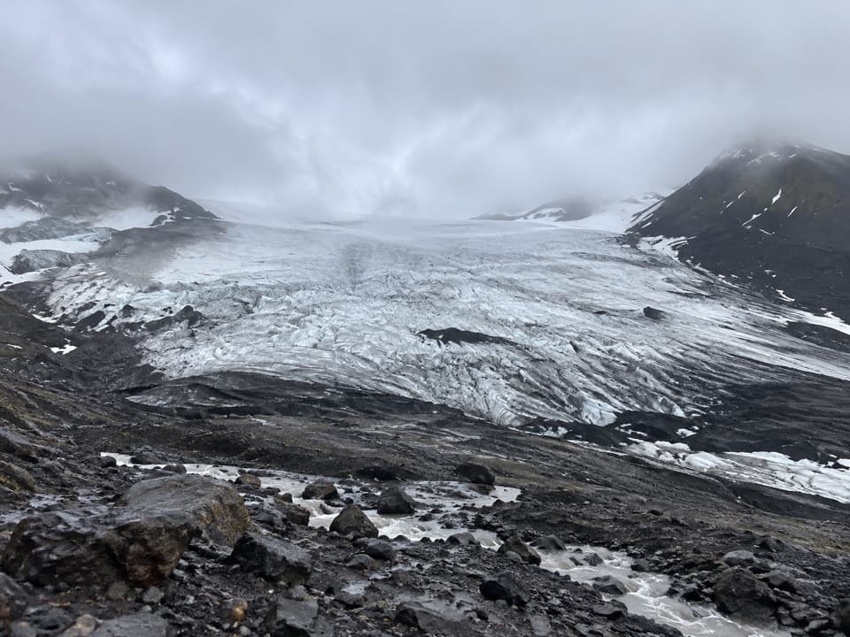
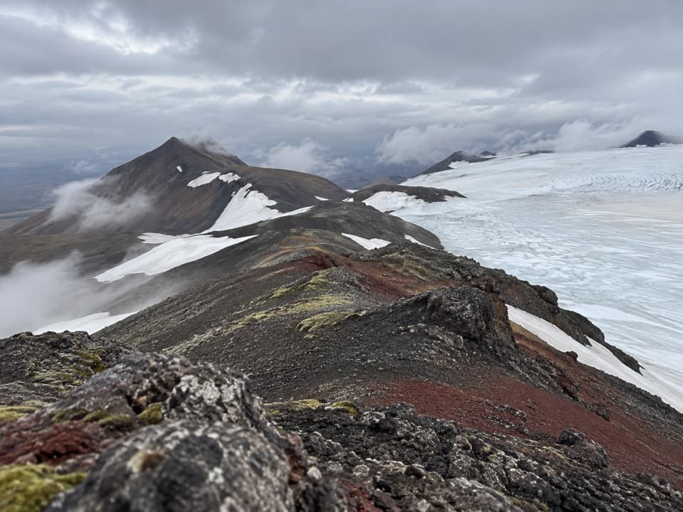
From Gjósta, the route looks toward the broad Bárðarbunga ice cap over dark volcanic ridges and barren ground. Keep some of the rocky foreground in a photo to show the scale. Vonarskarð means “Hope Pass.” A tradition links it with settler Gnúpa-Bárður, though no one can say which line he took; the earliest recorded crossing was around 1839, by Björn Gunnlaugsson.

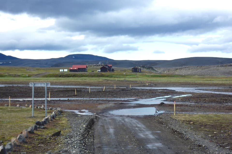
Getting to the startStart at the car park by Gjóstuklif. Reaching it means driving a mountain track from F910.

Start at the car park by Gjóstuklif. Reaching it means driving a mountain track from F910. Roads in this part of the park require a 4WD vehicle, and some need a large jeep. The regional map says they are usually open from mid-June through autumn, depending on weather. There is no phone or TETRA signal in Vonarskarð, so this is a genuinely remote outing.

Wildlife

Wildlife in Vatnajökull

All Vatnajökull wildlife maps

Sighting maps show where each species has been reported across Vatnajökull. Wildlife moves, so no sighting is guaranteed.

Parkwolf’s Vatnajökull ranking

Top-rated trails in Vatnajökull

All 92 trails
  1. 1Svartifoss–Sjónarsker–Sel Loop (S2)Moderate · 5.8 km
  2. 2Dettifoss and Selfoss – West BankEasy · 2.5 km
  3. 3Svartifoss TrailModerate · 3 km
  4. 4Skaftafellsjökull Glacier TrailEasy · 4.1 km
  5. 5Múlagljúfur Canyon TrailModerate · 3.9 km
  6. 6Kristínartindar S4 Summit CircuitChallenging · 17.9 km

Take Parkwolf to Vatnajökull.

The audio tour guide for the drive, plus offline maps, trails, and wildlife heatmaps for when the signal drops.

4.7 from 8,600+ ratings

Download Parkwolf on the App StoreGet Parkwolf on Google Play