Waiheʻe Coastal Dunes and Wetlands Refuge Trail in West Maui Scenic Drive

West Maui Scenic Drive, HI

Waiheʻe Coastal Dunes and Wetlands Refuge Trail

A level coast walk to wetlands, old heiau, and river mouth

Length
2.6mi
Time
1.8hr
Elevation
Flat
Difficulty
Easy
  • No dogs
  • High point 35 ft
  • #14 of 28 in West Maui Scenic Drive

Hear the audio tour

Waiheʻe Refuge: Wetlands and Village History

Overview

About Waiheʻe Coastal Dunes and Wetlands Refuge Trail

Why go

  • Dunes, wetlands and cultural history on one easy coastal walk
  • An optional native-plant restoration detour adds variety

Heads up

  • Little shade along the open coast
  • Route descriptions differ on the return path
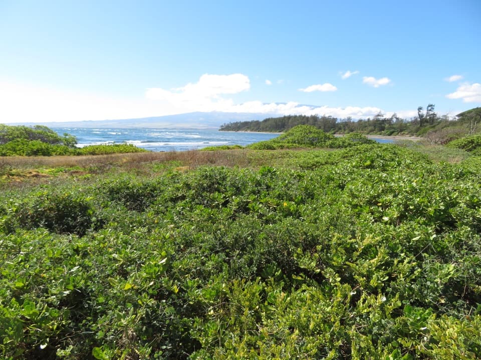
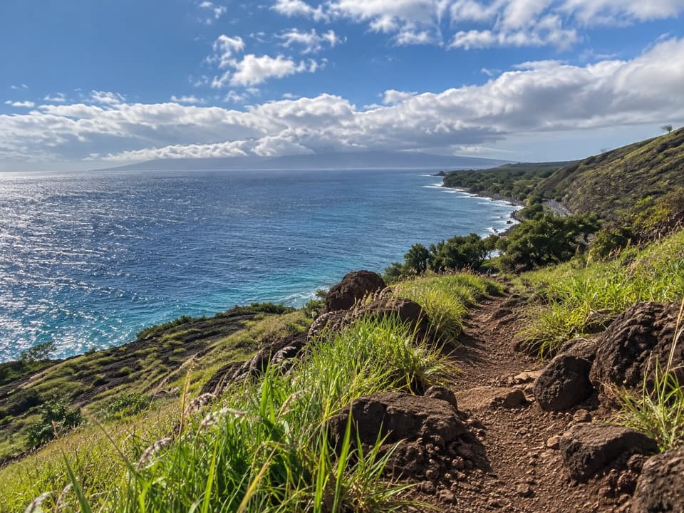
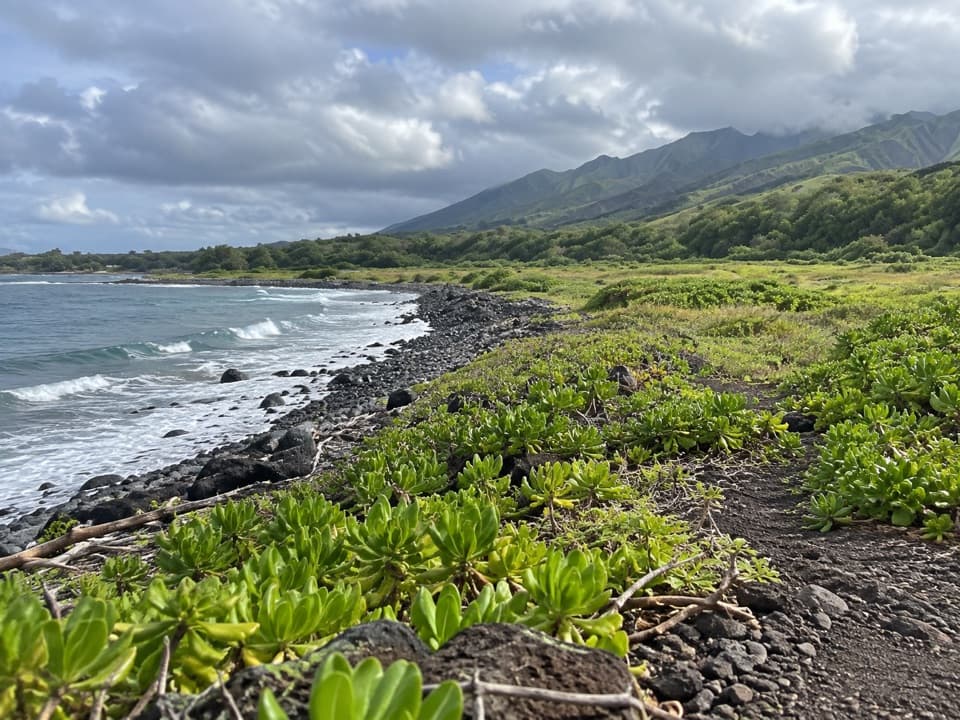
Waiheʻe Coastal Dunes and Wetlands Refuge Trail is a mostly level 2.6-mile out-and-back from the refuge entrance to the mouth of Waiheʻe River and back. It crosses low dunes, coastal wetlands and open shoreline, with no big climb to earn the view. Allow about 1.5 to 2 hours. Come for the birds, the quiet coast and the cultural landscape; sand and rounded beach stones make the walk slower than its elevation suggests.
Parkwolf’s verdictShould you walk it?

Map & elevation

The route

Loading the West Maui Scenic Drive map
Full map
Elevation9–35 ft
TrailheadWaiheʻe Refuge entrance, Halewaiu Road20.93415, -156.50454
Keep this map with you offline in the Parkwolf app

Plan your hike

Before you go

Parking

From Kahekili Highway, take Halewaiu Road toward Waiehu Golf Course and follow refuge signs. After about 0.4 mile, turn left at the refuge sign; the road ends about 0.2 mile later. Park on the grass by the refuge entrance or in the adjacent beach lot. Capacity is not confirmed.

Safety

The open shoreline has little shade, and sand and rounded cobbles can be uneven. Dogs are prohibited beyond the yellow tube gate. Some areas may close during wildlife breeding periods or to protect cultural or burial sites; follow posted boundaries. The vehicle gate on Halewaiu Road is locked at night. Do not move rocks, sand or soil or enter structures. Drinking water and restroom availability are not confirmed.

1 active West Maui Scenic Drive alert

  • CautionWest Maui daytime lane closures on Routes 30 and 340, Oct. 26–30Expect daytime single-lane closures on Route 30 near Honokōhau and Route 340 between Waiehu and Waiheʻe on scheduled weekdays Oct. 26–30; follow traffic control and allow for alternating traffic.Official details
West Maui Scenic Drive alerts
A park ranger sits on a dash-mounted phone, talking, as Parkwolf’s Tour Guide plays “Army Cutworm Moths: A Grizzly Bear Buffet” on Grand Loop Road below Dunraven Pass in Yellowstone
Parkwolf Tour GuideThe highest, rockiest slopes around here are a summer buffet for grizzly bears.

West Maui Scenic Drive Tour Guide

Your drive to Waiheʻe Coastal Dunes and Wetlands Refuge Trail, narrated.

Parkwolf is a GPS audio tour guide for West Maui Scenic Drive. As you drive, it chimes in with what’s ahead: hidden gems, upcoming stops, history, geology, and wildlife, right through your car’s speakers.

See the West Maui Scenic Drive audio tour

Recorded for this trailhead

Waiheʻe Refuge: Wetlands and Village History
0:00 / 0:35
“You’re approaching the access for Waiheʻe Coastal Dunes and Wetlands Refuge, a good choice for birds and Hawaiian history beside the sea.”

Plays as you drive up to this trailhead in the Parkwolf West Maui Scenic Drive Tour Guide.

More stories near here in the app

  • The Lawn Bird from Alaska
  • Why Poi Can Taste Different
  • Waiheʻe Ridge: Choose Your Climb
  • Makamakaʻole Falls: A Wet Two-Hour Hike
  • 65 audio storiesacross West Maui Scenic Drive’s roads, triggered by GPS as you drive
  • Wildlife heatmapsfor Humpback Whale, Hawaiian Monk Seal, Spinner Dolphin, and 13 more
  • Works offlinemaps, 28 trails, 54 places, and audio download before you lose signal
  • CarPlay readysimple controls built for the drive
★★★★★
“Fantastic app with many points of information… It’s great to just turn on while you’re driving and it gives you an audio tour of the national Park. We love it!!!!”
JMJamesApp Store review
Download Parkwolf on the App StoreGet Parkwolf on Google Play

4.7 from 8,600+ ratings

Trail guide

Hiking Waiheʻe Coastal Dunes and Wetlands Refuge Trail

Follow the coast to the riverThe signed track starts by the refuge gate.

The signed track starts by the refuge gate. About 1,000 feet in, a fork beside the former dairy and refuge map offers a left-hand detour through native-plant restoration work that rejoins the coast. For the core walk, continue along the coastal track to the river mouth, then return the same way. Some route directions show a parallel return path and call it a loop, so check the refuge's posted map at the fork if you want that option. The line here maps the coastal corridor once; the 2.6 miles includes the walk back.

A restored cultural landscapeThe 277-acre refuge protects coastal dunes, wetlands, shoreline and riparian habitat.

The 277-acre refuge protects coastal dunes, wetlands, shoreline and riparian habitat. Hawaiʻi Land Trust took ownership in 2004, after the land had been proposed for a golf resort. Two ancient Hawaiian villages, Kapoho and Kapokea, stood here, alongside an inland fishpond and several heiau, or temple sites. The restoration detour is a good place to notice native plantings such as naupaka and pōhinahina. Don't move rocks, sand or soil, and don't enter structures; archaeological sites are part of the landscape.

Give the habitat roomThe wetlands are home to native waterbirds including the endangered aeʻo, or Hawaiian stilt,…

The wetlands are home to native waterbirds including the endangered aeʻo, or Hawaiian stilt, and ʻalae keʻokeʻo, the Hawaiian coot. Hawaiian monk seals and nesting green turtles also use the shoreline, though a sighting is never guaranteed. The river mouth is the walk's best broad coastal view; include the dark shore rocks in the foreground to show how the stream meets the sea. Some areas can close during wildlife breeding periods or to protect cultural and burial sites, so stay within any posted open route.

Get there and plan for an open coastFrom Kahekili Highway, take Halewaiu Road toward Waiehu Golf Course and follow the refuge signs.

From Kahekili Highway, take Halewaiu Road toward Waiehu Golf Course and follow the refuge signs. After about 0.4 mile, turn left at the refuge sign; the road ends roughly 0.2 mile later, with the refuge entrance on the left and a beach lot on the right. Parking is on grass by the entrance or in that adjacent lot. The walk is exposed to sun and wind, and the shore can be uneven underfoot. Hawaiʻi Land Trust's posted rules prohibit dogs beyond the yellow tube gate; the gate along Halewaiu Road is locked at night. Food and drinking water were not listed, and restroom reports conflict, so don't count on facilities.

Wildlife

Wildlife in West Maui Scenic Drive

All West Maui Scenic Drive wildlife maps

Sighting maps show where each species has been reported across West Maui Scenic Drive. Wildlife moves, so no sighting is guaranteed.

Keep exploring

Near Waiheʻe Coastal Dunes and Wetlands Refuge Trail

See it all on the map

Trails that start nearby

Places near the trailhead

Parkwolf’s West Maui Scenic Drive ranking

Top-rated trails in West Maui Scenic Drive

All 28 trails
  1. 1Waiheʻe Ridge TrailChallenging · 4.3 mi
  2. 2Kapalua Coastal TrailModerate · 3.5 mi
  3. 3ʻŌhai Loop TrailModerate · 1.2 mi
  4. 4Lāhainā Pali TrailChallenging · 4.8 mi
  5. 5Mahana Ridge TrailModerate · 4 mi
  6. 6Honolua Bay Access TrailEasy · 0.8 mi

Take Parkwolf to West Maui Scenic Drive.

The audio tour guide for the drive, plus offline maps, trails, and wildlife heatmaps for when the signal drops.

4.7 from 8,600+ ratings

Download Parkwolf on the App StoreGet Parkwolf on Google Play