Parking
Travel north from Lahaina; the trailhead is between mile markers 40 and 41 on Highway 30. Use the small roadside ʻŌhai parking area, shared with the separate paved overlook; it holds roughly five or six cars, so parking can be tight.

#3 of 28 trails in West Maui Scenic Drive
West Maui Scenic Drive, HI
A short coastal loop with a long look at Kahakuloa Head.
Overview
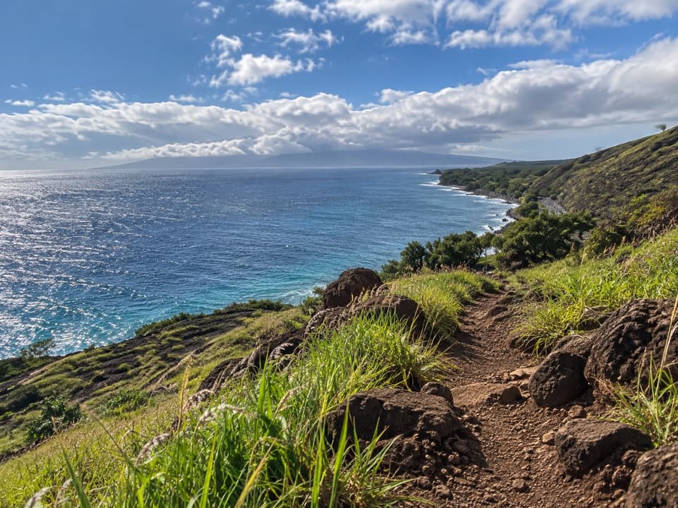
The trail is short, but it isn’t a paved stroll. Its rolling hills keep you going up and down, and the dirt and rock are uneven underfoot. Along the ocean side, the ground falls away toward eroded coastal cliffs and the view widens across Maui’s north shore. On a clear day you can make out Molokaʻi; farther east, Kahakuloa Head gives the route its most recognizable landmark. A few benches and interpretive panels make useful places to pause without leaving the loop.
 Parkwolf’s verdictThe coast is the payoff
Map & elevation
Plan your hike

The highest, rockiest slopes around here are a summer buffet for grizzly bears.
West Maui Scenic Drive Tour Guide
Parkwolf is a GPS audio tour guide for West Maui Scenic Drive. As you drive, it chimes in with what’s ahead: hidden gems, upcoming stops, history, geology, and wildlife, right through your car’s speakers.
See the West Maui Scenic Drive audio tourRecorded for this trailhead
ʻŌhai: Coast Walk or Quick Overlook“ʻŌhai’s trailhead is coming up, with a short paved overlook and a longer walk above the coastal cliffs.”
Plays as you drive up to this trailhead in the Parkwolf West Maui Scenic Drive Tour Guide.
More stories near here in the app
“Fantastic app with many points of information… It’s great to just turn on while you’re driving and it gives you an audio tour of the national Park. We love it!!!!”


Trail guide
ʻŌhai Loop Trail is a 1.2-mile coastal circuit above Papanalahoa Point on West Maui’s north shore. It crosses rolling, open ground over the headland and returns to the same roadside trailhead, so the published distance is the full loop, not a one-way figure. You get a proper walk through low coastal scrub, eroded rock and a wide stretch of ocean, with Kahakuloa Head (Puʻu Koaʻe) standing out at the far end. I’d make time for it if you want to stretch your legs and see this stretch of coast away from the car.
Close to the start, the path splits into mauka (mountain side) and makai (ocean side) legs. The loop works either way; take the mauka side first if you’d like to save the ocean-facing section for the return. That gives the coastline a little more room to open up as you walk. At the far junction, stay with the marked loop. A faint-looking spur heads closer to the cliff edge, but it isn’t part of the maintained route.
This is an interpretive walk through native coastal plants adapted to wind and salt spray, not just a track to a viewpoint. The signs introduce the low scrub along the path; look for names such as ʻūlei, naupaka and ʻākia. The trail’s namesake, ʻŌhai (Sesbania tomentosa), is an endangered Hawaiian shrub. Treat the signs as the guide to this sensitive plant community and stay on the established tread rather than wandering onto informal lookouts.
The same roadside access also serves a short paved overlook path, about 100 yards to a fenced promontory. It’s an easy way to get a coastal view if you don’t want the rough loop, but it is a different walk. The 1.2-mile distance here covers the interpretive loop only; don’t add the overlook spur unless you choose to walk it too.
Allow about 45 to 60 minutes if you stop at the signs and views. The hills are exposed with little shade, and wind can make the coast feel less sheltered than the short mileage suggests. Rocky tread is manageable for most walkers, but loose dirt can be slick when wet. Keep well back from the cliffs and skip the informal side paths. Dogs are allowed on leash. There’s no food or water service along the route, so bring water before leaving the small trailhead lot.
Wildlife
 152 sightingsHumpback WhaleMost seen around 9 AMSighting map
 71 sightingsHawaiian Monk SealMost seen around 11 AMSighting map
 23 sightingsSpinner DolphinMost seen around 7 AMSighting map
 401 sightingsGreen Sea TurtleMost seen around 5 PMSighting map
 14 sightingsHawksbill Sea TurtleMost seen around 10 AMSighting map
 92 sightingsWedge-tailed ShearwaterMost seen around 6 PMSighting map
Sighting maps show where each species has been reported across West Maui Scenic Drive. Wildlife moves, so no sighting is guaranteed.
Keep exploring
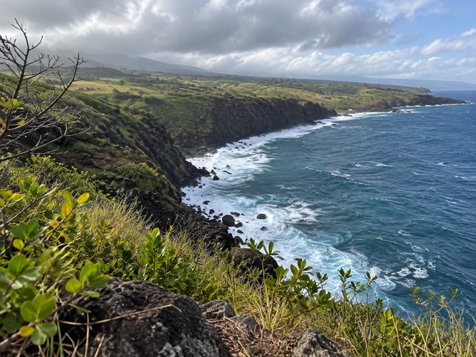 EasyʻŌhai Overlook Trail0.1 mi · 15 min · At the trailheadA quick paved lookout over Maui’s rugged north coast.
 ModerateNakalele Blowhole Trail0.4 mi · 30 min · 1.1 mi awayA short rocky approach; watch the blowhole from uphill.
 ModerateOlivine Pools Trail0.4 mi · 45 min · 1.4 mi awayA short lava scramble to tidepools on an exposed coast.ModerateAcid War Zone Trail1.3 mi · 1.5 hr · 1.4 mi awayA rough coastal path to a lighthouse beacon and blowhole.
 EasyKahakuloa Head Trail0.1 mi · 10 min · 2.3 mi awayA tiny coastal walk, if ranch access is confirmed.
 EasyHonolua Bay Access Trail0.8 mi · 24 min · 3.7 mi awayA shaded forest walk to a rocky, protected bay.
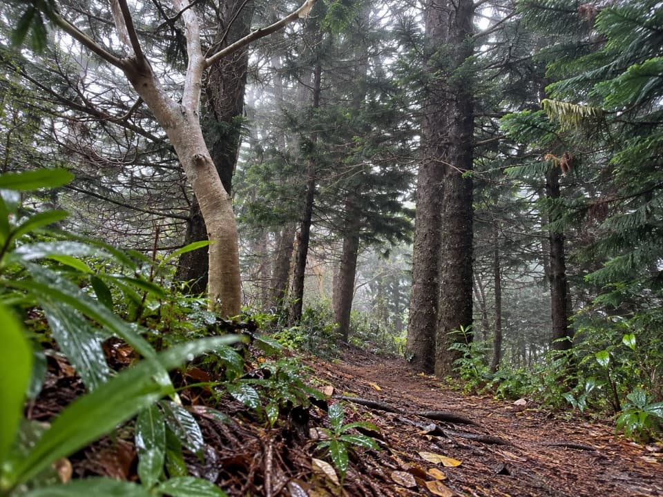 ModerateHonolua Ridge Trail2 mi · 2 hr · 3.8 mi awayA two-mile ridge walk to Puʻu Kaʻeo and a Sugi grove.
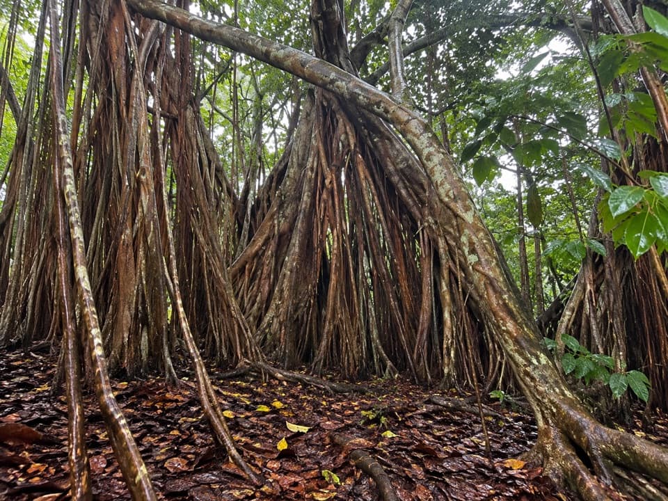 EasyBanyan Loop0.8 mi · 45 min · 3.8 mi awayAn arboretum loop with a strenuous ridge approach.Sight · 1.2 mi awayNākālele BlowholeWatch Pacific surf burst through lava from the dry roadside overlook.
 Sight · 1.3 mi awayPōhaku Kani (Bellstone)A roadside bellstone with a story, if you can stop safely.
 Sight · 1.4 mi awayOlivine PoolsA high-ground view of lava pools and surf; don’t go down.
 Food · 2.2 mi awayLorraine’s Shave IceShave ice and banana bread make a sweet break in Kahakuloa.
 Sight · 2.3 mi awayKahakuloa HeadTwin green headlands meet the sea in a dramatic roadside view.
 Food · 2.3 mi awayJulia’s Best Banana BreadA treehouse-style stand for soft banana bread on the coastal drive.
 Store · 2.4 mi awayKaren Lei’s Gallery at KahakuloaBrowse a broad art collection with Kahakuloa Bay below.
 Scenic pullout · 2.6 mi awayHonokōhau Bay LookoutA quick view of the curved bay and red-brown coastal cliffs.
Parkwolf’s West Maui Scenic Drive ranking
The audio tour guide for the drive, plus offline maps, trails, and wildlife heatmaps for when the signal drops.