1 active Westland Tai Poutini alert
- CautionActive landslide zones on Copland TrackDo not stop in either of Copland Track’s signposted active landslide zones; take extra care during and after heavy rain.Official details
Beach · Westland Tai Poutini National Park
A rugged beach with gold-rush relics and Southern Alps views.
Overview
Gillespies Beach is a remote pebble-and-dark-sand beach on the West Coast, 21 km by road from Fox Glacier Weheka. It pairs a rugged shore and Southern Alps views with walks through the remains of a gold-mining settlement. Make the detour if you want a beach walk or a bit of history; it is a long way for a quick look, and the surf can be strong if you were hoping to swim.
 Parkwolf’s verdictA remote beach worth the drive
Map
Plan your stop

The highest, rockiest slopes around here are a summer buffet for grizzly bears.
Westland Tai Poutini Tour Guide
Parkwolf is a GPS audio tour guide for Westland Tai Poutini National Park. As you drive, it chimes in with what’s ahead: hidden gems, upcoming stops, history, geology, and wildlife, right through your car’s speakers.
See the Westland Tai Poutini audio tourRecorded for this place
Gillespies Beach and the Failed Gold Dredge“Gillespies Beach is ahead, with dark sand, rounded pebbles and, when the clouds allow, the Southern Alps rising inland. Come for a shore walk and the old gold workings; strong surf makes it a poor choice for a swim.”
Plays as you drive up to Gillespies Beach in the Parkwolf Westland Tai Poutini Tour Guide.
More stories near here in the app
“Fantastic app with many points of information… It’s great to just turn on while you’re driving and it gives you an audio tour of the national Park. We love it!!!!”


Guide
Five walks start in the Gillespies Beach area, ranging from a 270 m cemetery walk (5 minutes return) to a 6.8 km Galway Beach trip (3 hours 30 minutes return). The 400 m suction-dredge loop takes about 15 minutes; the bucket dredge is 1.6 km and about 30 minutes return; Miners Tunnel is 3.6 km and about 1 hour 40 minutes return. The cemetery path begins before the campsite turnoff; the suction-dredge loop starts at the main beach car park.
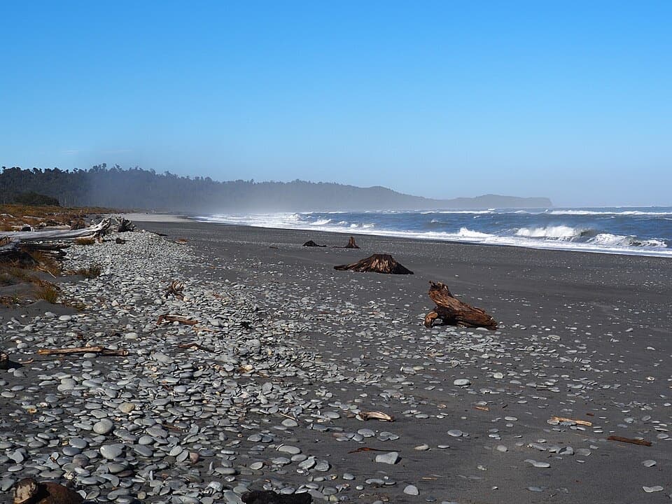
The shore is a mix of rounded stones and dark sand, with driftwood and breaking surf. It is better for wandering the waterline and watching the waves than planning a swim. On a clear day, look inland for the Southern Alps; shingle and driftwood make a useful foreground if you want the mountains to feel as big as they look. Cloud can hide the peaks, so treat that view as a bonus.
Gillespies Beach was once a remote gold-mining settlement. The short suction-dredge loop passes the remains of a late-19th-century machine and interpretation panels about the town. Farther along the track, gorse-covered dredge tailings lead to a bucket dredge dating from the 1930s. The small cemetery is a separate, very short stop and a reminder of the harsh conditions prospectors faced here.
The Miners Tunnel Track crosses a bridge at Gillespies Lagoon, then climbs an old glacier moraine along the line of a miners’ pack track. The tunnel was built to give miners an all-tide route. It ends at a viewpoint above the beach, with no way down to the shore from there, so return the same way.
The 6.8 km Galway Beach track takes about 3 hours 30 minutes return through rimu forest to a remote beach. Seals use it as a winter resting site. Keep clear of the colony and never walk between seals and the sea; return by the track rather than trying to follow the shore back toward Gillespies Lagoon. Dogs are not allowed on the walking tracks.
Much of the narrow approach is gravel. Vehicle guidance differs: the track directions warn against towing vehicles, while the campsite listing also advises against campervans and caravans. Confirm that your exact vehicle is suitable before setting out. Pack food, drinking water and insect repellent for the drive and walks.
Wildlife
 89 sightingsKeaMost seen around 10 AMSighting map
 10 sightingsBlue DuckMost seen around 5 PMSighting map
 80 sightingsKererūMost seen around 7 AMSighting map
 38 sightingsTūīMost seen around 5 AMSighting map
 10 sightingsNew Zealand FalconMost seen around 10 AMSighting map
 28 sightingsYellow-crowned ParakeetMost seen around 8 AMSighting map
Sighting maps show where each species has been reported across Westland Tai Poutini. Wildlife moves, so no sighting is guaranteed.
Keep exploring
 ModerateMiners Tunnel Track5.1 km · 1.7 hr · 0.1 km awayA gold dredge, lagoon bridge and tunnel fit in one coastal walk.
 EasyGillespies Bucket Dredge Walk1.6 km · 30 min · 0.1 km awayTake a short walk through old tailings to a rusting gold dredge.
 EasyMiners Cemetery Walking Track0.3 km · 5 min · 1.3 km awayA brief walk to the graves of early gold prospectors.
 Campground · 0.1 km awayGillespies Beach CampsiteA simple coastal camp with goldfields walks and Southern Alps views.
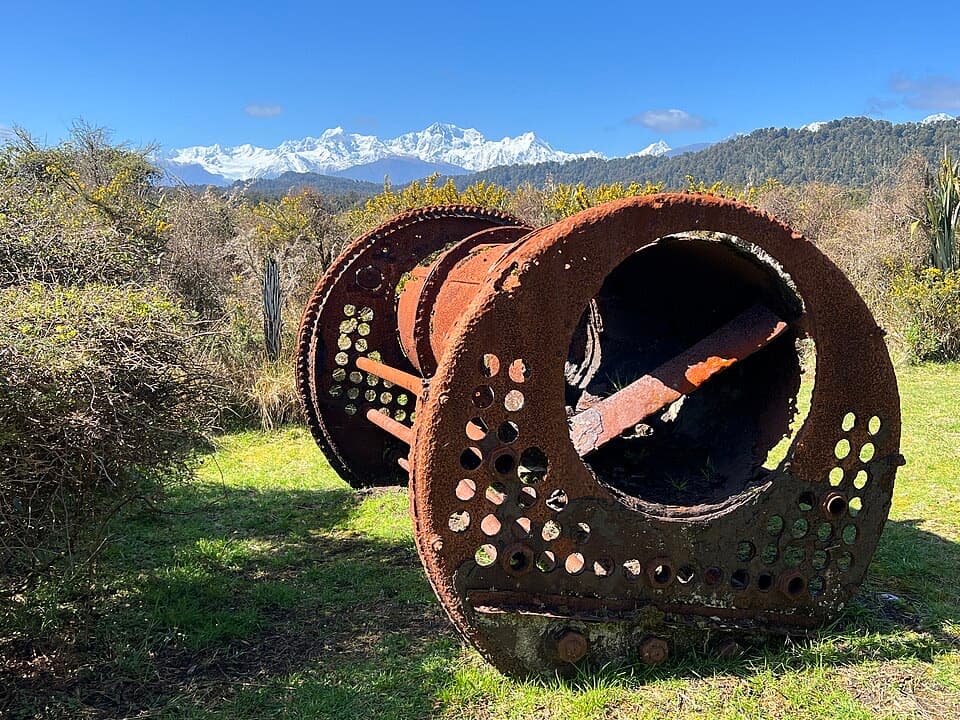 Sight · 0.3 km awayGillespies Suction DredgeA rusted dredge makes a failed gold venture easy to picture.Sight · 0.8 km awayGillespies Bucket DredgeA rusting gold dredge ties this quiet walk to its mining past.Sight · 1.3 km awayGillespies Beach Miners CemeteryA quick stop in Gillespies Beach's gold-mining past.Sight · 2.1 km awayGillespies Miners TunnelA miners’ tunnel still cuts through the old coastal pack track.
 Beach · 4.6 km awayGalway BeachA forest tramp to a pebble shore and winter seal haul-out.
Parkwolf’s Westland Tai Poutini ranking
The audio tour guide for the drive, plus offline maps, trails, and wildlife heatmaps for when the signal drops.