1 active Westland Tai Poutini alert
- CautionActive landslide zones on Copland TrackDo not stop in either of Copland Track’s signposted active landslide zones; take extra care during and after heavy rain.Official details

Sight · Westland Tai Poutini National Park
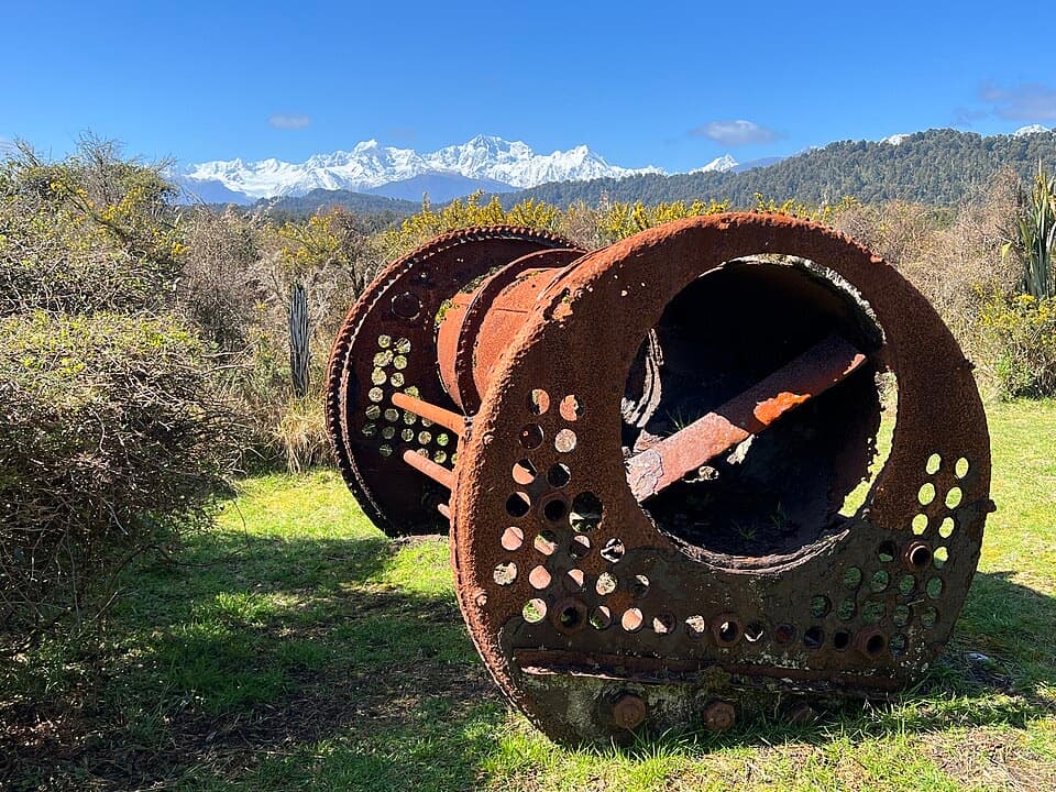
A rusting gold dredge ties this quiet walk to its mining past.
Overview
Map
Plan your stop

The highest, rockiest slopes around here are a summer buffet for grizzly bears.
Westland Tai Poutini Tour Guide
Parkwolf is a GPS audio tour guide for Westland Tai Poutini National Park. As you drive, it chimes in with what’s ahead: hidden gems, upcoming stops, history, geology, and wildlife, right through your car’s speakers.
See the Westland Tai Poutini audio tourRecorded for this place
Gillespies Beach and the Failed Gold Dredge“Gillespies Beach is ahead, with dark sand, rounded pebbles and, when the clouds allow, the Southern Alps rising inland. Come for a shore walk and the old gold workings; strong surf makes it a poor choice for a swim.”
Plays as you drive up to Gillespies Bucket Dredge in the Parkwolf Westland Tai Poutini Tour Guide.
More stories near here in the app
“Fantastic app with many points of information… It’s great to just turn on while you’re driving and it gives you an audio tour of the national Park. We love it!!!!”


Guide
Gillespies Bucket Dredge is a small historic stop reached on foot from Gillespies Beach. Rusted dredge machinery sits among old mining tailings, scrub and a pool; only fragments of the machine remain. This is the bucket dredge on the Miners Tunnel Track, separate from the late-19th-century suction dredge loop closer to the main beach car park. A wider look that includes the rusty machinery and pool makes the remains easier to read than a tight close-up.
Allow about 30 minutes for the 1.6 km return walk from the main car park and camping area. The route follows the Miners Tunnel Track through gorse-covered tailings. On a clear day, mountain tops show above the gorse. You can return the way you came or continue toward Miners Tunnel or Galway Beach.
Gillespies Beach is about 21 km by road from Fox Glacier. About half the drive is on a narrow, unsealed road; take it slowly and do not tow. Bring warm waterproof layers because the weather can change quickly. This is a destination drive, not a quick roadside pull-off.
The dredge operated from 1932 to 1945 and was built on site from local timber shaped by hand. Its mechanism came by horse-drawn wagon down the Cook River flat and around Otorokua Point. Electricity from the Fox Glacier hydroelectric station powered its buckets, winches and pumps, using water from Lake Gault. The rusted fragments link a quiet beach walk to the mining work and water infrastructure spread across this part of Westland.
Wildlife
 89 sightingsKeaMost seen around 10 AMSighting map
 10 sightingsBlue DuckMost seen around 5 PMSighting map
 80 sightingsKererūMost seen around 7 AMSighting map
 38 sightingsTūīMost seen around 5 AMSighting map
 10 sightingsNew Zealand FalconMost seen around 10 AMSighting map
 28 sightingsYellow-crowned ParakeetMost seen around 8 AMSighting map
Sighting maps show where each species has been reported across Westland Tai Poutini. Wildlife moves, so no sighting is guaranteed.
Keep exploring
 ModerateMiners Tunnel Track5.1 km · 1.7 hr · 0.9 km awayA gold dredge, lagoon bridge and tunnel fit in one coastal walk.EasyGillespies Bucket Dredge Walk1.6 km · 30 min · 0.9 km awayTake a short walk through old tailings to a rusting gold dredge.
 EasyMiners Cemetery Walking Track0.3 km · 5 min · 2 km awayA brief walk to the graves of early gold prospectors.
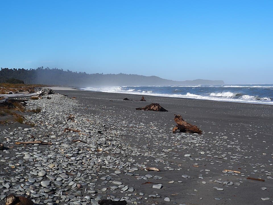 Beach · 0.8 km awayGillespies BeachA rugged beach with gold-rush relics and Southern Alps views.
 Campground · 0.8 km awayGillespies Beach CampsiteA simple coastal camp with goldfields walks and Southern Alps views.
 Sight · 0.9 km awayGillespies Suction DredgeA rusted dredge makes a failed gold venture easy to picture.Sight · 1.3 km awayGillespies Miners TunnelA miners’ tunnel still cuts through the old coastal pack track.Sight · 2.1 km awayGillespies Beach Miners CemeteryA quick stop in Gillespies Beach's gold-mining past.
 Beach · 3.8 km awayGalway BeachA forest tramp to a pebble shore and winter seal haul-out.
Parkwolf’s Westland Tai Poutini ranking

The audio tour guide for the drive, plus offline maps, trails, and wildlife heatmaps for when the signal drops.