1 active Westland Tai Poutini alert
- CautionActive landslide zones on Copland TrackDo not stop in either of Copland Track’s signposted active landslide zones; take extra care during and after heavy rain.Official details

Sight · Westland Tai Poutini National Park
A miners’ tunnel still cuts through the old coastal pack track.
Overview
Map
Plan your stop

The highest, rockiest slopes around here are a summer buffet for grizzly bears.
Westland Tai Poutini Tour Guide
Parkwolf is a GPS audio tour guide for Westland Tai Poutini National Park. As you drive, it chimes in with what’s ahead: hidden gems, upcoming stops, history, geology, and wildlife, right through your car’s speakers.
See the Westland Tai Poutini audio tourRecorded for this place
Gillespies Beach and the Failed Gold Dredge“Gillespies Beach is ahead, with dark sand, rounded pebbles and, when the clouds allow, the Southern Alps rising inland. Come for a shore walk and the old gold workings; strong surf makes it a poor choice for a swim.”
Plays as you drive up to Gillespies Miners Tunnel in the Parkwolf Westland Tai Poutini Tour Guide.
More stories near here in the app
“Fantastic app with many points of information… It’s great to just turn on while you’re driving and it gives you an audio tour of the national Park. We love it!!!!”


Guide
The Miners Tunnel Track is a 3.6 km return walk, about 1 hour 40 minutes, from Gillespies Beach’s main car park and campground to a historic tunnel and lookout above the coast. It’s a worthwhile longer detour if you want a walk with a clear link to the area’s mining past; this is reached on foot, not a quick roadside stop.
The tunnel gave miners a way around Gillespies Point at any tide, avoiding a coastal section where travel depended on the sea. It sits on the old pack track into South Westland. A 1954 photograph shows the tunnel decades after a road had replaced the beach as the region’s highway.
From the main car park, the track passes old mining tailings and a bucket dredge, follows the beach, crosses the Quinlan Creek lagoon and a bridge, then climbs an old glacier moraine through the tunnel. It emerges at a viewing point above the beach; there is no beach access from this lookout.
Gillespies Beach is a 21 km drive from Fox Glacier, with about half the route on a narrow, unsealed road that is unsuitable for towing. Carry drinking water; DOC also advises insect repellent and sun protection. Dogs are not allowed on these tracks.
From inside the passage, the dark rock walls and timber brace frame a bright green opening. Look back through the tunnel for a sense of its shape; the viewpoint beyond gives a wider coastal view on a fine day.
Wildlife
 89 sightingsKeaMost seen around 10 AMSighting map
 10 sightingsBlue DuckMost seen around 5 PMSighting map
 80 sightingsKererūMost seen around 7 AMSighting map
 38 sightingsTūīMost seen around 5 AMSighting map
 10 sightingsNew Zealand FalconMost seen around 10 AMSighting map
 28 sightingsYellow-crowned ParakeetMost seen around 8 AMSighting map
Sighting maps show where each species has been reported across Westland Tai Poutini. Wildlife moves, so no sighting is guaranteed.
Keep exploring
ModerateMiners Tunnel Track5.1 km · 1.7 hr · 2.1 km awayA gold dredge, lagoon bridge and tunnel fit in one coastal walk. EasyGillespies Bucket Dredge Walk1.6 km · 30 min · 2.1 km awayTake a short walk through old tailings to a rusting gold dredge.
 EasyMiners Cemetery Walking Track0.3 km · 5 min · 3.2 km awayA brief walk to the graves of early gold prospectors.Sight · 1.3 km awayGillespies Bucket DredgeA rusting gold dredge ties this quiet walk to its mining past.
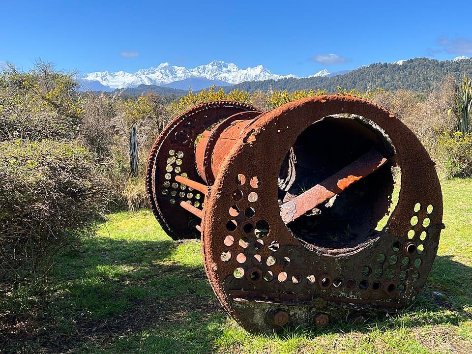 Sight · 2 km awayGillespies Suction DredgeA rusted dredge makes a failed gold venture easy to picture.
 Campground · 2.1 km awayGillespies Beach CampsiteA simple coastal camp with goldfields walks and Southern Alps views.
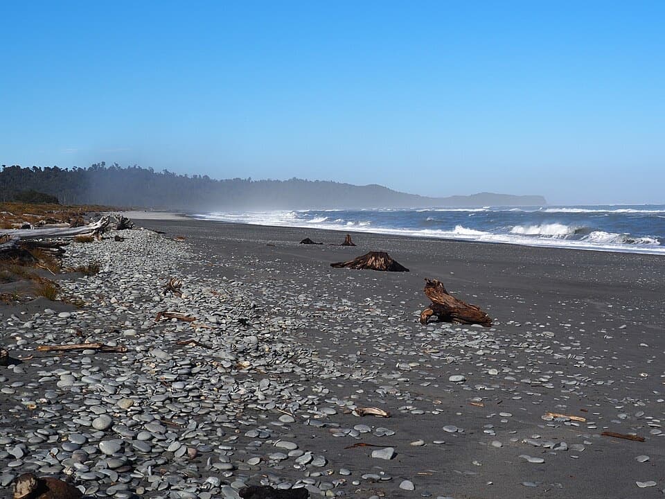 Beach · 2.1 km awayGillespies BeachA rugged beach with gold-rush relics and Southern Alps views.
 Beach · 2.6 km awayGalway BeachA forest tramp to a pebble shore and winter seal haul-out.Sight · 3.3 km awayGillespies Beach Miners CemeteryA quick stop in Gillespies Beach's gold-mining past.
Parkwolf’s Westland Tai Poutini ranking

The audio tour guide for the drive, plus offline maps, trails, and wildlife heatmaps for when the signal drops.