Pros & cons
PROS
- Textbook columnar basalt you can walk right up to
- Riverside picnic area with tables and a vault toilet
- Quick access to the Gardner River and a short stroll
CONS
- Small parking area with a tight turnaround; not suitable for RVs
- No potable water; only a vault toilet
Overview
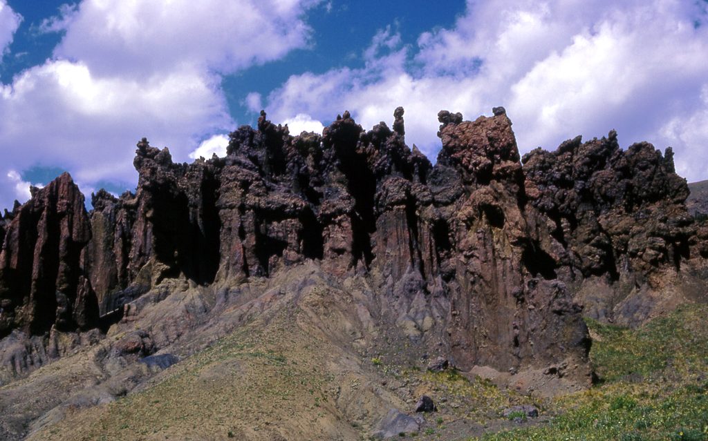
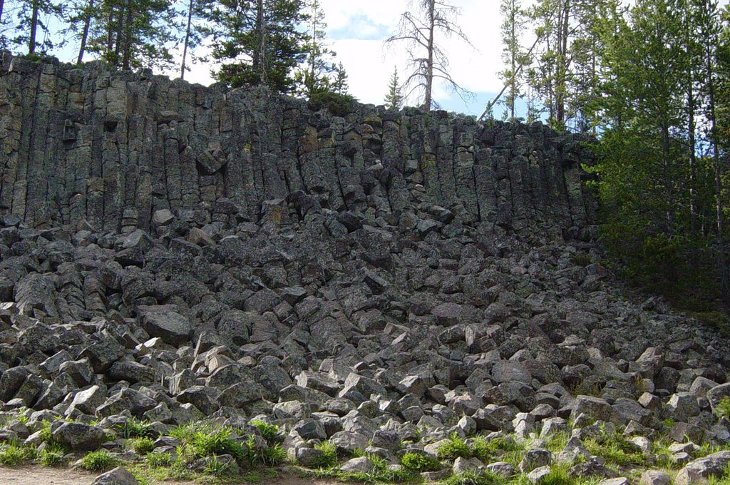
A quick detour between Mammoth and Norris drops you at the base of Sheepeater Cliffs—a striking wall of columnar basalt right beside the Gardner River. It’s the kind of stop that turns a drive into a geology lesson, with room to picnic, poke around the talus, and listen to the river.
Why the rocks look like that
About 500,000 years ago, a basalt lava flow cooled slowly here. As it contracted, the rock fractured into mostly hexagonal columns that stand like organ pipes today. Because columns form perpendicular to the cooling surface, their vertical alignment tells you the lava cooled from a horizontal top. The Gardner River later cut into the flow, exposing the cliff and the jumbled blocks at its base. Similar columnar jointing pops up elsewhere in the park (think Obsidian Cliff and Calcite Springs), but this is one of the easiest places to see it up close.
What to do
- Picnic at the base of the cliff and let the river set the mood.
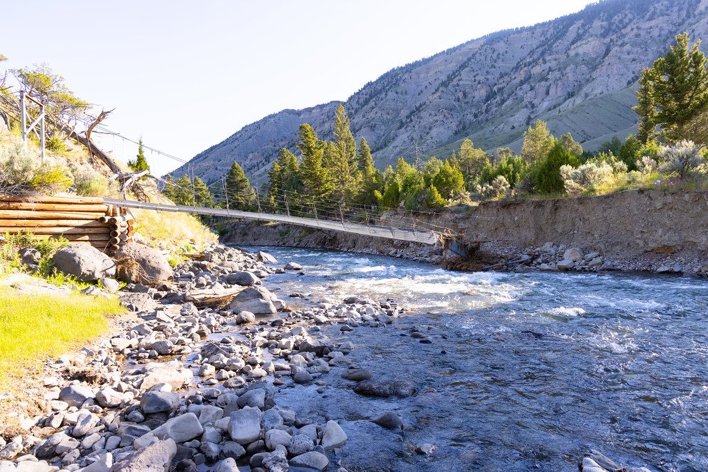
- Wander the short, informal path along the Gardner River for 15–45 minutes; expect some rocky footing and light scrambling in spots.
- Anglers get easy access to the river from the parking area.
- If you’ve got energetic kids, the talus blocks are a popular (supervised) scramble.
Wildlife
Yellow‑bellied marmots commonly den among the broken columns—watch the base of the cliff and listen for their chirps. Deer occasionally move through the river corridor, and this is bear country; keep food secured and stay alert.
Facilities and logistics
There’s a small gravel lot and a tight turnaround; skip this spur if you’re in an RV or towing. The picnic area has roughly five tables, a single vault toilet, and trash/recycling. No running water. Overnight camping isn’t allowed.
Name and background
The cliffs were named for the Tukudeka (Sheepeaters), a band of the Eastern Shoshone known for hunting bighorn sheep in this region.
Best time to visit
This is a quick, anytime stop when the road is open. Mid‑morning or late afternoon gives nicer texture on the columns and tends to be calmer than peak midday in summer. Spring and fall can be lovely if road conditions allow—always check current status before you go.
Where it is
44.9330, -110.6766Tips for Sheepeater Cliffs
- 01Skip RVs and trailers—the lot is small and the turnaround is tight.
- 02Wear sturdy shoes; the talus and riverbank can be jagged and unstable.
- 03Bring your own water; there’s no running water at the picnic area.
- 04Store all food properly and carry bear spray; this is active bear habitat.
- 05For softer light and fewer people, stop early or late; in spring, confirm road status.
Amenities
Near Sheepeater Cliffs
All places →All trails →
0.4 mi awayOsprey FallsBig waterfall in a wild canyon after a tough, quiet hikeTrailhead · Parking
1.5 mi awayBunsen PeakSwitchback climb to a panoramic summit above Mammoth and Swan Lake FlatsTrailhead · Parking
1.6 mi awayLava Creek TrailEasy waterfall stroll with canyon views and a quiet extensionModerate · 5.6 mi · 2.5 hr
1.9 mi awayUndine FallsEasy roadside view of a graceful three-tiered cascadePullout · Parking
2.3 mi awayHoodoosGhostly white travertine boulders with easy wandering and big viewsPullout · Parking
2.5 mi awayElectric Peak-Southeast Ridge TrailBig-mile Yellowstone summit with a spicy Class 2–3 finish.Challenging · 20.6 mi · 10 hr
2.5 mi awayEagle Pass-Mountain Creek TrailRemote descent from Eagle Pass into Yellowstone’s wild ThorofareChallenging · 10.2 mi · 6 hr
2.5 mi awaySportsman Lake TrailRemote pass hike to an isolated lake beneath Electric PeakChallenging · 24.6 mi · 11.1 hr